469 résultats
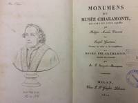
182260023Milan : chez Giegler 1822. In-8 p. mm. 220x132 mz. pelle coeva fregi e titolo oro al dorso pp. LXXXVII350 con un ritratto di Pio VII al frontespizio e 57 tavole incise in rame fuori testo alcune più volte ripiegate. Con timbri di appartenenza altrimenti ben conservato. chez Giegler, unknown
189634710Berlin 1896. Beschreibung Kultur und Verwendung des gesamten Pflanzenmaterials für deutsche Gärten Zwei Bände ine einem Die Farbabbildungern sind nicht dabei. Stockfleckig Dritte neubearb.Aufl. Paul Parey Gr.-8°. Hldr. marm. Biologie unknown
1886KC8047Paris: Alcan-Levy 20 May 1886. Limited Edition. Paperback. Very Good. 28pp 2. 245 x 152mm. Limited edition number 29 of 100 printed on papier Hollande. Original printed wrappers edges uncut preserved and bound possibly for Paul Verlaine in 19th-century marbled boards spine stamped with author title and Ex. De Paul Verlaine. Pierre Quillard dedicates this copy to friend Philippe Martinon 1859-1917 a French linguist philologist and translator À mon ami ce petit livre ancien en souvenir dancienne et présente amitié To my friend this little old book old memories of past and present friendship and autograph of Quillard. Martinon is best remembered for his classic text translations of Greek and Latin and other studies on French metric. It is possible Martinon gave this presentation copy to Verlaine who in turn had it bound with his ex-libris on the spine. Both men were of great literary reputation and frequented the same poetic circles of the burgeoning symbolist movement. <br/><br/>It was a new symbolist mystery play to be presented in two simple tableaux as opposed to acts and scenes with minimal direction and the barest of staging directions. In effect the speaker became a central character and the intention thus emphasized the lyricism of the verse. Therefore the verse has a continuous prose accompaniment which explains the changes in time and space indicating different entities and slowly revealing the facts. Quillards verse is freed to reveal the expression of the characters souls -- it becomes a book of masks and symbolic portraits. This Quillards manifesto performance aimed to establish a new aesthetic for stageable drama. The schematic story line of this work arguably made one of the boldest attempts to put such ideas into action. In it Quillard represents the medieval story of St. Uliva a young virgin who agrees to amputate her hands to save her from the incestuous caresses of her brutal father. The story is imbued with vague mysticism supernatural journeys and resurrections. This copy was well admired in the circle of symbolist artists and writers with a definite association with Martinon and perhaps the great Verlaine. Alcan-Levy paperback
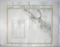
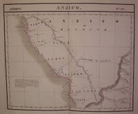
1827M2904Bruselles 1827. Excellent. Size : 464x557 mm 18.25x21.875 Inches Coloring: Original Outline Coloring Category: ; Maps Central America unknown
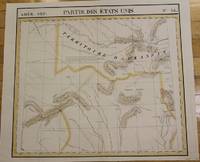
1827M2726Bruxelles 1827. Good; some worming on the upper and lower parts of the fold. Notes: From Vandermaelen's "Atlas Universel de Geographie Physique Politique Statistique et Mineralogique" Brusseles 1827.<br><br>"The map trade in the 1820s had taekn notice of the enormous interest in Texas and had begun to supply maps catering to it. In 1827 Phillipe van der Maelen's 'Atlas Universel' the most lavish and detailed cartographic production of the decade and the first major lithographed atlas included five maps depicting parts of Texas. These maps were based primarily on the outmoded models of Humboldt and Pike and contributed no new knowledge." Martin & Martin 32 Size : 470x515 mm 18.5x20.25 Inches Coloring: Original Outline Coloring Reference: Martin & Martin 32 Category: ; Maps United States South Texas unknown
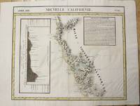
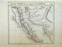
1827M2722Bruxelles 1827. Very Good; several wormholes on the upper and lower parts of the fold. Notes: From Vandermaelen's "Atlas Universel de Geographie Physique Politique Statistique et Mineralogique" Brusseles 1827. Size : 472x572 mm 18.625x22.5 Inches Coloring: Original Outline Coloring Category: Maps United States West California unknown
1827M2724Bruxelles 1827. Good; some worming on the upper and lower parts of the fold wormholes professionally filled. Notes: From Vandermaelen's "Atlas Universel de Geographie Physique Politique Statistique et Mineralogique" Brusseles 1827. Size : 468x490 mm 18.375x19.25 Inches Coloring: Original Outline Coloring Category: Maps United States West States; unknown
1827M2720Bruxelles 1827. Very Good; several wormholes on the upper and lower parts of the fold. Notes: From Vandermaelen's "Atlas Universel de Geographie Physique Politique Statistique et Mineralogique" Brusseles 1827. Size : 460x554 mm 18.125x21.75 Inches Coloring: Original Outline Coloring Category: Maps United States West States; unknown
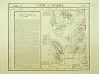
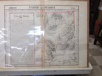
182740379Bruxelles: Ph. Vandermaelen 1827. First edition. A very good sharp copy. 1 sheet. Hand-colored lithographic map. 47 x 57 cm. Shows the ranges of eight Indian tribes. Covers parts of Utah Colorado and northern Arizona and New Mexico. Includes text: Note sur le Mexique. At a time when American map publishers were virtually ignoring the western United States Vandermaelen's large scale work -which includes sections of Utah Wyoming Arizona and Nevada then still considered part of Mexico along with the location of Indian tribes and shows Lake Timpanagos- was a landmark in the history the cartography of the Transmississippi West. Large text box on the left entitled: Note sur le Mexique by A. Delavault. From Phillipe Vandermaelen Atlas universel de geographie physique politique statistique et mineralogique. a magnificent and ground breaking six volume atlas of the entire world which was the first atlas to use lithography to show the entire world using such a large uniform scale approximately 26 miles to the inch and which was designed to be joined together into a three-dimensional globe with a diameter of approximately 25 feet. Wheat Transmississippi 378. Sabin 43762. Phillips 749. [Ph. Vandermaelen] unknown
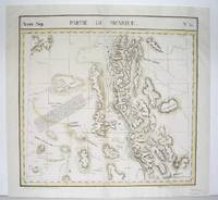
182740378Bruxelles: Ph. Vandermaelen 1827. First edition. Very good bright copies a few minor spots or marginal finger soiling. 2 sheets. Hand-colored lithographic maps. 46 x 51 cm and 46 x 54 cm. Large scale map of Baja. Map 58 includes parts of Baja California Sonora Sinaloa and Chihuahua. Map 65 includes the tip of Baja California and the "Iles Revillagigedo" and a text box: Note sur le Mexique . de Humboldt. Sheets from Phillipe Vandermaelen Atlas universel de geographie physique politique statistique et mineralogique. a magnificent and ground breaking six volume atlas of the entire world which was the first Atlas to use lithography to show the entire world using such a large uniform scale approcimately 26 miles to the inch and which was designed to be joined together into a three-dimensional globe with a diameter of approximately 25 feet. Phillips 749. Sabin 43762. [Ph. Vandermaelen] unknown
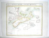
1827M2906Bruxelles 1827. Excellent. Size : 470x530 mm 18.5x20.875 Inches Coloring: Original Outline Coloring Category: ; Maps Canada East Nova Scotia; Maps Canada East Prince Edward Island; Maps Canada East New Brunswick; Maps Canada East Newfoundland unknown
1827M2907Bruxelles 1827. Excellent. Size : 482x565 mm 19x22.25 Inches Coloring: Original Outline Coloring Category: Maps Polar Arctic Regions Alaska Greenland Iceland; unknown
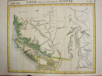
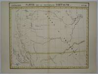
1825M3339Bruxelles 1825. Excellent;. Notes: The first atlas of the world on a uniform scale. If assembled as a globe gores forms a very large globe.<br><br>The map shows British Columbia and extends as far north and the Straits of Queen Charlotte. The map also notes the location of different Native tribes of the area. Finally this map shows the route that MacKenzie took to the Pacific from the Frasier River. Size : 472x561 mm 18.625x22.125 Inches Coloring: Original Hand Coloring Category: Maps Canada West British Columbia; unknown
1825M3340Bruxelles 1825. Very Good. Notes: An uncommon map of South Alberta. The map clearly shows the location of Fort Edmonton and other major establishment. From the first atlas of the World on an uniform scale. If assembled as a globe gores forms a very large globe. Size : 470x563 mm 18.5x22.125 Inches Coloring: Hand Colored Category: Maps Canada West Alberta unknown
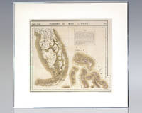
1825137108Brussels: Lithographed by H. Ode 1825. Rare hand-colored lithograph map of South Florida the Keys and the Bahamas from renowned 19th century Belgian cartographer Philippe Vandermaelen's Atlas Universel. One page the map displays South Florida and the Bahamas including major cities as of 1825 with numerous Native American trails and roads recorded and an inset text regarding the flora and fauna of the Everglades. Matted and framed. The entire piece measures 29 inches by 27 inches. Published in 1827 and consisting of approximately 380 conically projected sheets of maps in six volumes Belgian geographer's Vandermaelen's Atlas Universel was the first atlas produced using the method of lithography and the first to use the same large uniform scale for all of the maps included in its pages. Regarded as one of the most important and remarkable innovations in the private enterprise of cartography the maps were uniquely designed to be joined into a three-dimensional terrestrial globe with a diameter of approximately 25 feet. Lithographed by H. Ode unknown
1827202217Brussels: Vandermaelen Philippe Marie 1827. unbound. very good. Map. Large format lithograph of West Africa with original hand coloring. Image measures 18.5" x 22.25".<br/> <br/> Includes the Congo Congo River and Gabon. Double page with centerfold. From Vandermaelen's 6 volume "Atlas universel de geographie physique politique statistique et mineralogique sur l'echelle de 1/16411836". Can be combined as gores to form an immense globe. The atlas was the first to map the world on a uniform scale.<br/> <br/> Vandermaelen, Philippe Marie unknown
1827283421Brussels: Vandermaelen Phillipe Marie 1827. unbound. very good. Map. Large format lithograph with original hand outline color. Image measures 18.75" x 19 1/8". Sheet measures 21" x 27". Shows some foxing and a few tears to edges.<br/> <br/> Beautifully detailed map that shows Bejing "Pekin" and surrounding provinces. Mountains are delicately treated with hachure marks and major rivers and waterways are also shown. From Vandermaelen's 6 volume "Atlas universel de geographie physique politique statistique et mineralogique sur l'echelle de 1/16411836". The atlas was the first to map the world on a uniform scale; maps were meant to join together to form a huge globe.Phillippe Marie Vandermaelen 1795-1869 was a Belgian cartographer and publisher. This map is a fine example of his work.<br/> <br/> Vandermaelen, Phillipe Marie unknown
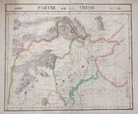
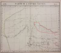
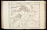
1827283424Brussels: Phillippe Marie Vandermaelen 1827. unbound. very good. Map diptych. Two double-page lithographs with original hand outline color. Each image measures 18.75" x 19 1/8". Sheets measure 21" x 27". Both show some foxing and some chips and tears to edges.<br/> <br/> Beautifully detailed map that shows northwest China including parts of the Silk Road. Mountains are delicately treated with hachure marks and major rivers and waterways are also shown. From Vandermaelen's 6 volume "Atlas universel de geographie physique politique statistique et mineralogique sur l'echelle de 1/16411836". The atlas was the first to map the world on a uniform scale; maps were meant to join together to form a huge globe.<br> <br> Phillippe Marie Vandermaelen 1795-1869 was a Belgian cartographer and publisher. This map is a fine example of his work.<br/> <br/> Phillippe Marie Vandermaelen unknown
182715962Brussels 1827. 540 by 410mm. 21.25 by 16.25 inches. 6 volumes. Folio 6 letterpress half-titles and title-pages dedication leaf 42 pages of text 'Statistique de l'Europe' 7 lithographed index maps one of comparative heights with contemporary hand-colour in full and 382 numbered double-page maps by Henri Ode with contemporary hand-colour in outline some very occasional spotting; contemporary half tree calf drab paper boards some wear. The maps in the atlas make up the first map of the world on a uniform scale constructed as a modified conical projection and if assembled forming a globe with a diameter of 7.75 metres although only one such was known to have been made by the author himself and requiring a specially designed room. "Philippe Vandermaelen was born in Brussels in 1795 the son of a rich soap manufacturer. After his father's death in 1816 he devoted himself to maps and eleven years later produced this quite remarkable atlas. It was totally at his own expense and like so many innovations in the past it came about through the single-minded efforts of a man who could afford failure. It offered the largest picture of the earth's surface available in the nineteenth century thereby giving the lesser known areas such as Australia South Africa and the West coast of America all developing countries a much greater coverage than before. And perhaps most importantly of all it was the first atlas to be produced by lithography" Wardington Catalogue. cf. Koeman III Vdm 1; NMM 3:179; Philips Atlases 749 hardcover
182736233Brussels Belgium: Lithographed By H. Ode. Very Good. 1827. Map. Map # 47 A Very Good primitive and early map of eastern Nevada the State of Utah also including part of northern Arizona and the Grand Canyon. The Great Salt Lake is shown but further south and west than later surveyed to be. Of course almost all localities shown are French or Indian names. Another large lake is shown probably Bear Lake is shown in Nevada. The atlas from which this is extracted is extremely rare and originally composed 6 volumes this map being from the North America volume. Lithographer Ode and Cartographer Vandermaelen produced the first lithographed atlas ever done. Condition is overall Very Good. Browning to the centerfold crease caused by glue used in attaching the tab to the original volume the two page spread measures 21" x 26 1/2" when opened out. Approximately 1/3 of the map consists of a lengthy description in French of the Mexican territory which comprised Nevada and Utah. Other contiguous maps are shown as parts of the "New Mexico territory" but this map describes itself as part of Mexico as was California in 1824. Topigraphical features are accentuated see image. Shipping will require extra care and cost due to insurance. Photo available upon request. ; 21" x 26 1/2"; 1 pages . Lithographed By H. Ode unknown