ZURCHER Frédéric et MARGOLLÉ Élie Philippe.Livre Rare Book
950 résultats
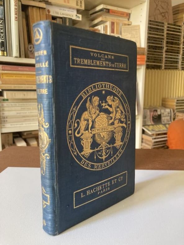
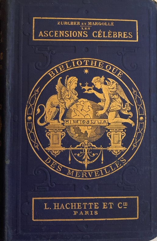
1867123321867 Paris, Hachette et Cie, 1867; in-12 de (2) - 384pp. ; illustrations hors texte comprises dans la pagination, d'après Alexandre de Bar. Pleine percaline éditeur bleue, décor doré sur les plats et le dos, tranches rouges.
187023821870 Paris Librairie Hachette, Bibliothèque des Merveilles 1868 Un volume in°12 reliure éditeur pleine percaline bleue, titres et décors dorés, tranches rouges 355 page
188687388Librairie Hachette et Cie, coll. « Bibliothèque des Merveilles » 1886 In-12. Reliure demi-percaline rouge à coins, dos lisse, pièce de titre maroquin marron, tête dorée, 311 pp. et 4 pp. de catalogue d’éditeur, 62 figures. Bon exemplaire.
186830321Librairie Hachette et Cie, Paris, 1868- Collection "Bibliothèque des Merveilles". DEUXIEME EDITION.- In-12 relié pleine percaline bleu-marine (18,2 x 11,7 cm), plat supérieur titré en lettres dorées et orné du fer doré de la Bibliothèque des merveilles, tranches rouges, 355 pages, illustré de 61 vignettes dessinées sur bois par E. Riou.- 360g.- Petit manque de papier au coin inférieur de la page de faux-titre. Intérieur frais. Reliure en excellent état aux dorures vives.
1860B92388Bruxelles, Heussner 1860 xii + 49pp., 22cm., dans la "Collection de mémoires relatifs à l'histoire de Belgique. XVIe siècle", br.orig., imprimé sur papier de luxe, nom du propriétaire écrit sur les p.d.t., bon état, B92388
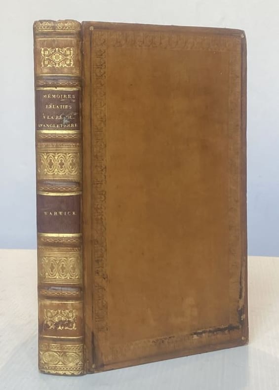
182322083Paris/ Rouen, Béchet Ainé, 1823 in-8 plein veau havane, roulette à froid encadrant les plats, dos à nerfs plats, fleurons dorés, pièce de titre et tomaison marron, tranches marbrées. XVI-420 pp. Reliure de l'époque. (Légers frottements aux dos, un mors fendillé sur 3 cm, deux coiffes usés).
18935011893 Paris Imprimerie de Chamerot et Renouard 1893 Un volume in°8 broché 40 pages Ouvrage tiré à 200 exemplaire LR7
182260023Milan : chez Giegler 1822. In-8 p. mm. 220x132 mz. pelle coeva fregi e titolo oro al dorso pp. LXXXVII350 con un ritratto di Pio VII al frontespizio e 57 tavole incise in rame fuori testo alcune più volte ripiegate. Con timbri di appartenenza altrimenti ben conservato. chez Giegler, unknown
189634710Berlin 1896. Beschreibung Kultur und Verwendung des gesamten Pflanzenmaterials für deutsche Gärten Zwei Bände ine einem Die Farbabbildungern sind nicht dabei. Stockfleckig Dritte neubearb.Aufl. Paul Parey Gr.-8°. Hldr. marm. Biologie unknown
183626273LA LIMOUZINIERE 1836/37 1- Plan Général sur lequel est indiqué l'écurie et l'étable à construire + le Presbytère à reconstruire, plan à l'encre sur papier calque contrecollé aquarellé en couleurs, format : 36 x 37,8 cm (cachet postal rons au dos daté du 1er Juin 1839), 2- Plan à l'encre de l'écurie et de l'étable du Presbytère daté de 1836 en couleur, format : 43,5 x 30,02 cm), 3- Plan de la Reconstruction du Presbytère de la Limouzinière : 3ème projet , signature à l'encre brune : Architecte Henri-Théodore Driollet, Nantes 11 mars 1837, plan en couleurs dessin à l'encre, format : 43,5 x 32 cm, 4- Plan Général du Projet de Reconstruction du Presbytère, signature manuscrite à l'encre brune : Driolet Architecte, Nantes, 1er Novembre 1836, plan à l'encre aquarellé en couleurs avec par dessus une variante du projet, format : 33,3 x 47 cm), 5- Projet de Reconstruction du Presbytère : Plan à l'encre du Rez-de-Chaussée + Plan à l'encre du 1er Etage (aquarellé en couleurs), Signature manuscrite à l'encre brune : Driollet Architecte, Nantes, 1 er Novembre 1836, format : 47 x 33,3 cm, 6- Plan de Coupe sur l'Epaisseur du Batiment et Coupe sur la Largeur, dessin à l'encre, lavis de couleur rose en bas, Signature manuscrite à l'encre brune : Driollet Architecte, Nantes, 1er Novembre 1836, format : 47 x 33,3 cm, 7- Plan à l'encre : Elévation Principale + Elévation dans le Jardin, lavis de couleur rose en bas, Signature manuscrite à l'encre brune : Driollet Architecte, Nantes, 1er Novembre 1836, format : 46,8 x 32,3 cm, 8 - Une enveloppe cachetée (cachet de cire rouge au dos) avec imprimé en bleu en haut à gauche : Service du Roi Cabinet de la reine , cachet rond bleu à droite : 24 Avril 1837 + en dessous, à droite et en bleu : un cachet de "Franchise Vérifiée" avec en bas, manuscrit à l'encre brune : Monsieur le Maire de la Limouzinière /Loire-Inférieure/ arrondissement de Nantes + une Lettre sur papier blanc, format : 19,5 x 12,5 cm, à en-tête du SECRÉTARIAT DE LA REINE, pré imprimée et manuscrite à l'encre brune, écrite au PALAIS DES TUILERIES, le 24 Avril 1837 , signature manuscrite à l'encre brune de : Octave BOREL DE BRETIZEL [ conseiller à la Cour de Cassation, Secrétaire des Commandements de la Reine Marie-Amélie (AMÉLIE DE BOURBON-SICILES FEMME DE LOUIS PHILIPPE 1ER - ROI DE FRANCE)],
1817B113419Anvers, chez Philippe Ville [1817] 84pp., 17cm., br.orig. marbrée d'époque (avec quelques traces d'usage), texte frais, B113419
188519344Bathlot 1885 approx.
1886KC8047Paris: Alcan-Levy 20 May 1886. Limited Edition. Paperback. Very Good. 28pp 2. 245 x 152mm. Limited edition number 29 of 100 printed on papier Hollande. Original printed wrappers edges uncut preserved and bound possibly for Paul Verlaine in 19th-century marbled boards spine stamped with author title and Ex. De Paul Verlaine. Pierre Quillard dedicates this copy to friend Philippe Martinon 1859-1917 a French linguist philologist and translator À mon ami ce petit livre ancien en souvenir dancienne et présente amitié To my friend this little old book old memories of past and present friendship and autograph of Quillard. Martinon is best remembered for his classic text translations of Greek and Latin and other studies on French metric. It is possible Martinon gave this presentation copy to Verlaine who in turn had it bound with his ex-libris on the spine. Both men were of great literary reputation and frequented the same poetic circles of the burgeoning symbolist movement. <br/><br/>It was a new symbolist mystery play to be presented in two simple tableaux as opposed to acts and scenes with minimal direction and the barest of staging directions. In effect the speaker became a central character and the intention thus emphasized the lyricism of the verse. Therefore the verse has a continuous prose accompaniment which explains the changes in time and space indicating different entities and slowly revealing the facts. Quillards verse is freed to reveal the expression of the characters souls -- it becomes a book of masks and symbolic portraits. This Quillards manifesto performance aimed to establish a new aesthetic for stageable drama. The schematic story line of this work arguably made one of the boldest attempts to put such ideas into action. In it Quillard represents the medieval story of St. Uliva a young virgin who agrees to amputate her hands to save her from the incestuous caresses of her brutal father. The story is imbued with vague mysticism supernatural journeys and resurrections. This copy was well admired in the circle of symbolist artists and writers with a definite association with Martinon and perhaps the great Verlaine. Alcan-Levy paperback
187510035Bourg, Imprimerie P. Comte-Milliet ; L. Grandin, éditeur, 1875 ; in-16, broché ; VII, (1) bl., 132 pp., couverture verte imprimée.
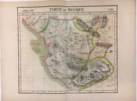
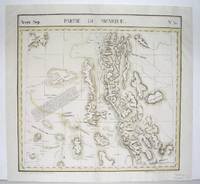
182740378Bruxelles: Ph. Vandermaelen 1827. First edition. Very good bright copies a few minor spots or marginal finger soiling. 2 sheets. Hand-colored lithographic maps. 46 x 51 cm and 46 x 54 cm. Large scale map of Baja. Map 58 includes parts of Baja California Sonora Sinaloa and Chihuahua. Map 65 includes the tip of Baja California and the "Iles Revillagigedo" and a text box: Note sur le Mexique . de Humboldt. Sheets from Phillipe Vandermaelen Atlas universel de geographie physique politique statistique et mineralogique. a magnificent and ground breaking six volume atlas of the entire world which was the first Atlas to use lithography to show the entire world using such a large uniform scale approcimately 26 miles to the inch and which was designed to be joined together into a three-dimensional globe with a diameter of approximately 25 feet. Phillips 749. Sabin 43762. [Ph. Vandermaelen] unknown books
1827279853Brussels 1827. Map. Lithograph with original hand coloring. 18" x 21".<br/><br/> Beautiful depiction of Western Mexico with a focus on elevation from Mazatlan to Manzanillo -Mexico's busiest Pacific port. Phillippe Marie Vandermaelen 1795-1869 was a Belgian cartographer and publisher. His Atlas universal was both the first lithograph atlas and the first atlas to map the world on a uniform scale. The maps were meant to join together to form a huge globe. This map is a fine example of his work.<br/><br/> unknown books
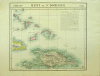
182740377Bruxelles: Ph. Vandermaelen 1827. First edition. Very good bright copies a few minor spots or marginal finger soiling. 2 sheets. Hand-colored lithographic maps. 46 x 53 cm and 50 x 56 cm. Large scale map of Haiti; map 68 also includes parts of Cuba and the Bahamas and has a text box entitled: Iles Bahamas ou Lucayes; map 74 includes the southern and remaining portion of Haiti plus Aruba Bonaire and small parts of Puerto Rico and Venezuela. Text box entitled: Republique d'Haiti. Redigee par A. Delavault. Sheets from Phillipe Vandermaelen Atlas universel de geographie physique politique statistique et mineralogique. a magnificent and ground breaking six volume atlas of the entire world which was the first Atlas to use lithography to show the entire world using such a large uniform scale approximately 26 miles to the inch and which was designed to be joined together into a three-dimensional globe with a diameter of approximately 25 feet. [Ph. Vandermaelen] unknown books
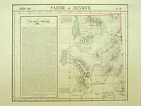
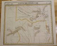
182740379Bruxelles: Ph. Vandermaelen 1827. First edition. A very good sharp copy. 1 sheet. Hand-colored lithographic map. 47 x 57 cm. Shows the ranges of eight Indian tribes. Covers parts of Utah Colorado and northern Arizona and New Mexico. Includes text: Note sur le Mexique. At a time when American map publishers were virtually ignoring the western United States Vandermaelen's large scale work -which includes sections of Utah Wyoming Arizona and Nevada then still considered part of Mexico along with the location of Indian tribes and shows Lake Timpanagos- was a landmark in the history the cartography of the Transmississippi West. Large text box on the left entitled: Note sur le Mexique by A. Delavault. From Phillipe Vandermaelen Atlas universel de geographie physique politique statistique et mineralogique. a magnificent and ground breaking six volume atlas of the entire world which was the first atlas to use lithography to show the entire world using such a large uniform scale approximately 26 miles to the inch and which was designed to be joined together into a three-dimensional globe with a diameter of approximately 25 feet. Wheat Transmississippi 378. Sabin 43762. Phillips 749. [Ph. Vandermaelen] unknown books
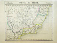
182740380Bruxelles: Ph. Vandermaelen 1827. First edition. A very good sharp set housed in a clamshell box. 17 sheets. Hand-colored lithographic maps. 47 x 57 cm. The Empire of Brazil on a grand scale printed shortly after Pedro declared the independence of Brazil but before the conclusion of the Cisplatine War against the United Provinces of the RÃo de la Plata Argentina which cost her Uruguay. Sheets from Phillipe Vandermaelen Atlas universel de geographie physique politique statistique et mineralogique. a magnificent and ground breaking six volume atlas of the entire world which was the first Atlas to use lithography to show the entire world using such a large uniform scale approximately 26 miles to the inch and which was designed to be joined together into a three-dimensional globe with a diameter of aboout 25 feet. Includes all of Brazil with some surrounding areas: 1. Amer. Merid. no. 9. Partie de la Colombie et du Bresil. Parts of Peru Colombia and Brazil. 2. Amer. Merid. 10. Partie du Bresil. Amazonas region Brazil. 3. Amer. Merid. 11. Partie du Bresil. Parts of Amazonas Para and Amapa. 4. Amer. Merid. 12. Partie du Bresil. Covers parts of Para and Maranhao. 5. Amer. Merid. 13. Partie du Bresil. Parts of Piaui Ceara and Rio Grande do Norte. Text: Note sur le Bresil . Pour la suite voyez la carte no. 32. 6. Amer. Merid. 15. Partie du Perou et du Bresil. Parts of Peru Brazil and northern Bolivia. 7. Amer. Merid. 16. Partie du Bresil. Parts of Brazil and northern Bolivia. 8. Amer. Merid. 17. Partie du Bresil. Parts of Mato Grosso Tocantins Amazonas and Para. 9. Amer. Merid. 18. Partie du Bresil. Parts Tocantins Bahia Maranhao and Piaui. 10. Amer. Merid. 19. Partie du Bresil. Parts of northeastern Brazil. 11. Amer. Merid. 22. Partie du Bresil. Part of Santa Cruz Bolivia and Mato Grosso and Mato Grosso do Sul Brazil. 12. Amer. Merid. 23. Partie du Bresil. Parts of Goias Federal District Minas Gerais and Tocantins. 13. Amer. Merid. 24. Partie du Bresil. Parts of Bahia and Minas Gerais with coast soundings. 14. Amer. Merid. 27. Partie du Bresil. Part of southern Brazil. 15. Amer. Merid. 28. Partie du Bresil. Parts of Sao Paulo Minas Gerais Espirito Santo and Rio de Janeiro states. 16. Amer. Merid. 32. Partie du Bresil. Part of southern Brazil. Text box: Note sur le Bresil. Pour le commencement voyez la carte no. 13. 17. Amer. Merid. 35. Partie du Bresil. Parts of Uruguay Rio Grande do Sul Brazil and Buenos Aires province Argentina an eighteenth sheet No.36 was labeled 'Partie du Bresil but in fact only included parts of Argentina and Chile. If joined together the map would measure approximately 9 x 7 feet. Phillips 749. Amer. Geol. Soc. Catalogue of Maps of Hispanic America: III p. 172. Sabin 43762. [Ph. Vandermaelen] unknown books
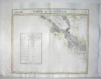
1827M2904Bruselles 1827. Excellent. Size : 464x557 mm 18.25x21.875 Inches Coloring: Original Outline Coloring Category: ; Maps Central America unknown
1827M2726Bruxelles 1827. Good; some worming on the upper and lower parts of the fold. Notes: From Vandermaelen's "Atlas Universel de Geographie Physique Politique Statistique et Mineralogique" Brusseles 1827.<br><br>"The map trade in the 1820s had taekn notice of the enormous interest in Texas and had begun to supply maps catering to it. In 1827 Phillipe van der Maelen's 'Atlas Universel' the most lavish and detailed cartographic production of the decade and the first major lithographed atlas included five maps depicting parts of Texas. These maps were based primarily on the outmoded models of Humboldt and Pike and contributed no new knowledge." Martin & Martin 32 Size : 470x515 mm 18.5x20.25 Inches Coloring: Original Outline Coloring Reference: Martin & Martin 32 Category: ; Maps United States South Texas unknown
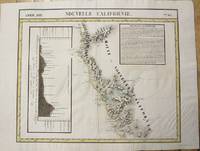
1827M2722Bruxelles 1827. Very Good; several wormholes on the upper and lower parts of the fold. Notes: From Vandermaelen's "Atlas Universel de Geographie Physique Politique Statistique et Mineralogique" Brusseles 1827. Size : 472x572 mm 18.625x22.5 Inches Coloring: Original Outline Coloring Category: Maps United States West California unknown
1827M2724Bruxelles 1827. Good; some worming on the upper and lower parts of the fold wormholes professionally filled. Notes: From Vandermaelen's "Atlas Universel de Geographie Physique Politique Statistique et Mineralogique" Brusseles 1827. Size : 468x490 mm 18.375x19.25 Inches Coloring: Original Outline Coloring Category: Maps United States West States; unknown
1827M2720Bruxelles 1827. Very Good; several wormholes on the upper and lower parts of the fold. Notes: From Vandermaelen's "Atlas Universel de Geographie Physique Politique Statistique et Mineralogique" Brusseles 1827. Size : 460x554 mm 18.125x21.75 Inches Coloring: Original Outline Coloring Category: Maps United States West States; unknown
182740379Bruxelles: Ph. Vandermaelen 1827. First edition. A very good sharp copy. 1 sheet. Hand-colored lithographic map. 47 x 57 cm. Shows the ranges of eight Indian tribes. Covers parts of Utah Colorado and northern Arizona and New Mexico. Includes text: Note sur le Mexique. At a time when American map publishers were virtually ignoring the western United States Vandermaelen's large scale work -which includes sections of Utah Wyoming Arizona and Nevada then still considered part of Mexico along with the location of Indian tribes and shows Lake Timpanagos- was a landmark in the history the cartography of the Transmississippi West. Large text box on the left entitled: Note sur le Mexique by A. Delavault. From Phillipe Vandermaelen Atlas universel de geographie physique politique statistique et mineralogique. a magnificent and ground breaking six volume atlas of the entire world which was the first atlas to use lithography to show the entire world using such a large uniform scale approximately 26 miles to the inch and which was designed to be joined together into a three-dimensional globe with a diameter of approximately 25 feet. Wheat Transmississippi 378. Sabin 43762. Phillips 749. [Ph. Vandermaelen] unknown