Philippe Derreumaux,Biblio.com

17 805 résultats
2013AME_9781848167544Imperial College Press 2013. 1st. Hardcover. New/New. Imperial College Press hardcover
6209419267.Gpaperback. Good. Access codes and supplements are not guaranteed with used items. May be an ex-library book. paperback
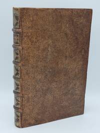
1667290471Paris.: Francois Preuveray. 1667. Folio. Contemporary mottled leather raised bands gilt spine decorations red speckled edges. Very good some rippling to pages. 36.5x24.5x6 cm. French text. A documentary history of the embassy of the young Louis XIII to the Holy Roman Emperor with commentary by Bethune. Scarce. Heavy book will require extra shipping. weight: 6.2 lb. Woodcut head- and tail-pieces initial letters and title page decoration title page printed in red and black. Francois Preuveray. hardcover
1144912326.Gpaperback. Good. Access codes and supplements are not guaranteed with used items. May be an ex-library book. paperback
1391228693.Ghardcover. Good. Access codes and supplements are not guaranteed with used items. May be an ex-library book. hardcover
1390822389.Gpaperback. Good. Access codes and supplements are not guaranteed with used items. May be an ex-library book. paperback
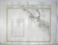
1827M2904Bruselles 1827. Excellent. Size : 464x557 mm 18.25x21.875 Inches Coloring: Original Outline Coloring Category: ; Maps Central America unknown
1827M2726Bruxelles 1827. Good; some worming on the upper and lower parts of the fold. Notes: From Vandermaelen's "Atlas Universel de Geographie Physique Politique Statistique et Mineralogique" Brusseles 1827.<br><br>"The map trade in the 1820s had taekn notice of the enormous interest in Texas and had begun to supply maps catering to it. In 1827 Phillipe van der Maelen's 'Atlas Universel' the most lavish and detailed cartographic production of the decade and the first major lithographed atlas included five maps depicting parts of Texas. These maps were based primarily on the outmoded models of Humboldt and Pike and contributed no new knowledge." Martin & Martin 32 Size : 470x515 mm 18.5x20.25 Inches Coloring: Original Outline Coloring Reference: Martin & Martin 32 Category: ; Maps United States South Texas unknown
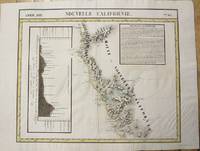
1827M2722Bruxelles 1827. Very Good; several wormholes on the upper and lower parts of the fold. Notes: From Vandermaelen's "Atlas Universel de Geographie Physique Politique Statistique et Mineralogique" Brusseles 1827. Size : 472x572 mm 18.625x22.5 Inches Coloring: Original Outline Coloring Category: Maps United States West California unknown
1827M2724Bruxelles 1827. Good; some worming on the upper and lower parts of the fold wormholes professionally filled. Notes: From Vandermaelen's "Atlas Universel de Geographie Physique Politique Statistique et Mineralogique" Brusseles 1827. Size : 468x490 mm 18.375x19.25 Inches Coloring: Original Outline Coloring Category: Maps United States West States; unknown
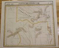
1827M2720Bruxelles 1827. Very Good; several wormholes on the upper and lower parts of the fold. Notes: From Vandermaelen's "Atlas Universel de Geographie Physique Politique Statistique et Mineralogique" Brusseles 1827. Size : 460x554 mm 18.125x21.75 Inches Coloring: Original Outline Coloring Category: Maps United States West States; unknown
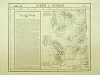
182740379Bruxelles: Ph. Vandermaelen 1827. First edition. A very good sharp copy. 1 sheet. Hand-colored lithographic map. 47 x 57 cm. Shows the ranges of eight Indian tribes. Covers parts of Utah Colorado and northern Arizona and New Mexico. Includes text: Note sur le Mexique. At a time when American map publishers were virtually ignoring the western United States Vandermaelen's large scale work -which includes sections of Utah Wyoming Arizona and Nevada then still considered part of Mexico along with the location of Indian tribes and shows Lake Timpanagos- was a landmark in the history the cartography of the Transmississippi West. Large text box on the left entitled: Note sur le Mexique by A. Delavault. From Phillipe Vandermaelen Atlas universel de geographie physique politique statistique et mineralogique. a magnificent and ground breaking six volume atlas of the entire world which was the first atlas to use lithography to show the entire world using such a large uniform scale approximately 26 miles to the inch and which was designed to be joined together into a three-dimensional globe with a diameter of approximately 25 feet. Wheat Transmississippi 378. Sabin 43762. Phillips 749. [Ph. Vandermaelen] unknown
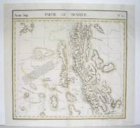
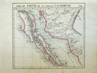
182740378Bruxelles: Ph. Vandermaelen 1827. First edition. Very good bright copies a few minor spots or marginal finger soiling. 2 sheets. Hand-colored lithographic maps. 46 x 51 cm and 46 x 54 cm. Large scale map of Baja. Map 58 includes parts of Baja California Sonora Sinaloa and Chihuahua. Map 65 includes the tip of Baja California and the "Iles Revillagigedo" and a text box: Note sur le Mexique . de Humboldt. Sheets from Phillipe Vandermaelen Atlas universel de geographie physique politique statistique et mineralogique. a magnificent and ground breaking six volume atlas of the entire world which was the first Atlas to use lithography to show the entire world using such a large uniform scale approcimately 26 miles to the inch and which was designed to be joined together into a three-dimensional globe with a diameter of approximately 25 feet. Phillips 749. Sabin 43762. [Ph. Vandermaelen] unknown
84218.5" x 22"-46.9 x 55.8 cm. . Colour. A nice crisp copy with wide margins. An interesting topographical chart showing the profile of the Canal of Huehuetca in Mexico and its funciotn of preserving flooding in Mexico city. unknown
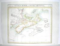
1827M2906Bruxelles 1827. Excellent. Size : 470x530 mm 18.5x20.875 Inches Coloring: Original Outline Coloring Category: ; Maps Canada East Nova Scotia; Maps Canada East Prince Edward Island; Maps Canada East New Brunswick; Maps Canada East Newfoundland unknown
1827M2907Bruxelles 1827. Excellent. Size : 482x565 mm 19x22.25 Inches Coloring: Original Outline Coloring Category: Maps Polar Arctic Regions Alaska Greenland Iceland; unknown
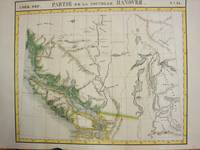
1825M3339Bruxelles 1825. Excellent;. Notes: The first atlas of the world on a uniform scale. If assembled as a globe gores forms a very large globe.<br><br>The map shows British Columbia and extends as far north and the Straits of Queen Charlotte. The map also notes the location of different Native tribes of the area. Finally this map shows the route that MacKenzie took to the Pacific from the Frasier River. Size : 472x561 mm 18.625x22.125 Inches Coloring: Original Hand Coloring Category: Maps Canada West British Columbia; unknown
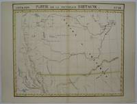
1825M3340Bruxelles 1825. Very Good. Notes: An uncommon map of South Alberta. The map clearly shows the location of Fort Edmonton and other major establishment. From the first atlas of the World on an uniform scale. If assembled as a globe gores forms a very large globe. Size : 470x563 mm 18.5x22.125 Inches Coloring: Hand Colored Category: Maps Canada West Alberta unknown
SONG1848222343Lund Humphries Publishers Ltd 2017-07-01. hardcover. Used: Good. 10.00x1.40x12.25. Buy with confidence. Excellent Customer Service & Return policy. Lund Humphries Publishers Ltd hardcover
2006DADAX0810930846Brand: Harry N. Abrams 2006-11-01. hardcover. New. 11.25x1.25x14.25. Buy with confidence. Excellent Customer Service & Return policy. Brand: Harry N. Abrams hardcover
19922090502130602496Sogen-sha 1992. Soft Cover. Fine. Number of books: 1 Sogen-sha paperback
19972081502111703528Sogen-sha 1997. Soft Cover. Fine. Number of pages: 198p Size: 18cm Sogen-sha paperback
19952091202132704176Knowledge Reintroduction Double Book 20 Sogensha 1995. Soft Cover. Fine. The book is in fine condition. Knowledge Reintroduction Double Book 20 Sogensha paperback
1991BN207029Harry N. Abrams Inc. / AFA 1991. 1991. American Watercolors from the Metropolitan Museum of Art <br/><br/>American Watercolors from the Metropolitan Museum of Art Stephen Rubin; N. Y. Metropolitan Museum of Art; American Federation of Arts Hrsg.; Victor Koshkin-Youritzin; Philippe de Montebello Mitarb.; John K. Howat Vorwort; Stephen Rubin Kommentare Harry N. Abrams, Inc. / AFA unknown
2343202222.Gpaperback. Good. Access codes and supplements are not guaranteed with used items. May be an ex-library book. paperback