BaconBiblio.com
6 931 résultats
1880019070London: G. W. Bacon 1880. Book. Fair. Hardcover. New Edition. Guide is heavily soiled with wear thus fair. Both folded maps are present. No date but the frontis with horse drawn vehicles suggests circa 1880. . G. W. Bacon Hardcover
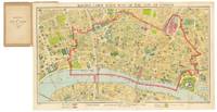
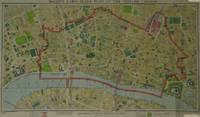
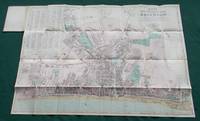
1946328551G. W. Bacon & Co 1946. Pocket map color lithograph folding into original brown printed card wrapper with Underground map printed on verso 16 pp. Date written on cover small label pasted inside cover and some light wear to map edges otherwise in very good condition. Index booklet to inner cover.<br/> <br/> Striking post war large scale folding map of London highlighting 'Blitzed City Areas". Area covered includes Farringdon Southwark Aldgate and Aldwych in the West end. George Washington Bacon 1830 - 1922 was a London-based book and map publisher. His firm G.W. Bacon and Co. published several important atlases including The New Ordnance Atlas of the British Isles. This map is a fine example of Bacon's publishing work.<br/> <br/> G. W. Bacon & Co unknown
5376London Bacon 1926. Hardcover. . ~ ~ NOTE: THE PRICE OF THIS BOOK IS CURRENTLY REDUCED! ~ ~ . Royal quarto. Complete with title-page printed in red & black Contents Alphabetical list of districts and all 59 double-page colour lithograph maps as follows: 7 maps of the Home Counties I-VII; 17 Special maps and plans of London VIII-XXIV; one Index map; and 34 four-inch scale maps sheets 1-34. Plus an alphabetical index to over 20000 streets. HARDCOVER bound in the original publisher's navy blue full cloth large decorative lettering in gilt to cover gilt spine sewn cloth inner hinges thumb index; extremities rubbed chafed the fold-out general map bit creased and edge-frayed few repairs to verso of maps splits at centre fold of few maps. In a very good condition. ~ On first paste-down is the ink stamp "Hiram Walker & Sons. Ltd. / 27 Cockspur Street S.W.1." The address is then crossed out and changed in contemporary hand to "170/3 Piccadilly W.1" and the date "1926" is added by different hand. Hiram Walker started producing spirits in 1858 pioneering numerous distillation and manufacturing processes that are now industry standards. Harry Clifford Hatch 1884-1946 a Canadian businessman acquired Hiram Walker & Sons in 1926. He merged it with Gooderham & Worts of Toronto to form Hiram Walker Gooderham & Worts Ltd. one of the largest whisky distillers in the world. The Scotland subsidiaries distributed spirits to pubs all over England. Almost all of the 4-inch scale maps in this copy were used to meticulously mark the location of every single London establishment that was on the distribution list of the distillery. Each enterprise is identified by unique number in a very neat hand in black or red ink; there are probably more than a thousand such entries. Names of some establishments are added in pencil by a different hand. Extremely rare document of the time mapping London's pub sector and hotel and catering industry of the first half of the 20th Century. Y-1 <br/> <br/> London, Bacon, (1926). hardcover
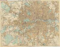
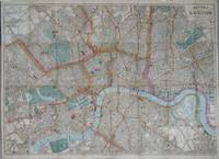
63834London: G.W. Bacon & Co. Ltd. Strand c.1882. Overall dimensions 71 x 93 cm. Colour printed map of London showing the extents fromHighgate down to Upper Norwood and West Ham across to Ealing with inset map of Hamptopn Court and surrounds. The plan backed onto thin cloth foldsingbetween red cloth covers 18 x 13 cm. gilt decorated to upper board advertisement for Chas. Baker Stores to front paste down Wthout the "Guide". Hyde. 191 London: G.W. Bacon & Co., Ltd. Strand, [c.1882]. hardcover
53850London: G.W. Bacon. c. 1900. Folding map with original hand-colour. Overall 51 x 72 cm. Folding into original green cloth wrappers 18 x 10 cm. with circular paper title label printed in red to upper cover. Slight wear to a few folded corners covers slightly soiled. London: G.W. Bacon. [c. 1900] hardcover
52100London: G. W. Bacon & Co. Ltd. 30 Museum Street 1948. Map dimensions 38 x 67 cm overall dimensions 42 x 71 cm. Folding plan of the City on a scale of 12 inches to the mile. The plan shows the extents from Farringdon down to Southwark and Aldgate across to Aldwych. The whole backed on linen folding into original brown printed card wrapper with Underground map printed on verso 16 pp. Index booklet to inner cover A serial number y/8 appears next to the copyright at the bottom left margin presumably 1948. Certainly a post war issue as it highlights "Blitzed City Areas" Cf. Boyle 445. London: G. W. Bacon & Co. Ltd., 30 Museum Street [1948] unknown
43274London: G. W. Bacon & Co. Ltd. 30 Museum Street 1948. Map dimensions 38 x 67 cm overall dimensions 42 x 71 cm. Folding plan of the City on a scale of 12 inches to the mile. The plan shows the extents from Farringdon down to Southwark and Aldgate across to Aldwych. The whole backed on linen folding into original brown printed card wrapper with Underground map printed on verso 16 pp. Index booklet to inner cover A fine copy. A serial number y/8 appears next to the copyright at the bottom left margin presumably 1948. Certainly a post war issue as it highlights "Blitzed City Areas" Cf. Boyle 445. London: G. W. Bacon & Co. Ltd., 30 Museum Street [1948] unknown
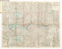
19059368London: GW Bacon & Co Ltd c. 1905. Red embossed cloth covered boards in good condition measuring 19.5 cm x 12 cm; a little age toned to edges; containing 60 pp. Guide to London and large colour folding linen backed map measuring 83.5 cm x 72 cm divided into half mile squares and showing underground and electric railways. No date is evident but the advertisements within the Guide show typeface and clothing consistent with the 1905 - 1910 period. GUIDE TO LONDON: In very good condition. Double page spread advertisement for Chas Baker & Co followed by a small double page map of Central London with scale 9 inches to a mile. Guide includes cab fares lists of attractions and places of interest a double page map of railway stations and an index to districts. Leaves numbered 1-60 although 51 - 58 no longer included. MAP: In very good condition colours remaining vibrant. A little age toned and nicked to edges; creased along central folds which remain otherwise very sound. Map extends North/South from Crouch End to Upper Norwood and West/East from Brentford to Greenwich. Underground and electric railways and stations marked in red. Please contact Christian White Rare Books Ltd for more information or images of this item 1905 GW Bacon & Co Ltd hardcover
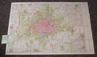
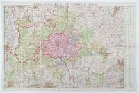
1930011326London: G. W. Bacon 1930. Large folding linen backed coloured map. Map measures 99x148.cm 39x58 inches with the extra fold-out Map in very good clean condition. House in original publishers green slipcase. A very nice clean map. F. Very Good. G. W. Bacon unknown
1912133548London : G.W. Bacon & Co Limited 1912. 1st Edition . Hardcover. Very Good/No Jacket. 4to - over 9¾ - 12" tall. first thus large 4to original half leather hardcover all page edges gilt many fine clean maps including the additional town maps/plans and additional Colonial maps extremities rubbed otherwise a very good well bound clean and complete copy. We are a real bookshop with real books situated in and shipping from the United Kingdom. <br/> <br/> G.W. Bacon & Co Limited hardcover
38267London: G. W. Bacon & Co. Ltd. Norwich Street Fetter Lane EC4. c. 1931. Map dimensions 92 x 132 cm excluding table to right margin overall dimensions 100 x 149 cm. Large folding map of London and the surrounding regions covering the extents from Hoddesdon down to Reigate and Canvey Island across to Windsor. Bright original colour marking out the counties boroughs districts and parishes. The map divided into three mile squares numbered and lettered at the borders the grid references corresponding to a large index of local authorities found at the right margin. Printed over four conjoined sheets the whole divided into 28 sections and mounted on linen. Folds into orginal dark green cloth slipcase gilt lettered to the upper board. Marbled paper to folded end sections on linen verso. The slipcase slightly worn at extremities one of the lower joints cracked at the upper edge. The map in excellent condition. The Northern Line extension from Clapham Common to Morden opened 1926 is marked on the map. Park Royal & Twyford Abbey Station on the District now Piccadilly Line is also shown the station was closed in mid 1931. Stations along the eastern extent of the District Line between Barking and Upminster re-opened 1932 such as Upney and Becontree are not shown. London: G. W. Bacon & Co. Ltd. Norwich Street, Fetter Lane, EC4. [c. 1931] hardcover
1912bac28bManchester: G W Bacon & Co Ltd. VG : in very good condition. Light rubbing and marking to cloth cover. 1912. First Edition. Maroon hardback cloth cover. 250mm x 250mm 10" x 10". 20 panels. 20 panel linen-backed colour map. Pre First World War map of the South East and Central England. Includes mileage limitations for cars which are set at c. 10 mph. . G W Bacon & Co Ltd hardcover
44904Manchester: G W Bacon & Co Ltd. no date c. 1912 . Light rubbing and marking to cloth cover. 1912. First Edition. Maroon hardback cloth cover. 10" x 10". 12 panel linen-backed colour map. Pre First World War map of the South East and Central England. Includes mileage limitations for cars which are set at 10 mph. . Manchester: G W Bacon & Co Ltd. [no date c. 1912?] . hardcover
1920017027London: G. W. Bacon. Printed By Permission of Roadway Publications 1920. No printed date circa 1920. Very large linen backed coloured map. Map measures 168x120.cm in 40 sections map in 2 parts. Library stamps on verso one library stamp on information caption some pencil marking to margins. Map in very good clean condition. Housed in original publushers slipcase. A very good clean rare map. F. Very Good Plus. G. W. Bacon. Printed By Permission of Roadway Publications unknown
007096London: 127 Strand: G.W. Bacon & Co. Hardcover. Very Good. Coloured map mounted on linen 18 panels 1170900 mm folded into a red cloth gilt printed case 315199 mm with the Alphabetical Index Gazetteer Table of Distrances Geological References Explanation & a Glossary ofWelsh Names within not dated but c1900 Uncommon not listed at WorldCat Copac or OCLC. <br/> <br/> G.W. Bacon & Co hardcover
40040AUTOMOBILE TRAVEL MAP - WORCESTER BACON & CO. G.W. BACON'S NEW HALF-INCH MAPS CYCLING AND MOTORING; WORCESTER DISTRICT. London: G.W. Bacon & Co. 1901. Small 8vo. Colored decorated stiff wrappers 10 2 pages with fold out map 26 x 35 1/2 inches unfolded. Scarce early 20th century automobile travel map for Worcester County in Engla A detailed map outlined in color with index included. Part of the G.W. Bacon Company services of county maps for England. 40040. unknown
1900013984London: Bacon 1900. No printed date circa 1900.Large coloured map printed on linen. Measure 45x68.cm in 24 secition. Map in clean near fine condition. Housed in original publishers slipcase. A very nice copy. F. Very Good Plus. Bacon unknown
1890015469G. W. Bacon 1890. Coloured map measures 62x87.cm. Linen backed in 32 sections. Map rubbed worn on folds crude hand colouring short split on one fold. Generally map in good condition. Without the original cloth cover. F. Good. G. W. Bacon hardcover
1890013831London: G. W. Bacon 1890. Coloured map measures 62x87.cm. Linen backed in 32 sections. Map has some minor wear. Generally in very good clean condition. Folding into green cloth covers. Covers rubbed some staining. A nice map. F. Near Very Good. G. W. Bacon hardcover
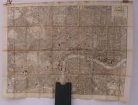
189028097Bacon c.1890. Folding engraved map printed on fine ivory linen size: 21 x 28 ins approx. 53.0 x 71.0 cms folding in 36 panels to 6 x 3 ins approx. 15.o x 7.5 cms printed surface very lightly browned rather more heavily so along central fold a few locations marked with red ink ; original green cloth slip-case framed in blind and lettered in black 'Flexible Map of London' with deckled thumb-hole a very good bright copy. Covers the area from Islington north to Oval south; Notting Hill west to Stepney east. IN THIS CONDITION A RARE SURVIVAL. Hyde 'Printed Maps of Victorian London' no. 201. Bacon, hardcover
59727London Bacon No date but later half of 19th century. Hand coloured folding map of London 102 x 79 . The map is printed on paper mounted on linen and folds between publisher's original cloth boards with title in gilt lettering to front board. Advertisement for 'Chas. Baker & Co.' to inside of upper cover and Guide Book and Index 62 pp. Wear to text and a few leaves detached. Boards and map fine and clean. hardcover
54393London: G.W. Bacon & Co. 127 Strand. c.1876. 66 x 84 cm. Original hand coloured folding map of London showing extents from Highbury in the north to Kennington in the south and from Holland Park in the west to Hackney in the east. The map is printed on paper mounted on linen and folds between original publisher's red cloth boards with titles and decoration stamped in gilt and black to upper cover and blind to lower cover. Advertisement for 'Chas. Baker & Co.' to inside of upper cover and Guide Book and Index Slight wear to some fold corners. Hyde 160 1. London: G.W. Bacon & Co. 127 Strand. [c.1876] hardcover
39204London: G.W. Bacon & Co. Ltd. 127 Strand. 1874. Map dimensions 58 x 81.5 cm overall dimensions 61 x 83.5 cm. Folding plan of London with printed colour in block and outline. The plan shows the extents from Holloway to North Brixton and West India Docks to Holland Park. The whole backed onto linen folds into rust coloured cloth covers with gilt lettering on upper cover. Booklet title "Stranger's Guide to London" pp.45 inserted at inner cover behind this an uncoloured fold out large scale plan of the City of London c. 14.5 x 40 cm showing the extents from Smithfield down to Blackfriars Bridge and Aldgate across to Lincoln's Inn. Spine of booklet perished contents loose. Except for some light spotting to linen verso both the map and the covers in very good condition. The map appears in a number of formats. Hyde lists 10 of these some of which went into a number of editions. This example has most in common with No. 160. A though it is dated earlier than Hyde's first example he attributes a date of c. 1876 Cf Hyde 160 A. Cf. Boyle 279 for Hyde's first state. London: G.W. Bacon & Co. Ltd. 127 Strand. 1874 hardcover
190071913colour map with with 21 sections scale of 1 cm to 10 miles details the Transvaal region inserts of Africa Cape Colony and Orange Free State Published by G. W. Bacon paperback
1928011452London: G. W. Bacon & Co 1928. 1st Edition. Hardcover. Near Fine. Undated but neat previous owner inscription on cover sates "purchased July 1928". Near fine no apparent signs of use. 36 panel folds out to aboout 38" x 29". Green cloth covers with 24 page text titled "Strangers' Guide to London" which includes detailed street index. A collectible copy. G. W. Bacon & Co hardcover