195 résultats
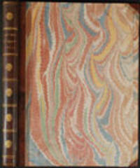
6717152 pp. 8vo orig. pink printed wrappers bound in attractive modern marbled wrappers. From the upper wrapper: "Perthes & Besser Buchhandlung Hamburg 1816." Following a nine-year apprenticeship Friedrich Christoph Perthes 1772-1843 established his own book business in 1796. Two years later he entered into a partnership with his brother-in-law Johann Heinrich Besser 1775-1826. They soon became one of the leading publishing and bookselling firms of northern Germany. During the Napoleonic period Perthes experienced many difficulties caused by his public resistance to French influences and was forced to leave Hamburg. This remarkable priced catalogue lists about 3000 books published in Britain and France from 1812 to 1816; it is quite incredible to imagine the quality and range of the stock of foreign books held by Perthes & Besser. Pages 1-77 list the British books; pages 81-149 the French books and pages 150-52 list about 60 books published in North America including Lewis and Clark's recently issued History. Perthes & Besser also sold British scholarly journals. Rare; WorldCat lists one copy in North America. unknown books
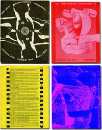
1971143125New York: Filmmakers Newsletter / Filmmakers' Cinematheque 1971. Archive of 41 issues of "Filmmakers Newsletter" dating from the first four years of the magazine including Vol. I issue 1. Early issues of the magazine are scarce and putting together a collection of this size piecemeal would be prohibitively difficult. <br/><br/>Founded in 1967 by experimental filmmaker Carl Linder as "New York Filmmakers' Newsletter" it was originally published out of the Filmmakers Cinematheque and served a similar purpose as Canyon Cinema's "Canyon Cinemanews" disseminating information on screenings festivals and republishing articles and essays about experimental film. Suni Mallow took over as editor in early 1968 and she quickly brought a wider focus to the magazine dropping "New York" from the title and publishing the magazine under its own imprint although it still retained ties to the Cinematheque. This broader approach to the world of avant garde film was successful and when Mallow sold the magazine in 1979 after becoming publisher in 1969 it had one of the highest ad rates per reader in business speaking to "Filmmakers Newsletter's" reach and influence among experimental filmmakers distributors hobbiest critics and fans. <br/><br/>Contributors to the issues in the archive include Jonas Mekas Stan Brakhage Bruce Conner George Maciunas Hollis Frampton Standish Lawder and Alan Lomax while future Academy Award and Cannes animator Bill Plympton was a staff member in 1970. <br/><br/>For more details please inquire. <br/><br/>Issues 8.5 x 11 inches with black and white images and illustrations throughout. Generally Near Fine. Filmmakers Newsletter / Filmmakers' Cinematheque unknown books
18883393San Francisco: Published by Bell & Heymans 1888. First Edition. Very good. Folio 350 x 258 mm. 86 ix 1 pp. including fascinating advertisements. Original wrappers chipped and foxed. Wrappers with two-color lithographs 44 b/w lithographs illustrating the text some extending over 2 pages all by Britton & Rey San Francisco. MAP 53 x 71 cm with some short tears at fold intersections. Recto: "Map of Sonoma County Cal'a sic. Showing Boundary Lines of County and Townships Railroads and Public Roads Cities Towns &c. &c." Published by Bell and Heymans 434 California St. San Francisco Copyrighted May 1888. Lithographer: Cal Label & MacCabe Lith Co. San Francisco. Verso: "Map of Verano Sonoma Valley California." Lithographer: H.S. Crocker & Co. San Francisco. Beautifully illustrated promotional materials for the nascent planned community of Verano Sonomy Valley created by the firm of Britton & Rey in their prime. The folio volume and the accompanying map sheet with color illustrations are rare: this is the only complete copy that has been recorded at auction.<br/><br/>Although more commercial than the Thompson & West local histories the present work has the same type of wonderful documentation with the added cache of ads that enhance the historical value. Following a history of Sonoma County and Russian River Valley are essays on industries agriculture orchards viticulture stock raising lumber minerals natural wonders business opportunities social life etc. These promotional materials were apparently aimed at investors from the East Coast and perhaps beyond; at some point our map was inscribed in French: "Californie" sic. <br/><br/>The remarkable lithographs by Britton & Rey depict scenes views panoramas portraits architecture vineyards orchards etc. some after photographs. Included with our copy is the rare folding lithograph sheet with map of Sonoma County on one side and colored illustrations and map of Verano on other side Hooker Falls orange and olive grove General Vallejo's home Sonoma Creek Verano Park. At that time Verano now known as El Verano was a planned community. The present promotional items were no doubt occasioned when a new train depot was built nearby. <br/><br/>The Bancroft copy as recorded by OskiCat does not contain the map but there is a related map greatly reduced defective and apparently printed on one side only by H.S. Crocker with the same title likewise surveyed by P.R. Davis which measures 26 x 46 cm or about half the size as ours. <br/><br/>Auction comparables: Dorothy Sloan Auction 20 2007 lot 6 this copy purchased after the sale for $1410. An ugly copy of the map backed with tissue thus obscuring the entire "Map of Sonoma County Cala" on the verso sold at PBA on June 7 2012 for $600. <br/><br/>Rocq 14850. Published by Bell & Heymans unknown books
179425786London: publish'd by Laurie & Whittle 1794. Engraved map on four joined sheets hand coloured in outline. Bowen and Gibson's large scale wall map of North America: a Laurie and Whittle issue published following the Treaty of Paris that ended the American Revolution.<br/> <br/>Bowen and Gibson's map was first issued in about 1755 under the title An Accurate Map of North America. It served as a generally accurate template for showing the enormous political changes that took place in the next forty years. Sometimes known as the Pownall Map of North America because of the significant contribution the former governor of Massachusetts Thomas Pownall made to the geographical knowledge of the northeast this large wall map has great presence and teems with information including numerous Native American placenames in the western areasnative tribal regions notes and routes of early roads and the forts along the Mississippi and to the west of the Appalachians. The two inset maps are of Baffin and Hudson's Bays and the mouth of the Colorado River the latter map based on the explorations of Eusebio Kino. The present map is the fourth version of the title and is an issue which incorporates the changes brought about by the 1783 Treaty of Paris. A notation on the map reads: "The Divisions in this map are coloured according to the preliminaries signed at Versailles sic. January 20th. 1783. The Red indicates the British posessions; the Green those of the United States; the Blue what belongs to the French and the Yellow what belongs to the Spaniards." Also included is Article III from the Treaty that guaranteed fishing rights to the United States in the Grand Banks and other places around New Brunswick and Newfoundland. Previous issues dating to the Revolution had included some of the articles of the 1763 Treaty these have been entirely removed and the cartouche has been reworked among other changes. The present issue has no imprint in the bottom right corner is printed on laid paper and includes the western coast of Newfoundland coloured in red.<br/> <br/>Degrees of Latitude 36; Stevens & Tree "Comparative Cartography" 49k in Tooley The Mapping of America. publish'd by Laurie & Whittle unknown books
18025174London: Harding 1802. Aquatint coloured by hand on laid paper watermark '1802' Publication line at foot of plate shaved with slight loss some expertly repaired tears to margins. An anonymous work of quality.<br/> <br/>Unusually the present work does not include either the artist responsible for the original or the engraver who worked on the plate. The publication line is very faint: sometimes an indication of a later issue but the early watermark does not support this. None of the standard reference works include either this print or mention of the horse Sacripant. This suggests that this image is rare and the absence of names allied with the early watermark may indicate some sort of proof issue. Harding unknown books
18905166London: J. Braill & Son 1890. Aquatint printed in colours and finished by hand. A fine copy of this excellent late example of the racing aquatint.<br/> <br/>The heyday of the racing aquatint in Britain was probably about 1830 but the present example shows that the art had not died out even sixty years later. The print is unfortunately unsigned but aside from the process used the style of painting is charming and recalls the work of John Frederick Herring and his contemporaries. J. Braill & Son unknown books
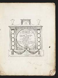
5153Engraved title-page & 24 engraved plates several plates slightly dampstained. Large 4to orig. blue wrappers frayed & scribbled upon by an early owner stitched as issued uncut. London: I. & J. Taylor 1792. First edition and very rare; ESTC locates only two copies: at the Bodleian and Avery Architecture Library. This is very attractive work of designs for storefronts and specialized doors issued by the leading publishers of architectural works of Britain the Taylor's Architectural Library. The Taylors father and son were shrewd businessmen and gave priority to the practical manuals required to support the building boom of the late eighteenth century. Bound-in at end is a two leaf folio catalogue of the Taylor's publications this seems to be ESTC T80563 dated after 1795. Good copy of a very rare book preserved in a box. ❧ ODNB. unknown books
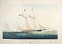
186119902New York: Currier & Ives 1861. Hand-coloured lithograph by Charles Parsons signature in image. Expert marginal repairs. Sheet size: 22 1/2 x 32 inches. Image size: 17 1/2 x 27 1/4 inches. A magnificent Currier & Ives portrait of one of the premier yachts in the New York Yacht Club: the yacht that beat the "America" in her speed trials.<br/> <br/>The Stevens brothers listed in the title were members of a prominent American family their father had served in the American Revolution. John Cox Stevens was one of the founding members of the New York Yacht Club the first Commodore and one of five sponsors of the "America" the yacht that went to England in 1851 and won the race thereafter known as the America's Cup Race. His brother Robert L. Stevens designed the "Maria" which beat the "America" during the series of speed trial races to Sandy Hook prior to the latter's epoch-making trip to England. The "Maria" was one of the most beautiful yachts in an era of exceptionally beautiful boats: an icon amongst American yachts. It was estimated that the Stevens spent a total of $100000 on experiments and alterations involving Maria in the 22 years that she was in the family. A 1914 article in the New York Times described her as "a scientific racing machine the first of her kind" cf. NYT 17 May 1914.<br/> <br/>Conningham 6805; Gale 7360. Currier & Ives unknown books
1896LV1550Los Angeles:: Elstner-Morehouse 1896. 1896. Large oblong 4to. Not paginated. 36 full page illustrations of Los Angeles with related adverts on the opposite pages 15 full page photos of individual Los Angeles Buildings. Original full gilt stamped brown cloth; inner hinges neatly repaired. Early inscription to Arthur Ellis 1927. Early Ownership signature of Sam Behrendt Los Angeles 1925. Fine. EXTREMELY SCARCE. BEAUTIFUL COPY OF THIS VERY RARE LOS ANGELES SKETCHBOOK. With 36 full-page plates depicting early Los Angeles buildings. This unequaled record of the central Los Angeles business district was created according to the preface in order ". . .to show the active business portions together with a few of the more pretentious of the office buildings and manufactories". Arthur Ellis was a founding member of the Zamorano Club. Provenance: Sam Behrendt the son of Los Angeles pioneer Caspare Behrendt d.1913 the discovery of gold brought him to California "acquired his education in the Spring Street and Eighth Street Grammar Schools at Los Angeles and after he was fifteen years old spent one year in a business college. For to years he clerked in a grocery and cigar business and remained there until 1900. Selling out and returning to Los Angeles he became connected with the San Gabriel Electric Company later merged with the Pacific Light and Power Company. He was employed as a collector and later solicited new contracts for three years. On leaving that corporation Mr. Behrendt entered the insurance business for himself and in 1907 took in Mr. I. O. Levy as a partner under the name Behrendt-Levy Company and they incorporated the business in 1908. This is a general insurance agency and the establishment now employs twenty-one people. Mr. Behrendt is also a director of the Union Bank and Trust Company and a director of the Shiff Lang & Company." He is a member of Hollenbeck Lodge no. 119 a Scottish Rite Mason and Shriner Elk Corona Parlor of the Native Sons of the Golden West B’nai Birth Los Angeles Athletic Club San Gabriel Country Club City Club Chamber of Commerce Merchants and Manufacturers Association and the Friars Club of New York. At Oakland Ca. he married Sadie Mosbacher. Together they had a son George b.1904. Behrendt was also known to be a friend of film star Roscoe "Fatty" Arbuckle holding a dinner in his honor at the Alexandria Hotel February 12 1917. – McGroarty. John Steven McGroarty Los Angeles from the mountains to the sea: with selected biography vol. II p. 422; James Miller Guinn A history of California and an extended history of Los Angeles and . . . 1915 page 124; Harris Newmark Sixty Years in Southern California. Elstner-Morehouse, 1896. hardcover books
17946467London: Laurie & Whittle 1794. Engraving with mezzotint and roulette-work a set of four titled 'Spring' 'Summer' 'Autumn' and 'Winter'. A beautiful series depicting a pair of lovers progressing through the seasons in a country landscape<br/> <br/>Spring and the gentleman presents his love with garlands of flowers a flower-seller kneels in front of them and holds up a swag of flowers she has just picked up from her overflowing basket. Summer and the harvest is in full swing the gentleman holds his love's hand and points to the young children gathering sheaths of corn in the mid-ground. The lady is seated on harvested corn in front of a stand of trees. In the trees an elder lady keeps an eye on the pair of lovers. Autumn and the pair are seated at the edge of some trees the lady offers her love a pineapple whilst her apron overflows with the fruits of the autumn. In the mid-ground two gentlemen and their dogs are out shooting. Winter and the happy pair well-wrapped against the cold take a stroll and watch the skaters in the mid-ground. Each title panel includes an appropriate 6 to 8 line quote from James Thomson's The Seasons. Laurie & Whittle unknown books
18823554New York: Currier & Ives 1882. Lithograph printed in colours. An excellent Currier & Ives image of a racing yacht at full stretch.<br/> <br/>A valuable pictorial record of this New York Yacht Club vessel owned jointly by H.W. Johnson and William Krebs from a painting by the prolific and highly talented Charles R. Parsons.<br/> <br/>Conningham 1281; Gale 1404. Currier & Ives unknown books
18673551New York: Currier & Ives 1867. Lithograph coloured by hand. Currier & Ives view of the start of the first Trans-Atlantic yacht race.<br/> <br/>This image recalls the start of modern ocean racing: in 1866 under New York Yacht Club rules three schooners of between 32 and 32.6 metres raced from Sandy Hook N.J. to Cowes Isle of Wight. The Henrietta owned by American newspaper publisher James Gordon Bennett won arriving at 5:45 pm on Christmas day in a time of 13 days and 22 hours. The Fleetwing arrived 8 hours later followed by the Vesta 1 1/2 hours after her.<br/> <br/>Conningham 2634; Gale 2854. Currier & Ives unknown books
1852WRCAM16070Nashville 1852. Two volumes. viii374 i.e. 376; vii376pp. plus thirty-one plates. Later three-quarter black morocco and cloth spines gilt. Corners lightly worn. Ownership inscription on verso of each frontispiece bookplate on rear pastedowns. First volume with ink stamp on pastedown and titlepage. Lightly foxed. Some light wear and soiling. Very good. A very rare complete set of this interesting and important Tennessee periodical containing all twelve articles entitled "Early History of the Southwest" which constitute the main interest of the magazine for modern readers. After the magazine ceased publication with the December 1852 issue the editors followed their intention stated in their last editorial and gathered all of the narratives into a book issued in January 1853 entitled INDIAN BATTLES MURDERS SEIGES sic AND FORAYS IN THE SOUTH- WEST. ".This was a collection of narratives by various authors. These had appeared separately as articles in the SOUTH WESTERN MONTHLY MAGAZINE printed in Nashville during the years 1851-52. The magazines are considered frontier periodicals of extreme rarity - the 1853 book.is all but unobtainable. Apparently few copies of the book were printed judging from the very few times one finds records of its sale." - Allen. The actual first appearances in print of all of the items in the book are the periodical versions. <br> <br> Articles include "Sketch of the Captivity of Col. Joseph Brown" "The Indian Massacres in the Vicinity of Bosley's Spring." "Indian Murders around Nashville - Narrative of John Davis Esq." "Scalping of Thomas Everett and his two sisters near Buchanan's Fort." "Indian Battles and Murders - Narrative of General Hall" "Perils attending emigration from Virginia to the West.burning of Sigler's Fort. Narrative of John Carr" "The levy of men sent out from North Carolina.narrative of Mr. Samuel Blair" "Narrative of John Rains" "Massacre at Cavet's Station." Virtually all of the narratives describe Indian fights in Tennessee between the 1780s and the War of 1812. <br> <br> An important rarity of Indian warfare on the Old Southwest frontier. This set has a remarkably large number of plates; other sets we know of have far fewer. All seem to be remainders from New York publications used as illustrations without regard to text. HOWES W30 ref. ALLEN RARITIES 47. ALLEN IMPRINTS 3160. hardcover books
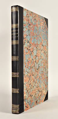
182729764Philadelphia: H.C. Carey & I. Lea 1827. Folio. Mounted on guards throughout. Letterpress title copyright notice on verso 1p. "Advertisement" to Third Edition dated "January 1827" verso blank 1p. "Contents" and "Index" verso blank plus forty-six double-page handcolored copper engraved maps most with descriptive letterpress in margins and many with supplementary text pages following; one double-page engraved plate of mountains uncolored; and one double-page colored plate of river lengths. Titlepage remargined minor foxing some faint staining along bottom edge. Later 19th-century three-quarter calf and original plain paper boards later gilt morocco label. Boards slightly rubbed.<br/> <br/>One of the most important early atlases printed in the United States: a handsome atlas of the Americas with individual colour maps of each state in the Union including a seminal map of the West by Stephen H. Long.<br/> <br/>At the time of publication this was the best and most detailed atlas to be produced in the United States. Fielding Lucas the major Baltimore printer was the principal engraver and substantial historical background text accompanies each map. Among the most noted maps in the atlas is Major Stephen H. Long's "Map of Arkansa and other Territories of the United States." That map which depicts the Missouri basin between Nashville in the east the Mandan villages in the north and the Rocky Mountains in the west was based on the surveys conducted by Long on his expeditions of 1819 and 1820. On this famous map is the printed legend which would perpetuate a myth for many years to come identifying the high plains as the "Great American Desert." The 1827 edition "Third edition Corrected and Improved" of Carey & Lea's historic atlas first published in 1822 includes much new material with all the maps and text updated except for the Washington D.C. and Michigan maps. This was the first American atlas that was modeled on Le Sage's plan of having explanatory text surrounding the maps. The maps for the most part by Fielding Lucas are beautifully drawn and colored.<br/> <br/>Howes C133 "aa"; Phillips 1373a; Sabin 15055; Wheat Transmississippi West 348 and 352. H.C. Carey & I. Lea unknown books
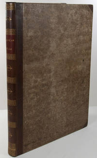
1823WRCAM43415APhiladelphia: H.C. Carey & I. Lea 1823. Letterpress title copyright notice on verso 1p. advertisement verso blank 1p. table of contents verso blank. Forty-six double-page handcolored engraved maps of the United States all but one with borders of letterpress descriptive text; uncolored double-page engraved view showing the comparative heights of mountains throughout the world; handcolored double-page engraved table showing the comparative lengths of the principal rivers worldwide; five letterpress tables four double-page three of these handcolored; 18pp. of letterpress text. Mounted on guards throughout. Modern half calf and marbled boards spine gilt leather label. Dampstaining along lower edge causing chipping to initial leaves. Closed tear in bottom margin of first map repaired with tissue. Very light offsetting from maps. Some dust soiling light tanning and foxing. Good plus. A handsome atlas of the Americas with individual color maps of each state in the Union including a seminal map of the West by Stephen H. Long. At the time of publication this was the best and most detailed atlas to be produced in the United States with substantial historical background text accompanying each map. Fielding Lucas the major Baltimore printer was the principal engraver. <br> <br> Among the most noted maps in the atlas is Major Stephen H. Long's "Map of Arkansa and other Territories of the United States." That map which depicts the Missouri basin between Nashville in the east the Mandan villages in the north and the Rocky Mountains in the west was based on the surveys conducted by Long on his expeditions of 1819 and 1820. The map published in Carey & Lea's atlas preceded the official account of that expedition by expedition botanist Edwin James which includes a smaller map with similar detail titled "Country drained by the Mississippi Western Section." Carey & Lea's 1823 publication of James' ACCOUNT perhaps explains the prior inclusion of this map with Long expedition information in their atlas. <br> <br> On this famous map is the printed legend which would perpetuate a myth for many years to come identifying the high plains as the "Great American Desert." Carey & Lea's atlas was first issued in 1822; this is the second issue with revised states of three maps Maine North Carolina and Louisiana with the same printing of the remaining maps and a cancel title. HOWES C133 "aa." PHILLIPS ATLASES 1373a. SABIN 15055. WHEAT TRANSMISSISSIPPI 348 352. H.C. Carey & I. Lea hardcover books
182325085Philadelphia: H.C. Carey & I. Lea 1823. Folio. 17 1/2 x 11 7/8 inches. Mounted on guards throughout letterpress title copyright notice on verso 1p. Advertisement verso blank 1p. Contents verso blank 46 double-page hand-coloured engraved maps of the United States all but one with borders of letterpress descriptive text 1 uncoloured double-page engraved view showing the comparative heights of mountains throughout the world 1 hand-coloured double-page engraved table showing the comparative lengths of the principal rivers worldwide 5 letterpress tables 4 double-page 3 of these hand-coloured 18pp. of letterpress text. Expertly bound to style in half calf over contemporary marbled paper covered boards flat spine in six compartments divided by gilt roll tools red morocco label in the second compartment the others with a repeat decoration in gilt.<br/> <br/>One of the most important early atlases printed in the United States: a handsome atlas of the Americas with individual colour maps of each state in the Union including a seminal map of the West by Stephen H. Long.<br/> <br/>At the time of publication this was the best and most detailed atlas to be produced in the United States. Fielding Lucas the major Baltimore printer was the principal engraver and substantial historical background text accompanies each map. Among the most noted maps in the atlas is Major Stephen H. Long's "Map of Arkansa and other Territories of the United States." That map which depicts the Missouri basin between Nashville in the east the Mandan villages in the north and the Rocky Mountains in the west was based on the surveys conducted by Long on his expeditions of 1819 and 1820. The map published in Carey & Lea's atlas preceded the official account of that expedition by expedition botanist Edwin James which included a smaller map with similar detail titled "Country drained by the Mississippi Western Section". Carey and Lea's 1823 publication of James Account perhaps explains the prior inclusion of this map with Long expedition information in their atlas. On this famous map is the printed legend which would perpetuate a myth for many years to come identifying the high plains as the "Great American Desert." Carey and Lea's atlas was first issued in 1822; this is the 1823 second issue substantially the same as the first but with a new title and revised states of several maps and text leaves generally minor revisions including additional shading to maps and improved resetting of several text leaves though this copy with first state settings of the Maryland and Virginia text leaves.<br/> <br/>Howes C133 "aa"; Phillips 1373a; Sabin 15055; Wheat Transmississippi West 348 and 352. H.C. Carey & I. Lea unknown books
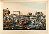
186820565New York: Currier & Ives 1868. Hand-coloured lithograph by James Merrit Ives after Fanny Palmer. A poignant image demonstrating the triumph of the human spirit and depicting the twin stack steam paddle wheel and riverboat "Stonewall Jackson."<br/> <br/>In the foreground uprooted trees bob in the current using a roof as a raft two men pole themselves and nine others to safety one of their companions holds tight to reins of a mule swimming beside the roof whilst two others rescue furniture and a barrel. In the mid-ground: a large white-painted house with second-floor balconies front and back and a smaller cook-house off to the right side. Two men in a row boat approach the back of the house a lady stands on the balcony speaking to the men; on the widow's walk on the roof a man and a woman stand: the man waves a handkerchief to the twin-stack riverboat. The riverboat "Stonewall Jackson" is travelling at speed: the near-side paddle creates a substantial wake the flags fly in the stiff breeze and the smoke from the stacks steams backwards: passengers line the rails attracted by the human drama they are passing. The overall impression is of a crisis that is being survived and dealt with by man's ingenuity whilst life continues.<br/> <br/>Conningham 2819; Gale 3057. Currier & Ives unknown books
177623542London: Printed for R. Sayer and J. Bennet 1776. Octavo. 10 5/8 x 8 1/4 inches. Letterpress text: title verso blank 2pp. dedication to 'Gov. Pownall' 2pp. 'Advertisement' 1p. 'List of maps' verso blank. 6 folding engraved maps all hand-coloured in outline all cut into sections hinged with linen and folded. Large triangle from upper outer corner of dedication leaf torn away without affecting the text. Expertly bound to style in 18th-century half russia over contemporary marbled paper-covered boards spine ruled in gilt in compartments lettered direct in the second compartment the others with a repeat decoration in gilt<br/> <br/>The Holster Atlas: one of the most important atlases of the American Revolution designed for use in the field. The Holster Atlas was issued at the suggestion of Governor George Pownall and included the "maps that the British high command regarded as providing essential topographical information in the most convenient form" Schwartz & Ehrenberg.<br/> <br/>This collection of maps was published by Sayer and Bennet at the beginning of the Revolution for the use of British officers. "Surveys and Topographical Charts being fit only for a Library such maps as an Officer may take with him into the Field have been much wanted. The following Collection forms a Portable Atlas of North America calculated in its Bulk and Price to suit the Pockets of Officers of all Ranks" Advertisement. Although the publishers claimed the atlas would fit into an officer's pocket it was more usually carried in a holster and thus gained its nick-name. The six maps are as follows: 1. DUNN Samuel. 'North America as divided amongst the European Powers. By Samuel Dunn Mathematician London: printed for Robt. Sayer 10 Jany. 1774.' Engraved map hand-coloured in outline in six unequal sections sheet size: 13 3/4 x 19 inches. Engraved for Dunn's 'A New Atlas' London: 1774. 2. DUNN Samuel. 'A compleat map of the West Indies containing the coasts of Florida Louisiana New Spain and Terra Firma: with all the islands.' London: Robt. Sayer 10 January 1774. Engraved map hand-coloured in outline in six unequal sections sheet size: 13 1/8 x 19 inches. Engraved for Dunn's 'A New Atlas' London: 1774. The 'Advertisement' describes these first two maps as 'a general map of the part of the globe called North America and a second general map of those islands shores gulfs and bays which form what is commonly called the West Indies; these we consider as introductory and as giving a general idea and we trust a just one.' 3. 'A general map of the Northern British Colonies in America. which comprehends the Province of Quebec the Government of Newfoundland Nova-Scotia New-England and New-York. from the maps published by the Admiralty and Board of Trade Regulated by the astronomic and trigonometric observations of Major Holland and corrected from Governor Pownall's late Map 1776. London: Robt. Sayer & Jno. Bennet 14 August 1776.' Engraved map hand-coloured in outline in eight unequal sections sheet size: 20 1/2 x 27 1/2 inches. First state also issued as a separate map. This map was re-issued in 1788 with the title changed to reflect the new political realities. McCorkle New England 776.11; Sellers & Van Ee 143; Stevens & Tree 65 4. EVANS Lewis. 'A general map of the Middle British Colonies in America. containing Virginia Maryland the Delaware Counties Pennsylvania and New Jersey. With the addition of New York and the greatest part of New England as also of the bordering parts of the Province of Quebec improved from several surveys made after the late war and corrected from Governor Pownall's late Map 1776. London: R. Sayer & J. Bennet 15 October 1776.' Engraved map hand-coloured in outline in eight unequal sections sheet size: 20 1/4 x 27 3/4 inches. Based on Lewis Evans' map of 1755 with additions and corrections. Cf. Stephenson & McKee Virginia p.82 an image of the Evans map 5. ROMANS Bernard. 'A general map of the Southern British Colonies in America. comprehending North and South Carolina Georgia East and West Florida with the neighbouring Indian countries. From the modern surveys of Engineer de Brahm Capt. Collet Mouzon & others; and from the large hydrographical survey of the coasts of East and West Florida. By B. Romans. London: R.Sayer & J. Bennett sic. 15 Octr. 1776.' Engraved map hand-coloured in outline eight unequal sections sheet size: 20 3/4 x 27 inches. Based on charts and maps by Roman and others. 6. BRASSIER William Furness 1745-1772. 'A Survey of Lake Champlain including Lake George Crown Point and St. John Surveyed by order of . Sr. Jeffery Amherst . by William Brassier draughtsman. 1762. London: Robt. Sayer & Jno. Bennet 5 Aug. 1776.' Engraved map hand-coloured in outline on eight unequal panels 27 3/4 x 20 3/8 inches. Also issued as the first separately published map of Lake Champlain this excellent detailed chart was based on a survey made during the French and Indian War but not published until the Revolution. Included is an inset illustrating America's first naval battle in which General Benedict Arnold though forced back down the lake was able to delay the British attempt to descend to the Hudson for that year. No mention of course is made of Ethan Allen's taking of Fort Ticonderoga in 1775.<br/> <br/>Fite & Freeman A Book of Old Maps pp.212-216; Howes A208; Nebenzahl Atlas of the American Revolution pp.61-63; Phillips Atlases 1206; Rumsey p.311; Sabin 1147; Schwartz & Ehrenberg p.190; Streeter Sale 73. Printed for R. Sayer and J. Bennet unknown books
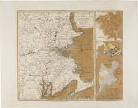
1775WRCAM54968London: Printed for R. Sayer & J. Bennett 1775. Copper-engraved map with original color. Two insets along the right side titled "Plan of Boston Harbour from an Actual Survey" and "Plan of the Town of Boston with the Attack on Bunker's Hill in the Peninsula of Charlestown." Plate mark: 18 1/4 x 21 1/2 inches. Sheet size: 21 1/4 x 27 1/4 inches. Expertly conserved with a few instances of renewed color. In very good condition with large margins. A rare and dramatic Revolutionary war map of New England showing George Washington's troops marching on British-occupied Boston with a large inset plan of the Battle of Bunker Hill showing Charlestown in flames: among the earliest pictorial representations of the Battle of Bunker Hill. This copy is printed on a large full sheet with ample margins. <br> <br> Published by Sayer & Bennett shortly after news of the Battle of Bunker Hill reached London the map celebrates the British victory in the battle but gives a portent of the impending siege of Boston and the eventual Battle of Dorchester Heights. The general map of New England provides a backdrop for illustrations of American troops most notably including the "march of General Washington" in western Massachusetts but also showing militia marching from New Hampshire Connecticut and Rhode Island all converging on Boston. Two smaller insets along the right side of the map each printed from a separate plate depict a general plan of Boston Harbor and a plan of Boston and Charlestown showing the Battle of Bunker Hill. <br> <br> This latter inset is quite dramatic and of great significance. Charlestown is shown under attack by British forces with the town in flames as British warships bombard it from the water and a British battery fires across the Charles River from Cornhill in Boston; the locations of the British and American forces on Breed's Hill are shown as the two armies face each other in battle. In Boston a large encampment of British regulars is shown on Boston Commons surrounding the Liberty tree. The inset would later be re- engraved and used in Newcastle and Boston editions of Murray's IMPARTIAL HISTORY OF THE WAR. <br> <br> It is believed that the inset is a graphic representation of information on the battle derived from a June 25 1775 letter written by General Burgoyne to Lord Stanley: <br> <br> ".Howe's corps ascending the hill in the face of entrenchments and in a very disadvantageous ground was much engaged; and to the left the enemy pouring in fresh troops by the thousands over the land; and in the arm of the sea our ships and floating batteries cannonading them: straight before us a large and noble town in one great blaze; the church steeples being of timber were great pyramids of fire above the rest.the whole a picture and a complication of horror and importance beyond any thing that ever came to my lot to be witness to." <br> <br> Sayer and Bennett published this letter as a broadside on November 27 1775 nearly two months after this inset illustrating it with a different plan of the battle. <br> <br> The earliest cartographic representation of the Battle of Bunker Hill is an August 1 1775 plan published by Jefferys and Faden titled "A Sketch of the Action between British Forces and the American Provincials on the Heights of the Peninsula of Charlestown." That map however purely shows military movements. The inset to the present map is the second printed plan of the battle and considered to be the first pictorial representation. This map was produced on September 2 1775 a scant two- and-a-half months after the crucially important actions it depicts. It is remarkable that such detailed news was transmitted from New England to London and published in such a magnificent cartographic representation in so brief a period of time. Not in Nebenzahl's ATLAS OF THE AMERICAN REVOLUTION which reproduces a later version of the inset on page 55 or Phillips. <br> <br> An exciting important rare and early map of the American Revolution. NEBENZAHL BATTLE PLANS OF THE AMERICAN REVOLUTION 6 6A. McCORKLE NEW ENGLAND IN EARLY PRINTED MAPS 775.1. KRIEGER & COBB MAPPING BOSTON p.103. SCHWARTZ & EHRENBERG plate 117. GUTHORN BRITISH MAPS OF THE AMERICAN REVOLUTION p.66. STOKES B105. RISTOW CARTOGRAPHY OF THE BATTLE OF BUNKER HILL. SELLERS & VAN EE 813. Printed for R. Sayer & J. Bennett unknown books
180119020London: Printed and Published by Robert Laurie and James Whittle 1801. Folio. 21 1/8 x 15 1/4 inches. Mounted on guards throughout letterpress title verso blank and 1p. index verso blank otherwise engraved throughout. 59 engraved maps on seventy-five mapsheets all hand-coloured in outline 1 map on 3 folding sheets; 14 on 2 folding sheets; 9 on single folding sheets; 34 on single double-page sheets; 1 on a one-page sheet. Contemporary tree calf covers with roll-tool border in gilt the flat spine divided into seven compartments by gilt fillets and roll-tools blue morocco lettering-piece in the second the other compartments with repeat neo-classical decoration of a single centrally-placed tool marbled endpapers<br/> <br/>A very fine copy of the fifth edition of this important atlas of the world including a newly revised chart of world and nine other maps that were not available in the early editions of this spectacular work.<br/> <br/>Eight editions of this work were issued on an almost annual basis from 1796 until 1807. The publishers constantly changed and improved the atlas in an effort to outdo not only their competitors but also to improve on the previous edition. Maps were added the first edition included only 66 map sheets maps were replaced the present work includes two maps dated 1800 including 'A New Chart of the World' dated 25 November 1800 and maps were updated eight maps are dated 1799. The scale of some of the maps is truly spectacular: this atlas contains 15 maps that if joined would form large scale wall maps: 'Asia and its Islands' on three folding sheets ranging from the Arctic regions in the north down through Russia Indonesia and Australia would measure approximately 56 x 46 inches if assembled. The remaining maps on two folding sheets would all be approximately 40 x 46 inches if joined: these include three maps of American interest: 'A new map of the whole continent of America'; 'A new map of North America with the West India Islands'; and 'A map of South America'. The remaining areas that are covered by large scale maps are 'A general map of the World'; England & Wales; Scotland; Ireland; the Netherlands; Germany; Hindoostan; Bengal Bahar etc; Delhi Agrah Oude and Allahabad. This atlas was originally created by Thomas Kitchin. Sayer and Bennett had published the work in 1773 and Laurie and Whittle took over the Sayer business in 1794. They subsequently enlarged the work adding maps and changing the name from the General Atlas to A New Universal Atlas. The maps are based on the work of a variety of mapmakers and surveyors: Thomas Kitchin Thomas Jefferys John Rocque Robert Campbell John Armstrong John Roberts L. S. d'Arcy Delarochette James Rennell Andrew Dury Thomas Pownall and Jean Baptiste Bourguignon d'Anville. Also included is the information gathered as a result of the important Pacific voyages of Captain James Cook George Vancouver and Jean Francois Galaup de La Perouse.<br/> <br/>Phillips Atlases 3534. Printed and Published by Robert Laurie and James Whittle unknown books