195 résultats
1970Embry 161576Progress Publishers 1970. First U.S. edition. Small abrasion from label removal to front free endpaper else fine in fine dust jacket in mylar cover. Progress Publishers, 1970. First U.S. edition. unknown books
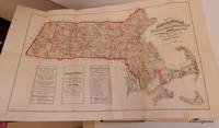
187824532Boston Massachusetts: Sampson Davenport and Company 1878. First Edition. Cloth. Good. First Edition. 6 ads 860 2 pages. Advertisements on endpapers as well. Colored folded map of Massachusetts in front. 8vo. Publisher's black cloth with coppergilt lettering on spine panel. Cover is worn with silverfish damage to surface of cloth and front hinge paper. Sound textblock front hinge loose and could use reinforcement. Cloth. A scarce survival most were discarded as they became dated or when the nice colored map was removed and sold separately. Now a great reference for who was active in Boston a major city at the time. Sampson, Davenport, and Company unknown books
2001WRCLIT75851New York: Purgatory Pie Press 2001. Printed stiff card portfolio 24 x 17.5 cm enclosing separate paperworks by six artists held by folded tabs. Light use at portfolio corners but near fine. First edition. One of 150 numbered copies signed by Smith and Faust. Includes works by Judy Hoffman Harvey Redding Susan Happersett Stephanie Brody Lederman Chris Collicott and Patricia Clark. The constituent works have the same limitation and are also signed by the respective artist. In print at $250. Purgatory Pie Press unknown books
1911SGG313B-2Chicago:: Rand McNally and Co. 1911. Very Good. Map. 21 1/4 x 28 inches folds down to 5 5/8 x 3 5/8 inches. Single sheet. Full color inset with enlarged map of Mexico state index of places and Mexican railroads; text clean unmarked minor toning mostly on verso wear to folds a few small holes at the folds 3 x 1/2 inches torn away on left edge does not effect text initials R.O.R. in ink on verso. Very Good. Early twentieth-century road map of Mexico states noted in five colors water in blue railroads indexed and printed in red inset with enlarged scale map of the state of Mexico and the surrounding states. Index with place names and locations printed in the left margin. Rand McNally and Co., unknown books
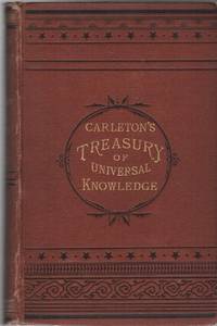
188219572New York: G.W. Carleton & Co. 1882. Hardcover. Very good. 8vo. Printed cloth gilt-stamped titles. Very good. Modest scuffs edgewear to boards. Pages moderately to heavily foxed throughout but complete and unmarked. Binding cracked at several points; mostly good and sound throughout. 514pp. <br/><br/>Rare. Stated eighteenth edition but OCLC locates no other editions of this title so this was likely a marketing tactic to increase the impression of the book's popularity. OCLC finds only four worldwide holdings of the physical book: one in Canada and three in the U.S. An extensively illustrated general encyclopedia for popular consumption which includes "whole chapters upon" subjects including Fine Arts Jurisprudence Vegetable Creation Animal Creation Mineralogy Chronology and more; edited by "The Ablest Talent the World Affords." G.W. Carleton & Co. hardcover books
2008187605Twin Lights Publishers 2008-05-26. 2nd. Hardcover. Very Good. Dust jacket and book are clean has a very good binding and crisp pages no marks or notations. HB HS Twin Lights Publishers hardcover books
1975244554San Francisco: Benro Enterprises 1975. Magazine. 32p 8x10.75 inches photos ads articles listings reviews services personals mild wear otherwise a very good magazine-style newspaper in stapled glossy wraps and newsprint. San Francisco-Bay Area's long-running respected homophile/LGBT newspaper a free entertainment and services biweekly community paper. Two articles from Harvey Milk. The 10th Annual Coronation Ball report. In the early days pre-AIDS pre-White Night Riots the political reports were mainly on the campaigns for Empress. Yet with an increase in police & political abuse of gay rights note the attempt by Republican George Dye to pass a bill requiring all homosexuals be castrated and the advent of gay activists like Reverend Ray Broshears the paper began to publish an increasing number of political and gay-rights reports. The emphasis continued to be Drag shows Tavern Guild and S.I.R. reports. Book film and stage reviews relating to the gay experience. For the most part this was an exciting and fun period in the Castro and the early issues reflect that. An important record of the early days of Gay Liberation in SF. Benro Enterprises unknown books
1975244564San Francisco: Benro Enterprises 1975. Magazine. 32p. 8.25x10.75 inches photos ads articles listings reviews services personals mild wear otherwise a very good magazine-style newspaper in stapled glossy wraps and newsprint. San Francisco-Bay Area's long-running respected homophile/LGBT newspaper a free entertainment and services biweekly community paper. Gay Freedom Day report and photos. Harvey Milk castigates the Board of Supervisors and City Hall for not supporting the Parade. Entertainment Sweetlips Polk Street Sally Mr. Marcus et al. Benro Enterprises unknown books
1975244566San Francisco: Benro Enterprises 1975. Magazine. 32p. 8.25x10.75 inches photos ads articles listings reviews services personals mild wear otherwise a very good magazine-style newspaper in stapled glossy wraps and newsprint. San Francisco-Bay Area's long-running respected homophile/LGBT newspaper a free entertainment and services biweekly community paper. Interviews with Jeff Druce Jack Wrangler and Paul Thomas under his actual name Philip Toubus who got his start in "Jesus Christ Superstar" and shifted to straight and gay pornography in the late 1970s. Entertainment Sweetlips Polk Street Sally Mr. Marcus et al. Benro Enterprises unknown books
1975244567San Francisco: Benro Enterprises 1975. Magazine. 32p. 8.25x10.75 inches photos ads articles listings reviews services personals mild wear otherwise a very good magazine-style newspaper in worn and chipped stapled glossy wraps and newsprint. San Francisco-Bay Area's long-running respected homophile/LGBT newspaper a free entertainment and services biweekly community paper. Interviews with Jeff Druce Jack Wrangler and Paul Thomas under his actual name Philip Toubus who got his start in "Jesus Christ Superstar" and shifted to straight and gay pornography in the late 1970s. Entertainment Sweetlips Polk Street Sally Mr. Marcus et al. Benro Enterprises unknown books
1975244559San Francisco: Benro Enterprises 1975. Magazine. 32p. 8.25x10.75 inches photos ads articles listings reviews services personals mild wear otherwise a very good magazine-style newspaper in stapled glossy wraps and newsprint. San Francisco-Bay Area's long-running respected homophile/LGBT newspaper a free entertainment and services biweekly community paper. Political Views from Harvey Milk. Entertainment Sweetlips Polk Street Sally Mr. Marcus et al. Benro Enterprises unknown books
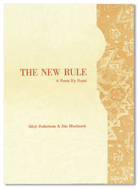
200027851San Diego: Bay Park Press 2000. First Edition. Limited to 45 copies of which this is no. 20. Octavo 23cm.; single leaf of card stock folded into 6-panelled pamphlet laid into navy blue chemise printed in gilt; illus. Fine. "False Bay Editions" rear chemise panel. Premier publication of the Bay Park Press a screen printed visual interpretation of a Rumi poem translated by Coleman Barks. Bay Park Press unknown books
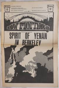
1972258571Berkeley: New Morning Collective 1972. Newspaper. 20p. folded tabloid underground newspaper local ads stories reviews events comix opinion politics psychedelia listings lightly-worn newsprint. Radical paper originally distributed for free with cover story on the Yenan Spirit in Berkeley with a centerfold poster of a revolutionary Chinese papercut. Other articles on organic food KPFA radio and more. New Morning Collective unknown books
191218790New York: Sam Gabriel Sons & Company 1912. Wraps. good. Small 4to. Original printed card wraps. Good only. Binding loosening a bit dampstaining inside and out; edgewear. A hole in one page else decently clean throughout. Ownership signature from Christmas 1914 written on rear cover. 10pp. <br/><br/>Children's book on wild animals lions zebras hippos elephants etc. Sam Gabriel Sons & Company paperback books
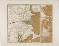
1775WRCAM54968London: Printed for R. Sayer & J. Bennett 1775. Copper-engraved map with original color. Two insets along the right side titled "Plan of Boston Harbour from an Actual Survey" and "Plan of the Town of Boston with the Attack on Bunker's Hill in the Peninsula of Charlestown." Plate mark: 18 1/4 x 21 1/2 inches. Sheet size: 21 1/4 x 27 1/4 inches. Expertly conserved with a few instances of renewed color. In very good condition with large margins. A rare and dramatic Revolutionary war map of New England showing George Washington's troops marching on British-occupied Boston with a large inset plan of the Battle of Bunker Hill showing Charlestown in flames: among the earliest pictorial representations of the Battle of Bunker Hill. This copy is printed on a large full sheet with ample margins. <br> <br> Published by Sayer & Bennett shortly after news of the Battle of Bunker Hill reached London the map celebrates the British victory in the battle but gives a portent of the impending siege of Boston and the eventual Battle of Dorchester Heights. The general map of New England provides a backdrop for illustrations of American troops most notably including the "march of General Washington" in western Massachusetts but also showing militia marching from New Hampshire Connecticut and Rhode Island all converging on Boston. Two smaller insets along the right side of the map each printed from a separate plate depict a general plan of Boston Harbor and a plan of Boston and Charlestown showing the Battle of Bunker Hill. <br> <br> This latter inset is quite dramatic and of great significance. Charlestown is shown under attack by British forces with the town in flames as British warships bombard it from the water and a British battery fires across the Charles River from Cornhill in Boston; the locations of the British and American forces on Breed's Hill are shown as the two armies face each other in battle. In Boston a large encampment of British regulars is shown on Boston Commons surrounding the Liberty tree. The inset would later be re- engraved and used in Newcastle and Boston editions of Murray's IMPARTIAL HISTORY OF THE WAR. <br> <br> It is believed that the inset is a graphic representation of information on the battle derived from a June 25 1775 letter written by General Burgoyne to Lord Stanley: <br> <br> ".Howe's corps ascending the hill in the face of entrenchments and in a very disadvantageous ground was much engaged; and to the left the enemy pouring in fresh troops by the thousands over the land; and in the arm of the sea our ships and floating batteries cannonading them: straight before us a large and noble town in one great blaze; the church steeples being of timber were great pyramids of fire above the rest.the whole a picture and a complication of horror and importance beyond any thing that ever came to my lot to be witness to." <br> <br> Sayer and Bennett published this letter as a broadside on November 27 1775 nearly two months after this inset illustrating it with a different plan of the battle. <br> <br> The earliest cartographic representation of the Battle of Bunker Hill is an August 1 1775 plan published by Jefferys and Faden titled "A Sketch of the Action between British Forces and the American Provincials on the Heights of the Peninsula of Charlestown." That map however purely shows military movements. The inset to the present map is the second printed plan of the battle and considered to be the first pictorial representation. This map was produced on September 2 1775 a scant two- and-a-half months after the crucially important actions it depicts. It is remarkable that such detailed news was transmitted from New England to London and published in such a magnificent cartographic representation in so brief a period of time. Not in Nebenzahl's ATLAS OF THE AMERICAN REVOLUTION which reproduces a later version of the inset on page 55 or Phillips. <br> <br> An exciting important rare and early map of the American Revolution. NEBENZAHL BATTLE PLANS OF THE AMERICAN REVOLUTION 6 6A. McCORKLE NEW ENGLAND IN EARLY PRINTED MAPS 775.1. KRIEGER & COBB MAPPING BOSTON p.103. SCHWARTZ & EHRENBERG plate 117. GUTHORN BRITISH MAPS OF THE AMERICAN REVOLUTION p.66. STOKES B105. RISTOW CARTOGRAPHY OF THE BATTLE OF BUNKER HILL. SELLERS & VAN EE 813. Printed for R. Sayer & J. Bennett unknown books
17836524London: R. Sayer & J. Bennett 1783. Mezzotint collection mark on verso tipped onto early mount. Expert small repairs to upper corners. A charming anonymous image from the collection of Frederic R. Halsey 1847-1918 'un des principaux collectionneurs de son èpoque à New York' Lugt 1308<br/> <br/>The image of a fashionably-dressed young lady reclining by a brook being approached by a young gentleman is explained by the engraved verse by 'Mr. Nicholl' in the title area beneath the image: Alone by the side of a murmuring rill / That lav'd the gay foot of a primrosy hill / Pastora beneath a broad poplar was laid / When Damon in extasy enter'd the Shade / He sigh'd & he swore by the pow'rs overhead / If she'd bless him to day to morrow he'd wed. R. Sayer & J. Bennett unknown books
177623542London: Printed for R. Sayer and J. Bennet 1776. Octavo. 10 5/8 x 8 1/4 inches. Letterpress text: title verso blank 2pp. dedication to 'Gov. Pownall' 2pp. 'Advertisement' 1p. 'List of maps' verso blank. 6 folding engraved maps all hand-coloured in outline all cut into sections hinged with linen and folded. Large triangle from upper outer corner of dedication leaf torn away without affecting the text. Expertly bound to style in 18th-century half russia over contemporary marbled paper-covered boards spine ruled in gilt in compartments lettered direct in the second compartment the others with a repeat decoration in gilt<br/> <br/>The Holster Atlas: one of the most important atlases of the American Revolution designed for use in the field. The Holster Atlas was issued at the suggestion of Governor George Pownall and included the "maps that the British high command regarded as providing essential topographical information in the most convenient form" Schwartz & Ehrenberg.<br/> <br/>This collection of maps was published by Sayer and Bennet at the beginning of the Revolution for the use of British officers. "Surveys and Topographical Charts being fit only for a Library such maps as an Officer may take with him into the Field have been much wanted. The following Collection forms a Portable Atlas of North America calculated in its Bulk and Price to suit the Pockets of Officers of all Ranks" Advertisement. Although the publishers claimed the atlas would fit into an officer's pocket it was more usually carried in a holster and thus gained its nick-name. The six maps are as follows: 1. DUNN Samuel. 'North America as divided amongst the European Powers. By Samuel Dunn Mathematician London: printed for Robt. Sayer 10 Jany. 1774.' Engraved map hand-coloured in outline in six unequal sections sheet size: 13 3/4 x 19 inches. Engraved for Dunn's 'A New Atlas' London: 1774. 2. DUNN Samuel. 'A compleat map of the West Indies containing the coasts of Florida Louisiana New Spain and Terra Firma: with all the islands.' London: Robt. Sayer 10 January 1774. Engraved map hand-coloured in outline in six unequal sections sheet size: 13 1/8 x 19 inches. Engraved for Dunn's 'A New Atlas' London: 1774. The 'Advertisement' describes these first two maps as 'a general map of the part of the globe called North America and a second general map of those islands shores gulfs and bays which form what is commonly called the West Indies; these we consider as introductory and as giving a general idea and we trust a just one.' 3. 'A general map of the Northern British Colonies in America. which comprehends the Province of Quebec the Government of Newfoundland Nova-Scotia New-England and New-York. from the maps published by the Admiralty and Board of Trade Regulated by the astronomic and trigonometric observations of Major Holland and corrected from Governor Pownall's late Map 1776. London: Robt. Sayer & Jno. Bennet 14 August 1776.' Engraved map hand-coloured in outline in eight unequal sections sheet size: 20 1/2 x 27 1/2 inches. First state also issued as a separate map. This map was re-issued in 1788 with the title changed to reflect the new political realities. McCorkle New England 776.11; Sellers & Van Ee 143; Stevens & Tree 65 4. EVANS Lewis. 'A general map of the Middle British Colonies in America. containing Virginia Maryland the Delaware Counties Pennsylvania and New Jersey. With the addition of New York and the greatest part of New England as also of the bordering parts of the Province of Quebec improved from several surveys made after the late war and corrected from Governor Pownall's late Map 1776. London: R. Sayer & J. Bennet 15 October 1776.' Engraved map hand-coloured in outline in eight unequal sections sheet size: 20 1/4 x 27 3/4 inches. Based on Lewis Evans' map of 1755 with additions and corrections. Cf. Stephenson & McKee Virginia p.82 an image of the Evans map 5. ROMANS Bernard. 'A general map of the Southern British Colonies in America. comprehending North and South Carolina Georgia East and West Florida with the neighbouring Indian countries. From the modern surveys of Engineer de Brahm Capt. Collet Mouzon & others; and from the large hydrographical survey of the coasts of East and West Florida. By B. Romans. London: R.Sayer & J. Bennett sic. 15 Octr. 1776.' Engraved map hand-coloured in outline eight unequal sections sheet size: 20 3/4 x 27 inches. Based on charts and maps by Roman and others. 6. BRASSIER William Furness 1745-1772. 'A Survey of Lake Champlain including Lake George Crown Point and St. John Surveyed by order of . Sr. Jeffery Amherst . by William Brassier draughtsman. 1762. London: Robt. Sayer & Jno. Bennet 5 Aug. 1776.' Engraved map hand-coloured in outline on eight unequal panels 27 3/4 x 20 3/8 inches. Also issued as the first separately published map of Lake Champlain this excellent detailed chart was based on a survey made during the French and Indian War but not published until the Revolution. Included is an inset illustrating America's first naval battle in which General Benedict Arnold though forced back down the lake was able to delay the British attempt to descend to the Hudson for that year. No mention of course is made of Ethan Allen's taking of Fort Ticonderoga in 1775.<br/> <br/>Fite & Freeman A Book of Old Maps pp.212-216; Howes A208; Nebenzahl Atlas of the American Revolution pp.61-63; Phillips Atlases 1206; Rumsey p.311; Sabin 1147; Schwartz & Ehrenberg p.190; Streeter Sale 73. Printed for R. Sayer and J. Bennet unknown books
197421671Forest Grove British Columbia: William and Penelope Scharf ca. 1974. First Edition. Wraps. Very good. 4to. Side-stapled printed wraps. Very good. Moderate rubbing to wraps. Interior clean throughout; printed mimeo on variously coloed pages rectos only. Ca. 30 pp. <br/><br/>Scarce poetry mimeo. Features contributions from Duncan McNaughton John Clarke Colin Stuart and more. William and Penelope Scharf paperback books
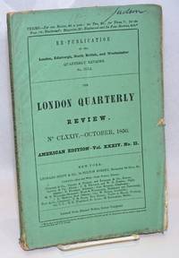
1850242322New York: Leonard Scott & Co 1850. Magazine. Pp.157-312p. i.e. about 150 pages printed doublecolumn throughout on reasonably alkaline paperstock sewn textblock in paste-fastened green printed wraps. Untrimmed very edgeworn with dirt and a stain to foredge and foxing to top edge short splits and small chips to head and tail some pencillings and here & there a little mouse-gnaw. A somewhat repulsive copy nonetheless quite securely bound and handleable. Topics include twenty pages on Welsh education twenty again of French/English vocabulary for travelers twenty on the geologic distribution of gold in Siberia and California Sierras "more lofty than the Appenines" histories of Spanish literature ditto ancient Greek lit twenty pages on urban water-supply and sanitation especially of London and. more. Leonard Scott & Co unknown books
197420026Berkeley: For Ourselves Council For Generalized Self-Management 1974. First Edition. Wraps. Very good . 8vo. Stapled self-wraps. Very good plus. Light toning to edges. Price penned to upper-right corner of front. Interior clean and unmarked throughout. 11 pp. <br/><br/>Distributed by the "pro-situationist" group For Ourselves. The statement discusses Portugal's Carnation Revolution as an example of "today's battles between capital and the world proletariat." For Ourselves disagreed with several of the points made in the groups' statement and add a critique at the end making use of their own brand of "Marxist-Stirnerist" ideology. OCLC locates only two copies. For Ourselves Council For Generalized Self-Management paperback books
306138New York The Vanguard Press 1954. First edition. 8vo. Dust jacket unclipped; rubbed; few nicks. Very good. 442 pages. No other signatures or bookplates. Presentation copy signed and inscribed by Sitwell: "For Helen and Kurt Wolff signed with best wishes by Edith Sitwell." Helen and Kurt Wolff were book publishers associated with Harcourt Brace and Jovanovich. Fifoot EA49: Pages 115-116 are on a stub. The English edition was not published until 1957. Signed by Authors. 1st Edition. Hardcover. Very Good/Very Good. New York, The Vanguard Press [1954]. hardcover books
193979729Moscow and Leningrad: State Art Publishers 1939. 1st ed. Hardcover. Very Good. frontis sepia-toned photos unpaginated. Original blue cloth with beveled edges. 26cm. Light cover soil and wear including a small scratch on back cover. Bookplate. No Jacket. Consists almost entirely of captioned photos of Soviet athletics physical culture and mass parades. <br/><br/> State Art Publishers hardcover books
193923519Moscow: State Art Publishers 1939. Hardcover. Very good/No dust jacket. Moscow: State Art Publishers 1939. Copious b/w photographs. Unpaginated. Hardcover. Small 4to size. Blue cloth. Extremities rubbed; head and heel bumped heel fraying and damaged as well; front joint beginning to crack; preliminaries very lightly toned; former ownerÕs bookplate to verso of ffep. Interior clean; sound. Very good/No dust jacket. Insurance required to ship this item. State Art Publishers hardcover books
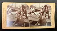
189849371Meadville Pa / St. Louis Mo: Keystone View Company 1898. Pink mount slightly bowed with publisher imprint to either side caption under right image. Rounded corners. Blank verso. Now housed in a mylar sleeve. Light wear & soiling. Photo clear & sharp. A VG example. Domed b/w images of 7 men on a dock with a dozen or so sea turtles being gathered. Oblong format: 3-7/16" x 7" <br/><br/> Keystone View Company unknown books
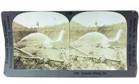
45562Meadville PA: Keystone View Company n. d. Ca. early 1900s. Housed in a clear mlyar sleeve. Vertical crack to card visible on verso. Image clear & sharp. Verso with extensive description of Hydraulic Mining. Oblong format: 3-1/2" x 7" <br/><br/> Keystone View Company unknown books