195 résultats
1971257453San Francisco: Benro Enterprises 1971. Newspaper. 32p includes covers 8.5x10.5 inches news reviews opinion events ads photos very good pastebound magazine on newsprint. The country's oldest continuously published LGBTQ periodical and one of the largest circulations. Early issues seemed to focus heavily on drag performance. Cover photo of drag winners of a costume contest as "Wizard of Oz" characters at the Beaux Arts Ball. Benro Enterprises unknown books
1971257454San Francisco: Benro Enterprises 1971. Newspaper. 40p includes covers 8.5x10.5 inches news reviews opinion events ads photos very good pastebound magazine on newsprint. The country's oldest continuously published LGBTQ periodical and one of the largest circulations. Early issues seemed to focus heavily on drag performance. Cover photo of drag performer Michelle' starring in a Christmas show at S.I.R. Benro Enterprises unknown books
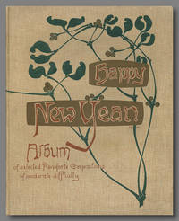
1897WRCLIT77280New York: Breitkopf and Hartell 1897. 92pp. Small folio 34 x 27.5 cm. Khaki cloth elaborately decorated in green gilt and dark brown with a floral art nouveau motif signed 'M.M'. Pictorial endsheets. Publisher's address revision stamp on title below imprint some pencil annotations otherwise a very near fine copy. A handsome period binding from the American branch of the venerable music publishers. While there are plate marks for the music v.a. 1868 OCLC suggests a far more reasonable publication date of 1897 which is highly consistent with the style of the binding and printing. OCLC locates copies at Cleveland Public and Martin Luther College. OCLC: 22334613. Breitkopf and Hartell hardcover books
7421818. BLACK Adam and Charles Publishers. BLACK'S NEW LARGE MAP OF ENGLAND & WALES. According to the Ordnance Admirality and Other Surveys. On the scale of 4 miles to an inch by John Bartholomew F.R.G.S. Edinburgh: Adam & Charles Black n.d. circa 1870-1890. Three color sheets folding mounted on linen. The North and Midlands Sections are each 37 1/2 by 81 1/2 inches 95 x 206 cm; the South Section is 28 3/4 by 81 1/2 inches 73 x 206 cm. All fold to 9 1/2 by 6 3/4 inches 24 x 17 cm. A fine copy housed in slightly rubbed and soiled green cloth pull-off slipcase with publisher's paper label on the front gilt-stamped title and a hand-lettered label on one side. Unfolded this is a huge and wonderful map. unknown books
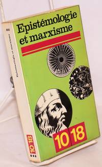
1972168905Paris: 10/18 1972. Paperback. 312p. glossy pocket-size wraps text stock somewhat toned a very good copy. 10/18 paperback books
179425786London: publish'd by Laurie & Whittle 1794. Engraved map on four joined sheets hand coloured in outline. Bowen and Gibson's large scale wall map of North America: a Laurie and Whittle issue published following the Treaty of Paris that ended the American Revolution.<br/> <br/>Bowen and Gibson's map was first issued in about 1755 under the title An Accurate Map of North America. It served as a generally accurate template for showing the enormous political changes that took place in the next forty years. Sometimes known as the Pownall Map of North America because of the significant contribution the former governor of Massachusetts Thomas Pownall made to the geographical knowledge of the northeast this large wall map has great presence and teems with information including numerous Native American placenames in the western areasnative tribal regions notes and routes of early roads and the forts along the Mississippi and to the west of the Appalachians. The two inset maps are of Baffin and Hudson's Bays and the mouth of the Colorado River the latter map based on the explorations of Eusebio Kino. The present map is the fourth version of the title and is an issue which incorporates the changes brought about by the 1783 Treaty of Paris. A notation on the map reads: "The Divisions in this map are coloured according to the preliminaries signed at Versailles sic. January 20th. 1783. The Red indicates the British posessions; the Green those of the United States; the Blue what belongs to the French and the Yellow what belongs to the Spaniards." Also included is Article III from the Treaty that guaranteed fishing rights to the United States in the Grand Banks and other places around New Brunswick and Newfoundland. Previous issues dating to the Revolution had included some of the articles of the 1763 Treaty these have been entirely removed and the cartouche has been reworked among other changes. The present issue has no imprint in the bottom right corner is printed on laid paper and includes the western coast of Newfoundland coloured in red.<br/> <br/>Degrees of Latitude 36; Stevens & Tree "Comparative Cartography" 49k in Tooley The Mapping of America. publish'd by Laurie & Whittle unknown books
18905166London: J. Braill & Son 1890. Aquatint printed in colours and finished by hand. A fine copy of this excellent late example of the racing aquatint.<br/> <br/>The heyday of the racing aquatint in Britain was probably about 1830 but the present example shows that the art had not died out even sixty years later. The print is unfortunately unsigned but aside from the process used the style of painting is charming and recalls the work of John Frederick Herring and his contemporaries. J. Braill & Son unknown books
196286206Leiden: E. J. Brill 1962. Paperback. Very Good. 170p. Softcover in original green wrapper. 20cm. Contents moderately browned. Backstrip faded. 2555 items are listed and priced. <br/><br/> E. J. Brill paperback books
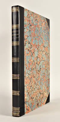
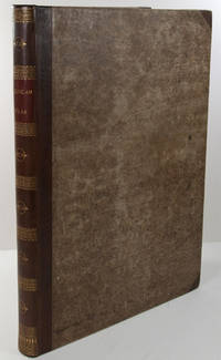
1823WRCAM43415APhiladelphia: H.C. Carey & I. Lea 1823. Letterpress title copyright notice on verso 1p. advertisement verso blank 1p. table of contents verso blank. Forty-six double-page handcolored engraved maps of the United States all but one with borders of letterpress descriptive text; uncolored double-page engraved view showing the comparative heights of mountains throughout the world; handcolored double-page engraved table showing the comparative lengths of the principal rivers worldwide; five letterpress tables four double-page three of these handcolored; 18pp. of letterpress text. Mounted on guards throughout. Modern half calf and marbled boards spine gilt leather label. Dampstaining along lower edge causing chipping to initial leaves. Closed tear in bottom margin of first map repaired with tissue. Very light offsetting from maps. Some dust soiling light tanning and foxing. Good plus. A handsome atlas of the Americas with individual color maps of each state in the Union including a seminal map of the West by Stephen H. Long. At the time of publication this was the best and most detailed atlas to be produced in the United States with substantial historical background text accompanying each map. Fielding Lucas the major Baltimore printer was the principal engraver. <br> <br> Among the most noted maps in the atlas is Major Stephen H. Long's "Map of Arkansa and other Territories of the United States." That map which depicts the Missouri basin between Nashville in the east the Mandan villages in the north and the Rocky Mountains in the west was based on the surveys conducted by Long on his expeditions of 1819 and 1820. The map published in Carey & Lea's atlas preceded the official account of that expedition by expedition botanist Edwin James which includes a smaller map with similar detail titled "Country drained by the Mississippi Western Section." Carey & Lea's 1823 publication of James' ACCOUNT perhaps explains the prior inclusion of this map with Long expedition information in their atlas. <br> <br> On this famous map is the printed legend which would perpetuate a myth for many years to come identifying the high plains as the "Great American Desert." Carey & Lea's atlas was first issued in 1822; this is the second issue with revised states of three maps Maine North Carolina and Louisiana with the same printing of the remaining maps and a cancel title. HOWES C133 "aa." PHILLIPS ATLASES 1373a. SABIN 15055. WHEAT TRANSMISSISSIPPI 348 352. H.C. Carey & I. Lea hardcover books
182729764Philadelphia: H.C. Carey & I. Lea 1827. Folio. Mounted on guards throughout. Letterpress title copyright notice on verso 1p. "Advertisement" to Third Edition dated "January 1827" verso blank 1p. "Contents" and "Index" verso blank plus forty-six double-page handcolored copper engraved maps most with descriptive letterpress in margins and many with supplementary text pages following; one double-page engraved plate of mountains uncolored; and one double-page colored plate of river lengths. Titlepage remargined minor foxing some faint staining along bottom edge. Later 19th-century three-quarter calf and original plain paper boards later gilt morocco label. Boards slightly rubbed.<br/> <br/>One of the most important early atlases printed in the United States: a handsome atlas of the Americas with individual colour maps of each state in the Union including a seminal map of the West by Stephen H. Long.<br/> <br/>At the time of publication this was the best and most detailed atlas to be produced in the United States. Fielding Lucas the major Baltimore printer was the principal engraver and substantial historical background text accompanies each map. Among the most noted maps in the atlas is Major Stephen H. Long's "Map of Arkansa and other Territories of the United States." That map which depicts the Missouri basin between Nashville in the east the Mandan villages in the north and the Rocky Mountains in the west was based on the surveys conducted by Long on his expeditions of 1819 and 1820. On this famous map is the printed legend which would perpetuate a myth for many years to come identifying the high plains as the "Great American Desert." The 1827 edition "Third edition Corrected and Improved" of Carey & Lea's historic atlas first published in 1822 includes much new material with all the maps and text updated except for the Washington D.C. and Michigan maps. This was the first American atlas that was modeled on Le Sage's plan of having explanatory text surrounding the maps. The maps for the most part by Fielding Lucas are beautifully drawn and colored.<br/> <br/>Howes C133 "aa"; Phillips 1373a; Sabin 15055; Wheat Transmississippi West 348 and 352. H.C. Carey & I. Lea unknown books
182325085Philadelphia: H.C. Carey & I. Lea 1823. Folio. 17 1/2 x 11 7/8 inches. Mounted on guards throughout letterpress title copyright notice on verso 1p. Advertisement verso blank 1p. Contents verso blank 46 double-page hand-coloured engraved maps of the United States all but one with borders of letterpress descriptive text 1 uncoloured double-page engraved view showing the comparative heights of mountains throughout the world 1 hand-coloured double-page engraved table showing the comparative lengths of the principal rivers worldwide 5 letterpress tables 4 double-page 3 of these hand-coloured 18pp. of letterpress text. Expertly bound to style in half calf over contemporary marbled paper covered boards flat spine in six compartments divided by gilt roll tools red morocco label in the second compartment the others with a repeat decoration in gilt.<br/> <br/>One of the most important early atlases printed in the United States: a handsome atlas of the Americas with individual colour maps of each state in the Union including a seminal map of the West by Stephen H. Long.<br/> <br/>At the time of publication this was the best and most detailed atlas to be produced in the United States. Fielding Lucas the major Baltimore printer was the principal engraver and substantial historical background text accompanies each map. Among the most noted maps in the atlas is Major Stephen H. Long's "Map of Arkansa and other Territories of the United States." That map which depicts the Missouri basin between Nashville in the east the Mandan villages in the north and the Rocky Mountains in the west was based on the surveys conducted by Long on his expeditions of 1819 and 1820. The map published in Carey & Lea's atlas preceded the official account of that expedition by expedition botanist Edwin James which included a smaller map with similar detail titled "Country drained by the Mississippi Western Section". Carey and Lea's 1823 publication of James Account perhaps explains the prior inclusion of this map with Long expedition information in their atlas. On this famous map is the printed legend which would perpetuate a myth for many years to come identifying the high plains as the "Great American Desert." Carey and Lea's atlas was first issued in 1822; this is the 1823 second issue substantially the same as the first but with a new title and revised states of several maps and text leaves generally minor revisions including additional shading to maps and improved resetting of several text leaves though this copy with first state settings of the Maryland and Virginia text leaves.<br/> <br/>Howes C133 "aa"; Phillips 1373a; Sabin 15055; Wheat Transmississippi West 348 and 352. H.C. Carey & I. Lea unknown books
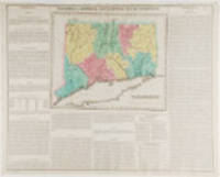
182319787Philadelphia: Carey & Lea 1823. Engraving with full period colour. Backed on linen. Split at fold expertly repaired. Occasional creases. Fascinating and informative map of Connecticut from one of the most innovative American atlases of the 19th century.<br/> <br/>Carey & Lea's atlas established a style that was widely admired especially in Europe: placing a fully coloured map as the centerpiece of the page and surrounding it with geographical and historical facts. The texts were well written and intriguing. The immense transformation of continental America: the vast migration settlement and industrialization really began at about this time not long after the War of 1812 when expansion and opportunity were American by-words. It was at this time that American atlases began to need semi-annual revisions because the country had changed so rapidly. In fact the Carey & Lea gazetteer style most reminiscent of Herman Moll really was too time consuming for the firms that published atlases of America as the century progressed. Carey & Lea unknown books
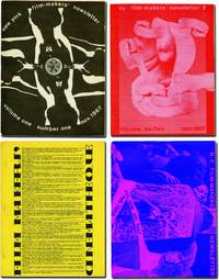
1971143125New York: Filmmakers Newsletter / Filmmakers' Cinematheque 1971. Archive of 41 issues of "Filmmakers Newsletter" dating from the first four years of the magazine including Vol. I issue 1. Early issues of the magazine are scarce and putting together a collection of this size piecemeal would be prohibitively difficult. <br/><br/>Founded in 1967 by experimental filmmaker Carl Linder as "New York Filmmakers' Newsletter" it was originally published out of the Filmmakers Cinematheque and served a similar purpose as Canyon Cinema's "Canyon Cinemanews" disseminating information on screenings festivals and republishing articles and essays about experimental film. Suni Mallow took over as editor in early 1968 and she quickly brought a wider focus to the magazine dropping "New York" from the title and publishing the magazine under its own imprint although it still retained ties to the Cinematheque. This broader approach to the world of avant garde film was successful and when Mallow sold the magazine in 1979 after becoming publisher in 1969 it had one of the highest ad rates per reader in business speaking to "Filmmakers Newsletter's" reach and influence among experimental filmmakers distributors hobbiest critics and fans. <br/><br/>Contributors to the issues in the archive include Jonas Mekas Stan Brakhage Bruce Conner George Maciunas Hollis Frampton Standish Lawder and Alan Lomax while future Academy Award and Cannes animator Bill Plympton was a staff member in 1970. <br/><br/>For more details please inquire. <br/><br/>Issues 8.5 x 11 inches with black and white images and illustrations throughout. Generally Near Fine. Filmmakers Newsletter / Filmmakers' Cinematheque unknown books
1993260902Hollywood: Dragazine 1993. Magazine. 40p. including covers 8.5x11 inches b&w photos magazine semi-glossy stock otherwise very good in stapled pictorial wraps. Interview with Philthee Ritz of the Cockettes. Also Wigstock '93. interview with Gypsy from La Cage Aux Folles. Dragazine unknown books
1850WRCAM5467London & Edinburgh 1850. 7 chapters 32pp. each. Original decorated paper over boards rebacked in cloth. Boards rubbed as usual but very good. The fourth volume in this popular series aimed at satisfying the literary appetite of "higher minded" people. This volume includes "The Bourbon Family" "Every-day Life of the Greeks" "Science of the Sunbeam "Sir Robert Peel" and "California" which describes the gold rush. hardcover books
1929132025Paris: Bureau de la Chambre Syndicale des Editeurs de Liveres d'Art et de Publications a Tirage Limite 1929. Softcover. VG sunning/age toning to cover and spine wear to cover chip in spine first few pages coming loose. Blue paper wraps folded over. Unpaginated. Pages partially uncut. Many BW and color illustrations. In French. No. 1035 of 1800. This volume is the third of three annual volumes of "Livre D'or du Bibliophile" which collected examples of outstanding books from books top art and limted-edition publishers. The catalogue reproduces title pages excertps and illustrations and features many outstanding examples of typesetting and book design . Begins with a poem by Tristan Dereme. Bureau de la Chambre Syndicale des Editeurs de Liveres d'Art et de Publications a Tirage Limite paperback books
1925167263Paris: Siege Social - Cercle de la Librairie 1925. paperback. very good. Two volumes. Profusely illustrated throughout some in color with samples of finely printed book pages covers and drawings. 4to original brown printed wrappers edgeworn especially at spine ends; some signatures starting in second volume; uncut edges. Paris: Siege Social - Cercle de la Librairie 1926 1928. Very good.<br/><br/> I: Premiere Annee 1925. Limited edition of 2000 numbered copies. II: Deuxieme Annee 1926-1927.<br/><br/> Siege Social - Cercle de la Librairie unknown books
19891994China Tiananmen Square New Star Publishers. <b>The Beijing Riot--A Photo Record</b>. Beijing: New Star Publishers 1989. First Edition First Printing. <br /><br />Small Quarto 10 1/8 x 7 1/4 inches; 260 x 185 mm 32 pages in stapled wrappers.<br /><br />Chinese government booklet justifying the bloody crackdown in Tiananmen Square in June 1989. "Beijing experienced a horrifying counter-revolutionary rebellion on June 3 and 4 1989" according to the introduction. "The purpose of the rebellion was to overthrow the leadership of the Chinese Communist Party and subvert the socialist People's Republic of China."<br /><br />Profusely illustrated with gruesome color photos of soldiers allegedly beaten or killed by "ruffians" and "thugs" as well as photos of burned-out vehicles; ordinary people supposedly thanking soldiers for ending the rebellion; scenes from Tiananmen Square and the surrounding streets; government and party leaders; and much more.<br /><br />This booklet is rare. OCLC lists only three institutional holdings: Harvard and Linfield College in the U.S. and the International Institute of Social History in the Netherlands. An oddly fascinating -- if jarring -- attempt by the Chinese government to present its case to a foreign audience. <b>RARE</b>. <br /><br />CONDITION: Light edge wear rubbing to laminated wrappers internally clean bright and unmarked. A Very Good or better copy. New Star Publishers books
195740656New York: New Century Publishers 1957. Offprint. Octavo 19.5cm.; publisher's grey decorative staplebound self-wrappers; 15pp. Light toning else Near Fine. Translations provided by the Hsinhua News Agency in Peking i.e. Beijing and first published in the December 1957 issue of Political Affairs. New Century Publishers unknown books
192579836Rome & London 1925. Hardcover. Near Fine/Near Fine. frontis photos folding map 224p. Original paper-covered boards. dj. 17cm. Jacket lightly chipped at head of backstrip. Spine slightly sloped. Former owners' names or contact information in pencil on endpaper. <br/><br/> hardcover books
1933WRCLIT83926New York: ASCAP 1933. 32pp. Large octavo. Printed wrapper. Slight bumps and soft creases trace of dust to wrapper very good. First edition. Laid in is a quarto multilithed letter of conveyance as well as a 12mo printed "Note." An explanation of recent developments re: copyright and royalties for broadcast recorded ambient and motion picture use of music. ASCAP unknown books
197019264Highland Park MI: Red Hanrahan Press ca. 1970-1974. Near fine. 43 items 20 broadsides 11 postcards 5 bookmarks 3 chapbooks and 4 miscellaneous. Most are about fine with a handful of exceptions light corner creases hints of soil etc. PROVENANCE: Ex-libris Ken Mikolowski who along with his wife Ann operating the long-running Ann Arbor-based Alterative Press publisher of letterpress-printed mail art and broadsides. <br/><br/>A nice collection of publications from this early '70s Michigan fine press named after the W.B. Yeats bard. Red Hanrahan produced primarily broadsides by Detroit-area poets including Henrietta Epstein and other prominent names including Richard Austin Marge Piercy Donald Hall. Many of the publications are advertised as originally being free or costing as little as 50 cents. The collection presents a charming picture of the varied activities of this small press during what appears to be the length of its run WorldCat Identities only locates works from Red Hanrahan published during this period. An itemized list is available on request. Red Hanrahan Press unknown books
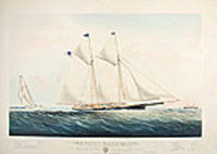
186119902New York: Currier & Ives 1861. Hand-coloured lithograph by Charles Parsons signature in image. Expert marginal repairs. Sheet size: 22 1/2 x 32 inches. Image size: 17 1/2 x 27 1/4 inches. A magnificent Currier & Ives portrait of one of the premier yachts in the New York Yacht Club: the yacht that beat the "America" in her speed trials.<br/> <br/>The Stevens brothers listed in the title were members of a prominent American family their father had served in the American Revolution. John Cox Stevens was one of the founding members of the New York Yacht Club the first Commodore and one of five sponsors of the "America" the yacht that went to England in 1851 and won the race thereafter known as the America's Cup Race. His brother Robert L. Stevens designed the "Maria" which beat the "America" during the series of speed trial races to Sandy Hook prior to the latter's epoch-making trip to England. The "Maria" was one of the most beautiful yachts in an era of exceptionally beautiful boats: an icon amongst American yachts. It was estimated that the Stevens spent a total of $100000 on experiments and alterations involving Maria in the 22 years that she was in the family. A 1914 article in the New York Times described her as "a scientific racing machine the first of her kind" cf. NYT 17 May 1914.<br/> <br/>Conningham 6805; Gale 7360. Currier & Ives unknown books
18673551New York: Currier & Ives 1867. Lithograph coloured by hand. Currier & Ives view of the start of the first Trans-Atlantic yacht race.<br/> <br/>This image recalls the start of modern ocean racing: in 1866 under New York Yacht Club rules three schooners of between 32 and 32.6 metres raced from Sandy Hook N.J. to Cowes Isle of Wight. The Henrietta owned by American newspaper publisher James Gordon Bennett won arriving at 5:45 pm on Christmas day in a time of 13 days and 22 hours. The Fleetwing arrived 8 hours later followed by the Vesta 1 1/2 hours after her.<br/> <br/>Conningham 2634; Gale 2854. Currier & Ives unknown books
18823554New York: Currier & Ives 1882. Lithograph printed in colours. An excellent Currier & Ives image of a racing yacht at full stretch.<br/> <br/>A valuable pictorial record of this New York Yacht Club vessel owned jointly by H.W. Johnson and William Krebs from a painting by the prolific and highly talented Charles R. Parsons.<br/> <br/>Conningham 1281; Gale 1404. Currier & Ives unknown books