34 résultats
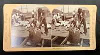
189849371Meadville Pa / St. Louis Mo: Keystone View Company 1898. Pink mount slightly bowed with publisher imprint to either side caption under right image. Rounded corners. Blank verso. Now housed in a mylar sleeve. Light wear & soiling. Photo clear & sharp. A VG example. Domed b/w images of 7 men on a dock with a dozen or so sea turtles being gathered. Oblong format: 3-7/16" x 7" <br/><br/> Keystone View Company unknown books
18823554New York: Currier & Ives 1882. Lithograph printed in colours. An excellent Currier & Ives image of a racing yacht at full stretch.<br/> <br/>A valuable pictorial record of this New York Yacht Club vessel owned jointly by H.W. Johnson and William Krebs from a painting by the prolific and highly talented Charles R. Parsons.<br/> <br/>Conningham 1281; Gale 1404. Currier & Ives unknown books
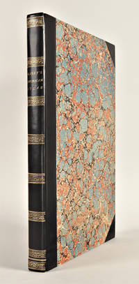
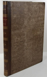
1823WRCAM43415APhiladelphia: H.C. Carey & I. Lea 1823. Letterpress title copyright notice on verso 1p. advertisement verso blank 1p. table of contents verso blank. Forty-six double-page handcolored engraved maps of the United States all but one with borders of letterpress descriptive text; uncolored double-page engraved view showing the comparative heights of mountains throughout the world; handcolored double-page engraved table showing the comparative lengths of the principal rivers worldwide; five letterpress tables four double-page three of these handcolored; 18pp. of letterpress text. Mounted on guards throughout. Modern half calf and marbled boards spine gilt leather label. Dampstaining along lower edge causing chipping to initial leaves. Closed tear in bottom margin of first map repaired with tissue. Very light offsetting from maps. Some dust soiling light tanning and foxing. Good plus. A handsome atlas of the Americas with individual color maps of each state in the Union including a seminal map of the West by Stephen H. Long. At the time of publication this was the best and most detailed atlas to be produced in the United States with substantial historical background text accompanying each map. Fielding Lucas the major Baltimore printer was the principal engraver. <br> <br> Among the most noted maps in the atlas is Major Stephen H. Long's "Map of Arkansa and other Territories of the United States." That map which depicts the Missouri basin between Nashville in the east the Mandan villages in the north and the Rocky Mountains in the west was based on the surveys conducted by Long on his expeditions of 1819 and 1820. The map published in Carey & Lea's atlas preceded the official account of that expedition by expedition botanist Edwin James which includes a smaller map with similar detail titled "Country drained by the Mississippi Western Section." Carey & Lea's 1823 publication of James' ACCOUNT perhaps explains the prior inclusion of this map with Long expedition information in their atlas. <br> <br> On this famous map is the printed legend which would perpetuate a myth for many years to come identifying the high plains as the "Great American Desert." Carey & Lea's atlas was first issued in 1822; this is the second issue with revised states of three maps Maine North Carolina and Louisiana with the same printing of the remaining maps and a cancel title. HOWES C133 "aa." PHILLIPS ATLASES 1373a. SABIN 15055. WHEAT TRANSMISSISSIPPI 348 352. H.C. Carey & I. Lea hardcover books
182729764Philadelphia: H.C. Carey & I. Lea 1827. Folio. Mounted on guards throughout. Letterpress title copyright notice on verso 1p. "Advertisement" to Third Edition dated "January 1827" verso blank 1p. "Contents" and "Index" verso blank plus forty-six double-page handcolored copper engraved maps most with descriptive letterpress in margins and many with supplementary text pages following; one double-page engraved plate of mountains uncolored; and one double-page colored plate of river lengths. Titlepage remargined minor foxing some faint staining along bottom edge. Later 19th-century three-quarter calf and original plain paper boards later gilt morocco label. Boards slightly rubbed.<br/> <br/>One of the most important early atlases printed in the United States: a handsome atlas of the Americas with individual colour maps of each state in the Union including a seminal map of the West by Stephen H. Long.<br/> <br/>At the time of publication this was the best and most detailed atlas to be produced in the United States. Fielding Lucas the major Baltimore printer was the principal engraver and substantial historical background text accompanies each map. Among the most noted maps in the atlas is Major Stephen H. Long's "Map of Arkansa and other Territories of the United States." That map which depicts the Missouri basin between Nashville in the east the Mandan villages in the north and the Rocky Mountains in the west was based on the surveys conducted by Long on his expeditions of 1819 and 1820. On this famous map is the printed legend which would perpetuate a myth for many years to come identifying the high plains as the "Great American Desert." The 1827 edition "Third edition Corrected and Improved" of Carey & Lea's historic atlas first published in 1822 includes much new material with all the maps and text updated except for the Washington D.C. and Michigan maps. This was the first American atlas that was modeled on Le Sage's plan of having explanatory text surrounding the maps. The maps for the most part by Fielding Lucas are beautifully drawn and colored.<br/> <br/>Howes C133 "aa"; Phillips 1373a; Sabin 15055; Wheat Transmississippi West 348 and 352. H.C. Carey & I. Lea unknown books
182325085Philadelphia: H.C. Carey & I. Lea 1823. Folio. 17 1/2 x 11 7/8 inches. Mounted on guards throughout letterpress title copyright notice on verso 1p. Advertisement verso blank 1p. Contents verso blank 46 double-page hand-coloured engraved maps of the United States all but one with borders of letterpress descriptive text 1 uncoloured double-page engraved view showing the comparative heights of mountains throughout the world 1 hand-coloured double-page engraved table showing the comparative lengths of the principal rivers worldwide 5 letterpress tables 4 double-page 3 of these hand-coloured 18pp. of letterpress text. Expertly bound to style in half calf over contemporary marbled paper covered boards flat spine in six compartments divided by gilt roll tools red morocco label in the second compartment the others with a repeat decoration in gilt.<br/> <br/>One of the most important early atlases printed in the United States: a handsome atlas of the Americas with individual colour maps of each state in the Union including a seminal map of the West by Stephen H. Long.<br/> <br/>At the time of publication this was the best and most detailed atlas to be produced in the United States. Fielding Lucas the major Baltimore printer was the principal engraver and substantial historical background text accompanies each map. Among the most noted maps in the atlas is Major Stephen H. Long's "Map of Arkansa and other Territories of the United States." That map which depicts the Missouri basin between Nashville in the east the Mandan villages in the north and the Rocky Mountains in the west was based on the surveys conducted by Long on his expeditions of 1819 and 1820. The map published in Carey & Lea's atlas preceded the official account of that expedition by expedition botanist Edwin James which included a smaller map with similar detail titled "Country drained by the Mississippi Western Section". Carey and Lea's 1823 publication of James Account perhaps explains the prior inclusion of this map with Long expedition information in their atlas. On this famous map is the printed legend which would perpetuate a myth for many years to come identifying the high plains as the "Great American Desert." Carey and Lea's atlas was first issued in 1822; this is the 1823 second issue substantially the same as the first but with a new title and revised states of several maps and text leaves generally minor revisions including additional shading to maps and improved resetting of several text leaves though this copy with first state settings of the Maryland and Virginia text leaves.<br/> <br/>Howes C133 "aa"; Phillips 1373a; Sabin 15055; Wheat Transmississippi West 348 and 352. H.C. Carey & I. Lea unknown books
180119020London: Printed and Published by Robert Laurie and James Whittle 1801. Folio. 21 1/8 x 15 1/4 inches. Mounted on guards throughout letterpress title verso blank and 1p. index verso blank otherwise engraved throughout. 59 engraved maps on seventy-five mapsheets all hand-coloured in outline 1 map on 3 folding sheets; 14 on 2 folding sheets; 9 on single folding sheets; 34 on single double-page sheets; 1 on a one-page sheet. Contemporary tree calf covers with roll-tool border in gilt the flat spine divided into seven compartments by gilt fillets and roll-tools blue morocco lettering-piece in the second the other compartments with repeat neo-classical decoration of a single centrally-placed tool marbled endpapers<br/> <br/>A very fine copy of the fifth edition of this important atlas of the world including a newly revised chart of world and nine other maps that were not available in the early editions of this spectacular work.<br/> <br/>Eight editions of this work were issued on an almost annual basis from 1796 until 1807. The publishers constantly changed and improved the atlas in an effort to outdo not only their competitors but also to improve on the previous edition. Maps were added the first edition included only 66 map sheets maps were replaced the present work includes two maps dated 1800 including 'A New Chart of the World' dated 25 November 1800 and maps were updated eight maps are dated 1799. The scale of some of the maps is truly spectacular: this atlas contains 15 maps that if joined would form large scale wall maps: 'Asia and its Islands' on three folding sheets ranging from the Arctic regions in the north down through Russia Indonesia and Australia would measure approximately 56 x 46 inches if assembled. The remaining maps on two folding sheets would all be approximately 40 x 46 inches if joined: these include three maps of American interest: 'A new map of the whole continent of America'; 'A new map of North America with the West India Islands'; and 'A map of South America'. The remaining areas that are covered by large scale maps are 'A general map of the World'; England & Wales; Scotland; Ireland; the Netherlands; Germany; Hindoostan; Bengal Bahar etc; Delhi Agrah Oude and Allahabad. This atlas was originally created by Thomas Kitchin. Sayer and Bennett had published the work in 1773 and Laurie and Whittle took over the Sayer business in 1794. They subsequently enlarged the work adding maps and changing the name from the General Atlas to A New Universal Atlas. The maps are based on the work of a variety of mapmakers and surveyors: Thomas Kitchin Thomas Jefferys John Rocque Robert Campbell John Armstrong John Roberts L. S. d'Arcy Delarochette James Rennell Andrew Dury Thomas Pownall and Jean Baptiste Bourguignon d'Anville. Also included is the information gathered as a result of the important Pacific voyages of Captain James Cook George Vancouver and Jean Francois Galaup de La Perouse.<br/> <br/>Phillips Atlases 3534. Printed and Published by Robert Laurie and James Whittle unknown books
185524811Fairfield Iowa and Philadelphia: Henn Williams & Co. and R. Barnes 1855. Folding pocket map lithographed by Friend & Aub of Philadelphia full original period hand colouring. Folds into original blue cloth covers blocked in blind the upper cover with publisher and title in gilt. A fine copy of this attractive map of Iowa from the early years of its settlement this second edition shows the rapid development within the state and is the first edition to include Sioux City and many proposed railroad routes.<br/> <br/>This large and colourful map of Iowa shows the state divided into numerous counties all within nine land districts with the sites of the land offices identified in each. Issued to promote settlement in the state the map includes an advertisement in the upper left corner for Henn Williams and Co.: "dealers in land land warrants & exchange . special attention given to Location of Land the sale and loan of Warrants and to the collecting & remitting of sight and time bills. Investments made in any part of Iowa." Besides locating numerous towns and river systems the state's burgeoning railroad system is shown with many proposed routes depicted across the state by means of dotted lines. This is the second edition of the map after the first of 1854 but apparently printed from a new plate to incorporate the rapid growth. A third edition followed in 1856.<br/> <br/>Phillips A List of Maps of America p. 337; Rumsey 1739; Graff 1857; Streeter sale 3898. Henn, Williams & Co. and R. Barnes unknown books
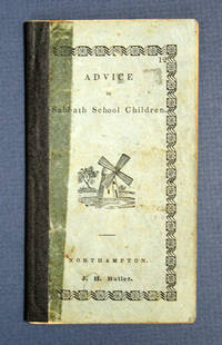
183840630Northampton: J. H. Butler / John Metcalf 1838. 1st printing presumed. Light blue printed paper wrappers with later navy blue cloth spine reinforcement. Significant wear to wrappers glue remains to sides of spine reinforcement light soiling and rubbing. A Good copy. 24 2 pp. Woodcut illustrations within. 5-3/16" x 2-7/8" <br/><br/> J. H. Butler / John Metcalf hardcover books
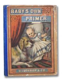
18772292001D. Lothrop & Co 1877. First Edition. Hard Cover. Very Good/No Jacket - Pictorial Cover. Edges rubbed ink gift note on front endpaper 'From "my dear little Josi" on my third birth-day Feb 21st. 1878.'. 1877 Hard Cover. 64 pp. Blue cloth spine color pictorial paper over boards. Engraved frontispiece silhouette illustration on title page full alphabet in both capital and lower case on copyright page alphabet paired with illustrations featuring two letters per page each paired with two lines of verse with an additional page for '&' followed by fifteen brief stories in which all polysyllabic words are hyphenated. D. Lothrop & Co hardcover books
18883393San Francisco: Published by Bell & Heymans 1888. First Edition. Very good. Folio 350 x 258 mm. 86 ix 1 pp. including fascinating advertisements. Original wrappers chipped and foxed. Wrappers with two-color lithographs 44 b/w lithographs illustrating the text some extending over 2 pages all by Britton & Rey San Francisco. MAP 53 x 71 cm with some short tears at fold intersections. Recto: "Map of Sonoma County Cal'a sic. Showing Boundary Lines of County and Townships Railroads and Public Roads Cities Towns &c. &c." Published by Bell and Heymans 434 California St. San Francisco Copyrighted May 1888. Lithographer: Cal Label & MacCabe Lith Co. San Francisco. Verso: "Map of Verano Sonoma Valley California." Lithographer: H.S. Crocker & Co. San Francisco. Beautifully illustrated promotional materials for the nascent planned community of Verano Sonomy Valley created by the firm of Britton & Rey in their prime. The folio volume and the accompanying map sheet with color illustrations are rare: this is the only complete copy that has been recorded at auction.<br/><br/>Although more commercial than the Thompson & West local histories the present work has the same type of wonderful documentation with the added cache of ads that enhance the historical value. Following a history of Sonoma County and Russian River Valley are essays on industries agriculture orchards viticulture stock raising lumber minerals natural wonders business opportunities social life etc. These promotional materials were apparently aimed at investors from the East Coast and perhaps beyond; at some point our map was inscribed in French: "Californie" sic. <br/><br/>The remarkable lithographs by Britton & Rey depict scenes views panoramas portraits architecture vineyards orchards etc. some after photographs. Included with our copy is the rare folding lithograph sheet with map of Sonoma County on one side and colored illustrations and map of Verano on other side Hooker Falls orange and olive grove General Vallejo's home Sonoma Creek Verano Park. At that time Verano now known as El Verano was a planned community. The present promotional items were no doubt occasioned when a new train depot was built nearby. <br/><br/>The Bancroft copy as recorded by OskiCat does not contain the map but there is a related map greatly reduced defective and apparently printed on one side only by H.S. Crocker with the same title likewise surveyed by P.R. Davis which measures 26 x 46 cm or about half the size as ours. <br/><br/>Auction comparables: Dorothy Sloan Auction 20 2007 lot 6 this copy purchased after the sale for $1410. An ugly copy of the map backed with tissue thus obscuring the entire "Map of Sonoma County Cala" on the verso sold at PBA on June 7 2012 for $600. <br/><br/>Rocq 14850. Published by Bell & Heymans unknown books
188219572New York: G.W. Carleton & Co. 1882. Hardcover. Very good. 8vo. Printed cloth gilt-stamped titles. Very good. Modest scuffs edgewear to boards. Pages moderately to heavily foxed throughout but complete and unmarked. Binding cracked at several points; mostly good and sound throughout. 514pp. <br/><br/>Rare. Stated eighteenth edition but OCLC locates no other editions of this title so this was likely a marketing tactic to increase the impression of the book's popularity. OCLC finds only four worldwide holdings of the physical book: one in Canada and three in the U.S. An extensively illustrated general encyclopedia for popular consumption which includes "whole chapters upon" subjects including Fine Arts Jurisprudence Vegetable Creation Animal Creation Mineralogy Chronology and more; edited by "The Ablest Talent the World Affords." G.W. Carleton & Co. hardcover books
1850WRCAM5467London & Edinburgh 1850. 7 chapters 32pp. each. Original decorated paper over boards rebacked in cloth. Boards rubbed as usual but very good. The fourth volume in this popular series aimed at satisfying the literary appetite of "higher minded" people. This volume includes "The Bourbon Family" "Every-day Life of the Greeks" "Science of the Sunbeam "Sir Robert Peel" and "California" which describes the gold rush. hardcover books
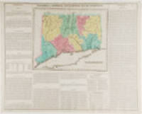
182319787Philadelphia: Carey & Lea 1823. Engraving with full period colour. Backed on linen. Split at fold expertly repaired. Occasional creases. Fascinating and informative map of Connecticut from one of the most innovative American atlases of the 19th century.<br/> <br/>Carey & Lea's atlas established a style that was widely admired especially in Europe: placing a fully coloured map as the centerpiece of the page and surrounding it with geographical and historical facts. The texts were well written and intriguing. The immense transformation of continental America: the vast migration settlement and industrialization really began at about this time not long after the War of 1812 when expansion and opportunity were American by-words. It was at this time that American atlases began to need semi-annual revisions because the country had changed so rapidly. In fact the Carey & Lea gazetteer style most reminiscent of Herman Moll really was too time consuming for the firms that published atlases of America as the century progressed. Carey & Lea unknown books
1870WRCLIT23143Savannah GA.: Published by Wilson & Havens 1870. Stereopticon photograph mounted on card with printed label on verso. Small early ink name on verso of card else very nice. An example of the blizzard of racially stereotypical stereographs produced and sold in the South and North for that matter in the years following the Emancipation Proclamation. In this view a black man in a straw hat is riding a rather skeletal steer with an overloaded haycart drawn behind. The title label indicates this was image 126 in the publisher's series. Darrah cites Wilson and Havens as active in Savannah during the 1860s and the 1870s. Published by Wilson & Havens unknown books
1897WRCLIT77280New York: Breitkopf and Hartell 1897. 92pp. Small folio 34 x 27.5 cm. Khaki cloth elaborately decorated in green gilt and dark brown with a floral art nouveau motif signed 'M.M'. Pictorial endsheets. Publisher's address revision stamp on title below imprint some pencil annotations otherwise a very near fine copy. A handsome period binding from the American branch of the venerable music publishers. While there are plate marks for the music v.a. 1868 OCLC suggests a far more reasonable publication date of 1897 which is highly consistent with the style of the binding and printing. OCLC locates copies at Cleveland Public and Martin Luther College. OCLC: 22334613. Breitkopf and Hartell hardcover books
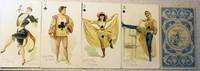
189021478Np: MacLin-Zimmer-McGill 1890. Stiff Boards. Orig. decorated light blue and white illustrated backs. Fine. Complete deck of 53 chromolithographic playing cards 9.5 x 5.5 cm. including the "Little Joker." The Aces and numeral cards have the suit symbols superimposed over the costumes. Backs in blue and white depicting a sailor at the helm with the advertising line "Smoke and Chew Hard-A-Port Cut Plug." Hard-a-Port Cut Plug" tobacco insert playing cards published by MacLin-Zimmer-McGill USA c.1890 featuring a selection of beautiful actresses from a past era in poses some might consider risqué. This set of designs was used in around six different editions with various backs advertising "Hard-a-Port Cut Plug" and/or "Trumps Long Cut" chewing tobacco. They were originally produced by Moore and Calvi then by their successors MacLin and Zimmer and Maclin-Zimmer-McGill in around the 1890s. The "Hard-a-Port Cut Plug" series depicts actresses with angelic faces dressed for the pantomime or dance hall. MacLin-Zimmer-McGill unknown books
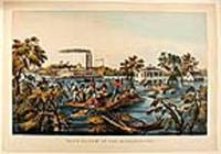
186820565New York: Currier & Ives 1868. Hand-coloured lithograph by James Merrit Ives after Fanny Palmer. A poignant image demonstrating the triumph of the human spirit and depicting the twin stack steam paddle wheel and riverboat "Stonewall Jackson."<br/> <br/>In the foreground uprooted trees bob in the current using a roof as a raft two men pole themselves and nine others to safety one of their companions holds tight to reins of a mule swimming beside the roof whilst two others rescue furniture and a barrel. In the mid-ground: a large white-painted house with second-floor balconies front and back and a smaller cook-house off to the right side. Two men in a row boat approach the back of the house a lady stands on the balcony speaking to the men; on the widow's walk on the roof a man and a woman stand: the man waves a handkerchief to the twin-stack riverboat. The riverboat "Stonewall Jackson" is travelling at speed: the near-side paddle creates a substantial wake the flags fly in the stiff breeze and the smoke from the stacks steams backwards: passengers line the rails attracted by the human drama they are passing. The overall impression is of a crisis that is being survived and dealt with by man's ingenuity whilst life continues.<br/> <br/>Conningham 2819; Gale 3057. Currier & Ives unknown books
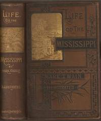
1883L0531<p>624 pages with frontispiece and over 300 black and white illustrations. Royal Octavo 9" x 6 1/4" bound in the original publisher's brown cloth with gilt lettering and pictorial on spine and black and gilt lettering with pictorial to cover. Lacks the illustration of Twain's head in flames on page 441 and the corrected "St Charles Hotel" on page 443. Simultaneously published in 1883 in the United States and Great Britain the book is the first submitted to a publisher as a typewritten manuscript BAL 34II Second state of the first American edition.<br /><br />Twain once remarked that he considered this book his masterpiece the book that would outlive his other works and endure as a classic. Of course Twain once defined a classic as a book everybody talks about but nobody ever reads. At first glance it seems to be a travel book but it is really a highly readable discursive autobiographical account of Twain's boyhood and his region and of a culture that radically changed since he left home 30 years earlier. It makes good reading as background for <i>Huck Finn</i>. The only thing that is known of the printing history is what Twain wrote in 1891: that 50000 copies were printed and bound but only 32000 sold. Implication is that the unsold copies were reissued by Charles L Webster between 1884 and 1891 when he took over Osgood's stock. Copies are found with Osgood's sheets and Webster cancel title-page in Webster bindings dated 1888 and 1891. As a subscription book this book was similar in size to the hefty tomes of the American Publishing Company but the handsome pictorial brown cloth binding ranks with the binding of <i>Huck Finn</i> as one of the best on a Twain first edition. It could be ordered with gilt edges in full sheep three-quarter morocco and three-quarter calf. MacDonald: <i>Firsts</i>.<br /><br />This is a memoir by Mark Twain of his days as a steamboat pilot on the Mississippi River before the American Civil War and also a travel book recounting his trip along the Mississippi River from St. Louis to New Orleans many years after the War. The book begins with a brief history of the river as reported by Europeans and Americans beginning with the Spanish explorer Hernando de Soto in 1542. It continues with anecdotes of Twain's training as a steamboat pilot as the 'cub' apprentice of an experienced pilot Horace E. Bixby. He describes with great affection the science of navigating the ever-changing Mississippi River in a section that was first published in 1876 entitled "Old Times on the Mississippi". Although Twain was actually 21 when he began his training he uses artistic license to make himself seem somewhat younger referring to himself as a "fledgling" and a "boy" who "ran away from home" to seek his fortune on the river and playing up his own callowness and naïveté. In the second half Twain narrates his trip many years later on a steamboat from St. Louis to New Orleans. He describes the competition from railroads and the new large cities and adds his observations on greed gullibility tragedy and bad architecture. He also tells some stories that are most likely tall tales. In 1980 the book was adapted as a TV movie for American public television with David Knell performing as Sam Clemens and Robert Lansing as Horace Bixby the steamboat pilot who mentored him. The film used many tall tales from the book woven into a fictional narrative. In 2010 <i>Life on the Mississippi</i> was adapted as a stage musical with book and lyrics by Douglas M. Parker and music by Denver Casado. It was produced that year in Kansas City Missouri and Door County Wisconsin. <br /><br /><b>Condition:</b><br /><br />Recased in original spine some occasional foxing and finger soiling one signature slightly sprung else a very good and bright copy.</p> James R Osgood and Company hardcover books
186521705St. Paul: Groff & Bailey 1865. First edition 8vo pp. 16 ads 399 including rear free endpaper and rear pastedown; 6 leaves printed on colored paper and outside the pagination are inserted; final 18 leaves in pagination also printed on colored paper; lacking front free endpaper containing ads p. 120-121 torn with loss also pp. 225-234; worn and rubbed soiling to covers else good and sound in orig. red morocco-backed printed paper-covered boards. Includes a full-p. illustrated ad for the North-Western Packet Co. James J. Hill agent. Preface identifies this directory as "the first state directory ever published in Minnesota." <br/><br/> Groff & Bailey hardcover books
1896LV1550Los Angeles:: Elstner-Morehouse 1896. 1896. Large oblong 4to. Not paginated. 36 full page illustrations of Los Angeles with related adverts on the opposite pages 15 full page photos of individual Los Angeles Buildings. Original full gilt stamped brown cloth; inner hinges neatly repaired. Early inscription to Arthur Ellis 1927. Early Ownership signature of Sam Behrendt Los Angeles 1925. Fine. EXTREMELY SCARCE. BEAUTIFUL COPY OF THIS VERY RARE LOS ANGELES SKETCHBOOK. With 36 full-page plates depicting early Los Angeles buildings. This unequaled record of the central Los Angeles business district was created according to the preface in order ". . .to show the active business portions together with a few of the more pretentious of the office buildings and manufactories". Arthur Ellis was a founding member of the Zamorano Club. Provenance: Sam Behrendt the son of Los Angeles pioneer Caspare Behrendt d.1913 the discovery of gold brought him to California "acquired his education in the Spring Street and Eighth Street Grammar Schools at Los Angeles and after he was fifteen years old spent one year in a business college. For to years he clerked in a grocery and cigar business and remained there until 1900. Selling out and returning to Los Angeles he became connected with the San Gabriel Electric Company later merged with the Pacific Light and Power Company. He was employed as a collector and later solicited new contracts for three years. On leaving that corporation Mr. Behrendt entered the insurance business for himself and in 1907 took in Mr. I. O. Levy as a partner under the name Behrendt-Levy Company and they incorporated the business in 1908. This is a general insurance agency and the establishment now employs twenty-one people. Mr. Behrendt is also a director of the Union Bank and Trust Company and a director of the Shiff Lang & Company." He is a member of Hollenbeck Lodge no. 119 a Scottish Rite Mason and Shriner Elk Corona Parlor of the Native Sons of the Golden West B’nai Birth Los Angeles Athletic Club San Gabriel Country Club City Club Chamber of Commerce Merchants and Manufacturers Association and the Friars Club of New York. At Oakland Ca. he married Sadie Mosbacher. Together they had a son George b.1904. Behrendt was also known to be a friend of film star Roscoe "Fatty" Arbuckle holding a dinner in his honor at the Alexandria Hotel February 12 1917. – McGroarty. John Steven McGroarty Los Angeles from the mountains to the sea: with selected biography vol. II p. 422; James Miller Guinn A history of California and an extended history of Los Angeles and . . . 1915 page 124; Harris Newmark Sixty Years in Southern California. Elstner-Morehouse, 1896. hardcover books
18025174London: Harding 1802. Aquatint coloured by hand on laid paper watermark '1802' Publication line at foot of plate shaved with slight loss some expertly repaired tears to margins. An anonymous work of quality.<br/> <br/>Unusually the present work does not include either the artist responsible for the original or the engraver who worked on the plate. The publication line is very faint: sometimes an indication of a later issue but the early watermark does not support this. None of the standard reference works include either this print or mention of the horse Sacripant. This suggests that this image is rare and the absence of names allied with the early watermark may indicate some sort of proof issue. Harding unknown books
18905166London: J. Braill & Son 1890. Aquatint printed in colours and finished by hand. A fine copy of this excellent late example of the racing aquatint.<br/> <br/>The heyday of the racing aquatint in Britain was probably about 1830 but the present example shows that the art had not died out even sixty years later. The print is unfortunately unsigned but aside from the process used the style of painting is charming and recalls the work of John Frederick Herring and his contemporaries. J. Braill & Son unknown books
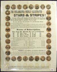
186145862Philadelphia 1861. Broadside approx. 18 x 14"; adorned with 32 small circular mustard-colored vignettes engraved in black each depicting the seal of a state of the Union; some offsetting due to having been previously folded else a fine example. Attractive advertisement for the Philadelphia weekly illustrated newspaper which "contains 8 Pages 40 columns of reading matter from the pens of the best American authors; national and not sectional; it is emphatically the best literary paper in America. It has no equal." Contents also include a review excerpt from the Philadelphia Weekly; terms of subscription; and a call for agents. Subscribers are additionally bribed with the promise of certificates being sold at $1 and redeemable for various goods the most luxurious of which is a gold chronometer hunting watch valued at $200. AAS only in OCLC as of July 2014. <br/><br/> unknown books
187261762New York: James Sutton and Company. Very Good. 1872. Hardcover. This is a bound Volume V from 1872 of this heavily illustrated monthly. It lacks the first issue and so is Volume V No. 2- Volume V No. 12. Original boards but the binding has been crudely rebacked and repaired with a cloth tape by a Library. The Contents are clean and fresh and unmarked with the single exception of a library stamp at the top of one page of text in No. 4 and include many full page woodcut illustrations. . James Sutton and Company hardcover books
1804247484Hudson N.Y. 1804. 8 pp. printed in three columns. 4to. Old fold lines. Minor soiling and toning. Very good. In a tan half morocco and cloth folder spine gilt. 8 pp. printed in three columns. 4to. A single issue of this Upstate New York weekly newspaper which began publication in 1801. This issue contains the text of President Jefferson's Message to Congress of Nov. 8th. In his speech Jefferson discusses relations with foreign powers including the Delaware and other Indian tribes the Louisiana Purchase; the United States Navy; and the federal budget. Critical of Jefferson Croswell would later be tried for libel and defended before the Supreme Court by Alexander Hamilton. The publication of this weekly newspaper would continue through 1807. unknown books