425 résultats
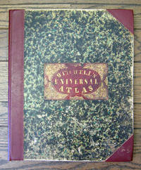
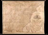
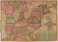
183122138Philadelphia 1831. No binding. Fine. Map of the United States. Entered according to Act of Congress in the Clerks Office of the Eastern District of Pennsylvania October 10th 1831. Philadelphia 1831. Folding map on four sheets joined. Folding into original covers 8vo binding size: 9 5/8 x 6 1/2 in. red half morocco over marbled paper boards upper cover with gilt-lettered title label corner and edges worn. The map and covers now apart and separately mounted for display. Historical BackgroundFirst edition and the first wall map issued by Mitchell. This edition does not have the counties delineated and numbered. Ristow mistakenly says all editions have the townships he means counties numbered but this one the first does not thereby eliminating the index of counties and thus showing more of the western territory. This map predates the Traveler's Guide by 1 year and thus is Mitchell's first ""original"" production as opposed to the Finley material he reissued as the American Atlas and Pocket Maps. Copyright date is October 10 1831. There is no other date on the map. Ristow thinks the map was issued in early 1832 but it is not in Phillips until 1834 edition which probably has the counties indicated by number and the 1831 copyright so Ristow may not have seen this edition but rather the 1834.ReferenceKarrow 1-1473; Ristow p309.ConditionOriginal full color the palette rich and bright. One 5-inch repaired tear at left into Arkansas some cracking and more minor tears at folds. Some overall browning of the sheet. In good condition. books
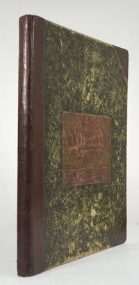
1852236680Philadelphia: Thomas Cowperthwait & Co 1852. Chromolithograph title hand-colored frontispiece 73 hand-colored lithographic maps. 1 vols. Folio. Half red morocco in period style original marbled boards with printed label on upper cover very clean. Chromolithograph title hand-colored frontispiece 73 hand-colored lithographic maps. 1 vols. Folio. Mitchell & Sons first published their NEW UNIVERSAL ATLAS in 1846 having acquired Tanner's NEW UNIVERSAL ATLAS in 1845 and printed it several times subsequently until 1850 when the firm sold the rights to Cowperthwait & Co. of Philadelphia who published it until 1856 continually adding to and editing the hand-colored maps. Despite the attribute "Universal" in the title the Atlas clearly concentrates on America with 43 maps of the continent and features a large double-page transcontinental map of the U.S; and this 1852 Cowperthwait edition is the first to show counties in California and New Mexico. Phillips 809; Ristow pp.311-13; Rumsey p.240 Thomas, Cowperthwait & Co unknown books
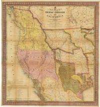
1846WRCAM32518CPhiladelphia: S. Augustus Mitchell 1846. 46pp. text plus colored folding map 22 1/2 x 20 3/4 inches. 18mo. Original gilt morocco cover neatly rebacked in matching morocco. Map neatly repaired with tissue on folds. Text is clean. A major western map with accompanying text. The detailed "New Map of Texas Oregon and California with the Regions Adjoining." shows the western portion of the U.S. to the Pacific with Indian Territory Missouri Territory Iowa and portions of the states of Missouri Arkansas Louisiana and Wisconsin as well as northern Mexico and part of British Columbia illustrating in detail the trans-Mississippi region on the verge of the Mexican-American War. Texas is elaborately depicted with the Rio Grande as its southern border; Oregon is shown to extend to 54° 40"; and the Santa Fe Trail and the Oregon Trail are both detailed the latter with a table of distances published in the lower corner of the map. "This map represents a great step forward in that it is among the first by a commercial cartographer to utilize the recent explorations that had bounded and determined the nature of the Great Basin.because of its popularity this map of the West exerted great influence not only with the public but on other commercial cartographers" - Wheat. The text describes each territory or state in turn with notes on Lewis and Clark and other early explorers and more historical material. Howes also mentions an issue with thirty-four pages of text but Sabin lists only the present collation. HOWES M685 "aa." SABIN 49714. MARTIN & MARTIN 36. WAGNER-CAMP 122b. COWAN p.433. WHEAT TRANSMISSISSIPPI 520. STREETER SALE 2511. PHILLIPS MAPS p.844. WHEAT GOLD REGIONS 29. REESE BEST OF THE WEST 91. S. Augustus Mitchell unknown books
185949436Philadelphia: S. Augustus Mitchell 1859. Large hand-colored wall map on rods approx. 64" square with 4 engraved vignettes 3 inset maps 2 of the world and 1 of the Sandwich Islands all within an elaborate floral border; some infill along the margins slight loss in the population tables at the bottom and several cracks in the paper the whole neatly and professionally backed with linen; overall appearance is certainly very good or better with the usual small defects. America as it was on the eve of the Civil War. OCLC records examples from 1856 1857 1858 1860 and 1861 but not this. Unusual features of this map include the Shoshone Territory what is now mostly Idaho Colona now part of Colorado the unusually large Nebraska the horizontal Utah and New Mexico and the unusually small Dakotas. <br/><br/> S. Augustus Mitchell unknown books
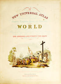
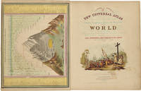
18525810Philadelphia: Thomas Cowperthwait & Co 1852. Folio. 17 x 13 3/4 inches. Chromolithographic title with large vignette hand-coloured frontispiece of the heights of the principal mountains and lengths of the principal rivers contents list printed in red black and gold 73 hand-coloured lithographed maps charts and city plans 1 double-page. Publisher's green marbled paper-covered boards with morocco title label elaborately tooled and lettered in gilt on upper cover red morocco spine and corners expertly renewed to style. Modern red cloth box morocco lettering piece<br/> <br/>A fine copy of this famous atlas with hand-coloured maps of all the individual States and Territories. The map of California shows counties in California and New Mexico for the first time.<br/> <br/>Despite its title the Atlas concentrates to a marked degree on the American continent with 43 maps of the area including a fine double-page east-to-west-coast map of the United States. S. Augustus Mitchell and his sons were the leading publishers of maps in the United States during most of the nineteenth century. Mitchell had come to Philadelphia around 1830 with the intention of improving the standard of geography textbooks Philadelphia then being the leading city in America for cartographical publications. A New American Atlas published in 1831 was his first work. In 1845 he acquired the rights to Tanner's New Universal Atlas first published in 1836 and in 1846 he published his first edition of the present work. Mitchell continued to publish the atlas until 1850 when he sold the copyright to Cowperthwait & Co. of Philadelphia. Thomas Cowperthwait & Company published it until the mid-1850s when it was purchased by Charles De Silver. The Cowperthwait company continued to add edit alter and hand-colour the maps.<br/> <br/>Phillips Atlases 807; cf. Ristow pp. 311-313; Rumsey p.239. Thomas, Cowperthwait & Co unknown books
18556365Philadelphia: Charles DeSilver 1855. Folio. 17 x 14 inches. Chromolithographic title with large vignette hand-coloured frontispiece of the heights of the principal mountains and lengths of the principal rivers contents list printed in red black and gold 71 hand-coloured lithographed maps and charts 3 double-page and 1 city plan. Publisher's red half morocco with green marbled paper-covered boards morocco title label elaborately tooled and lettered in gilt on upper cover. Modern red cloth box dark red morocco lettering piece<br/> <br/>A fine copy of this famous atlas with hand-coloured maps of all the individual States and Territories. The first edition to have DeSilver as publisher and here including 'A New Map of Nebraska Kansas New Mexico & the Indian Territories' for the first time: present here as an additional map un-numbered and not called for in the contents list<br/> <br/>Despite its title the Atlas concentrates to a marked degree on the American continent with a city plan of Washington D.C. and 42 maps of the area including a fine double-page coast-to-coast map of the United States and 30 maps of the States and Territories. The un-numbered map of Nebraska Kansas etc. is here bound between sheets numbered 37 and 38. S. Augustus Mitchell and his sons were the leading publishers of maps in the United States during most of the nineteenth century. Mitchell had come to Philadelphia around 1830 with the intention of improving the standard of geography textbooks Philadelphia then being the leading city in America for cartographical publications. A New American Atlas published in 1831 was his first work. In 1845 he acquired the rights to Tanner's New Universal Atlas first published in 1836 and in 1846 he published his first edition of the present work. Mitchell continued to publish the atlas until 1850 when he sold the copyright to Cowperthwait & Co. of Philadelphia. Thomas Cowperthwait & Company published it until the mid-1850s when it was purchased by Charles De Silver. The Cowperthwait company continued to add edit alter and hand-colour the maps.<br/> <br/>Phillips Atlases 6118; cf. Ristow pp. 311-313; Rumsey pp.240-241. Charles DeSilver unknown books
1852WRCAM31820APhiladelphia: Thomas Cowperthwait & Co. 1852. Chromolithographic title with large vignette; handcolored frontispiece of heights of principal mountains and lengths of principal rivers; contents list printed in red black and gold; seventy-three handcolored lithographic maps charts and city plans one double-page. Folio. Publisher's three-quarter red morocco and marbled boards spine ruled in gilt morocco label lettered in gilt on front board. Binding worn and rubbed front hinge tender. Contemporary bookplate on front pastedown. Some toning but generally clean internally. Very good overall. A famous atlas with handcolored maps of all the individual states and territories with the map of California showing counties in California and New Mexico for the first time and with the locations of Native American tribes shown in several western states and territories. Despite its title the atlas concentrates to a marked degree on the American continent with forty-three maps of the area including a fine double-page coast- to-coast map of the United States. <br> <br> S. Augustus Mitchell and his sons were the leading publishers of maps in the United States during most of the 19th century. Mitchell had come to Philadelphia round 1830 with the intention of improving the standard of geography textbooks Philadelphia then being the leading city in America for cartographical publications. A NEW AMERICAN ATLAS published in 1831 was his first work. In 1845 he acquired the right to Tanner's NEW UNIVERSAL ATLAS first published in 1836 and in 1846 he published his first edition of the present work. Mitchell continued to publish the atlas until 1850 when he sold the copyright to Cowperthwait & Co. of Philadelphia. Thomas Cowperthwait & Company published it until 1856 when it was purchased by Charles DeSilver. The Cowperthwait company continued to add edit alter and hand-color the maps. PHILLIPS ATLASES 807. RISTOW pp.311-13 ref. RUMSEY 553. Thomas, Cowperthwait & Co. hardcover books
185265704With the First Map to Show Counties in California and New Mexico MITCHELL S. Augustus. A New Universal Atlas of the World. Containing Maps of the various Empires Kingdoms States and Republics Of The World. With a special map of each of the United States Plans of Cities &c. Comprehended in seventy sheets and forming a series of One Hundred And Seventeen Maps Plans And Sections Philadelphia: Cowperthwait & Co. 1852. Complete with seventy-three full colored maps one of which is double-paged color frontispiece vignette title-page and table of contents heightened in gilt. Folio 17 x 14 inches; 430 x 355 mm. Half red morocco over marbled boards. Front board with red morocco label lettered in gilt. Binding scuffed and bumped. Hinges professionally repaired. Some toning throughout mainly to blank versos of maps and margin edges only occasionally affecting the maps. Closed tear to front free endpaper. A few instances of foxing on maps mainly to map 51 "Holland and Belgium." A small dark spot in Buenos Ayres on map 44. A small piece scraped off of map 73 "Oceana" but not making a hole all the way through. Also a marginal closed tear to this map professionally repaired. Overall a very good copy. This atlas was first published in 1846 by Mitchell & Sons after acquiring the rights to Tanner's New Universal Atlas in 1845. Mitchell & Sons reprinted it several times until 1850 when they sold the rights to Cowperthwait & Co. of Philadelphia who published it until 1856. During this time the atlas was further expanded and edited. Over half of this atlas deals with the Americas and features the double-page "A New Map of the United States of America." Within this map of the USA is a detailed inset of "The Gold Regions of California." The present edition is the first to show counties in California and New Mexico. Howes. Streeter. HBS 65704. $7500 Cowperthwait & Co. hardcover books
18496558Philadelphia: S. Augustus Mitchell 1849 Folio. 17 3/8 x 14 inches. Lithographed title with large vignette letterpress "Table of Contents" and 73 hand-colored lithographed maps charts and city plans. Three-quarter red morocco over marbled boards large red morocco title label on front cover elaborately tooled and lettered in gilt. Spine and corners renewed in red leather. Boards rubbed and scuffed at edges. Maps in fine condition. Overall a fine copy. A very nice copy of this very scarce atlas with hand-colored maps of all the individual States and Territories and including the rare and famous map of "Oregon Upper California & New Mexico" showing the large yellow-colored area in California labeled "Gold Region." The Atlas concentrates on the American continent with 43 maps of the area including a fine double-page coast-to-coast map of the United States. Samuel Augustus Mitchell and his sons were the leading publishers of maps in the United States during most of the nineteenth century. A New American Atlas published in 1831 was Mitchell's first work. In 1846 he published his first edition of the present work. He continued to publish the Atlas until 1850 when he sold the copyright to Cowperthwait & Co. It was with this 1849 edition that "New Mexico" was added to the title of the map as well as the words "Gold Region" added in a large yellow area in "Upper or New California." As Wheat states "We find S. Augustus Mitchell in Philadelphia publishing in 1849 a revised version of his Texas Oregon and California map taking advantage of Frémont's later work and displaying a large colored Gold Region." Also many routes are shown by red hand-colored lines including Frémont's routes. Wheat: Mapping the Transmississippi West: 630 p.284; text p.82; not noted in Wheat's Maps of the Gold Region. S. Augustus Mitchell hardcover books
1845WRCAM32219Philadelphia: S. Augustus Mitchell 1845. Wall map 52 x 66 inches with full period hand-color. Expertly repaired backed with modern linen trimmed in green cloth on contemporary rollers. A few light creases and some marginal soiling but on the whole a bright map in very good condition. This impressive wall map of the United States was originally published in 1836 and again in 1841 supplemented by an occasional ACCOMPANIMENT. In this 1846 edition an important inset map is added entitled "A General Map of the United States with the Contiguous British & Mexican Possessions" 16 1/2 x 21 inches. This inset incorporates the discoveries of Fremont in the Great Basin and California shows all of Texas and stretches Oregon Territory well into Canada beyond the line of the Treaty of Guadalupe Hidalgo. In the large map some counties are added in Iowa Territory. There are also small inset maps of Boston New York Philadelphia Charleston Washington Albany Rochester and Niagara Falls. An important American map showing the country on the eve of its second great national expansion. RUMSEY 4223. PHILLIPS MAPS p.898. S. Augustus Mitchell hardcover books
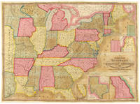
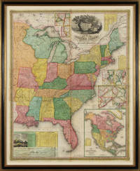
18454885Philadelphia: S. Augustus Mitchell 1845. Copper-engraved wall map with full original colour expertly repaired backed with modern linen trimmed in green cloth on contemporary rollers with bright colour overall in very good condition. An impressive wall map of the United States from a crucial year in American history.<br/> <br/>In 1834 Mitchell republished his A New Map of the United States under the title of Reference and Distance Map. New updated editions appeared almost yearly. When compared to the 1833 edition of the former this 1845 edition of the Reference and Distance Map shows many new developments in the upper Midwest. The outline of Lake Michigan has undergone extensive corrections. An oversized Wisconsin Territory 1836 now appears. Two of the small insets of American towns have been removed from the upper left-hand corner so that the new oversized Territory of Iowa 1838 could be added. The large inset General Map of the United States now shows Texas in its last year as an independent Republic. An important American map showing the country on the eve of its second great national expansion.<br/> <br/>Rumsey 4223; Phillips Maps p. 898. S. Augustus Mitchell unknown books
1888106806Philadelphia: J.B. Lippincott Company 1888. Rare first edition presentation copy of the father of American neurology's most popular work. Octavo original cloth with gilt titles to the spine and front panel. Presentation copy inscribed by the author on the front free endpaper "Mrs. Johnson with the author's regards." Weir has also noted "25 copies large paper No. 19." In near fine condition. One of Mitchell's most popular works Doctor an Patient provides a prime example of the eminent physician's direct appeal to the common sense and intelligence of the layman at large. Addressed chiefly to women the essays include: The Physician Convalescence Pain and Consequences The Moral Management of Sick or Invalid Children Nervousness and it Influence on Character and Out-Door Camp-Life for Women. The work quickly gained popularity upon publication and went through four revisions. Mitchell's more prominent patients included Charlotte Perkins Gilman and Virginia Woolf who wrote a savage satire of his treatments in her 1925 novel Mrs. Dalloway. J.B. Lippincott Company hardcover books
1846WRCAM39939Philadelphia: S. Augustus Mitchell 1846. 46pp. plus large folding map 25 x 34 1/4 inches with full period color. 16mo. Original blindstamped and gilt blue morocco with original clasp. Morocco a bit rubbed and edgeworn. Map with two closed tears in left edge where bound in with no loss; small closed tear along Iowa-Missouri border with no loss. The text is very clean. In very good condition the map with brilliant contemporary color. Second edition after the first of 1843 of this rare pocket map of North America showing the United States west to Texas Indian Territory and Dakota Territory i.e. 19° longitude west of Washington D.C. The map J.H. Young's "Mitchell's National Map of the American Republic or the United States of North America" is revised and updated from the 1843 version most notably by the addition of the newly created Territory of Iowa. The inset map of Texas is new to this 1846 edition and dates from the first year of statehood still showing Texas with its Republic boundaries. The Oregon inset is also new and shows the Oregon border going north into Canada i.e. before the 1846 treaty boundaries. There are also two population tables and the text lists the major railroad steamboat and stage routes all the way west to Iowa Wisconsin and Missouri. The four insets are: "Map of the North-Eastern boundary of the United States According to the Treaty of 1842" "Map of the Southern part of Florida" "Map of Oregon Territory" and "Map of the State of Texas." These four insets take the place of the thirty-two small inset maps of cities and town from the 1843 version of the map. Rumsey lists only the wall map version of this 1846 map. OCLC locates eight copies of this important pocket map. RISTOW p.310. OCLC 228693421 8551053. RUMSEY 3796 ref. S. Augustus Mitchell unknown books
184631381Philadelphia: S. Augustus Mitchell 1846. 16mo. 46pp. plus large folding map 25 x 34 1/4 inches with full period color. Original blindstamped and gilt purple morocco with original clasp. Morocco a bit rubbed and edgeworn. One significant tear from the left edge where bound in with no loss; several other noticeable separations along folds.<br/> <br/>Second edition after the first of 1843 of this rare pocket map of North America showing the United States west to Texas Indian Territory and Dakota Territory i.e. 19° longitude west of Washington D.C.<br/> <br/>The map J.H. Young's "Mitchell's National Map of the American Republic or the United States of North America" is revised and updated from the 1843 version most notably by the addition of the newly created Territory of Iowa. The inset map of Texas is new to this 1846 edition and dates from the first year of statehood still showing Texas with its Republic boundaries. The Oregon inset is also new and shows the Oregon border going north into Canada i.e. before the 1846 treaty boundaries. There are also two population tables and the text lists the major railroad steamboat and stage routes all the way west to Iowa Wisconsin and Missouri. The four insets are: "Map of the North-Eastern boundary of the United States According to the Treaty of 1842" "Map of the Southern part of Florida" "Map of Oregon Territory" and "Map of the State of Texas." These four insets take the place of the thirty-two small inset maps of cities and town from the 1843 version of the map. Rumsey lists only the wall map version of this 1846 map. OCLC locates eight copies of this important pocket map.<br/> <br/>OCLC 228693421 8551053; Ristow p.310; Rumsey 3796 ref. S. Augustus Mitchell unknown books
18377717Philadelphia 1837. No Binding. Near Fine. 7 x 20 ½ inches. Lithograph with original wash color; fold reinforcements else excellent. Rare separately issued folding map showing Missouri as a state Arkansas as a territory and the area of present-day Oklahoma as "Indian Territory Attached to Arkansas." This is a significantly updated edition of the map "has many changes topographically and new borders.There are many new counties in Missouri and Arkansas and a table of Steam Boat Routes appears in the lower right corner of the map. The detail in the surrounding states is now filled in" Rumsey. Rumsey 4102 1836 edition; cf. Ristow W. American Maps & Mapmakers pp. 303-304 unknown books
183921386Londini: sumptibus Societatis i.e. English Historical Society 1839. First edition large paper copy printed for one of the Society's members John Mee Mathew Esq. with his name printed in red on the verso of the half-title; 6 volumes royal 8vo contemporary half green morocco gilt paneled spines t.e.g. with the gilt stamp on the upper covers of the Birmingham Law Society and their gilt supralibros on the back covers rubberstamps on the title pages and occasionally in the text; upper joint of volume I tender several others rubbed; all in all a good sound set. "After his marriage in 1836 Kemble appears to have resided in London for some time employing himself in literary work and specially in transcribing in the British Museum and in various collegiate and cathedral libraries the Anglo-Saxon charters afterwards printed in his Codex Diplomaticus.In his knowledge of Teutonic philology he was far ahead of any of his fellow-countrymen and was the recognised exponent of the investigations of Jacob Grimm and other German writers on the subject. With regard to the study of Anglo-Saxon Kemble had a more scientific as well as a more accurate knowledge of the language than any earlier scholar and a deeper insight into its relations to other branches of Teutonic speech. He used his knowledge chiefly in illustrating Anglo-Saxon literature and history writing in all his original work as a man of letters no less than as a scholar. In commenting on an early fable he notes its significance traces its development and examines the forms under which it appears at different times and in various countries. The publication of his collection of documents belonging to the Anglo-Saxon period may be said to have laid the foundation of our present knowledge of the institutions and customs of the English before the Norman conquest.His Codex Diplomaticus must remain the great original of all such undertakings and the pattern to be followed by all future editors of charters. Besides the exact knowledge of Anglo-Saxon and the skill in deciphering manuscripts displayed by this book it presents though so unobtrusively as to be almost likely to escape notice proofs of an amazing amount of knowledge and critical acumen. Every charter which offers ground for suspicion is marked with an asterisk. Kemble's work was always done with minute care and a charter that he has not marked as spurious may as a rule safely be accepted as genuine. Founded on the Codex Kemble's Saxons in England was until the appearance of Bishop Stubbs's Constitutional History in 1873 the best English treatise on the polity of our ancestors before the coming of the Normans" DNB. <br/><br/> sumptibus Societatis [i.e. English Historical Society] unknown books
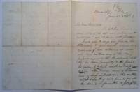
1867212358Washington 1867. unbound. Exceedingly rare and historically important two-page letter 10 x 8 inches Washington January 22 1867. Written on lined paper with "House Reps Confidential" at the top. In this correspondence Ashley writes to W.G. Brownlow the Governor of Tennessee soliciting witnesses who will testify against President Andrew Johnson at his impeachment trial. In part: ".give me the names at once of all witnesses who can sustain any of the charges preferred against the President.let this be done promptly.If the Union men are earnest let them come forward with the facts.I hope your legislature will promptly enfranchise the loyal men of color and this same Tennessee from the fate of Maryland." Several folds with light browning and foxing; small tear along one of the folds. Very good- condition.<br/><br/> Ashley was the democratic congressman and abolitionist who supervised the underground railroad and who drew the bill abolishing slavery the first proposition to amend the constitution. Through his hatred for Republican Andrew Johnson Ashley solicited charges and then introduced the Articles of Impeachment in 1867.<br/><br/> unknown books
1843WRCAM7742Philadelphia 1843. Two colored folding maps 33 1/2 x 24 inches and 34 3/4 x 25 1/2 inches. In original elaborately gilt pictorial morocco brass clasp intact. Small tear in second map i.e. the chart. Otherwise fine and bright. In a half morocco box. The national map shows the United States west to the Indian Territory west of Missouri including the eastern part of Texas north through most of Maine and with a portion of Canada and south through most of Florida. There are insets of the portions of Maine and Florida which are excluded from the larger image. The second map contains a large center statistical chart surrounded by thirty- two inset maps of various major American cities and their environs or states. This map is dated 1842 at the bottom and is described in Graff as a broadside noting that the map listed by Phillips was issued in 1843. Streeter lists the two maps together as in the present copy. His copy sold to parties unknown for $40 in 1969. PHILLIPS MAPS p.896. STREETER SALE 3861. GRAFF 2838. SERVIES 2872. unknown books
1864100375Folio original cloth with leather spine and corners embossed gilt title on front cover 49 colored maps. Rubbing and fading to binding gilt dull removed label from front coverwear to extremities small stain aaffecting preliminaries occassional margin soiling and a few margin tears; U.S. map has split at the bottom of fold some minor toning but contents generally bright and clean. This atlas contains 49 colored maps twenty-six relate to the U.S. Only for maps are double page. Maps of Texas California and South America are particularly attractive. S. Augustus Mitchell, hardcover books
1868100377Folio original cloth with leather spine and corners gilt title on front cover 65 colored maps. Joints and extremities rubbed but binding is sturdy and in very good condition the U.S. map has a small split at lower end of center fold someminor foxing and stains but maps are generally bright and clean. Five of the 65 maps in this atlas are double page and 33 realte to the U.S. The maps of the United States New York Pennsylvania and Texas are particularly attractive. S. Augustus Mitchell, hardcover books
186429101Philadelphia: S. Augustus Mitchell Jr. 1864. Square folio pp. 4 27 4; 84 hand-colored maps on 54 sheets; gilt on cover dull spine a little scuffed; internally very clean; aside from the dullness of the binding a very good sound copy in publisher's quarter brown morocco and brown cloth lettered in gilt on front. Includes full page city maps of Boston New York Baltimore Washington D.C. Cincinnati and New Orleans. <br/><br/> S. Augustus Mitchell, Jr. hardcover books
1868100381Folio original cloth with leather spine and corners gilt title on front cover 65 colored maps. Joints and extremities rubbed but binding is sturdy and in very good condition the U.S. map is split at the middle fold someminor foxing and stains but maps are generally bright and clean. Five of the 65 maps in this atlas are double page and 33 realte to the U.S. The maps of the United States New York Pennsylvania and Texas are particularly attractive. S. Augustus Mitchell, hardcover books
1872D17717Philadelphia: J. B. Lippincott Company 1872. First Edition. Hardcover. Good. 8vo. viii 9-377 pp. Publisher's brown cloth lettered in gilt on spine brown coated endpapers. Some wear to spine ends and extremities with some loss to head of spine splitting to endpapers library stamps and pocket otherwise very good. Provenance: Library of the Medical Society of the County of Kings bookplate stamps to title and endpapers pocket to r.f.e.p. BAL 14075; Cushing M401; Garrison-Morton 4544; Heirs of Hippocrates 1956; Norman 1520. <br/><br/>First edition of this "basic and time-honored work on the symptomssigns and treatment of nerve injuries. Together with his other major work Gunshot wounds 1864 it established fundamental lines of treatment which remained essentially unchanged until World War I" Heirs of Hippocrates. This copy with an ALS of Mitchell undated reading "Dear Dr What a fellow you are to grow books It is amazing even to a man of my industry this nice book is strangely interesting - Thanks". J. B. Lippincott Company hardcover books
1876217610Philadelphia: Mitchell 1876. hardcover. good. 64 pages of colored maps in fine condition. Title page creased original 1/2 morocco and ornately printed pebbled rust cloth front cover. Small folio covers loose and spine barely present. Philadelphia: S Augustus Mitchell 1876. But for the binding all the maps are fine.<br/><br/> Mitchell unknown books
18396303Philadelphia: Thomas Cowperthwait & Co 1839. Hard Cover. Quarto. 18 hand-colored mapssome are insets with two maps; Map #3 North America and Map #4 of the United States and Texas each depicting Texas as a Republic with capitol as Austin. Bound in paper covered boards backed in calf rather worn maps are all very nice without foxing boards are darkened with some staining; small loss to rear endpaper; armorial bookplate on front pastedown. In all a very good atlas and quite scarce with all maps intact; housed in a custom leather backed clamshell case. <br/><br/> Thomas, Cowperthwait & Co hardcover books