1 490 résultats
1844RMITANC00MWButler 1844. Fair. Mitchell S. Augustus. Ancient Atlas Classical and Sacred. Philadelphia: Butler 1844. Indexed. Illustrated. 4to. Paper-covered boards. Book condition: Fair with chipped corners rubbing soiled covers and frayed backstrip still holding in places by the mesh. Contemporary owner's name on front free endsheet. Tattered edges of textblock. Maps are in good condition and mostly very clean. The sixteen beautiful hand-colored maps are: several maps of the World as seen by different groups at different times; Asia Minor; Ancient Italy; the Roman Empire including Britannia Romanum and Syria; Canaan; Israel; Palestine; Jerusalem; and Barbarian incursions into the Roman Empire. Butler hardcover books
18814321Philadelphia: S. Augustus Mitchell 1881. Map 35 cm x 55 cm on a single sheet 38.5 cm x 59 cm. The territorial Utah and state Nevada boundaries and the counties within each have been hand tinted Colors are bright. Vertical centerfold as issued. Splitting at the foot of the centerfold. A few small chips and age toning to extremities. Detailed map that shows roads township lines and railroads to Eureka NV Austin Juab Stockton Alta Bingham and Frisco as well as showing the U.P and D&RG. Nephi is labeled 'Salt Creek.' Inset map of the southern tip of Nevada. From Mitchell's New General Atlas. Moffat 166. Phillips 895. S. Augustus Mitchell unknown books
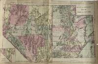
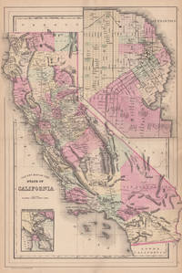
1860001305Philadelphia: S. A. Mitchell 1860. Softcover. First edition; 12 1/2 x 15 1/4; hand-colored map; ornate engraved border; chips with some loss of paper to lower corners; foxing to lower right quarter; good. Published as part of the first edition of "Mitchell's New General Atlas" the map featured not only the State of California with each county major cities bodies of water railroads etc. outlined but also two smaller inset maps of Great Salt Lake Country Utah and the San Francisco Bay Area. Philadelphia: S. A. Mitchell paperback books
188444576Philadelphia: W.M. Bradley 1884. Very good faint browning mostly to margins. 1 sheet. 55 x 39 cm image. Hand colored map. 21 x 14.5 inches. Plates 96-97. Hand colored map with two insets: San Francisco and San Francisco Bay and Vicinity. Shows settlements railroads rivers etc. City map of San Francisco shows wards major buildings aqueduct pay etc. Earlier versions often had a decorative border. W.M. Bradley unknown books
183737871Philadelphia: S. Augustus Mitchell 1837. 8vo. 143 1pp. Folding map with hand-colored outline. Original cloth-backed printed boards soiling & rubbing to boards. Scattered foxing but a crisp copy. First edition second issue "animals" correctly spelled on title page. Howes M-689. <br/><br/> S. Augustus Mitchell hardcover books
183737872Philadelphia: S. Augustus Mitchell 1837. 8vo. 143 pp. Folding map with hand-colored outline dated 1838. Original cloth-backed printed boards giving the title "Illinois in 1837 & 8" and dated 1838. Cloth a little frayed along the front joint and chipped at head of spine else very good. Second edition. Howes M-689. <br/><br/> S. Augustus Mitchell hardcover books
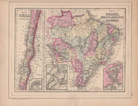
188644579Philadelphia: W.M. Bradley 1886. Very good faint soiling and browning few closed edge tears. 1 sheet. Hand colored map. 12 x 9.25 inches. Plate 105 is the Map of Brazil Bolivia Paraguay and Uruguay with two insets of the Harbor of Bahia and the Harbor of Rio de Janeiro with Map of Chili with inset of the Island of Juan Fernandez. On the verso is Plate 106 a map of Europe Showing Its Gt. Political Divisions. Constructed & Engraved by W. Williams Philadelphia. W.M. Bradley unknown books
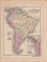
188644580Philadelphia: W.M. Bradley 1886. Very good light browning and soiling mostly to margins. 1 sheet. Hand colored map. 12 x 9.25 inches. Plate 103 is Map of South America Showing Its Political Divisions with inset of Map Showing the Proposed Atrato-Inter-Oceanic Canal Routes for Connecting the Atlantic and Pacific Oceans. Constructed & Engraved by W. Williams Philadelphia. On the verso is plate 104 containing three maps: 1 Map of New Granada Venezuela and Guiana 2 Map of Peru and Equador and 3 Map of the Argentine Confederation. W.M. Bradley unknown books
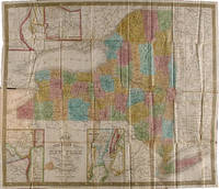
1839WRCAM29278APhiladelphia: S. Augustus Mitchell 1839. Folding pocket map 17 x 20 1/2 inches with full period color. Bound into original 16mo. green morocco boards stamped in blind and gilt. Boards rubbed. Minor repairs a bit of staining else good. The fourth Mitchell edition of D.H. Vance's map of New York State with extensive additions to New York's embryonic railroad system both on the main and the inset maps. "Sold by Thomas Cowperthwait & Co. No. 253 Market Street" added below neat line and the front covers now stamped" "New-York." With five insets: "Map of the Hudson River" "Vicinity of Albany" "Vicinity of New York" "Vicinity of the Falls of Niagara" and "Vicinity of Rochester." This edition is not in Rumsey or Phillips. S. Augustus Mitchell hardcover books
18343245Philadelphia: S. Augustus Mitchell 1834. Full period color 17 x 20 1/2 inches folding into gilt-stamped brown leather covers. Statistical table laid down on inside front cover. Five insets see below. Minor repairs. This is the second pocket map edition of D. H. Vance's map of New York State with the imprint of S. Augustus Mitchell. Mitchell had purchased the plate from Anthony Finley in 1831 removed Vance's name added a new border and included it in his edition of the A New American Atlas 1831. The map was first issued as a pocket map by Mitchell in 1832. With the 1832 edition Mitchell replaced the inset "Profile of the Erie Canal" with four insets: "Vicinity of Albany" "Vicinity of New York" "Vicinity of the Falls of Niagara" and "Vicinity of Rochester." With this 1834 edition the statistical table at right was replaced by an inset "Map of the Hudson River." Numerous new towns are present throughout and distances in miles along roads between towns have been added. New York's first railroads are also included for the first time. The title has been moved from the upper left to the lower left corner. This edition is not listed in Rumsey nor in Phillips. S. Augustus Mitchell unknown books
18393248Philadelphia: S. Augustus Mitchell 1839. Full period color 17 x 20 1/2 inches folding into gilt-stamped brown leather covers. Statistical table laid down inside front cover. Minor repairs a bit of staining. The fourth Mitchell edition of D.H. Vance's map of New York State. Extensive additions to New York's embryonic railroad system both on the main and the inset maps. "Sold by Thomas Cowperthwait & Co. No. 253 Market Street." added below neat line. The front covers now stamped "New-York." With five insets: "Map of the Hudson River" "Vicinity of Albany" "Vicinity of New York" "Vicinity of the Falls of Niagara" and "Vicinity of Rochester." This edition not in Rumsey; not in Phillips. S. Augustus Mitchell unknown books
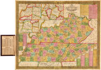
1838WRCAM41839Philadelphia: S. Augustus Mitchell 1838. Handcolored folding pocket map 18 x 21 1/2 inches in a. 16mo. morocco folder cover stamped in blind and gilt. Lightly rubbed at extremities. Minor toning a few small spots of foxing. A few small separations at corner folds. Colors fresh and bright. Very good. A nice pocket map of Kentucky and Tennessee intended for travellers. The map includes charts with steamboat and stage routes through the states as well as insets of the area around Nashville Louisville and Frankfort and Lexington. The census data for 1830 is pasted to the inside of the front cover. Not in Phillips or Rumsey; no copies of this edition in OCLC. S. Augustus Mitchell unknown books
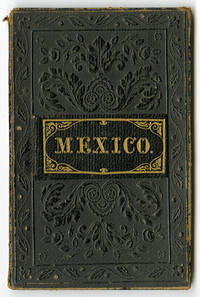
1846WRCAM51708Philadelphia 1846. Folding handcolored pocket map 12 1/2 x 15 inches. Tipped into original 12mo. cloth folder. Separating at corner folds. Light soiling and foxing. Light wear to folder. Good. A pocket variation of Mitchell's map of Mexico and Guatemala. "This is based largely on 1845 FREMONT" - Wheat. Mitchell issued several maps of Mexico and the surrounding area in 1846 and this map appears to have gone through several editions. The handcolored map shows all the states of Mexico including Upper and Lower California and parts of the American Southwest. It also has insets of the Valley of Mexico and of Guatemala. Not in Phillips' MAPS. Scarce. WHEAT TRANSMISSISSIPPI 519 ref. hardcover books
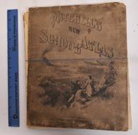
1874183293Philadelphia: J.H. Butler & Co 1874. Hardcover. G/Fair covers are heavily worn rubbed and chipped. Front cover is detached. Spine is gone. Pages are good maps are clean and bright. Ex-library stamps on flyleafs but not on any maps. Illustrated board covers. 2 unnumbered pages 40 pages of plates 24 pages : color maps part double. A series of forty-four copperplate maps compiled from the great atlases of Keith Johnston Kiepert the Geographical Institute of Weimar from the United States Coast Survey the surveys of the War Department and of the several states and from other reliable authorities drawn and engraved expressly to illustrate Mitchell's New School Geography. With important geographical tables and an extensive pronouncing vocabulary of nearly ten thousand names. Two maps numbered XVIII./ Publisher's advertisement on back cover. Could easily be re-bound or used for maps only. J.H. Butler & Co hardcover books
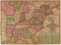
1843WRCAM7742Philadelphia 1843. Two colored folding maps 33 1/2 x 24 inches and 34 3/4 x 25 1/2 inches. In original elaborately gilt pictorial morocco brass clasp intact. Small tear in second map i.e. the chart. Otherwise fine and bright. In a half morocco box. The national map shows the United States west to the Indian Territory west of Missouri including the eastern part of Texas north through most of Maine and with a portion of Canada and south through most of Florida. There are insets of the portions of Maine and Florida which are excluded from the larger image. The second map contains a large center statistical chart surrounded by thirty- two inset maps of various major American cities and their environs or states. This map is dated 1842 at the bottom and is described in Graff as a broadside noting that the map listed by Phillips was issued in 1843. Streeter lists the two maps together as in the present copy. His copy sold to parties unknown for $40 in 1969. PHILLIPS MAPS p.896. STREETER SALE 3861. GRAFF 2838. SERVIES 2872. unknown books
1864100375Folio original cloth with leather spine and corners embossed gilt title on front cover 49 colored maps. Rubbing and fading to binding gilt dull removed label from front coverwear to extremities small stain aaffecting preliminaries occassional margin soiling and a few margin tears; U.S. map has split at the bottom of fold some minor toning but contents generally bright and clean. This atlas contains 49 colored maps twenty-six relate to the U.S. Only for maps are double page. Maps of Texas California and South America are particularly attractive. S. Augustus Mitchell, hardcover books
1868100381Folio original cloth with leather spine and corners gilt title on front cover 65 colored maps. Joints and extremities rubbed but binding is sturdy and in very good condition the U.S. map is split at the middle fold someminor foxing and stains but maps are generally bright and clean. Five of the 65 maps in this atlas are double page and 33 realte to the U.S. The maps of the United States New York Pennsylvania and Texas are particularly attractive. S. Augustus Mitchell, hardcover books
1868100377Folio original cloth with leather spine and corners gilt title on front cover 65 colored maps. Joints and extremities rubbed but binding is sturdy and in very good condition the U.S. map has a small split at lower end of center fold someminor foxing and stains but maps are generally bright and clean. Five of the 65 maps in this atlas are double page and 33 realte to the U.S. The maps of the United States New York Pennsylvania and Texas are particularly attractive. S. Augustus Mitchell, hardcover books
185949436Philadelphia: S. Augustus Mitchell 1859. Large hand-colored wall map on rods approx. 64" square with 4 engraved vignettes 3 inset maps 2 of the world and 1 of the Sandwich Islands all within an elaborate floral border; some infill along the margins slight loss in the population tables at the bottom and several cracks in the paper the whole neatly and professionally backed with linen; overall appearance is certainly very good or better with the usual small defects. America as it was on the eve of the Civil War. OCLC records examples from 1856 1857 1858 1860 and 1861 but not this. Unusual features of this map include the Shoshone Territory what is now mostly Idaho Colona now part of Colorado the unusually large Nebraska the horizontal Utah and New Mexico and the unusually small Dakotas. <br/><br/> S. Augustus Mitchell unknown books
18396303Philadelphia: Thomas Cowperthwait & Co 1839. Hard Cover. Quarto. 18 hand-colored mapssome are insets with two maps; Map #3 North America and Map #4 of the United States and Texas each depicting Texas as a Republic with capitol as Austin. Bound in paper covered boards backed in calf rather worn maps are all very nice without foxing boards are darkened with some staining; small loss to rear endpaper; armorial bookplate on front pastedown. In all a very good atlas and quite scarce with all maps intact; housed in a custom leather backed clamshell case. <br/><br/> Thomas, Cowperthwait & Co hardcover books
1851185142Philadelphia Penn: Thomas Cowperthwait & Co 1851. Hardcover. VG Cover and spine have general wear and fading corner and edge damage. Internal pages have staining water damage age toning foxing. Bookblock has age toning. Brown cloth boards black spine with gilt lettering. 336 pp. illus. Samuel Augustus Mitchell 1792-1868 was an American geographer who became known for publishing textbooks and maps. Thomas, Cowperthwait & Co hardcover books
1849135274Philadelphia Penn: Thomas Cowperthwait & Co 1849. 2d rev. ed. Hardcover. Fair Ex-library with usual library markings bookplate on front inside cover pocket remnant at back inside cover perforation stamp used on first pages boards have separated from block but are still present pages have some foxing but text and illus. are still easy to see flyleaves have darkened a child has colored one drawing near the back still a nifty schoolbook to browse through. Black paper-covered boards 336 pp. illus. Samuel Augustus Mitchell 1792-1868 was an American geographer who became known for publishing textbooks and maps. Thomas, Cowperthwait & Co hardcover books
1850100371Engraved hand colored map 54.3x72.3cm 21 ½ x28 ½†with 128 pp of text folding into original gilt pictorial blindstamped leather covers 5 ¼ x3 ½ . Leather scuffed at joints and extremities a few short slits at folds bright very good or better. The United States from the Missouri River and the eastern Texas border. You can also see where the U.S. borders on the Indian Territory. There are five insets: Gold and Quicksilver District of California; North and South America showing the maritime and land routes to California; the copper mine regions around Lake Superior; region around Niagara Falls; and New England. Thomas, Cowperthwait & Co., hardcover books
185265704With the First Map to Show Counties in California and New Mexico MITCHELL S. Augustus. A New Universal Atlas of the World. Containing Maps of the various Empires Kingdoms States and Republics Of The World. With a special map of each of the United States Plans of Cities &c. Comprehended in seventy sheets and forming a series of One Hundred And Seventeen Maps Plans And Sections Philadelphia: Cowperthwait & Co. 1852. Complete with seventy-three full colored maps one of which is double-paged color frontispiece vignette title-page and table of contents heightened in gilt. Folio 17 x 14 inches; 430 x 355 mm. Half red morocco over marbled boards. Front board with red morocco label lettered in gilt. Binding scuffed and bumped. Hinges professionally repaired. Some toning throughout mainly to blank versos of maps and margin edges only occasionally affecting the maps. Closed tear to front free endpaper. A few instances of foxing on maps mainly to map 51 "Holland and Belgium." A small dark spot in Buenos Ayres on map 44. A small piece scraped off of map 73 "Oceana" but not making a hole all the way through. Also a marginal closed tear to this map professionally repaired. Overall a very good copy. This atlas was first published in 1846 by Mitchell & Sons after acquiring the rights to Tanner's New Universal Atlas in 1845. Mitchell & Sons reprinted it several times until 1850 when they sold the rights to Cowperthwait & Co. of Philadelphia who published it until 1856. During this time the atlas was further expanded and edited. Over half of this atlas deals with the Americas and features the double-page "A New Map of the United States of America." Within this map of the USA is a detailed inset of "The Gold Regions of California." The present edition is the first to show counties in California and New Mexico. Howes. Streeter. HBS 65704. $7500 Cowperthwait & Co. hardcover books
1948160462OAKLAND BIOBOOKS 1948 1948. ORIGINAL GILT STAMPED RED CLOTH; NO DUST JACKET; 1/750 COPIES VERY GOOD. Hardcover. OAKLAND, BIOBOOKS, 1948 hardcover books