1 490 résultats
194138417Chicago 1941. 8vo 27.4 cm 10.75". 8 1 blank ff. <br><br>Gorgeously rendered manuscript tribute to a prominent lawyer financial advisor and railroad executive remembered fondly for "his public spirit his high personal character his urbanity and his loyalty as a friend." Follansbee was a Harvard graduate and notably active alumnus serving as president of the Associated Clubs of Harvard who studied law at Northwestern University prior to becoming a board member and director of the Erie Railroad Company.<br>Â Â Â Â This admiring hand-accomplished homage to Follansbee's life and career was commissioned by his fellow directors and => beautifully calligraphed and illuminated on vellum by the Harris Engrossing Studio of Chicago. The capitals are accomplished in whitework gilt purple and green and the text in an even handsome modern Gothic hand with a gilt border surrounding the text on each page. Each leaf is protected by a moiré-patterned tissue guard. The final page was signed by the chairman and the secretary of the board and pressure-stamped with the Erie Railroad Company's seal.<br>Â Â Â Â Binding: Dark blue morocco framed in gilt double fillets and panelled in a dotted gilt roll with gilt-tooled corner fleurons; spine with gilt-ruled raised bands and gilt-framed compartments. Turn-ins tooled to echo covers cream moiré silk endpapers all edges gilt. Binding as above edges and extremities showing slight sunning and wear. Vellum expectably cockled. => Lovely unique beautifully bound and an impressive showcase both of modern calligraphy and of Follansbee's impact. hardcover books
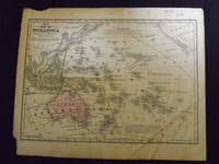
1839106607Engraved colored map 9" x12" Box like cartouche with map information. Some light aging and browning a couple of small holes in top margin where it was bound not affecting image a couple of margin chips creasing in the lower right portion of the map affecting the lettering more than image; otherwise good. Pricing will reflect creasing. Interesting and early small map of Oceanica. From a school and family geography. books
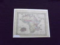
1865101001Philadelphia 1865. Unbound colored engraved map decorative border 14"x 11". Slight toning and aging a couple a minor chips to left edge; overall bright and clear and in very good shape. Maps are wrapped with acid free board or in rigid sleeves. The Mitchell family started to produce atlases in 1846 and continued into the early 1890s. Around 1860 S. Augustus Mitchell Jr. took over and the atlas would be called Mitchell's New General Atlas. This is an attractive colored map of Africa from the 1861 installment of that atlas. The map shows a sizeable unknown territory and not surprisingly the map presents some very different political boundaries from more modern times. A small map of the Island of St. Helena is featured in an inset. Ristow 311-313 unknown books
1882101003<p>Philadelphia: Bradley 1882. Unbound colored engraved map decorative border 14"x 11". Slight toning and aging a couple a minor chips to edges; overall bright and clear and in very good shape. Maps are wrapped with acid free board or in rigid sleeves. The Mitchell family started to produce atlases in 1846 and continued into the early 1890s. Around 1860 S. Augustus Mitchell Jr. took over and the atlas would be called Mitchell's New General Atlas. This is an attractive colored map of Africa from the 1882 installment of that atlas. The map shows a sizeable unknown territory and not surprisingly the map presents some very different political boundaries from more modern times. A small map of the Island of St. Helena is featured in an inset. May require extra postage. Ristow 311-313 Phillips 907</p> Bradley books
1861101000Philadelphia 1861. Unbound colored engraved map decorative border 14"x 11". Slight toning and aging a couple a minor chips to edges; overall bright and clear and in very good shape. Maps are wrapped with acid free board or in rigid sleeves. The Mitchell family started to produce atlases in 1846 and continued into the early 1890s. Around 1860 S. Augustus Mitchell Jr. took over and the atlas would be called Mitchell's New General Atlas. This is an attractive colored map of Africa from the 1861 installment of that atlas. The map shows a sizeable unknown territory and not surprisingly the map presents some very different political boundaries from more modern times. A small map of the Island of St. Helena is featured in an inset. Ristow 311-313 books
1869101002<p>Philadelphia 1869. Unbound colored engraved map decorative border 14"x 11". Slight toning and aging; overall bright and clear and in very good shape. Maps are wrapped with acid free board or in rigid sleeves. The Mitchell family started to produce atlases in 1846 and continued into the early 1890s. Around 1860 S. Augustus Mitchell Jr. took over and the atlas would be called Mitchell's New General Atlas. This is an attractive colored map of Africa from the 1869 installment of that atlas. The map shows a sizeable unknown territory and not surprisingly the map presents some very different political boundaries from more modern times. A small map of the Island of St. Helena is featured in an inset. Ristow 311-313</p> books
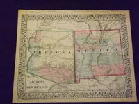
1870101005<p>Unbound colored engraved map decorative boarder 14 "x 11". Slight toning and aging a few small chips in margins; overall bright and clear and in very good shape. Maps are wrapped with acid free board or in rigid sleeves. The Mitchell family started to produce atlases in 1846 and continued into the early 1890s. Around 1860 S. Augustus Mitchell Jr. took over and the atlas would be called Mitchell's New General Atlas. This is a bright and attractive map of two western states from the 1870 installment of that atlas. A little of the Colorado river can be seen and the Apache Territory is featured in this map. Ristow 311-313</p> books
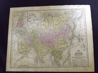
1865101007Philadelphia 1865. Unbound colored engraved map decorative border 14"x 11". Slight toning and aging a little minor staining or soling in left margin; overall bright and clear and in very good shape. Maps are wrapped with acid free board or in rigid sleeves. The Mitchell family started to produce atlases in 1846 and continued into the early 1890s. Around 1860 S. Augustus Mitchell Jr. took over and the atlas would be called Mitchell's New General Atlas. This is an attractive single page colored map of Asia from the 1865 installment of that atlas. The map features China Hindostan Turkestan Persia and part of Arabia. Ristow 311-313 unknown books
1861101199<p>Philadelphia 1861. Unbound colored engraved map decorative border 14"x 11". Slight toning and aging; overall bright and clear and in very good shape. Maps are wrapped with acid free board or in rigid sleeves. The Mitchell family started to produce atlases in 1846 and continued into the early 1890s. Around 1860 S. Augustus Mitchell Jr. took over and the atlas would be called Mitchell's New General Atlas. This is a very attractive single page colored map of Asia from the 1861 installment of that atlas. A very brightly colored version of this map. The map features China Hindostan Turkestan Persia and Siberia. Extra postage may be required. Ristow 311-313</p> books
1839106601<p>Engraved colored map 9" x11 1/2" Box like cartouche with map information. Some slight soiling toning and browning right margin a little uneven small holes in upper margin where it was bound not affecting image; otherwise very good. Not a bad looking little map with plenty of detail and some decent color. Small insert box featuring a map of Palestine. From a school and family geography. </p> S. Augustus Mitchell, books
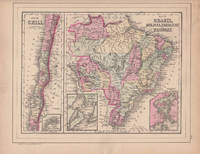
188644579Philadelphia: W.M. Bradley 1886. Very good faint soiling and browning few closed edge tears. 1 sheet. Hand colored map. 12 x 9.25 inches. Plate 105 is the Map of Brazil Bolivia Paraguay and Uruguay with two insets of the Harbor of Bahia and the Harbor of Rio de Janeiro with Map of Chili with inset of the Island of Juan Fernandez. On the verso is Plate 106 a map of Europe Showing Its Gt. Political Divisions. Constructed & Engraved by W. Williams Philadelphia. W.M. Bradley unknown books
1864106096<p>Unbound colored engraved map decorative border 14" x 11". Slight toning and aging; otherwise bright and clear and very good. Maps are wrapped with acid free board or in rigid sleeves. The Mitchell family started to produce atlases in 1846 and continued into the early 1890s. Around 1860 S. Augustus Mitchell Jr. took over and the atlas would be called Mitchell's New General Atlas. This is a detailed single page map of Brazil Chilli and Bolivia from the 1864 installment of this atlas. Uncludes inset showing the harbor of Rio Janeiro. Colorful and attractive. Ristow 311-313.</p> books
1870101015Philadelphia 1870. Unbound colored engraved map decorative border 14"x 11". Slight toning and aging; overall bright and clean. Maps are wrapped with acid free board or in rigid sleeves. The Mitchell family started to produce atlases in 1846 and continued into the early 1890s. Around 1860 S. Augustus Mitchell Jr. took over and the atlas would be called Mitchell's New General Atlas. This is a nice colorful map of Chicago from the 1870 installment of this atlas. Ristow 311-313 unknown books
1882101016Philadelphia: Bradley 1882. Unbound colored engraved map 23"x 15". Slight toning and aging a little staining or soiling in the margins a few chips at edge; still rather bright and clear and in very good shape. Maps are wrapped with acid free board or in rigid sleeves. The Mitchell family started to produce atlases in 1846 and continued into the early 1890s. Around 1860 S. Augustus Mitchell Jr. took over and the atlas would be called Mitchell's New General Atlas. This is a nice colorful double page map of Chicago from the 1882 installment of this atlas. The map includes Chicago street guide in the lower portion of the map. Ristow 311-313 Phillips 907 Bradley unknown books
1869101014Philadelphia 1869. Unbound colored engraved map decorative border 14"x 11". Slight toning and aging; overall bright and clean. Maps are wrapped with acid free board or in rigid sleeves. The Mitchell family started to produce atlases in 1846 and continued into the early 1890s. Around 1860 S. Augustus Mitchell Jr. took over and the atlas would be called Mitchell's New General Atlas. This is a nice map of Chicago from the 1869 installment of this atlas. A very good street map. Ristow 311-313 unknown books
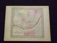
1861101018Philadelphia 1861. Unbound colored engraved map decorative boarder 13"x 11". Slight toning and aging a little light staining in the margins; still rather bright and clear and in very good shape. Maps are wrapped with acid free board or in rigid sleeves. The Mitchell family started to produce atlases in 1846 and continued into the early 1890s. Around 1860 S. Augustus Mitchell Jr. took over and the atlas would be called Mitchell's New General Atlas. This is an attractive and rather early single page map of Cincinnati from the 1861 installment of this atlas. Ristow 311-313 unknown books
1861101017Philadelphia 1861. Unbound colored engraved map decorative boarder 13"x 11". Slight toning and aging a little light staining in the margins; still rather bright and clear and in very good shape. Maps are wrapped with acid free board or in rigid sleeves. The Mitchell family started to produce atlases in 1846 and continued into the early 1890s. Around 1860 S. Augustus Mitchell Jr. took over and the atlas would be called Mitchell's New General Atlas. This is an attractive and rather early single page map of Cincinnati from the 1861 installment of this atlas. Ristow 311-313 unknown books
1869103224<p>Unbound colored engraved map decorative boarder 14" x 11". Slight browning and aging; otherwise bright and clean and in very good shape. Maps are wrapped with acid free board or in rigid sleeves. The Mitchell family started to produce atlases in 1846 and continued into the early 1890s. Around 1860 S. Augustus Mitchell Jr. took over and the atlas would be called Mitchell's New General Atlas. This is an attractive and rather early single page map of Cincinnati from the 1869 installment of this atlas. The map has nice color and good street detail. Part of Covington and Newport are also visible on the other side of the Ohio River. May require extra postage. Ristow 311-313.</p> books
1870103227<p>Unbound colored engraved map decorative boarder 14" x 11". Slight browning and aging; otherwise bright and clean and in very good shape. Maps are wrapped with acid free board or in rigid sleeves. The Mitchell family started to produce atlases in 1846 and continued into the early 1890s. Around 1860 S. Augustus Mitchell Jr. took over and the atlas would be called Mitchell's New General Atlas. This is an attractive and rather early single page map of Cincinnati from the 1870 installment of this atlas. The map has nice color and good street detail. Part of Covington and Newport are also visible on the other side of the Ohio River. May require extra postage. Ristow 311-313. # 103227</p> books
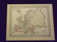
1861101203<p>Philadelphia 1861. Unbound colored engraved map decorative border 14"x 11". Slight toning and aging; overall bright and clear and in very good shape. Maps are wrapped with acid free board or in rigid sleeves. The Mitchell family started to produce atlases in 1846 and continued into the early 1890s. Around 1860 S. Augustus Mitchell Jr. took over and the atlas would be called Mitchell's New General Atlas. This is a nice map of Europe from the 1861 installment of that atlas. Despite the large area the map covers there is still a decent amount of detail. Ristow 311-313</p> books
1869103234<p>Unbound colored engraved map decorative border 14"x 11". Slight toning and aging; overall bright and clear and in very good shape. Maps are wrapped with acid free board or in rigid sleeves. The Mitchell family started to produce atlases in 1846 and continued into the early 1890s. Around 1860 S. Augustus Mitchell Jr. took over and the atlas would be called Mitchell's New General Atlas. This is a nice map of Europe from the 1869 installment of that atlas. Despite the large area the map covers there is still a decent amount of detail. Extra postage may be required. Ristow 311-313. # 103234</p> books
1882103242<p>Unbound colored engraved map decorative border 14"x 11". Slight browning and aging a little foxing in margins; still overall bright and clear and in very good shape. Maps are wrapped with acid free board or in rigid sleeves. The Mitchell family started to produce atlases in 1846 and continued into the early 1890s. Around 1860 S. Augustus Mitchell Jr. took over and the atlas would be called Mitchell's New General Atlas. This is a nice map of Europe from the 1882 installment of that atlas. Despite the large area the map covers there is still a decent amount of detail. Extra postage may be required. Ristow 311-313. # 103242</p> books
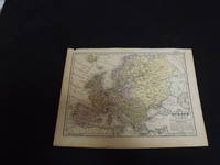
1839106606<p>Engraved colored map 9" x12" Box like cartouche with map information. Some soiling aging and browning a couple of small holes in top margin where it was bound not affecting image otherwise very good. Interesting and detailed small map of Europe. From a school and family geography. </p> S. Augustus Mitchell, books
1864101300Philadelphia 1864. Unbound colored engraved map decorative boarder 14"x 11". Slight toning and aging minor chip in margin; otherwise bright and clear and in very good shape. Maps are wrapped with acid free board or in rigid sleeves. The Mitchell family started to produce atlases in 1846 and continued into the early 1890s. Around 1860 S. Augustus Mitchell Jr. took over and the atlas would be called Mitchell's New General Atlas. This is colorful attractive map of France Spain and Portugal from the 1864 installment of that atlas. Nicely presented color and detail. Ristow 311-313 Phillips 907 S. Augustus Mittchell, books
1870101304Unbound colored engraved map decorative boarder 14"x 11". Slight toning and aging some staining and soiling in margins; otherwise bright and clear and in very good shape. Maps are wrapped with acid free board or in rigid sleeves. The Mitchell family started to produce atlases in 1846 and continued into the early 1890s. Around 1860 S. Augustus Mitchell Jr. took over and the atlas would be called Mitchell's New General Atlas. This is colorful attractive map of France Spain and Portugal from the 1869 installment of that atlas. Nicely presented color and detail. Ristow 311-313 Phillips 907 S. Augustus Mitchell, books