Mitchell, S AugustusBiblio.com
28 785 résultats
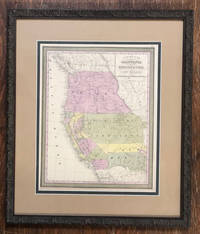
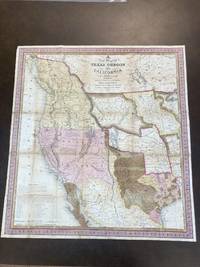
184687887Philadelphia PA: S. Augustus Mitchell 1846. Map. Good Plus. Folding lithographic map 22.75 in. x 21 in. with original color. Map is laid flat in archival plastic and will be securely protected and shipped in a mailing tube. Tanning to seams. Tape repairs and reinforcement on verso to all seams. Tiny losses of paper at six seam junctions. Storm 2841. Wagner-Camp 122b. <br /> <br /> This is Mitchell's third map of Oregon the first being "Oregon and California" published in Mitchell's ;School and Family Geography; and the second being "Mexico and Guatemala" which includes Upper or New California New Mexico and Texas." Wheat Mapping The Transmississippi West 520. Carl Wheat described it as: ".a work of real importance highly popular and.on it the influence of the War wioth Mexico is strikingly revealed.It was among the first by a commercial cartographer to utilize the recent explorations that had bounded and determined the nature of the Great Basin. The Texas claim to a western boundary up the Rio Grande is here shown with the northern panhandle extending all the way to the 42nd parallel.Because of its popularity this map of the West exerted great influence not only on the public but on other commercial cartographers." "The region covered by the map was of particular interest in 1846 because of two recent and related events. In 1845 Texas was admitted into the Union which prompted Mexico to invade Texas in 1846 thus precipitating the U.S.-Mexican war. General curiosity about the new State of Texas and interest in the war with Mexico led to Mitchell's timely map becoming quite popular. Mitchell used the latest and best sources for the map including Arrowsmith's 1841 map of Texas Fremont's and Emory's maps of their explorations in the region data from the Lewis & Clark expedition Nicollet's map of the region between the Mississippi River and the Missouri River Wilkes map of Oregon. <br /> <br /> Among other significant uses of the map Brigham Young ordered 6 copies of the map and an example in the BYU collection includes an annotation placing the Mormons in Utah pre-dating Fremont's map of 1848 which is the first printed map noting the presence of the Mormons in the Great Basin. <br /> <br /> The map shows Texas's claims to the Upper Rio Grande in present-day New Mexico -- eventually given up as part of the Great Compromise of 1850 in exchange for the U.S. Federal Government's assumption of Texas's public debt. One of the most influential maps in Western American History." from Stanford University Library. S. Augustus Mitchell unknown
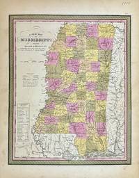
1848327877Philadelphia: S. Augustus Mitchell 1848. unbound. Map. Lithograph with original hand coloring. Image measures 11 1/2" x 14 1/4"<br/> <br/> Beautifully detailed first edition map of Mississippi divided into counties. The map delineates towns waterways railroads and major routes. Steamboat routes and distances are listed in a table. Canals and railroads are indicated. In very good condition with some toning to margins.<br> <br> Samuel Augustus Mitchell Sr. 1792-1868 published this map as part of the 1848 edition of his seminal New Universal Atlas. Mitchell is one of the pioneers in American cartography of the 19th century and led the conversion of engraved map plates to more affordable lithographic plates.<br/> <br/> S. Augustus Mitchell unknown
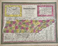
1847329553Philadelphia: S. Augustus Mitchell 1847. unbound. Map. Engraving with original hand coloring. Image measures 11 1/4" x 15 1/4".<br/> <br/> Nice map of Tennessee divided into counties. Features cities major routes canals railroads waterways and topographical elements. Insets include the environs of Knoxville and Nashville. A table lists steam boat routes. Minor overall toning.<br> <br> Samuel Augustus Mitchell Sr. 1792-1868 was one of the leaders in American cartography of the 19th century and pioneered the conversion of engraved map plates to more affordable lithographic plates. His son Samuel Augustus Mitchell Jr. continued his father's successful mapmaking and publishing business and was one of the most prolific and renowned 19th century American publishers.<br/> <br/> S. Augustus Mitchell unknown
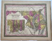
1848330432Philadelphia: S.A. Mitchell 1848. unbound. H.N. Burroughs. Map. Engraving with hand coloring. Image measures 11 1/8" x 14 1/4"<br/> <br/> Beautiful map of Maryland and Delaware divided into counties and townships. Shows towns waterways major routes and geographic features. Includes an inset showing the city plan of Baltimore with important buildings and points of interest listed and numbered. A table in the upper left shows steam boat routes from Baltimore to Norfolk Baltimore to Philadelphia and Baltimore to Washington.<br> <br> Samuel Augustus Mitchell Sr. 1792-1868 was one of the leaders in American cartography of the 19th century and pioneered the conversion of engraved map plates to more affordable lithographic plates. His son Samuel Augustus Mitchell Jr. continued his father's successful mapmaking and publishing business and was one of the most prolific and renowned 19th century American publishers.<br/> <br/> S.A. Mitchell unknown
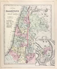
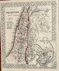
1884333035Philadelphia 1884. unbound. Map. Engraving with original hand coloring. 14 1/4 x 11 1/2 inches.<br/> <br/> Early map of Palestine or the Holy Land from the Dead Sea to Lebanon with part of Syria showing the biblical names of the tribes of Israel. Royal cities noted with towns waterways and geographical features also labeled. Turkish names noted as well as ruins. An inset of modern Jerusalem is included. In the index a color line should denote 'Land of the Philistines' but it was not colored in. In very excellent condition.<br> <br> Samuel Augustus Mitchell Sr. 1792-1868 was one of the leaders in American cartography of the 19th century and pioneered the conversion of engraved map plates to more affordable lithographic plates. His son Samuel Augustus Mitchell Jr. continued his father's successful mapmaking and publishing business and was one of the most prolific and renowned 19th century American publishers.<br/> <br/> unknown
185057229Philadelphia: Thomas Cowperthwait & Co 1850. Hand-colored. 13" x 16 1/4" 20 1/2" x 23 1/2" in frame. Near fine. A slightly later 1850 edition with "Utah Territory" rather than "Deseret." Moffat 22. Wheat Transmississippi West 685. From Samuel Augustus Mitchell's "A New Universal Atlas."<br /> <br /> The Utah geography is taken from Fremont's 1845 map with a channel between Utah Lake and Great Salt Lake. Salt Lake City is the sole settlement depicted. The Great Basin is labeled "Fremont Basin" and "Tueson" is shown fifty miles east northeast of Tubac. Thomas Cowperthwait & Co unknown
188645701Philadelphia: W.M. Bradley 1886. Very good light soiling primarily to margins one edge tear not affecting contents. Hand colored map. Plate 117: New Map of Palestine or the Holy Land with inset Map of Modern Jerusalem drawn & engraved by W.H. Gamble Philadelphia. Copyright by S. Augustus Mitchell 1884. 11.5 x 14 inches.<br /> <br /> On verso Plate 118: Map of Hindoostan Farther India China and Tibet constructed & engraved by W. Williams Philadelphia. Copyright by S. Augustus Mitchell 1884. 13.75 x 11.25 inches.<br /> <br /> From: Mitchell's New General Atlas Containing Maps Of The Various Countries Of The World Plans Of Cities Etc. Embraced In Ninety-Three Quarto Maps Forming A Series Of One Hundred and Forty-seven Maps and Plans Together With Valuable Statistical Tables. Also A List Of Post-Offices Of The United States And Territories And Also Census Of 1880 For States Territories And Counties Also Of Cities Of Over 10000 Inhabitants. Philadelphia: Published By Wm. M. Bradley & Bro. No. 1026 Arch Street. 1886. [W.M. Bradley] unknown
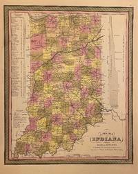
1846310093Philadelphia: H. N. Burroughs 1846. unbound. Map. Lithograph with original hand coloring. Image measures 14 3/8" x 11 7/16".<br/> <br/> Classic map of Indiana divided into counties. The map includes towns and roads in addition to canals drawn in blue and railroads drawn in red. A table in the upper left shows steamboat routes from Louisville to Pittsburgh and to New Orleans. An elevation view on the right shows a profile of the Wabash and Erie Canal. The map is in good condition with only minor chips and tears to edges not affecting the image.<br> <Br> Samuel Augustus Mitchell Sr. 1792-1868 published this map as part of the first edition of his seminal New Universal Atlas. Mitchell is one of the pioneers in American cartography of the 19th century and led the conversion of engraved map plates to more affordable lithographic plates.<br/> <br/> H. N. Burroughs unknown
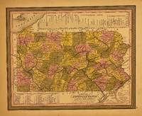
1848309999Philadelphia: S. Augustus Mitchell 1848. unbound. Map. Lithograph with original hand coloring. Image measures 11.5 x 14.5 inches.<br/> <br/> This map depicts the state of Pennsylvania divided into counties. The map includes towns and roads in addition to canals colored in blue and railroads colored in red. An elevation view near the top margin shows the profile of the Pennsylvania Canal and the Columbia Railroad. A table in the lower left lists steam boat routes from Pittsburgh to Louisville from Philadelphia to New York and Philadelphia to Baltimore. The map appeared in Mitchell's seminal New Universal Atlas. The map is in very good condition. One small closed tear to upper left margin not affecting the image. Archival tape repair. <Br> <br> Samuel Augustus Mitchell Sr. 1792-1868 is one of the pioneers in American cartography of the 19th century and led the conversion of engraved map plates to more affordable lithographic plates.<br/> <br/> S. Augustus Mitchell unknown
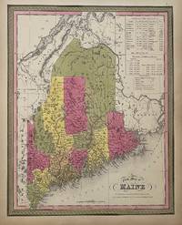
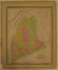
1847310373Philadelphia: S. A. Mitchell 1847. unbound. Map. Lithograph with original hand coloring. Image measures 14 7/8" x 12".<br/> <br/> Excellent map of Maine showing all counties railroads major routes and waterways. Two tables at the top of the page list population over time. Small chips to lower margin not affecting the image. From the 1847 edition of Mitchell's seminal New Universal Atlas. This is State XII of this map Thompson 84.<br> <br> Samuel Augustus Mitchell Sr. 1792-1868 was one of the leaders in American cartography of the 19th century and pioneered the conversion of engraved map plates to more affordable lithographic plates. His son Samuel Augustus Mitchell Jr. continued his father's successful mapmaking and publishing business and was one of the most prolific and renowned 19th century American publishers.<br/> <br/> S. A. Mitchell unknown
186718Philadelphia: Mitchell S. Augustus 1867. 1867 edition. 14 x 11 34 inches. Very good condition. Mitchell S. Augustus. Contemporary color highlights this lithograph from two years after the closing of the Civil War. The map shows the Holy Land with an inset of the town of Modern Jerusalem. Mitchell S. Augustus unknown
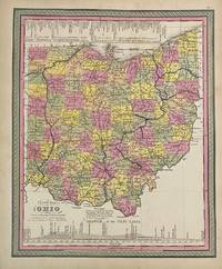
1846313477Philadelphia: S.A. Mitchell 1846. unbound. Map. Engraving with original hand coloring. Image measures 14" x 11 1/2"<br/> <br/> Classic map of Ohio divided into counties. Showing towns major routes railroads and waterways. Includes a profile of the Ohio Canal and a table listing steam boat routes from Cincinnati to Pittsburgh and to New Orleans and from Cleveland to Portsmouth Buffalo and Detroit. Canals are prominently delineated in blue and railroads in orange. In very good condition. Minor toning and chips to margin not affecting image. <Br> <br> Samuel Augustus Mitchell Sr. 1792-1868 was one of the leaders in American cartography of the 19th century and pioneered the conversion of engraved map plates to more affordable lithographic plates. His son Samuel Augustus Mitchell Jr. continued his father's successful mapmaking and publishing business and was one of the most prolific and renowned 19th century American publishers.<br/> <br/> S.A. Mitchell unknown
1870106777<p>Unbound colored engraved map decorative boarder 14" x 11". Slight toning and aging a couple of nicks or chips in left margin; otherwise bright and clear. Maps are wrapped with acid free board or in rigid sleeves. The Mitchell family started to produce atlases in 1846 and continued into the early 1890s. Around 1860 S. Augustus Mitchell Jr. took over and the atlas would be called Mitchell's New General Atlas. This is a very attractive single page map of Palestine and the Holy Land from the 1870 installment of that atlas. This map is probably one of the more attractive versions of this map from the Mitchell series. Modern Jerusalem is shown in an inset. Extra postage may be required. Ristow 311-313.</p>
1869106778<p> Unbound colored engraved map decorative boarder 14" x 11". Slight toning and aging margins a little narrow but still ample; otherwise bright and clear. Maps are wrapped with acid free board or in rigid sleeves. The Mitchell family started to produce atlases in 1846 and continued into the early 1890s. Around 1860 S. Augustus Mitchell Jr. took over and the atlas would be called Mitchell's New General Atlas. This is a very attractive single page map of Palestine and the Holy Land from the 1869 installment of that atlas. This map is probably one of the more attractive versions of this map from the Mitchell series. Modern Jerusalem is shown in an inset. Extra postage may be required. Ristow 311-313.</p>
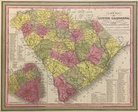
1848293169Philadelphia: S. Augustus Mitchell 1848. unbound. Map. Lithograph with original hand coloring. Image measures 11 1/4" x 14".<br/> <br/> Beautifully detailed first edition map of South Carolina divided into counties. The map delineates towns waterways railroads and major routes as explained in a small key at the bottom right. Canals and railroads are marked. Also included are insets of Charleston and a table of distances. The map is in good condition with minor toning. <br> <br> Samuel Augustus Mitchell Sr. 1792-1868 published this map as part of the 1848 edition of his seminal New Universal Atlas. Mitchell is one of the pioneers in American cartography of the 19th century and led the conversion of engraved map plates to more affordable lithographic plates.<br/> <br/> S. Augustus Mitchell unknown
1865103232<p>Unbound colored engraved map decorative boarder 14" x 11". Slight toning and aging a couple of nicks or chips in left margin; otherwise bright and clear. Maps are wrapped with acid free board or in rigid sleeves. The Mitchell family started to produce atlases in 1846 and continued into the early 1890s. Around 1860 S. Augustus Mitchell Jr. took over and the atlas would be called Mitchell's New General Atlas. This is a very attractive single page map of Palestine and the Holy Land from the 1865 installment of that atlas. This map is probably one of the more attractive versions of this map from the Mitchell series. Modern Jerusalem is shown in an inset. Extra postage may be required. Ristow 311-313. </p>
1846232149Philadelphia: S. A. Mitchell 1846. First. unbound. Map. Lithograph with original hand coloring. Image measures 14 7/8" x 12".<br/> <br/> Excellent map of Maine showing all counties railroads major routes and waterways. Two tables at the top of the page list population over time. Small chips to lower margin not affecting the image. From the first edition of Mitchell's seminal New Universal Atlas. This copy is State X-A of this map Thompson 80<br> <br> Samuel Augustus Mitchell Sr. 1792-1868 was one of the leaders in American cartography of the 19th century and pioneered the conversion of engraved map plates to more affordable lithographic plates. His son Samuel Augustus Mitchell Jr. continued his father's successful mapmaking and publishing business and was one of the most prolific and renowned 19th century American publishers.<br/> <br/> S. A. Mitchell unknown
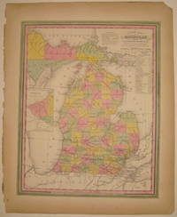
1846232287Philadelphia: H. N. Burroughs 1846. First. unbound. Map. Lithograph with original hand coloring. Image measures 14 3/8" x 11 7/16".<br/> <br/> Wonderfully graphic and colorful map of Michigan amidst four Great Lakes. The map includes towns and roads in addition to canals drawn in blue and railroads drawn in orange. A small inset on the left depicts the western part of the state. Beneath the title two tables list steam boat routes from Detroit to Fort Gratiot and Fort Howard. The map is in good condition with only minor chips along the binding edge of the paper outside the margin. This map was published in 1846 as part of the first edition of Mitchell's seminal New Universal Atlas. <Br> <br> Samuel Augustus Mitchell Sr. 1792-1868 was one of the leaders in American cartography of the 19th century and pioneered the conversion of engraved map plates to more affordable lithographic plates. His son Samuel Augustus Mitchell Jr. continued his father's successful mapmaking and publishing business and was one of the most prolific and renowned 19th century American publishers. Mitchell is one of the pioneers in American cartography of the 19th century and led the conversion of engraved map plates to more affordable lithographic plates. First edition if this classic map.<br/> <br/> H. N. Burroughs unknown
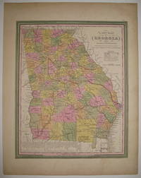
1846219154Philadelphia: S. Augustus Mitchell 1846. unbound. very good. Map. Lithograph with original hand coloring. Image measures 13 7/8" x 11 3/8".<br/> <br/> Great map of Georgia showing all counties railroads major routes and waterways. A table at the bottom of the page lists steam boat routes. Minor overall toning one small tear to bottom edge and a crease to upper left corner. <Br> <br> Samuel Augustus Mitchell Sr. 1792-1868 was one of the leaders in American cartography of the 19th century and pioneered the conversion of engraved map plates to more affordable lithographic plates. His son Samuel Augustus Mitchell Jr. continued his father's successful mapmaking and publishing business and was one of the most prolific and renowned 19th century American publishers.<br/> <br/> S. Augustus Mitchell unknown
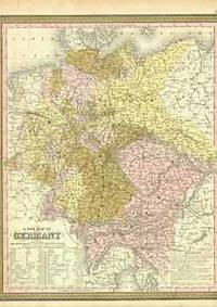
18-1013Philadelphia: Mitchell's New Universal Atlas 1849. 17 x 14 inches. Very Good. Some foxing in margins not affecting image. Minor wrinkling along right edge. 19th Century full color atlas map. Includes explanation chart and table of the German states and Austria Lichtenstein and Luxembourg. From page 51 of Mitchell's 1850 edition of the New Universal Atlas. This was one of the earliest editions of Mitchell's atlas rarer and generally considered more desirable among collectors of his maps and atlases.Samuel Augustus Mitchell and his son and successor S. Augustus Mitchell Jr. were successful Philadelphia-based map publishers. The Mitchell family’s famous annual atlas the New Universal Atlas was first published by Henry Tanner starting in 1836. Mitchell published it under his own name starting in 1846 and he continued publishing it until 1849. In 1850 the copyright to Mitchell’s atlas was first acquired by Thomas Cowperthwait & Co. and then in 1856 by Charles DeSilver both Philadelphia publishers. Thomas Cowperthwait added five maps for their 1853 edition. DeSilver still owned the copyright in 1859 when another edition came out published by Cushings & Bailey Baltimore which added 23 more maps. In 1860 when S. Augustus Mitchell Jr. succeeded his father the Mitchells published the atlas again and the name of the atlas was changed to the New General Atlas. Philadelphia: Mitchell's New Universal Atlas, [1849]. unknown
1846219154Philadelphia: S. Augustus Mitchell 1846. unbound. very good. Map. Lithograph with original hand coloring. Image measures 13 7/8" x 11 3/8".<br/><br/> Great map of Georgia showing all counties railroads major routes and waterways. A table at the bottom of the page lists steam boat routes. Minor overall toning one small tear to bottom edge and a crease to upper left corner. Samuel Augustus Mitchell Sr. 1792-1868 is one of the pioneers in American cartography of the 19th century.<br/><br/> S. Augustus Mitchell unknown books
1846232149Philadelphia: H. N. Burroughs 1846. First. unbound. Map. Lithograph with original hand coloring. Image measures 14 7/8" x 12".<br/><br/> Excellent map of Maine showing all counties railroads major routes and waterways. Two tables at the top of the page list population over time. Small chips to lower margin not affecting the image. Samuel Augustus Mitchell Sr. 1792-1868 is one of the pioneers in American cartography of the 19th century. From the first edition of Mitchell's seminal New Universal Atlas.<br/><br/> H. N. Burroughs unknown books
1846232287Philadelphia: H. N. Burroughs 1846. First. unbound. Map. Lithograph with original hand coloring. Image measures 14 3/8" x 11 7/16".<br/><br/> Wonderfully graphic and colorful map of Michigan amidst four Great Lakes. The map includes towns and roads in addition to canals drawn in blue and railroads drawn in orange. A small inset on the left depicts the western part of the state. Beneath the title two tables list steam boat routes from Detroit to Fort Gratiot and Fort Howard. The map is in good condition with only minor chips along the binding edge of the paper outside the margin. Samuel Augustus Mitchell Sr. 1792-1868 published this map as part of the first edition of his seminal New Universal Atlas. Mitchell is one of the pioneers in American cartography of the 19th century and led the conversion of engraved map plates to more affordable lithographic plates. First edition if this classic map.<br/><br/> H. N. Burroughs unknown books
1865103232<p>Unbound colored engraved map decorative boarder 14" x 11". Slight toning and aging a couple of nicks or chips in left margin; otherwise bright and clear. Maps are wrapped with acid free board or in rigid sleeves. The Mitchell family started to produce atlases in 1846 and continued into the early 1890s. Around 1860 S. Augustus Mitchell Jr. took over and the atlas would be called Mitchell's New General Atlas. This is a very attractive single page map of Palestine and the Holy Land from the 1865 installment of that atlas. This map is probably one of the more attractive versions of this map from the Mitchell series. Modern Jerusalem is shown in an inset. Extra postage may be required. Ristow 311-313. </p> books
1848293169Philadelphia: S. Augustus Mitchell 1848. unbound. Map. Lithograph with original hand coloring. Image measures 11 1/4" x 14".<br/><br/> Beautifully detailed first edition map of South Carolina divided into counties. The map delineates towns waterways railroads and major routes as explained in a small key at the bottom right. Canals and railroads are marked. Also included are insets of Charleston and a table of distances. The map is in good condition with minor toning. <br><br>Samuel Augustus Mitchell Sr. 1792-1868 published this map as part of the 1848 edition of his seminal New Universal Atlas. Mitchell is one of the pioneers in American cartography of the 19th century and led the conversion of engraved map plates to more affordable lithographic plates.<br/><br/> S. Augustus Mitchell unknown books