28 788 résultats
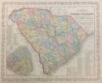
1856293171Philadelphia: S. Augustus Mitchell 1856. unbound. Map. Lithograph with original hand coloring. Image measures 11 1/4" x 14 1/4".<br/><br/> Beautifully detailed first edition map of South Carolina divided into counties. The map delineates towns waterways railroads and major routes as explained in a small key at the bottom right. Canals and railroads are marked. Also included are insets of Charleston and a table of distances. The map is in good condition.<br><br>Samuel Augustus Mitchell Sr. 1792-1868 published this map as part of the 1856 edition of his seminal New Universal Atlas. Mitchell is one of the pioneers in American cartography of the 19th century and led the conversion of engraved map plates to more affordable lithographic plates.<br/><br/> S. Augustus Mitchell unknown books
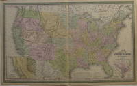
1855207430Philadelphia: Cowperthwait Desilver & Butler 1855. unbound. very good. Young J.H. Map. Engraving and lithograph with original hand coloring. Image measures 16" x 26.25".<br/><br/> Beautifully detailed map of the United States including insets of the Gold Region of California and the District of Columbia. Shows states and territories towns and cities major routes historic trails topographical features and mountain heights waterways battle sites and railroads completed and projected. Light creases to right corners. Samuel Augustus Mitchell Sr. 1792-1868 is one of the pioneers in American cartography of the 19th century.<br/><br/> Cowperthwait, Desilver & Butler unknown books
1971Q-1558635025Lorenz Educational Press 1971-09-01. Paperback. New. In shrink wrap. Looks like an interesting title! Lorenz Educational Press paperback
2017TH230625Rpb Publishing Bristol 2017. 1st Edition. HARDCOVER. Large square 4to in white printed black cloth covered boards variously paginated approx. 108pp on thick art paper colour photos etc __CONDITION : NEW unread and unmarked copy in a NEW complete Dust Jacket. . __To see more of our Photo books type DbbPHOTO in the Keywords search box __We always ship in PROTECTIVE CARD PARCELS Rpb Publishing, Bristol hardcover
20172-0993232361RRB Publishing 2017. Hardcover. New. 80 pages. 7.87x3.94x0.39 inches. RRB Publishing hardcover
2017209189Bristol: RRB PhotoBooks 2017. Rilegato tela sovracoperta cloth dust jacket. Perfetto Mint. Firma autografa dell'Artista Signed by the Artist. Testo di Val Williams. 65 fotografie a colori di Peter Mitchell. Edizione in inglese e francese. Cm 27x245. pp. 88. Firma autografa dell'Artista Signed by the Artist. Perfetto Mint. Prima edizione First Edition. <em>A metà";" degli anni settanta i <strong>Viking Landers</strong> furono le prime navicelle a sbarcare sul pianeta Marte.<br />Sebbene il paesaggio "alieno" fosse magnifico non c'erano canali o scheletri o abitazioni in rovina sferzate dal vento. Oggi non rimane nessuna traccia di Viking Landers 3 e 4. Ma il mito e varie teorie cospirative sostengono che un sondaggio alieno fosse stato commissionato sul pianeta Terra.<br /><br />A <strong>"New Refutation of the Viking 4 Space Mission" </strong>di Peter Mitchell contiene foto e ritratti scattati a Leeds negli anni '70. Le immagini mostrano il tradizionale paesaggio urbano presentato su uno sfondo di carte spaziali simulando in questo modo l'arrivo di un alieno sbarcato da Marte mentre gira per Leeds sorpreso e perplesso. Queste fotografie sembrerebbero ritrarre soltanto un paesaggio anonimo.eppure per qualcuno sono il centro dell'universo. Per qualcuno è";" Casa.</em> RRB PhotoBooks, hardcover
A9781977218674Paperback / softback. New. paperback
B9781977218674Paperback / softback. New. paperback
1977218679.Gpaperback. Good. Access codes and supplements are not guaranteed with used items. May be an ex-library book. paperback
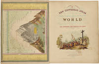
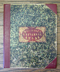
185516332Philadelphia: Cowperthwait Desilver & Butler 1855. First Edition Early Issue. Quarter Leather. Very good. The 1855 Mitchell's Universal Atlas published by Cowperthwait Desilver & Butler in Philadelphia. Folio 74 plates. Three-quarter polished red morocco marbled boards title in gilt on label affixed to front panel. Measures 17" x 14". Front hinge reinforced donation bookplate on front endpaper. Faint damp stain to front and rear endpaper no impact to maps. Occasional toning to plates faint spotting to a few plates a bright example. This work is complete with 71 hand colored lithographed maps with three double page maps for a total of 74 plates. Includes a city plan of Washington D.C. Frontispiece map of the "Lengths of the Principal Rivers in the World." This work is an early issue of the 1855 Mitchell's Atlas with Pierce County Minnesota Plate 35 before it was divided into Pierce Davis and Renville Counties. Includes the Arkansas population map not the table of steamboat routes. Lacking the "New Map of Nebraska Kansas New Mexico and Indian Territories" which follows Plate 37 in the first issue. Philips Atlases 6118. Cowperthwait, Desilver & Butler unknown
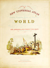
1852236680Philadelphia: Thomas Cowperthwait & Co 1852. Chromolithograph title hand-colored frontispiece 73 hand-colored lithographic maps. 1 vols. Folio. Half red morocco in period style original marbled boards with printed label on upper cover very clean. Chromolithograph title hand-colored frontispiece 73 hand-colored lithographic maps. 1 vols. Folio. Mitchell & Sons first published their NEW UNIVERSAL ATLAS in 1846 having acquired Tanner's NEW UNIVERSAL ATLAS in 1845 and printed it several times subsequently until 1850 when the firm sold the rights to Cowperthwait & Co. of Philadelphia who published it until 1856 continually adding to and editing the hand-colored maps. Despite the attribute "Universal" in the title the Atlas clearly concentrates on America with 43 maps of the continent and features a large double-page transcontinental map of the U.S; and this 1852 Cowperthwait edition is the first to show counties in California and New Mexico. Phillips 809; Ristow pp.311-13; Rumsey p.240 Thomas, Cowperthwait & Co unknown
1855231635<p>Cowperthwait Desilver & Butler 1855. Hardcover. Good. Rebound in green cloth boards. 2 plates are missing #18 North Carolina and #19 South Carolina. All other plates are included. The following plates have old tape applied to a backside edge none are attached to the map side most are simple small strips with none being more than 4 inches in length and most being 1 or 2 inches in length. #6 Eastern side of double sheet map of USA #10 Connecticut #20 Georgia #44 Chili La Playa and Uruguay #45 and #46 Double sheet map of Europe #53 Germany #71 China #73 Egypt. The applied tape is either unseen or only lightly seen on the map sides. The Georgia map photo can be viewed as an example. Colors are bright and clear. No marks or notations. Folio. Ships insured with signature confirmation to domestic US customers.</p> Cowperthwait, Desilver and Butler hardcover
1852WRCAM31820APhiladelphia: Thomas Cowperthwait & Co. 1852. Chromolithographic title with large vignette; handcolored frontispiece of heights of principal mountains and lengths of principal rivers; contents list printed in red black and gold; seventy-three handcolored lithographic maps charts and city plans one double-page. Folio. Publisher's three-quarter red morocco and marbled boards spine ruled in gilt morocco label lettered in gilt on front board. Binding worn and rubbed front hinge tender. Contemporary bookplate on front pastedown. Some toning but generally clean internally. Very good overall. A famous atlas with handcolored maps of all the individual states and territories with the map of California showing counties in California and New Mexico for the first time and with the locations of Native American tribes shown in several western states and territories. Despite its title the atlas concentrates to a marked degree on the American continent with forty-three maps of the area including a fine double-page coast- to-coast map of the United States. <br> <br> S. Augustus Mitchell and his sons were the leading publishers of maps in the United States during most of the 19th century. Mitchell had come to Philadelphia round 1830 with the intention of improving the standard of geography textbooks Philadelphia then being the leading city in America for cartographical publications. A NEW AMERICAN ATLAS published in 1831 was his first work. In 1845 he acquired the right to Tanner's NEW UNIVERSAL ATLAS first published in 1836 and in 1846 he published his first edition of the present work. Mitchell continued to publish the atlas until 1850 when he sold the copyright to Cowperthwait & Co. of Philadelphia. Thomas Cowperthwait & Company published it until 1856 when it was purchased by Charles DeSilver. The Cowperthwait company continued to add edit alter and hand-color the maps. PHILLIPS ATLASES 807. RISTOW pp.311-13 ref. RUMSEY 553. Thomas, Cowperthwait & Co. hardcover books
1852236680Philadelphia: Thomas Cowperthwait & Co 1852. Chromolithograph title hand-colored frontispiece 73 hand-colored lithographic maps. 1 vols. Folio. Half red morocco in period style original marbled boards with printed label on upper cover very clean. Chromolithograph title hand-colored frontispiece 73 hand-colored lithographic maps. 1 vols. Folio. Mitchell & Sons first published their NEW UNIVERSAL ATLAS in 1846 having acquired Tanner's NEW UNIVERSAL ATLAS in 1845 and printed it several times subsequently until 1850 when the firm sold the rights to Cowperthwait & Co. of Philadelphia who published it until 1856 continually adding to and editing the hand-colored maps. Despite the attribute "Universal" in the title the Atlas clearly concentrates on America with 43 maps of the continent and features a large double-page transcontinental map of the U.S; and this 1852 Cowperthwait edition is the first to show counties in California and New Mexico. Phillips 809; Ristow pp.311-13; Rumsey p.240 Thomas, Cowperthwait & Co unknown books
18496558Philadelphia: S. Augustus Mitchell 1849 Folio. 17 3/8 x 14 inches. Lithographed title with large vignette letterpress "Table of Contents" and 73 hand-colored lithographed maps charts and city plans. Three-quarter red morocco over marbled boards large red morocco title label on front cover elaborately tooled and lettered in gilt. Spine and corners renewed in red leather. Boards rubbed and scuffed at edges. Maps in fine condition. Overall a fine copy. A very nice copy of this very scarce atlas with hand-colored maps of all the individual States and Territories and including the rare and famous map of "Oregon Upper California & New Mexico" showing the large yellow-colored area in California labeled "Gold Region." The Atlas concentrates on the American continent with 43 maps of the area including a fine double-page coast-to-coast map of the United States. Samuel Augustus Mitchell and his sons were the leading publishers of maps in the United States during most of the nineteenth century. A New American Atlas published in 1831 was Mitchell's first work. In 1846 he published his first edition of the present work. He continued to publish the Atlas until 1850 when he sold the copyright to Cowperthwait & Co. It was with this 1849 edition that "New Mexico" was added to the title of the map as well as the words "Gold Region" added in a large yellow area in "Upper or New California." As Wheat states "We find S. Augustus Mitchell in Philadelphia publishing in 1849 a revised version of his Texas Oregon and California map taking advantage of Frémont's later work and displaying a large colored Gold Region." Also many routes are shown by red hand-colored lines including Frémont's routes. Wheat: Mapping the Transmississippi West: 630 p.284; text p.82; not noted in Wheat's Maps of the Gold Region. S. Augustus Mitchell hardcover books
18525810Philadelphia: Thomas Cowperthwait & Co 1852. Folio. 17 x 13 3/4 inches. Chromolithographic title with large vignette hand-coloured frontispiece of the heights of the principal mountains and lengths of the principal rivers contents list printed in red black and gold 73 hand-coloured lithographed maps charts and city plans 1 double-page. Publisher's green marbled paper-covered boards with morocco title label elaborately tooled and lettered in gilt on upper cover red morocco spine and corners expertly renewed to style. Modern red cloth box morocco lettering piece<br/> <br/>A fine copy of this famous atlas with hand-coloured maps of all the individual States and Territories. The map of California shows counties in California and New Mexico for the first time.<br/> <br/>Despite its title the Atlas concentrates to a marked degree on the American continent with 43 maps of the area including a fine double-page east-to-west-coast map of the United States. S. Augustus Mitchell and his sons were the leading publishers of maps in the United States during most of the nineteenth century. Mitchell had come to Philadelphia around 1830 with the intention of improving the standard of geography textbooks Philadelphia then being the leading city in America for cartographical publications. A New American Atlas published in 1831 was his first work. In 1845 he acquired the rights to Tanner's New Universal Atlas first published in 1836 and in 1846 he published his first edition of the present work. Mitchell continued to publish the atlas until 1850 when he sold the copyright to Cowperthwait & Co. of Philadelphia. Thomas Cowperthwait & Company published it until the mid-1850s when it was purchased by Charles De Silver. The Cowperthwait company continued to add edit alter and hand-colour the maps.<br/> <br/>Phillips Atlases 807; cf. Ristow pp. 311-313; Rumsey p.239. Thomas, Cowperthwait & Co unknown books
18556365Philadelphia: Charles DeSilver 1855. Folio. 17 x 14 inches. Chromolithographic title with large vignette hand-coloured frontispiece of the heights of the principal mountains and lengths of the principal rivers contents list printed in red black and gold 71 hand-coloured lithographed maps and charts 3 double-page and 1 city plan. Publisher's red half morocco with green marbled paper-covered boards morocco title label elaborately tooled and lettered in gilt on upper cover. Modern red cloth box dark red morocco lettering piece<br/> <br/>A fine copy of this famous atlas with hand-coloured maps of all the individual States and Territories. The first edition to have DeSilver as publisher and here including 'A New Map of Nebraska Kansas New Mexico & the Indian Territories' for the first time: present here as an additional map un-numbered and not called for in the contents list<br/> <br/>Despite its title the Atlas concentrates to a marked degree on the American continent with a city plan of Washington D.C. and 42 maps of the area including a fine double-page coast-to-coast map of the United States and 30 maps of the States and Territories. The un-numbered map of Nebraska Kansas etc. is here bound between sheets numbered 37 and 38. S. Augustus Mitchell and his sons were the leading publishers of maps in the United States during most of the nineteenth century. Mitchell had come to Philadelphia around 1830 with the intention of improving the standard of geography textbooks Philadelphia then being the leading city in America for cartographical publications. A New American Atlas published in 1831 was his first work. In 1845 he acquired the rights to Tanner's New Universal Atlas first published in 1836 and in 1846 he published his first edition of the present work. Mitchell continued to publish the atlas until 1850 when he sold the copyright to Cowperthwait & Co. of Philadelphia. Thomas Cowperthwait & Company published it until the mid-1850s when it was purchased by Charles De Silver. The Cowperthwait company continued to add edit alter and hand-colour the maps.<br/> <br/>Phillips Atlases 6118; cf. Ristow pp. 311-313; Rumsey pp.240-241. Charles DeSilver unknown books
135769282X.Ghardcover. Good. Access codes and supplements are not guaranteed with used items. May be an ex-library book. hardcover
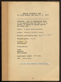
1982586965New York: Charles Scribner's Sons 1982. Softcover. Very Good. Uncorrected proof. Cream wrappers. Toning thus very good with publisher's material laid in. Charles Scribner's Sons unknown
0684174286.Ghardcover. Good. Access codes and supplements are not guaranteed with used items. May be an ex-library book. hardcover
20011338736PN. New. 2001. Soft Cover. Date is original print. This is a reprint edition . PN paperback
19931218770PN. New. 1993. Reprint Edition. Soft Cover. Date is copyright date; this is a later reprint edition . PN paperback
1993262811PN. New. 1993. Soft Cover. Date is original print. This is a reprint edition . PN paperback
1898023926New York: The Century Company 1898. Photographs available upon request. First Edition. A single issue of this monthly magazine. NOT print on demand or a modern reprint. NOT a library discard. Very Good condition. Cover has edge wear and a small chip at the foot of the spine. Pages are clean and unmarked. NO owner's name or bookplate. Vol. LVIII No. 5 September 1899. Bound in the original decorated wraps with green and brown seascape illustration on the front cover. Complete with all ads. Questions on content Please inquire. Special SALT-WATER number. In this issue are A PAINTER OF THE SEA by William A. Coffin with 2 full page paintings by Winslow Homer; Benjamin FRANKLIN THE SCIENTIST by Paul Leicester Ford; VIA CRUCIS XI by F. Marion Crawford; THE VIZIER OF THE TWO-HORNED ALEXANDER conclusion by Frank R. Stockton; THE SEA-GULL by S. Weir Mitchell; etc. First Edition. Softcover. Very Good condition. Illus. by Homer Winslow 2 full page plates. 6.75" wide by 9.75" tall. Great Packaging Fast Shipping. The Century Company Paperback