1 490 résultats
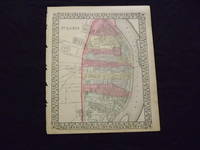
1869101080Philadelphia 1869. Unbound colored engraved map decorative border 14 "x 11 ". Slight toning and aging; overall bright and clear and in very good shape. Maps are wrapped with acid free board or in rigid sleeves. The Mitchell family started to produce atlases in 1846 and continued into the early 1890s. Around 1860 S. Augustus Mitchell Jr. took over and the atlas would be called Mitchell's New General Atlas. This is a fairly detailed map of St. Louis from the 1882 installment of that atlas. Ristow 311-313 unknown books
1870103221<p>Unbound colored engraved map decorative border 14 "x 11 ". Some browning and aging bottom margin narrow left margin has rough edge with some nicks and chips; still bright and clean and in very good shape. Maps are wrapped with acid free board or in rigid sleeves. The Mitchell family started to produce atlases in 1846 and continued into the early 1890s. Around 1860 S. Augustus Mitchell Jr. took over and the atlas would be called Mitchell's New General Atlas. This is a fairly detailed map of St. Louis from the 1870 installment of that atlas. Colorful and contains considerable street detail. May require extra postage. Ristow 311-313. </p> books
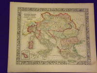
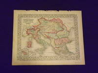
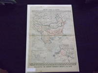
1861101210<p>Philadelphia 1861. Unbound colored engraved map decorative border 14"x 11". Slight toning and aging a little minor staining or soling in rightt margin; overall bright clear and crisp and in very good shape. Maps are wrapped with acid free board or in rigid sleeves. The Mitchell family started to produce atlases in 1846 and continued into the early 1890s. Around 1860 S. Augustus Mitchell Jr. took over and the atlas would be called Mitchell's New General Atlas. This is a very attractive single page colored map of mostly modern day Germany Italy and Turkey from the 1861 installment of that atlas. American maps with a complete picture of Italy are often hard to find. Ristow 311-313</p> books
1870106140Unbound colored engraved map decorative border 14"x 11". Slight toning and aging top margin a little rough on the edge; overall bright clear and crisp and in very good shape. Maps are wrapped with acid free board or in rigid sleeves. The Mitchell family started to produce atlases in 1846 and continued into the early 1890s. Around 1860 S. Augustus Mitchell Jr. took over and the atlas would be called Mitchell's New General Atlas. This is a very attractive single page colored map of mostly modern day Germany Italy and Turkey from the 1870 installment of that atlas. American maps with a complete picture of Italy are often hard to find. Ristow 311-313. books
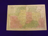
1839102173Engraved colored map 11" x17" cartouche with map information. Some slight soiling toning and browning small archival tape repair on reverse near split insignificant perhaps faint staining in the lower left margin decent margins; map is generally bright and clean. This is an interesting early Mitchell map of the Western States and Territories from the Mitchell's School & Family Geography. The states furthest west at this point are Illinois and Indiana. Iowa and Wisconsin are still shown as territories. S. Augustus Mitchell, books
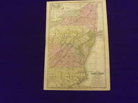
1839102174Engraved colored map 11" x17" cartouche with map information. Some slight soiling toning and browning archival tape repairs on reverse near split relatively decent margins; map is generally bright and clean. Early Mitchell map of the Middle States the Mitchell's School & Family Geography. New York Pennsylvania and Virginia are the most visible but a significant portion of North Carolina is also shown. S. Augustus Mitchell, books
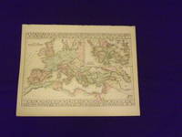
1882106130<p>Unbound colored engraved map decorative border 14"x 11". Slight toning and aging; overall bright and clear and in very good shape. Maps are wrapped with acid free board or in rigid sleeves. The Mitchell family started to produce atlases in 1846 and continued into the early 1890s. Around 1860 S. Augustus Mitchell Jr. took over and the atlas would be called Mitchell's New General Atlas. This somewhat unusual map of the Roman Empire is from the 1882 edition of the Mitchell series. In addition to an attractive rendering of the Roman Empire there is a large section of the map that presents Ancient Greece. Ristow 311-313. Phillips 907.</p> books
18377717Philadelphia 1837. No Binding. Near Fine. 7 x 20 ½ inches. Lithograph with original wash color; fold reinforcements else excellent. Rare separately issued folding map showing Missouri as a state Arkansas as a territory and the area of present-day Oklahoma as "Indian Territory Attached to Arkansas." This is a significantly updated edition of the map "has many changes topographically and new borders.There are many new counties in Missouri and Arkansas and a table of Steam Boat Routes appears in the lower right corner of the map. The detail in the surrounding states is now filled in" Rumsey. Rumsey 4102 1836 edition; cf. Ristow W. American Maps & Mapmakers pp. 303-304 unknown books
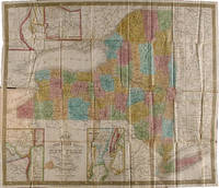
1839WRCAM29278APhiladelphia: S. Augustus Mitchell 1839. Folding pocket map 17 x 20 1/2 inches with full period color. Bound into original 16mo. green morocco boards stamped in blind and gilt. Boards rubbed. Minor repairs a bit of staining else good. The fourth Mitchell edition of D.H. Vance's map of New York State with extensive additions to New York's embryonic railroad system both on the main and the inset maps. "Sold by Thomas Cowperthwait & Co. No. 253 Market Street" added below neat line and the front covers now stamped" "New-York." With five insets: "Map of the Hudson River" "Vicinity of Albany" "Vicinity of New York" "Vicinity of the Falls of Niagara" and "Vicinity of Rochester." This edition is not in Rumsey or Phillips. S. Augustus Mitchell hardcover books
18343245Philadelphia: S. Augustus Mitchell 1834. Full period color 17 x 20 1/2 inches folding into gilt-stamped brown leather covers. Statistical table laid down on inside front cover. Five insets see below. Minor repairs. This is the second pocket map edition of D. H. Vance's map of New York State with the imprint of S. Augustus Mitchell. Mitchell had purchased the plate from Anthony Finley in 1831 removed Vance's name added a new border and included it in his edition of the A New American Atlas 1831. The map was first issued as a pocket map by Mitchell in 1832. With the 1832 edition Mitchell replaced the inset "Profile of the Erie Canal" with four insets: "Vicinity of Albany" "Vicinity of New York" "Vicinity of the Falls of Niagara" and "Vicinity of Rochester." With this 1834 edition the statistical table at right was replaced by an inset "Map of the Hudson River." Numerous new towns are present throughout and distances in miles along roads between towns have been added. New York's first railroads are also included for the first time. The title has been moved from the upper left to the lower left corner. This edition is not listed in Rumsey nor in Phillips. S. Augustus Mitchell unknown books
18393248Philadelphia: S. Augustus Mitchell 1839. Full period color 17 x 20 1/2 inches folding into gilt-stamped brown leather covers. Statistical table laid down inside front cover. Minor repairs a bit of staining. The fourth Mitchell edition of D.H. Vance's map of New York State. Extensive additions to New York's embryonic railroad system both on the main and the inset maps. "Sold by Thomas Cowperthwait & Co. No. 253 Market Street." added below neat line. The front covers now stamped "New-York." With five insets: "Map of the Hudson River" "Vicinity of Albany" "Vicinity of New York" "Vicinity of the Falls of Niagara" and "Vicinity of Rochester." This edition not in Rumsey; not in Phillips. S. Augustus Mitchell unknown books
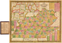
1838WRCAM41839Philadelphia: S. Augustus Mitchell 1838. Handcolored folding pocket map 18 x 21 1/2 inches in a. 16mo. morocco folder cover stamped in blind and gilt. Lightly rubbed at extremities. Minor toning a few small spots of foxing. A few small separations at corner folds. Colors fresh and bright. Very good. A nice pocket map of Kentucky and Tennessee intended for travellers. The map includes charts with steamboat and stage routes through the states as well as insets of the area around Nashville Louisville and Frankfort and Lexington. The census data for 1830 is pasted to the inside of the front cover. Not in Phillips or Rumsey; no copies of this edition in OCLC. S. Augustus Mitchell unknown books
3163Philadelphia: The Company 1835. . Single sheet hand-colored 18 x 22 1/4 inches folded to 5 1/4x 3 1/4 inches 16mo full straight-grained scarlet morocco gilt title on front and ornate gilt rules on both covers; expert repairs in folds and one other 3-inch repair barely discernible One copy mounted to canvas located at Dartmouth. Not an reissue of the 1831 map but re-engraved with 3 inserts for: Louisville Nashville and Frankfort and Lexington. A contemporary owner Olmsted Baker made several notations in pencil on the verso of the map including "Visited the Hermitage March 9m 1836" we have been unable to find a connection between Andrew Jackson and Mr. Baker. Philadelphia: The Company, 1835. unknown books
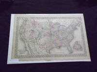
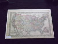
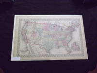
1882101086<p>Philadelphia: Bradley 1882. Unbound colored engraved map decorative boarder 22 1/2"x 14 1/2". Slight toning and aging; overall bright and clear and in very good shape. Maps are wrapped with acid free board or in rigid sleeves. The Mitchell family started to produce atlases in 1846 and continued into the early 1890s. Around 1860 S. Augustus Mitchell Jr. took over and the atlas would be called Mitchell's New General Atlas. This is an attractive double page map of the United States from the 1882 installment. The Indian Territory is highlighted and the Island of Newfoundland is illustrated in a small inset. May require extra postage. Ristow 311-313 Phillips 907</p> Bradley books
1865101084<p>Philadelphia 1865. Unbound colored engraved map decorative boarder 22 1/2"x 14 1/2". Slight toning and aging; overall bright and clear and in very good shape. Maps are wrapped with acid free board or in rigid sleeves. The Mitchell family started to produce atlases in 1846 and continued into the early 1890s. Around 1860 S. Augustus Mitchell Jr. took over and the atlas would be called Mitchell's New General Atlas. This is a colorful and attractive double page map of the United States from the 1865 installment. The Indian Territory is highlighted and Pensacola Bay and Norfolk Harbor are illustrated in two small insets. May require extra postage. Ristow 311-313</p> books
1870101085<p>Philadelphia 1870. Unbound colored engraved map decorative boarder 22 1/2"x 14 1/2". Slight toning and aging just a little staining in margins; overall bright and clear and in very good shape. Maps are wrapped with acid free board or in rigid sleeves. The Mitchell family started to produce atlases in 1846 and continued into the early 1890s. Around 1860 S. Augustus Mitchell Jr. took over and the atlas would be called Mitchell's New General Atlas. This is an attractive double page map of the United States from the 1870 installment. The Indian Territory is highlighted and the Island of Newfoundland is illustrated in a small inset. May Require extra postage. Ristow 311-313</p> books
1869103260<p> Unbound colored engraved map decorative boarder 22 1/2" x 14 1/2". Slight toning and aging just a little darkening in margins; overall bright and clear and in very good condition. Maps are wrapped with acid free board or in rigid sleeves. The Mitchell family started to produce atlases in 1846 and continued into the early 1890s. Around 1860 S. Augustus Mitchell Jr. took over and the atlas would be called Mitchell's New General Atlas. This is an attractive double page map of the United States from the 1869 installment. The Indian Territory is highlighted and the Island of Newfoundland is illustrated in a small inset. Extra postage may be required. Ristow 311-313. </p> books
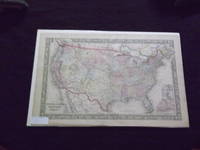
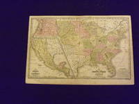
1839102172Engraved colored map 11" x16" smaller map inset included. Some soiling toning and browning a little occasional foxing a couple places with small miss coloring very slight decent margins; very good otherwise. This is a historically significant early Mitchell map of the United States from the Mitchell's School & Family Geography. Texas is shown as a separate country and part of the map is an inset featuring Mexico and Guatemala. Iowa Wisconsin Oregon Missouri are territories and not yet states. A somewhat sizeable section of land is presented as the Indian Territory. S. Augustus Mitchell, books
1882101092Philadelphia: Bradley 1882. Unbound colored engraved map decorative boarder 22 1/2"x 14 1/2". Some toning and aging a couple of small chips in margins no impact on image or boarder; otherwise very good. Maps are wrapped with acid free board or in rigid sleeves. The Mitchell family started to produce atlases in 1846 and continued into the early 1890s. Around 1860 S. Augustus Mitchell Jr. took over and the atlas would be called Mitchell's New General Atlas. This is an attractive double page map of the world from the 1882 installment that atlas. Ristow 311-313 Phillips 907 Bradley unknown books
1870101131Philadelphia 1870. Unbound colored engraved map decorative boarder 22 1/2"x 14 1/2". Some toning and aging a little staining in margins; otherwise very good. Maps are wrapped with acid free board or in rigid sleeves. The Mitchell family started to produce atlases in 1846 and continued into the early 1890s. Around 1860 S. Augustus Mitchell Jr. took over and the atlas would be called Mitchell's New General Atlas. This is an attractive double page map of the world from the 1870 installment that atlas. Ristow 311-313 Phillips 907 unknown books
1865101176Philadelphia 1865. Unbound colored engraved map decorative boarder 22 1/2"x 14 1/2". Some toning and aging; otherwise very good. Maps are wrapped with acid free board or in rigid sleeves. The Mitchell family started to produce atlases in 1846 and continued into the early 1890s. Around 1860 S. Augustus Mitchell Jr. took over and the atlas would be called Mitchell's New General Atlas. This is an attractive double page map of the world from the 1865 installment that atlas. Ristow 311-313 Phillips 907 unknown books
1861101177Philadelphia 1861. Unbound colored engraved map decorative boarder 22 1/2"x 14 1/2". Some toning and aging; otherwise very good. Maps are wrapped with acid free board or in rigid sleeves. The Mitchell family started to produce atlases in 1846 and continued into the early 1890s. Around 1860 S. Augustus Mitchell Jr. took over and the atlas would be called Mitchell's New General Atlas. This is an attractive double page map of the world from the 1861 installment that atlas. Ristow 311-313 Phillips 907 unknown books
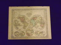
1869106105<p>Unbound colored engraved map decorative boarder 14" x 11". Slight toning darkening and aging bottom margin narrow upper margin with a few edge chips and a little rough; still fairly bright and clean and in very good condition. Maps are wrapped with acid free board or in rigid sleeves. The Mitchell family started to produce atlases in 1846 and continued into the early 1890s. Around 1860 S. Augustus Mitchell Jr. took over and the atlas would be called Mitchell's New General Atlas. This is an attractive hemispheric map of the world from the 1869 installment of that atlas. Ristow 311-313.</p> books
1870106106<p>Unbound colored engraved map decorative boarder 14" x 11". Slight toning darkening and aging top and bottom margina little narrow but still ample; otherwise fairly bright and clean and in very good condition. Maps are wrapped with acid free board or in rigid sleeves. The Mitchell family started to produce atlases in 1846 and continued into the early 1890s. Around 1860 S. Augustus Mitchell Jr. took over and the atlas would be called Mitchell's New General Atlas. This is an attractive hemispheric map of the world from the 1870 installment of that atlas. Ristow 311-313.</p> books
1882101083<p>Philadelphia: Bradley 1882. Unbound colored engraved map decorative boarder 22 1/2"x 14 1/2". Some toning and aging a little foxing in margins; otherwise very good. Maps are wrapped with acid free board or in rigid sleeves. The Mitchell family started to produce atlases in 1846 and continued into the early 1890s. Around 1860 S. Augustus Mitchell Jr. took over and the atlas would be called Mitchell's New General Atlas. This is an very interesting double page map of Turkey from the 1882 installment of that atlas. The map shows parts of Austria Russia and Armenia and illustrates the Berlin Congress Treaty of 1878. Map shows some territory annexed by Russia near the Black Sea. Extra postage may be required. Ristow 311-313 Phillips 907</p> Bradley books