1 490 résultats
1967016750Norman: University of Oklahoma Press. 1967. "The story of a Navaho boy" an autobiographical account by Mitchell now an esteemed artist and a teacher at Red Mesa High School and Navajo Community College written with Allen's guidance and assistance. Fine in a very good price-clipped dust jacket with light foxing and lighter edge wear. Unless otherwise noted our first editions are first printings. First Edition. Hardcover. Fine. University of Oklahoma Press hardcover books
191881755New York: Joint Centenary Committee Methodist Episcopal Church 1918. Hardcover. Very Good. 96p. Original cloth-backed boards. 15cm. Light cover rubbing and wear. Browning on title label. No Jacket. Internally this is a facsimile reprint of the 1827 first edition. <br/><br/> Joint Centenary Committee, Methodist Episcopal Church hardcover books
1968202043Communist Party USA 1968. One inch diameter pin black text on white and orange background. For the presidential campaign of Charlene Mitchell and Mike Zagarell. Mitchell was the first African-American woman ever to run for President as the Communist Party candidate in 1968. [Communist Party USA] unknown books

200725941Bolonga: Musei Senesi 2007. First edition. Cloth. Fine/fine. Oblong clothbound quarto in dustwrapper. Text by Marilena Pasquali with essays by Peter Campion and others. A fine copy in fine dustwrapper. Illustrated in full color. Text in Italian and English. Musei Senesi unknown books
2010127687Kansas City Missouri: Thornhill Gallery 2010. Softcover. NF. Color illus. wraps; Staple-bound; 24 pp.; 15 color plates. From the exhibition held August 27- September 23 2010; Includes artist biography and list of exhibitions and collections. Thornhill Gallery unknown books
200152159Santa Monica: Terrence Rogers Gallery 2001. First edition. Horizontal 4to. 36 pp. Very near fine in illustrated wrappers. W.S. Di Piero contributes an introductory essay. Santa Monica: Terrence Rogers Gallery unknown books
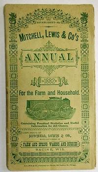
188223679Chicago: O.L. Fox & Co. Publishers and Printers 204 Dearborn St 1882. 3.75" x 7". 48pp illustrated. Original printed stiff paper wrappers elaborately illustrated the rear wrap folds over and encases text leaves. Many illustrations of wagons and buggies descriptions provided with each illustration. Light wear Very Good. <br/><br/> A rare catalogue annual from the Company founded by Henry Mitchell who came to Chicago from Scotland in 1834. "His name is intimately connected with the history of wagon manufacture in the West." Indeed "he built the first wagon ever constructed in" Chicago. Mitchell moved to Kenosha Wisconsin in 1839 and then to Racine. William T. Lewis was Mitchell's son-in-law and a Wisconsin assemblyman. The firm had the capacity to turn out one wagon every twenty minutes with an average production rate of 800 wagons each month. Wagons were sold worldwide. See Willshire. The History of Racine & Kenosha Counties 459. <br/>OCLC 31685140 4- U VA Clarke Hist. Lib. Lib. MI IA State Hist. Soc. as of February 2018. Romaine 87 1898 catalog. Not in Winterthur or NUC. O.L. Fox & Co., Publishers and Printers, 204 Dearborn St unknown books
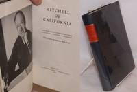
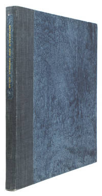
1960198235Berkeley California Library Association 1960. 1960. First edition. 8vo. Frontispiece portrait. Preface by Lawrence Clark Powell. Biographical essay by Cora R. Bandt. Bibliography by Betty Rosenberg. Illustrated with 2 b/w photographs. Original dark blue cloth stamped in red and gilt on the spine. Acetate dust jacket. Very good. No signatures or bookplates. Memoirs of the noted dean of the University of California Berkeley School of Librarianship 1878-1851. F. Hardcover. Berkeley, California Library Association, 1960. hardcover books
1960221308Berkeley: California Library Association 1960. 263p. two portrait photographs hardbound in 8x6 inch dark blue boards with red spine label ruled gilt; handsome production. A clear acetate dust jacket is partiallly torn away the front free endsheet bears a neat small ownership signature an otherwise entirely sound clean copy. California Library Association unknown books
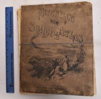
1874183293Philadelphia: J.H. Butler & Co 1874. Hardcover. G/Fair covers are heavily worn rubbed and chipped. Front cover is detached. Spine is gone. Pages are good maps are clean and bright. Ex-library stamps on flyleafs but not on any maps. Illustrated board covers. 2 unnumbered pages 40 pages of plates 24 pages : color maps part double. A series of forty-four copperplate maps compiled from the great atlases of Keith Johnston Kiepert the Geographical Institute of Weimar from the United States Coast Survey the surveys of the War Department and of the several states and from other reliable authorities drawn and engraved expressly to illustrate Mitchell's New School Geography. With important geographical tables and an extensive pronouncing vocabulary of nearly ten thousand names. Two maps numbered XVIII./ Publisher's advertisement on back cover. Could easily be re-bound or used for maps only. J.H. Butler & Co hardcover books
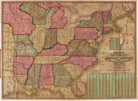
1843WRCAM7742Philadelphia 1843. Two colored folding maps 33 1/2 x 24 inches and 34 3/4 x 25 1/2 inches. In original elaborately gilt pictorial morocco brass clasp intact. Small tear in second map i.e. the chart. Otherwise fine and bright. In a half morocco box. The national map shows the United States west to the Indian Territory west of Missouri including the eastern part of Texas north through most of Maine and with a portion of Canada and south through most of Florida. There are insets of the portions of Maine and Florida which are excluded from the larger image. The second map contains a large center statistical chart surrounded by thirty- two inset maps of various major American cities and their environs or states. This map is dated 1842 at the bottom and is described in Graff as a broadside noting that the map listed by Phillips was issued in 1843. Streeter lists the two maps together as in the present copy. His copy sold to parties unknown for $40 in 1969. PHILLIPS MAPS p.896. STREETER SALE 3861. GRAFF 2838. SERVIES 2872. unknown books
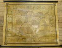
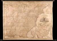
1844260312Philadelphia: S. Augustus Mitchell 1844. unbound. Map. Wall map on linen with wooden scrolls. 31.5" x 48.75"<br/><br/> Large scale map of the eastern United States surrounded with insets of major harbors and towns. Elaborate border design with national coat of arms placed in the each corner contributes to its official quality. Population tables listed in three different insets plus an inset map of the Treaty of 1842 also called Webster-Ashburton Treaty settling a border dispute between Maine and New Brunswick. Large Iowa Territory and Minnesota is not yet named showing impending Westward expansion. From the "National Map Series" that Mitchell produced by subscription over a series of years. Original color but heavily varnished as issued. Samuel Augustus Mitchell Sr. 1792-1868 is one of the pioneers in American cartography of the 19th century and led the conversion of engraved map plates to more affordable lithographic plates. Drawn by James Henry Young 1817-1866 and engraved by J.H. Brightly both collaborated with Mitchell on this series of maps.<br/><br/> S. Augustus Mitchell unknown books
18711318742Philadelphia: S. Augustus Mitchell 1871. Hardcover. Folio unpaginated; VG-; newly rebacked with brown cloth majority of original front board cloth preserved including gilt titling; spine with black label gilt titling; water-damage to upper half of the volume more pronounced on the first 5 pages impacts mags but does not affect coloring; With 67 hand-colored maps plus insets on 56 mapsheets including 9 double-page plus time table page reference table and appendices; shelved above case 2. 1318742. Shelved Dupont Bookstore. S. Augustus Mitchell hardcover books
186429101Philadelphia: S. Augustus Mitchell Jr. 1864. Square folio pp. 4 27 4; 84 hand-colored maps on 54 sheets; gilt on cover dull spine a little scuffed; internally very clean; aside from the dullness of the binding a very good sound copy in publisher's quarter brown morocco and brown cloth lettered in gilt on front. Includes full page city maps of Boston New York Baltimore Washington D.C. Cincinnati and New Orleans. <br/><br/> S. Augustus Mitchell, Jr. hardcover books
1888307523Philadelphia: Wm. M. Bradley & Bro 1888. Folio. Later blue cloth spine label. Very Good. Folio. Wm. M. Bradley & Bro unknown books
1862016467Philadelphia: S. Augustus Mitchell 1862. Book. Good condition. Hardcover. First Edition. Folio. Original leather and cloth binding is heavily worn with several maps loose. Moderate foxing scatted moderately throughout text and staining affecting all of the pages of text but only the first and final maps. Lacking plate 79 containing a map of Africa and an inset map 80 of the Island of St. Helena. Plates 8 13 13.5 34 36 have tears into the image area and about a half dozen plates have moderate to heavy soiling with some chipping to the edges about as many have pencil markings in them in what appears to be updates to railroad lines and about as many have minor smudging and/or soiling in the image area. The hand-colored maps are bright and attractive offering an interesting view of the States during the Civil War as well as the world. S. Augustus Mitchell Hardcover books
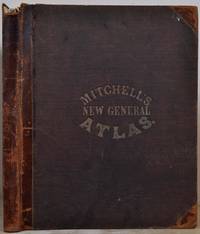
18632541Philadelphia: S. Augustus Mitchell Jr. 1863. First Edition. Cloth. Very good. The 1863 edition of Mitchell's New General Atlas complete with eighty-four maps. Folio 12.5"x15.5" 84 individual maps on 53 sheets title page and "List of Maps" at front. Publisher's stamped cloth cover half calf spine decorative bands. Some soiling to cloth wear to spine. Publisher's original endpapers. Index includes: 22pp list of Post Offices 2pp United States population records 1 world populations 3pp world distances mountains rivers. All maps have a copyright date of 1860. All maps in near fine condition. Occasional toning but overall bright illustrations. Floral borders hand-colored illustrations. Includes detailed city plans of Cincinnati Boston New York Philadelphia New Orleans Washington and Baltimore. S. Augustus Mitchell, Jr. unknown books
186735085Philadelphia: S. Augustus Mitchell Jr. 1867. Folio. 15 3/8 x 12 1/4 inches. 54 hand-coloured lithographic maps and town plans the first map printed with an additional table of the world time zones on verso five double-page numbered 1-91 i.e. including numbering of the insets and with the plan of St. Louis unnumbered. Publisher's red half morocco and red cloth-covered boards the upper cover decoratively blocked in gilt the lower cover blocked in blind rear endpaper torn<br/> <br/>A fine complete copy of Mitchell's important New General Atlas.<br/> <br/>S. Augustus Mitchell retired in 1860 leaving the business to his son S. Augustus Mitchell Jr. In the same year Mitchell Jr. published the first edition of the present work issued to replace the New Universal Atlas. The work was evidently a success: a second edition followed in 1861 a third in 1862 and the atlas continued to be issued annually until 1887. As with its predecessor the General Atlas concentrates on the Americas this edition includes 35 maps of the area including a fine double-page east-to-west-coast of the United States the individual states are delineated on 21 maps and there are city plans of Boston New York Philadelphia Baltimore Washington New Orleans Cincinnati Chicago and St.Louis. The text also is also heavily weighted in the same direction as the maps: pp.1-23 'List of Post Offices in the United States' 24-25pp. 'Population of the United States' 26-27pp. 'List of Post Offices in the Canadas' 1p. 'Table of Population Governments &c.' 1p. 'Table of Distances'; 1p. 'Mountains of the World' 1p. 'Rivers of the World'.<br/> <br/>Phillips Atlases 3558; cf. Ristow p.313; Rumsey p.244. S. Augustus Mitchell, Jr. unknown books
1864100375Folio original cloth with leather spine and corners embossed gilt title on front cover 49 colored maps. Rubbing and fading to binding gilt dull removed label from front coverwear to extremities small stain aaffecting preliminaries occassional margin soiling and a few margin tears; U.S. map has split at the bottom of fold some minor toning but contents generally bright and clean. This atlas contains 49 colored maps twenty-six relate to the U.S. Only for maps are double page. Maps of Texas California and South America are particularly attractive. S. Augustus Mitchell, hardcover books
1868100381Folio original cloth with leather spine and corners gilt title on front cover 65 colored maps. Joints and extremities rubbed but binding is sturdy and in very good condition the U.S. map is split at the middle fold someminor foxing and stains but maps are generally bright and clean. Five of the 65 maps in this atlas are double page and 33 realte to the U.S. The maps of the United States New York Pennsylvania and Texas are particularly attractive. S. Augustus Mitchell, hardcover books
1868100377Folio original cloth with leather spine and corners gilt title on front cover 65 colored maps. Joints and extremities rubbed but binding is sturdy and in very good condition the U.S. map has a small split at lower end of center fold someminor foxing and stains but maps are generally bright and clean. Five of the 65 maps in this atlas are double page and 33 realte to the U.S. The maps of the United States New York Pennsylvania and Texas are particularly attractive. S. Augustus Mitchell, hardcover books
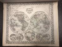
1874106572<p>Sold as a collection of maps. Folio original cloth with leather spine and corners about 48 colored maps. Joints cracked text block almost separated from coverts some spine and edge wear endpapers folded and creased some margin staining on maps of Ohio Cincinnati Illinois Chicago and Iowa. Pages 66 and 68 loose. Missing maps of Alaska Africa Central America Cuba Ireland Greece Connecticut Boston Norway New Jersey and Maltese Islands. However does contain attractive double page maps of the United States Texas California New York World and five other double page maps. Other maps appear to be present. Sold as collection of maps.</p> S. Augustus Mitchell, books
185949436Philadelphia: S. Augustus Mitchell 1859. Large hand-colored wall map on rods approx. 64" square with 4 engraved vignettes 3 inset maps 2 of the world and 1 of the Sandwich Islands all within an elaborate floral border; some infill along the margins slight loss in the population tables at the bottom and several cracks in the paper the whole neatly and professionally backed with linen; overall appearance is certainly very good or better with the usual small defects. America as it was on the eve of the Civil War. OCLC records examples from 1856 1857 1858 1860 and 1861 but not this. Unusual features of this map include the Shoshone Territory what is now mostly Idaho Colona now part of Colorado the unusually large Nebraska the horizontal Utah and New Mexico and the unusually small Dakotas. <br/><br/> S. Augustus Mitchell unknown books
1845WRCAM32219Philadelphia: S. Augustus Mitchell 1845. Wall map 52 x 66 inches with full period hand-color. Expertly repaired backed with modern linen trimmed in green cloth on contemporary rollers. A few light creases and some marginal soiling but on the whole a bright map in very good condition. This impressive wall map of the United States was originally published in 1836 and again in 1841 supplemented by an occasional ACCOMPANIMENT. In this 1846 edition an important inset map is added entitled "A General Map of the United States with the Contiguous British & Mexican Possessions" 16 1/2 x 21 inches. This inset incorporates the discoveries of Fremont in the Great Basin and California shows all of Texas and stretches Oregon Territory well into Canada beyond the line of the Treaty of Guadalupe Hidalgo. In the large map some counties are added in Iowa Territory. There are also small inset maps of Boston New York Philadelphia Charleston Washington Albany Rochester and Niagara Falls. An important American map showing the country on the eve of its second great national expansion. RUMSEY 4223. PHILLIPS MAPS p.898. S. Augustus Mitchell hardcover books
18454885Philadelphia: S. Augustus Mitchell 1845. Copper-engraved wall map with full original colour expertly repaired backed with modern linen trimmed in green cloth on contemporary rollers with bright colour overall in very good condition. An impressive wall map of the United States from a crucial year in American history.<br/> <br/>In 1834 Mitchell republished his A New Map of the United States under the title of Reference and Distance Map. New updated editions appeared almost yearly. When compared to the 1833 edition of the former this 1845 edition of the Reference and Distance Map shows many new developments in the upper Midwest. The outline of Lake Michigan has undergone extensive corrections. An oversized Wisconsin Territory 1836 now appears. Two of the small insets of American towns have been removed from the upper left-hand corner so that the new oversized Territory of Iowa 1838 could be added. The large inset General Map of the United States now shows Texas in its last year as an independent Republic. An important American map showing the country on the eve of its second great national expansion.<br/> <br/>Rumsey 4223; Phillips Maps p. 898. S. Augustus Mitchell unknown books