1 490 résultats
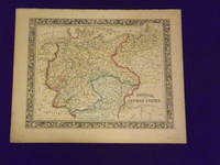
1861106135Unbound colored engraved map decorative boarder 14"x 11". Slight toning and aging top margin a little rough at the edge but not significant; overall bright and clear and in very good shape. Maps are wrapped with acid free board or in rigid sleeves. The Mitchell family started to produce atlases in 1846 and continued into the early 1890s. Around 1860 S. Augustus Mitchell Jr. took over and the atlas would be called Mitchell's New General Atlas. This is an attractive fairly colorful map of Prussia from the 1861 Mitchell atlas. The map shows part of Poland and Switzerland and has a very sharp and attractive boarder. Ristow 311-313. books
1882101069<p>Philadelphia 1882. Unbound colored engraved map decorative boarder 14"x 11". Slight toning and aging; overall bright and clear and in very good shape. Maps are wrapped with acid free board or in rigid sleeves. The Mitchell family started to produce atlases in 1846 and continued into the early 1890s. Around 1860 S. Augustus Mitchell Jr. took over and the atlas would be called Mitchell's New General Atlas. This is a colorful map of part of the Middle East from the 1882 installment of that atlas. Ristow 311-313</p> books
1861101068<p>Philadelphia 1861. Unbound colored engraved map decorative boarder 14"x 11". Slight toning and aging and a little staining or soiling along bottom edge; overall bright and clear and in very good shape. Maps are wrapped with acid free board or in rigid sleeves. The Mitchell family started to produce atlases in 1846 and continued into the early 1890s. Around 1860 S. Augustus Mitchell Jr. took over and the atlas would be called Mitchell's New General Atlas. This is a colorful map of part of the Middle East from the 1861 installment of that atlas. The map includes an inset showing Palestine and the Holy Land. May require extra postage. Ristow 311-313</p> books
1864103231<p>Unbound colored engraved map decorative boarder 14"x 11". Slight browning and aging; overall bright and clean and in very good shape. Maps are wrapped with acid free board or in rigid sleeves. The Mitchell family started to produce atlases in 1846 and continued into the early 1890s. Around 1860 S. Augustus Mitchell Jr. took over and the atlas would be called Mitchell's New General Atlas. This is a very colorful map of part of the Middle East from the 1864 installment of that atlas. The map includes an inset showing Palestine and the Holy Land. Extra postage may be required. Ristow 311-313. </p> books
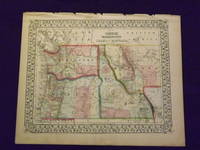
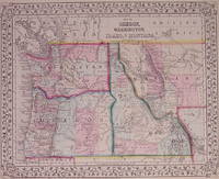
1870103161<p>Unbound colored engraved map decorative boarder 14" x 11". Slight toning and aging margins show a little darkening some chips in upper margin; otherwise very bright and clear. Maps are wrapped with acid free board or in rigid sleeves. The Mitchell family started to produce atlases in 1846 and continued into the early 1890s. Around 1860 S. Augustus Mitchell Jr. took over and the atlas would be called Mitchell's New General Atlas. This is a very colorful and attractive map of a still relatively early view of Oregon Washington and Idaho from the 1870 installment of that atlas. The map also shows part of British America and Montana. Ristow 311-313. Â # 103161</p><p>$100</p> books
1865101200<p>Philadelphia 1865. Unbound colored engraved map decorative boarder 14 1/2"x 11". Slight toning and aging; otherwise very bright and clear. Maps are wrapped with acid free board or in rigid sleeves. The Mitchell family started to produce atlases in 1846 and continued into the early 1890s. Around 1860 S. Augustus Mitchell Jr. took over and the atlas would be called Mitchell's New General Atlas. This is a very colorful and attractive map of a still relatively early view of Oregon Washington and Idaho from the 1865 installment of that atlas. The map also shows part of British America and Montana. Ristow 311-313</p> books
1871203192Philadelphia: Mitchell Samuel Augustus Jr. 1871. unbound. very good. Map. Engraving with original hand coloring. Image measures 10.75" x 13.25".<br/><br/> S. Augustus Mitchell Jr. continued his father's successful mapmaking and publishing business and was one of the most prolific and renowned 19th century American publishers.<br/><br/> Mitchell, Samuel Augustus Jr. unknown books
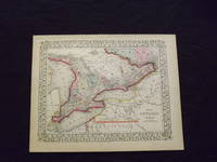
1869103217<p>Unbound colored engraved map decorative border 14" x 11". Slight toning browning and aging; otherwise bright and clean. Maps are wrapped with acid free board or in rigid sleeves. The Mitchell family started to produce atlases in 1846 and continued into the early 1890s. Around 1860 S. Augustus Mitchell Jr. took over and the atlas would be called Mitchell's New General Atlas. This is an attractive colorful map of Ontario from the 1869 installment of that atlas. The map provides good county detail and part of Quebec New York and Pennsylvania are visible. Extra postage may be required. Ristow 311-313. </p> books
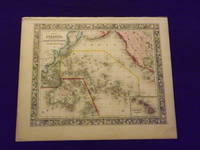
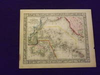
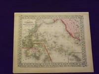
1861103166<p>Unbound colored engraved map decorative border 14" x 12". Slight toning and aging top edge a little rough some staining or browning in top margin; but still bright and clean. Maps are wrapped with acid free board or in rigid sleeves. The Mitchell family started to produce atlases in 1846 and continued into the early 1890s. Around 1860 S. Augustus Mitchell Jr. took over and the atlas would be called Mitchell's New General Atlas. This is a very attractive colorful single page map of the Pacific islands including Australia Japan and New Zealand. The Sandwich Islands is shown in a small inset. This map is from the 1861 installment of the Mitchell atlas. Some extra postage may be required. Ristow 311-313. </p> books
1864103248<p>Unbound colored engraved map decorative boarder 14" x 11". Slight browning and aging a little staining in margins a couple of edge chips; overall bright and clean and in very good condition. Maps are wrapped with acid free board or in rigid sleeves. The Mitchell family started to produce atlases in 1846 and continued into the early 1890s. Around 1860 S. Augustus Mitchell Jr. took over and the atlas would be called Mitchell's New General Atlas. This is a very colorful map of Oceanica South Pacific from the 1864 installment of that atlas. The map includes the Polynesian Islands Australia part of the Chinese coast; part of the western portion of North America and the Sandwich Islands is shown in a small inset. Extra postage may be required. Ristow 311-313. </p> books
1869103249<p>Unbound colored engraved map decorative boarder 14" x 11". Slight browning and aging; overall generally bright and clean and in very good condition. Maps are wrapped with acid free board or in rigid sleeves. The Mitchell family started to produce atlases in 1846 and continued into the early 1890s. Around 1860 S. Augustus Mitchell Jr. took over and the atlas would be called Mitchell's New General Atlas. This is a very colorful map of Oceanica South Pacific from the 1864 installment of that atlas. The map includes the Polynesian Islands Australia part of the Chinese coast; part of the western portion of North America and the Sandwich Islands is shown in a small inset. Extra postage may be required. Â Ristow 311-313. </p> books
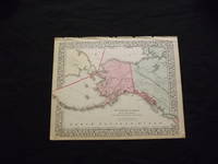
1870103216<p>Unbound colored engraved map decorative boarder 14" x 11". Slight toning browning and aging some chips and tears at top edge bottom margin somewhat narrow; overall very bright and clear and in very good shape. Maps are wrapped with acid free board or in rigid sleeves. The Mitchell family started to produce atlases in 1846 and continued into the early 1890s. Around 1860 S. Augustus Mitchell Jr. took over and the atlas would be called Mitchell's New General Atlas. This is a colorful map of Alaska is from the 1870 installment of that atlas. The map is bright and crisp and shows part of Siberia and the Aleutian Islands and part of Prince Albert Island is also visible. Extra postage may be required. Ristow 311-313.</p> books
1882106158Unbound colored engraved map decorative boarder 14" X 11". Slight toning and agin some writing in right margin; overall bright and clear and in very good shape. Maps are wrapped with acid free board or in rigid sleeves. The Mitchell family started to produce atlases in 1846 and continued into the early 1890s. Around 1860 S. Augustus Mitchell Jr. took over and the atlas would be called Mitchell's New General Atlas. This is an attractive and colorful map of North and South Carolina from the 1882 installment. The map has a fair amount of detail and an inset of Charleston Harbor and another of Charleston. Ristow 311-313. books
1870106161Unbound colored engraved map decorative boarder 14" X 11". Slight darkening and aging some some chipping in top margin edge; overall bright and clear and in very good shape. Maps are wrapped with acid free board or in rigid sleeves. The Mitchell family started to produce atlases in 1846 and continued into the early 1890s. Around 1860 S. Augustus Mitchell Jr. took over and the atlas would be called Mitchell's New General Atlas. This is an attractive and colorful map of North and South Carolina from the 1870 installment. The map has a fair amount of detail and an inset of Charleston Harbor and another of Charleston. Ristow 311-313. books
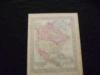
1869103215<p>Unbound colored engraved map decorative boarder 14" x 11". Slight toning browning and aging; overall very bright and clear and in very good shape. Maps are wrapped with acid free board or in rigid sleeves. The Mitchell family started to produce atlases in 1846 and continued into the early 1890s. Around 1860 S. Augustus Mitchell Jr. took over and the atlas would be called Mitchell's New General Atlas. This is a colorful map of North America from the 1869 installment of that atlas. The map is bright and crisp and includes Russian America Alaska Greenland and Central America. Extra postage may be required. Ristow 311-313. </p> books
1839106560Engraved colored map 8" x11 1/2" Box like cartouche with map information. Some slight soiling toning and browning right margin a little uneven; otherwise very good. Not a bad looking little map with plenty of detail and some decent color. From a school and family geography. S. Augustus Mitchell, books
1870101212<p>Philadelphia 1870. Unbound colored engraved map decorative boarder 14"x 11". Slight toning and aging minor staining in margins; overall very bright and clear and in very good shape. Maps are wrapped with acid free board or in rigid sleeves. The Mitchell family started to produce atlases in 1846 and continued into the early 1890s. Around 1860 S. Augustus Mitchell Jr. took over and the atlas would be called Mitchell's New General Atlas. This is a colorful map of North America from the 1870 installment of that atlas. The map is bright and crisp and includes Russian America Alaska Greenland and Central America. May require extra postage.Ristow 311-313</p> books
1861101205<p>Philadelphia 1861. Unbound colored engraved map decorative boarder 14"x 11". Slight toning and aging; overall very bright and clear and in very good shape. Maps are wrapped with acid free board or in rigid sleeves. The Mitchell family started to produce atlases in 1846 and continued into the early 1890s. Around 1860 S. Augustus Mitchell Jr. took over and the atlas would be called Mitchell's New General Atlas. This is a colorful map of North America from the 1861 installment of that atlas. The map is bright and crisp and includes Russian America Alaska Greenland and Central America. May require extra postage.Ristow 311-313</p> books
1861106100<p>Unbound colored engraved map decorative boarder 14"x 11". Slight toning and aging a few margin chips on margin edge; overall bright and clear and in very good shape. Maps are wrapped with acid free board or in rigid sleeves. The Mitchell family started to produce atlases in 1846 and continued into the early 1890s. Around 1860 S. Augustus Mitchell Jr. took over and the atlas would be called Mitchell's New General Atlas. This is a colorful map of several South American countries including Peru Venezuela and Argentina from the 1861 installment of that atlas. The map is colorful and has a fair amount of detail. Ristow 311-313.</p> books
1844106605Engraved double-page colored map 11 ½" x17 1/2" Box like cartouche with map information. Some soiling aging and browning a little creasing at fold; otherwise very good. Nice early map of New England with two inserts for Boston and Providence. From a school and family geography. S. Augustus Mitchell, books
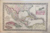
18605429Philadelphia: Augustus Mitchell 1860. Folio double-page from Mitchell's New General Atlas extending from southern US to northern South America. 34x54cm in the image with about 2.5 cm on all edges. Engraved by Williams of Philadelphia. There are four inset detailed maps of Cuba Jamaica Bermudas and the Panama Railroad. Brightly colored very attractive. Center fold split about 6 cm at bottom closed. Very good condition <br/><br/> Augustus Mitchell unknown books
1882101042Philadelphia: Bradley 1882. Unbound colored engraved map 22 1/2"x 14 1/2". Some toning and aging a little darkening at fold; otherwise very good. Maps are wrapped with acid free board or in rigid sleeves. The Mitchell family started to produce atlases in 1846 and continued into the early 1890s. Around 1860 S. Augustus Mitchell Jr. took over and the atlas would be called Mitchell's New General Atlas. This is an attractive double page map of Central America from the 1882 installment of that atlas. Bermuda Jamaica a map of the Panama Railroad and a map of the proposed Panama Canal route are highlighted within insets. Ristow 311-313 Phillips 907 Bradley unknown books
1865101130<p>Philadelphia 1865. Unbound colored engraved map decorative boarder 22 1/2"x 14 1/2". Slight toning and aging; overall bright and clean and in very good condition. Maps are wrapped with acid free board or in rigid sleeves. The Mitchell family started to produce atlases in 1846 and continued into the early 1890s. Around 1860 S. Augustus Mitchell Jr. took over and the atlas would be called Mitchell's New General Atlas. This is an attractive double page map of Central America from the 1865 installment of that atlas. Bermuda Jamaica a map of the Panama Railroad and a map of Cuba are highlighted within insets. May require extra postage.Ristow 311-313 Phillips 907</p> books
1870101214Philadelphia 1870. Unbound colored engraved map decorative border double page 22" x 14". Slight toning and aging; overall bright and clear and in very good shape. Maps are wrapped with acid free board or in rigid sleeves. The Mitchell family started to produce atlases in 1846 and continued into the early 1890s. Around 1860 S. Augustus Mitchell Jr. took over and the atlas would be called Mitchell's New General Atlas. This is an attractive double page map of Central America from the 1870 installment of that atlas. Bermuda Jamaica a map of the Panama Railroad and a map of Cuba are highlighted within insets. Ristow 311-313 Phillips 907 unknown books
1866297675Philadelphia: Mitchell Samuel Augustus Jr. 1866. unbound. W. Williams. Map. Engraving with original hand coloring. Image measures 13.25" x 21".<br/><br/> Beautiful map of Mexico published in 1866. centered on the Gulf of Mexico. Includes four inset maps; Jamaica Cuba Bermuda and Panama. Samuel Augustus Mitchell Sr. 1792-1868 is one of the leaders in American cartography of the 19th century and pioneered the conversion of engraved map plates to more affordable lithographic plates.<br/><br/> Mitchell, Samuel Augustus Jr. unknown books