DES BARRES, JFW (1721-1824) J F WBiblio.com

2 783 résultats
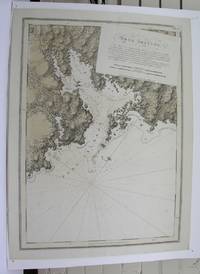
17795597London: Published by J.F.W. Des Barres in 'The Atlantic Neptune' 1779. Sea chart etched with roulette-work with original colour with aquatint view. Printed on laid paper with 'J Bates' watermark and 'JB' countermark. A very fine sea chart and view of Egmont now called Jeddore Harbour from 'The Atlantic Neptune' the first British sea atlas of her North American colonies<br/> <br/> This is a finely presented and highly detailed chart of what is now known as Jeddore Harbour near Halifax. The bay seven miles long and three miles wide is captured in a cartographic composition of great topographical and hydrographical detail and is further embellished by a roundel containing a mariner's view of the area. This chart is the fifth and final state produced and is identical to the Henry Stevens Collection variant 49G in the National Maritime Museum Greenwich. Des Barres studied under the great mathematician Daniel Bernoulli at the University of Basel before continuing on to the Royal Military College at Woolwich. On the outbreak of the Seven Years war in 1756 he joined the British Royal American Regiment as a military engineer. He came to the attention of General James Wolfe who appointed him to be his aide-de-camp. From 1762 Des Barres was enlisted to survey the coastlines of Nova Scotia Newfoundland and the Gulf of St.Lawrence while his colleague Samuel Holland charted the New England coast. In 1774 Des Barres returned to England where he began work on the Neptune. His dedication to the project was so strong that often at his own expense he continually updated and added new charts and views up until 1784. That year he returned to Canada where he remained for a further forty years becoming a senior political figure and a wealthy land owner and living to the advanced age of 103. The Atlantic Neptune was the first British sea atlas of her North American colonies and one of the most important achievements of eighteenth century cartography. With an official commission from the Royal Navy Des Barres published the first volume in London in 1775 which was soon followed by further volumes. Des Barres' monumental endeavor eventually featured over two-hundred charts and aquatint views many being found in several states. All of the charts were immensely detailed featuring both hydrographical and topographical information. Des Barres' plates were used to print further editions up into the first decade of the nineteenth-century. The Neptune met with the highest acclaim from the beginning and is today widely regarded as superior to all other atlases produced during its time.<br/> <br/> National Maritime Museum: Henry Stevens Collection: K0124 HNS 49G & Catalogue no.38 p.382; Cf. Spendlove The Face of Early Canada Chapter 4: "J.F.W. Des Barres and The Atlantic Neptune"; pp. 18-22; Debard "The Family Origins of Joseph Frederick Wallet Des Barres: A Riddle Finally Solved" Nova Scotia Historical Review Vol 14 No. 2 1994 p.15. Published by J.F.W. Des Barres in 'The Atlantic Neptune' unknown
177928787London: British Admiralty for 'The Atlantic Neptune' 1779. Etching with roulette work original outline color on laid paper watermarked "JBates" and countermarked "JB" This excellent example of Des Barres' craftsmanship details a portion of the strait between New Brunswick and what is now Prince Edward Island then St. John's Island. It includes on the New Brunswick side: Shediac Cocagne and Boutouche. The chart includes soundings throughout the Straits and Baie Verte. This is one of the many regions Des Barres himself surveyed during the 1760s. Des Barres of Swiss-Huguenot extraction studied under the great mathematician Daniel Bernoulli at the University of Basel before continuing on to the Royal Military College at Woolwich. Upon the outbreak of hostilities with France in 1756 he joined the British Royal American Regiment as a military engineer. He came to the attention of General James Wolfe who appointed him to join his personal detail. During this period he also worked with the future legendary explorer James Cook on a monumental chart of the St. Lawrence River. From 1762 Des Barres was enlisted to survey the coastlines of Nova Scotia Newfoundland and the Gulf of St. Lawrence while his colleague Samuel Holland charted the New England coast. He also managed to gain access to some surveys of the American South Cuba and Jamaica. In 1774 Des Barres returned to England where he began work on The Neptune. His dedication to the project was so strong that often at his own expense he continually updated and added new charts and views up until 1784. That year he returned to Canada where he remained for a further forty years becoming a senior political figure and a wealthy land owner and living to the advanced age of 103. The Atlantic Neptune the most celebrated sea atlas contained the first systematic survey of the east coast of North America. Des Barres's synergy of great empirical accuracy with the peerless artistic virtue of his aquatint views created a work that "has been described as the most splendid collection of charts plates and views ever published" National Maritime Museum Catalogue. Upon the conclusion of the Seven Years War Britain's empire in North America was greatly expanded and this required the creation of a master atlas featuring new and accurate sea charts for use by the Royal Navy. Des Barres was charged with this Herculean task publishing the first volume in London in 1775 which was soon followed by three further volumes. Des Barres's monumental endeavor eventually featured over two-hundred charts and views many being found in several states. Des Barres's charts were immensely detailed featuring both hydrographical and topographical information and in many cases remained the most authoritative maps of the regions covered for several decades.<br/> <br/> Streeter copy: Vol. II # 58; Stevens 68e. British Admiralty for 'The Atlantic Neptune'] unknown
M3913London 1775. Very good. Notes: Aquatint and line engraving. This fine chart is from "The Atlantic Neptune" by Capt. Joseph Fredrick Wallet Des Barres 1721-1824. "The Atlantic Neptune" is one of the most important sea atlases of the USA and Canadian Atlantic coast that was ever been produced. The atlas was first published in England in 1774 and was updated regularly till 1784. The maps are known for the accurate portrayal of various sounds bays bars and harbours in addition to navigational challenges. The maps are very detailed and contain both hydrographical and topographical information. Des Barres a Swiss cartographer and landscape artist who immigrated to England and trained at the royal military academy became a colonial administrator in Halifax Nova Scotia where he died. He was a lieutenant in rhw royal American regiment c 1756; engineer under general wolf at Quebec c.1759; and governor of Prince Edward Island. He mapped the shore line of Nova Scotia Newfoundland and St. Lawrence River regions c.1764/1774 . This atlas was used by the Royal Navy during the American Revolution. <br>Reference Debard J. M. the family origins of J.f.W.Des Barres; Evens uncommon Obdurate: the several public careers of J.F.W. Des Barres Toronto 1989; De Vorsey map collector 1982 p.31 Size : 540x748 mm 21.25x29.375 Inches Coloring: Original Hand Coloring Category: Maps Canada East Nova Scotia unknown
178120210London: J. F. W. Des Barres for 'The Atlantic Neptune' 1781. Etched with aquatint and stippling. Some outline color. Platemark: 29 1/4 x 21 3/8 inches; sheet: 32 3/4 x 24 3/4 inches. Laid paper watermarked "J. Bates" with counter mark "J.B." A meticulous survey of a portion of the eastern coast of New Brunswick on the Northumberland Straits with soundings and topographical detailing.<br/> <br/>This chart which appeared in Volume II of The Atlantic Neptune was part of the surveying work conducted by Des Barres himself in the late 1760s and early 1770s. The first state was issued in 1776; this enhanced second state appeared in 1779. Des Barres of Swiss-Huguenot extraction studied under the great mathematician Daniel Bernoulli at the University of Basel before continuing on to the Royal Military College at Woolwich. Upon the outbreak of hostilities with France in 1756 he joined the British Royal American Regiment as a military engineer. He came to the attention of General James Wolfe who appointed him to join his personal detail. During this period he also worked with the future legendary explorer James Cook on a monumental chart of the St. Lawrence River. From 1762 Des Barres was enlisted to survey the coastlines of Nova Scotia Newfoundland and the Gulf of St. Lawrence while his colleague Samuel Holland charted the New England coast. He also managed to gain access to some surveys of the American South Cuba and Jamaica. In 1774 Des Barres returned to England where he began work on The Neptune. His dedication to the project was so strong that often at his own expense he continually updated and added new charts and views up until 1784. That year he returned to Canada where he remained for a further forty years becoming a senior political figure and a wealthy land owner and living to the advanced age of 103. The Atlantic Neptune the most celebrated sea atlas contained the first systematic survey of the east coast of North America. Des Barres's synergy of great empirical accuracy with the peerless artistic virtue of his aquatint views created a work that "has been described as the most splendid collection of charts plates and views ever published" National Maritime Museum Catalogue. Upon the conclusion of the Seven Years War Britain's empire in North America was greatly expanded and this required the creation of a master atlas featuring new and accurate sea charts for use by the Royal Navy. Des Barres was charged with this Herculean task publishing the first volume in London in 1775 which was soon followed by three further volumes. Des Barres's monumental endeavor eventually featured over two-hundred charts and views many being found in several states. Des Barres's charts were immensely detailed featuring both hydrographical and topographical information and in many cases remained the most authoritative maps of the regions covered for several decades.<br/> <br/>Stevens 72h. J. F. W. Des Barres for 'The Atlantic Neptune' unknown books
17795597London: Published by J.F.W. Des Barres in 'The Atlantic Neptune' 1779. Sea chart etched with roulette-work with original colour with aquatint view. Printed on laid paper with 'J Bates' watermark and 'JB' countermark. A very fine sea chart and view of Egmont now called Jeddore Harbour from 'The Atlantic Neptune' the first British sea atlas of her North American colonies<br/> <br/>This is a finely presented and highly detailed chart of what is now known as Jeddore Harbour near Halifax. The bay seven miles long and three miles wide is captured in a cartographic composition of great topographical and hydrographical detail and is further embellished by a roundel containing a mariner's view of the area. This chart is the fifth and final state produced and is identical to the Henry Stevens Collection variant 49G in the National Maritime Museum Greenwich. Des Barres studied under the great mathematician Daniel Bernoulli at the University of Basel before continuing on to the Royal Military College at Woolwich. On the outbreak of the Seven Years war in 1756 he joined the British Royal American Regiment as a military engineer. He came to the attention of General James Wolfe who appointed him to be his aide-de-camp. From 1762 Des Barres was enlisted to survey the coastlines of Nova Scotia Newfoundland and the Gulf of St.Lawrence while his colleague Samuel Holland charted the New England coast. In 1774 Des Barres returned to England where he began work on the Neptune. His dedication to the project was so strong that often at his own expense he continually updated and added new charts and views up until 1784. That year he returned to Canada where he remained for a further forty years becoming a senior political figure and a wealthy land owner and living to the advanced age of 103. The Atlantic Neptune was the first British sea atlas of her North American colonies and one of the most important achievements of eighteenth century cartography. With an official commission from the Royal Navy Des Barres published the first volume in London in 1775 which was soon followed by further volumes. Des Barres' monumental endeavor eventually featured over two-hundred charts and aquatint views many being found in several states. All of the charts were immensely detailed featuring both hydrographical and topographical information. Des Barres' plates were used to print further editions up into the first decade of the nineteenth-century. The Neptune met with the highest acclaim from the beginning and is today widely regarded as superior to all other atlases produced during its time.<br/> <br/>National Maritime Museum: Henry Stevens Collection: K0124 HNS 49G & Catalogue no.38 p.382; Cf. Spendlove The Face of Early Canada Chapter 4: "J.F.W. Des Barres and The Atlantic Neptune"; pp. 18-22; Debard "The Family Origins of Joseph Frederick Wallet Des Barres: A Riddle Finally Solved" Nova Scotia Historical Review Vol 14 No. 2 1994 p.15. Published by J.F.W. Des Barres in 'The Atlantic Neptune' unknown books
177928787London: British Admiralty for 'The Atlantic Neptune' 1779. Etching with roulette work original outline color on laid paper watermarked "JBates" and countermarked "JB" This excellent example of Des Barres' craftsmanship details a portion of the strait between New Brunswick and what is now Prince Edward Island then St. John's Island. It includes on the New Brunswick side: Shediac Cocagne and Boutouche. The chart includes soundings throughout the Straits and Baie Verte. This is one of the many regions Des Barres himself surveyed during the 1760s. Des Barres of Swiss-Huguenot extraction studied under the great mathematician Daniel Bernoulli at the University of Basel before continuing on to the Royal Military College at Woolwich. Upon the outbreak of hostilities with France in 1756 he joined the British Royal American Regiment as a military engineer. He came to the attention of General James Wolfe who appointed him to join his personal detail. During this period he also worked with the future legendary explorer James Cook on a monumental chart of the St. Lawrence River. From 1762 Des Barres was enlisted to survey the coastlines of Nova Scotia Newfoundland and the Gulf of St. Lawrence while his colleague Samuel Holland charted the New England coast. He also managed to gain access to some surveys of the American South Cuba and Jamaica. In 1774 Des Barres returned to England where he began work on The Neptune. His dedication to the project was so strong that often at his own expense he continually updated and added new charts and views up until 1784. That year he returned to Canada where he remained for a further forty years becoming a senior political figure and a wealthy land owner and living to the advanced age of 103. The Atlantic Neptune the most celebrated sea atlas contained the first systematic survey of the east coast of North America. Des Barres's synergy of great empirical accuracy with the peerless artistic virtue of his aquatint views created a work that "has been described as the most splendid collection of charts plates and views ever published" National Maritime Museum Catalogue. Upon the conclusion of the Seven Years War Britain's empire in North America was greatly expanded and this required the creation of a master atlas featuring new and accurate sea charts for use by the Royal Navy. Des Barres was charged with this Herculean task publishing the first volume in London in 1775 which was soon followed by three further volumes. Des Barres's monumental endeavor eventually featured over two-hundred charts and views many being found in several states. Des Barres's charts were immensely detailed featuring both hydrographical and topographical information and in many cases remained the most authoritative maps of the regions covered for several decades.<br/> <br/>Streeter copy: Vol. II # 58; Stevens 68e. British Admiralty for 'The Atlantic Neptune'] unknown books
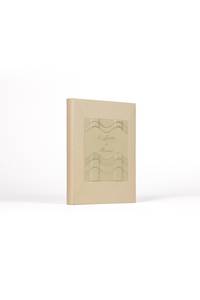
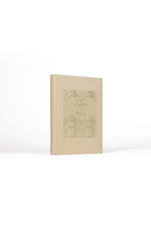
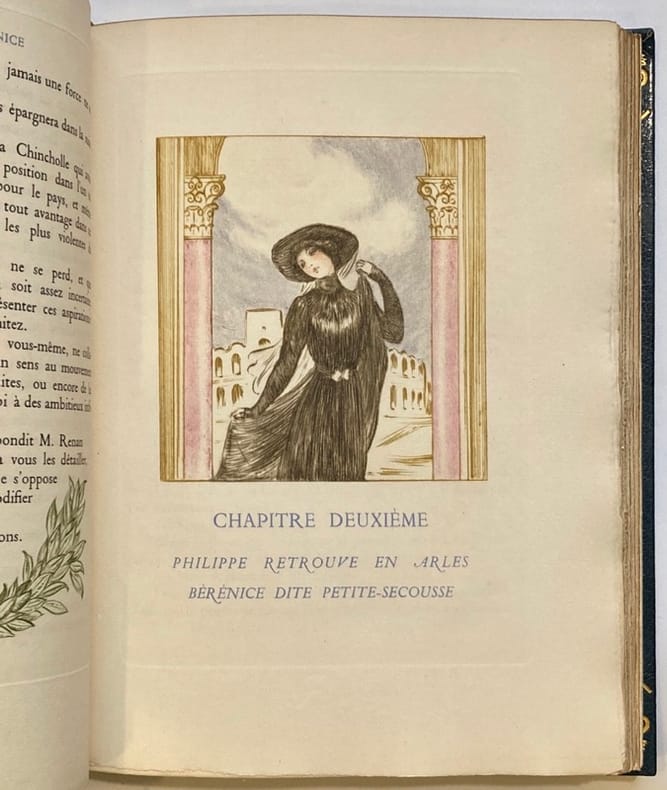
28450Paris pour les Cent Bibliophiles 10 août 1922. 1 vol. 200 x 265 mm de 171 p. 1 et 2 f. Maroquin à mastic dos lisse muet large pièce mosaïqué en box crème titre doré souligné par un jeu de vagues du même box estampé à froid et rehaussé de filets de pointillés à la guache lila contreplats et gardes de velours beige couverture illustrée et dos conservés reliure signée de N. Kiyomiya 2004. . Édition ornée de 42 pointes-sèches en couleurs tirées sur Rives dont un frontispice et un hors-texte. Tirage à 130 exemplaires n° 107. Les 13 pages de la préface sont également illustrées d'une ornementation végétale encadrant le texte œuvre de Malo Renault. . Né à Saint-Malo le 5 octobre 1870 il se spécialise d'abord dans l'eau-forte puis le vernis mou avant d'aborder à la pointe-sèche à l'occasion de cette édition commandée par les Cent bibliophiles pour lesquels il grave sur bois l'estampe du menu en utilisant quatre planches pour les quatre couleurs. Le Jardin de Bérénice troisième volet de la trilogie romanesque que Barrès intitula Le Culte du moi est publié en 1896. Cette fable allégorique magnifie la contemplation et l'imagination qui fait comprendre les choses du coeur : il raconte l'histoire d'un jeune intellectuel Philippe qui vient d'adhérer au programme du général Boulanger - on est en 1889 - et qui part plein d'enthousiasme pour la Provence organiser une campagne électorale - il brigue la députation à Arles. Mais c'est à Aigues-Mortes qu'il retrouve Bérénice une ancienne connaissance qu'il ne cesse de contempler « si belle dans son jardin » : il découvre pour la première fois l'harmonie de la vie et pense trouver dans le cadre de ce jardin et grâce à l'amour de cette femme la signification secrète de l'univers. Cette romance - qui prendra une tournure tragique - est particulièrement mise en valeur grâce aux pointes-sèches en couleur de Malo-Renault pseudonyme d'Émile Auguste Renault. 1922 marque un tournant dans son oeuvre qui se tourne dès lors vers la représentation de la grâce féminine la mutinerie et la naïveté des enfants. Influencé par l'oeuvre d'Henri de Toulouse-Lautrec et l'art japonais la richesse de ses tons et ses compositions hautement décoratives sont celles d'un coloriste de premier ordre. Paris, pour les Cent Bibliophiles, (10 août) 1922. 1 vol. (200 x 265 mm) de 171 p., [1] et 2 f. Maroquin à mastic, dos lisse m unknown
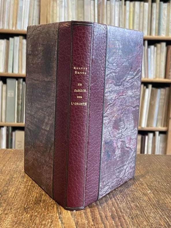
1922120535Paris Plon 1922 1 vol. relié in-12, demi-maroquin grenat à bandes bordé de listels de maroquin vert, dos lisse encadré d'un listel de maroquin vert, tête dorée, non rogné, couvertures conservées, 241 pp. Édition originale de ce roman considéré comme le chef-d'oeuvre de l'auteur. Barrès conduit son lecteur en Syrie et le plonge au temps des Croisés, décrivant la passion d'un chevalier pour Oriante, la perle du sérail de l'émir de Qalaat ! Un des 50 exemplaires de tête numérotés sur chine comprenant un envoi de Barrès à Pierre Mainguet, directeur des éditions Plon. Restauration au plat supérieur de la couverture, sinon bel exemplaire dans une fine reliure qui aurait mérité d'être signée.
1922120535Paris Plon 1922 1 vol. relié in-12, demi-maroquin grenat à bandes bordé de listels de maroquin vert, dos lisse encadré d'un listel de maroquin vert, tête dorée, non rogné, couvertures conservées, 241 pp. Édition originale de ce roman considéré comme le chef-d'oeuvre de l'auteur. Barrès conduit son lecteur en Syrie et le plonge au temps des Croisés, décrivant la passion d'un chevalier pour Oriante, la perle du sérail de l'émir de Qalaat ! Un des 50 exemplaires de tête numérotés sur chine comprenant un envoi de Barrès à Pierre Mainguet, directeur des éditions Plon. Restauration au plat supérieur de la couverture, sinon bel exemplaire dans une fine reliure qui aurait mérité d'être signée.
192228450Délicate reliure de Nobuko Kiyomiya Paris, pour les Cent Bibliophiles, (10 août) 1922. 1 vol. (200 x 265 mm) de 171 p., [1] et 2 f. Maroquin à mastic, dos lisse muet, large pièce mosaïqué en box crème, titre doré, souligné par un jeu de vagues du même box estampé à froid et rehaussé de filets de pointillés à la guache lila, contreplats et gardes de velours beige, couverture illustrée et dos conservés (reliure signée de N. Kiyomiya, 2004). Édition ornée de 42 pointes-sèches en couleurs tirées sur Rives, dont un frontispice et un hors-texte. Tirage à 130 exemplaires (n° 107). Les 13 pages de la préface sont également illustrées d'une ornementation végétale encadrant le texte, œuvre de Malo Renault.
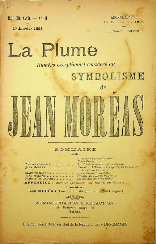
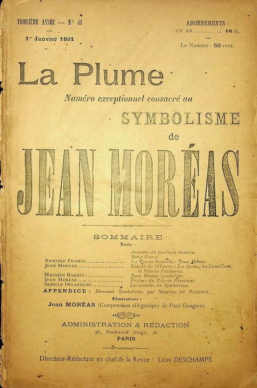
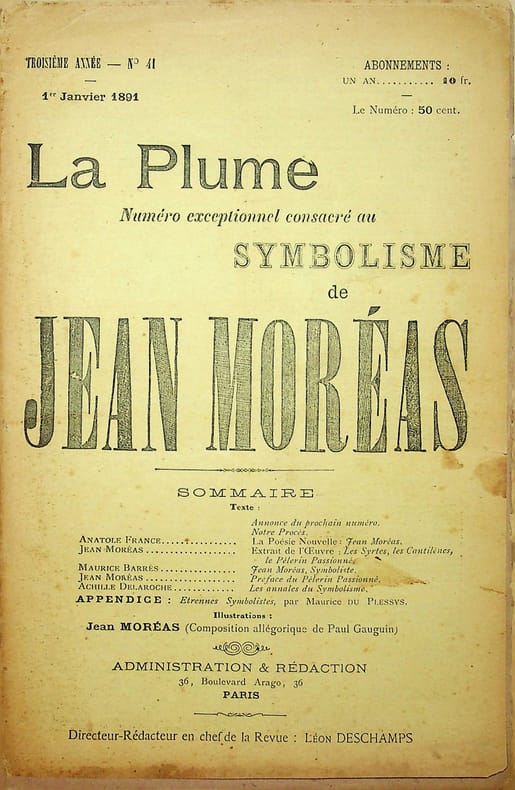
021275[Revue La Plume, Collectif dont] Paul Gauguin, Anatole France, Jean Moréas, Maurice Barrès, Maurice du Plessys et Achille Delaroche, La Plume, Revue Littéraire & Artistique - n°41 du 1er janvier 1891 - numéro exceptionnel consacré au Symbolisme de Jean Moréas. Paris, 1891. In-8, paginé 1 à 20 [saut de pagination de 8 à 13 sans manque]. Fameuse revue Fin-de-Siècle publiant essentiellement de l'inédit. Portrait (lithographie) de Jean Moréas par Paul Gauguin (compris dans la pagination pour 9/10 ou 11/12). Broché. Couvertures détachées, rousseurs, petite mouillure en marge de la lithographie. Très rare lithographie originale et d'époque de Gauguin. [I]
021276[Revue La Plume, Collectif dont] Paul Gauguin, Anatole France, Jean Moréas, Maurice Barrès, Maurice du Plessys et Achille Delaroche, La Plume, Revue Littéraire & Artistique - n°41 du 1er janvier 1891 - numéro exceptionnel consacré au Symbolisme de Jean Moréas. Paris, 1891. In-8, paginé 1 à 20 [saut de pagination de 8 à 13 sans manque]. Fameuse revue Fin-de-Siècle publiant essentiellement de l'inédit. Portrait (lithographie) de Jean Moréas par Paul Gauguin (compris dans la pagination pour 9/10 ou 11/12). Broché. Exemplaire dérelié, couverture salie, lithographie collée en bordure. Très rare lithographie originale et d'époque de Gauguin. [II]
021337[Revue La Plume, Collectif dont] Paul Gauguin, Anatole France, Jean Moréas, Maurice Barrès, Maurice du Plessys et Achille Delaroche, La Plume, Revue Littéraire & Artistique - n°41 du 1er janvier 1891 - numéro exceptionnel consacré au Symbolisme de Jean Moréas. Paris, 1891. In-8, paginé 1 à 20 [saut de pagination de 8 à 13 sans manque]. Fameuse revue Fin-de-Siècle publiant essentiellement de l'inédit. Portrait (lithographie) de Jean Moréas par Paul Gauguin (compris dans la pagination pour 9/10 ou 11/12). Broché. Couverture tachée, pli de la couverture en partie ouvert. Manque à la couverture arrière. Très rare lithographie originale et d'époque de Gauguin. [III]
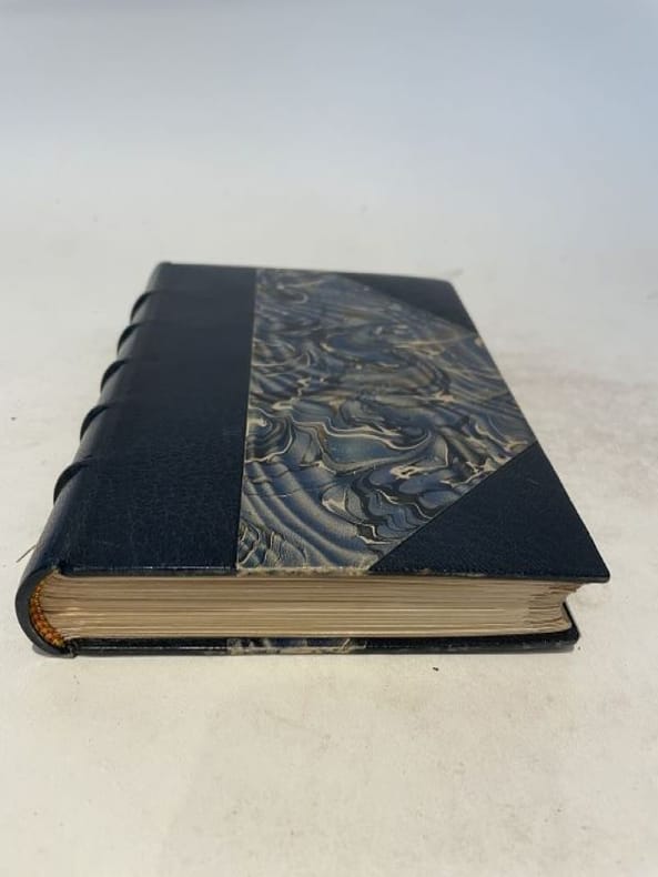
1909115836Paris Félix Juven 1909 1 vol. relié in-12, demi-maroquin bleu nuit à coins, dos à nerfs, tête dorée, non rogné, couvertures et dos conservés (E. Carayon), VII + 258 pp. Édition originale. L'histoire d'une jeune fille de Lorraine et d'un professeur allemand, au temps de l'annexion qui suit la défaite de 1870. Très bel exemplaire, un des 25 de tête numérotés sur Japon (n°23), finement relié à l'époque, enrichi en page de garde d'un envoi autographe signé de l'auteur à un militaire, daté de 1909, et truffé d'une carte postale présentant une vue du vieux Metz. En parfaite condition.
1909115836Paris Félix Juven 1909 1 vol. relié in-12, demi-maroquin bleu nuit à coins, dos à nerfs, tête dorée, non rogné, couvertures et dos conservés (E. Carayon), VII + 258 pp. Édition originale. L'histoire d'une jeune fille de Lorraine et d'un professeur allemand, au temps de l'annexion qui suit la défaite de 1870. Très bel exemplaire, un des 25 de tête numérotés sur Japon (n°23), finement relié à l'époque, enrichi en page de garde d'un envoi autographe signé de l'auteur à un militaire, daté de 1909, et truffé d'une carte postale présentant une vue du vieux Metz. En parfaite condition.
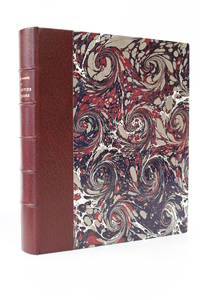
190353153Paris: Félix Juven 1903. Fine. Félix Juven Paris 1903 16 x 19 cm relié First edition one of 20 numbered copies on Japan paper the tirage de tête. Half maroon morocco over marbled paper boards by P. Goy & C. Vilaine spine in six compartments maroon paper pastedowns and endpapers covers preserved top edge gilt. A fine well-margined copy in a lovely binding. Félix Juven hardcover
41513Paris, Les Bibliophiles Franco-Suisses, 1941. Gr. in-4°, 321p. Reliure plein maroquin brun, dos à 4 nerfs avec titre doré à froid, encadrements dorés sur les plats, filet doré sur les coupes, gardes doublées de maroquin vert, tête dorée, sous étui bordé doublé de velours [signée J. Ogiez].
1779M8840London: Des Barres Joseph F.W. 1779. Very Good lower margin extended. Laid down on acid free paper for long term preservation. . Notes: This map of the Keppell Knowles Tangier Saunder's and Deane harbours found on Cape Breton Island in Nova Scotia appears in The Atlantic Neptune an important cartographic work published by De Barres. <br><br>Colonel Joseph Frederick Wallet DesBarres 1721 – 1824 was a hydrographer cartographer military engineer and landscape artist who served in the Seven Years War in part as the aide-de-camp to General James Wolfe. He also created the monumental four volume Atlantic Neptune which was the most important collection of maps charts and views of North America published in the eighteenth century. Finally he was the Governor of Cape Breton Island and Prince Edward Island. Size : 620x930 mm 24.41x36.61 Inches Coloring: Original faint Hand Coloring Category: Maps Canada East Nova Scotia; Des Barres, Joseph F.W. unknown
178134986London: J. F. W. Des Barres 1781. Engraved with aquatint on single double-page sheet watermarked "J. Bates." Excellent condition with minor repairs along centerfold. Detailed depiction of the mouth of the Miramachi River in New Brunswick and Miramachi Bay in the Gulf of St. Larwence.<br/> <br/> Des Barres of Swiss-Huguenot extraction studied under the great mathematician Daniel Bernoulli at the University of Basel before continuing on to the Royal Military College at Woolwich. Upon the outbreak of hostilities with France in 1756 he joined the British Royal American Regiment as a military engineer. He came to the attention of General James Wolfe who appointed him to join his personal detail. During this period he also worked with the future legendary explorer James Cook on a monumental chart of the St. Lawrence River. From 1762 Des Barres was enlisted to survey the coastlines of Nova Scotia Newfoundland and the Gulf of St. Lawrence while his colleague Samuel Holland charted the New England coast. He also managed to gain access to some surveys of the American South Cuba and Jamaica. In 1774 Des Barres returned to England where he began work on The Neptune. His dedication to the project was so strong that often at his own expense he continually updated and added new charts and views up until 1784. That year he returned to Canada where he remained for a further forty years becoming a senior political figure and a wealthy land owner and living to the advanced age of 103. The Atlantic Neptune the most celebrated sea atlas contained the first systematic survey of the east coast of North America. Des Barres's synergy of great empirical accuracy with the peerless artistic virtue of his aquatint views created a work that "has been described as the most splendid collection of charts plates and views ever published" National Maritime Museum Catalogue. Upon the conclusion of the Seven Years War Britain's empire in North America was greatly expanded and this required the creation of a master atlas featuring new and accurate sea charts for use by the Royal Navy. Des Barres was charged with this Herculean task publishing the first volume in London in 1775 which was soon followed by three further volumes. Des Barres's monumental endeavor eventually featured over two-hundred charts and views many being found in several states. Des Barres's charts were immensely detailed featuring both hydrographical and topographical information and in many cases remained the most authoritative maps of the regions covered for several decades. The survey of the St. Lawrence River and Gulf was conducted by Samuel Holland who provided many charts to the immense hydrographic enterprise realized in the Atlantic Neptune. This is the fourth state of the map with the imprint date changed to 1781.<br/> <br/> HNS 131D; Spendlove The Face of Early Canada Chapter 4: "J.F.W. Des Barres and The Atlantic Neptune"; pp. 18-22; Debard "The Family Origins of Joseph Fredericks Wallet Des Barres: A Riddle Finally Solved" Nova Scotia Historical Review Vol 14 No. 2 1994 p.15. J. F. W. Des Barres unknown
1779M10469London 1779. Very Good wide margins. Notes: With oval shaped Inset View showing Cape Spry N. NE… Beaver Isles… Westermost Ledge of Pegasus Wing East.<br><br>The Atlantic Neptune published for the Royal Navy of Great Britain in London 1774-1781. It included a comprehensive survey of the coasts of Nova Scotia the coasts and harbors of the Gulf and River of St. Lawrence and the Atlantic coast of North America including New York to Mexico and New England. Size : 723x1035 mm 28.46x40.75 Inches Coloring: Original Outline Coloring Category: Maps Canada East Nova Scotia; unknown
178134986London: J. F. W. Des Barres 1781. Engraved with aquatint on single double-page sheet watermarked "J. Bates." Excellent condition with minor repairs along centerfold. Detailed depiction of the mouth of the Miramachi River in New Brunswick and Miramachi Bay in the Gulf of St. Larwence.<br/> <br/>Des Barres of Swiss-Huguenot extraction studied under the great mathematician Daniel Bernoulli at the University of Basel before continuing on to the Royal Military College at Woolwich. Upon the outbreak of hostilities with France in 1756 he joined the British Royal American Regiment as a military engineer. He came to the attention of General James Wolfe who appointed him to join his personal detail. During this period he also worked with the future legendary explorer James Cook on a monumental chart of the St. Lawrence River. From 1762 Des Barres was enlisted to survey the coastlines of Nova Scotia Newfoundland and the Gulf of St. Lawrence while his colleague Samuel Holland charted the New England coast. He also managed to gain access to some surveys of the American South Cuba and Jamaica. In 1774 Des Barres returned to England where he began work on The Neptune. His dedication to the project was so strong that often at his own expense he continually updated and added new charts and views up until 1784. That year he returned to Canada where he remained for a further forty years becoming a senior political figure and a wealthy land owner and living to the advanced age of 103. The Atlantic Neptune the most celebrated sea atlas contained the first systematic survey of the east coast of North America. Des Barres's synergy of great empirical accuracy with the peerless artistic virtue of his aquatint views created a work that "has been described as the most splendid collection of charts plates and views ever published" National Maritime Museum Catalogue. Upon the conclusion of the Seven Years War Britain's empire in North America was greatly expanded and this required the creation of a master atlas featuring new and accurate sea charts for use by the Royal Navy. Des Barres was charged with this Herculean task publishing the first volume in London in 1775 which was soon followed by three further volumes. Des Barres's monumental endeavor eventually featured over two-hundred charts and views many being found in several states. Des Barres's charts were immensely detailed featuring both hydrographical and topographical information and in many cases remained the most authoritative maps of the regions covered for several decades. The survey of the St. Lawrence River and Gulf was conducted by Samuel Holland who provided many charts to the immense hydrographic enterprise realized in the Atlantic Neptune. This is the fourth state of the map with the imprint date changed to 1781.<br/> <br/>HNS 131D; Spendlove The Face of Early Canada Chapter 4: "J.F.W. Des Barres and The Atlantic Neptune"; pp. 18-22; Debard "The Family Origins of Joseph Fredericks Wallet Des Barres: A Riddle Finally Solved" Nova Scotia Historical Review Vol 14 No. 2 1994 p.15. J. F. W. Des Barres unknown books
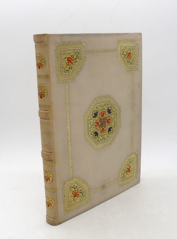
22509Paris, pour les Cent bibliophiles, 1922. In-4, 171 pp., maroquin gris clair de René Kieffer, plats mosaïqués de pièce vertes, bleues et rouge et ornés de motifs dorés, dos à nerfs orné de même, encadrement intérieur orné de même, doublure et garde de soie Madras, tête dorée, couverture conservée, chemise de demi-maroquin à bande lie-de-vin doublée de basane havane, étui bordé (minuscules épidermures et frottements éparses, rares taches).
190353153Félix Juven | Paris 1903 | 16 x 19 cm | relié
1922421411922 Paris. Les Cent Bibliophiles. 1922. 1 volume in-8 , plein maroquin bleu, triple filet doré s’entrelaçant en encadrement sur les plats, dos à nerfs orné légèrement passé, titre doré, tranches dorées, bordures intérieures ornées de motifs dorés, couvertures et dos conservés. Reliure signée Yseux suc. Thierry Simier.
196921834Sierre, 1969. In-folio de [72] pages, couverture imprimée, chemise et étui de l'éditeur.