Barres, MauriceBiblio.com

2 783 résultats
1016316089.Ghardcover. Good. Access codes and supplements are not guaranteed with used items. May be an ex-library book. hardcover
1331775663.Gpaperback. Good. Access codes and supplements are not guaranteed with used items. May be an ex-library book. paperback
1915119903London: T. Fisher Unwin 1915. Softcover. VG clean and tight but for ex-lib. stamp on front cover and a bit of age discoloration. Ivory paper wraps stapled with red lettering and border; 41 pp. Contents include The Savage Onslaught of the Inferior Race The Soul of the Ruins The Mass on the Graves of Victory Burnt Villages Spring Awakening among the Ruins and The Village in the Forest. T. Fisher Unwin paperback books
6700654Columbia University Press pp. 400 . Papeback. New. Columbia University Press unknown
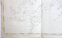
17763748<b>Striking Casco Bay Chart from the Atlantic Neptune 1776</b><br /><br />This is an exceptional chart of the coast of Maine between Cape Elizabeth and Popham from the early Revolutionary War period. It is from Des Barres' monumental <i>Atlantic Neptune</i> a sea atlas published by the British Admiralty during the last quarter of the 18th century. The <i>Atlantic Neptune</i> has been called "the most splendid collection of charts plans and views ever published." <br /><br />The present chart includes all of Casco Bay naming the larger islands and extends east to include Seguin "Segevin Island" and Georgetown Islands. Among the numerous geographic features named are Great Jebieg Chebeague Merrymeeting Bay Segadahock River Arrowsick Island and Halfway Road i.e. Rock. Roads are shown on the chart as are individual buildings. <br /><br />The chart is dated July___ 1776 i.e. with a prominent space after the month as if a date were going to be inserted. There is no type-stamped "15" at the upper right as called for in some copies of state "b" of the Stevens Catalogue. <br /><br />The chart was folded into four vertical panels about 30 1/4 x 12" to accommodate being "bound up in tall narrow form" Stevens' Catalogue p. vii. The chart paper has the LVG watermark consistent with the earlier issues of the chart. <br />A scarce early state of a desirable chart. <br /><br /><b>References:</b> Stevens <i>Catalogue of the Atlantic Neptune</i>: 105 State: b. Sellers & Van Ee <i>Maps and Charts of North America and the West Indies</i> 1750-1789: 855. <br /><br /><b>Condition: </b>A wonderfully clean example of a striking chart of Casco Bay.<br /><br />ICN 3763. From The Atlantic Neptune.
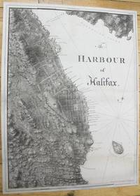
1781M10024London c.1781. Very good few marginal tears expertly repaired; backed on acid free tissue paper for long term preservation. Notes: scarce and superb sea chart constructed for the use of the British Navy shows The Harbour of Halifax Nova Scotia during the late 18th century. <br><br>Colonel Joseph Frederick Wallet DesBarres 1721 – 1824 was a hydrographer cartographer military engineer and landscape artist who served in the Seven Years War in part as the aide-de-camp to General James Wolfe. He also created the monumental four volume Atlantic Neptune which was the most important collection of maps charts and views of North America published in the eighteenth century. Finally he was the Governor of Cape Breton Island and Prince Edward Island. Size : 837x616 mm 32.95x24.25 Inches Coloring: Black & White Category: Maps City Maps; Maps Canada East Nova Scotia; unknown
1019854731.Ghardcover. Good. Access codes and supplements are not guaranteed with used items. May be an ex-library book. hardcover
2007SONG0548068844Kessinger Publishing 2007-07-25. hardcover. Used: Good. 6.00x0.88x9.00. Buy with confidence. Excellent Customer Service & Return policy. Kessinger Publishing hardcover
0548068844.Ghardcover. Good. Access codes and supplements are not guaranteed with used items. May be an ex-library book. hardcover
116337850X.Ghardcover. Good. Access codes and supplements are not guaranteed with used items. May be an ex-library book. hardcover
1498027067.Gpaperback. Good. Access codes and supplements are not guaranteed with used items. May be an ex-library book. paperback
1162786930.Gpaperback. Good. Access codes and supplements are not guaranteed with used items. May be an ex-library book. paperback
1419129996.Gpaperback. Good. Access codes and supplements are not guaranteed with used items. May be an ex-library book. paperback
2007DADAX0548068844Kessinger Publishing 2007-07-25. hardcover. New. 6.00x0.88x9.00. Buy with confidence. Excellent Customer Service & Return policy. Kessinger Publishing hardcover
1330087615.Gpaperback. Good. Access codes and supplements are not guaranteed with used items. May be an ex-library book. paperback
0656492171.Ghardcover. Good. Access codes and supplements are not guaranteed with used items. May be an ex-library book. hardcover
5326960-nnew. unknown
5326960like new. unknown
B9781498027069Paperback / softback. New. paperback
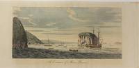
177913202London: Published by J.F.W. Des Barres in 'The Atlantic Neptune' 1779. Etching with aquatint printed in sepia coloured by hand. Printed on laid paper with `J Bates' watermark and `JB' countermark. Small tears to fold repaired tear to plate mark. A large-scale view of the entrance to the harbour at Louisbourg from one of the most important North American marine atlases.<br/> <br/>This very fine view is taken from the sea with the harbour mouth in the foreground and in the background the spires and roofs of the town and fort of Louisbourg the port of entry to Cape Breton county Nova Scotia. As usual Des Barres has added rowing boats and ships to give the viewer the correct sense of scale. Des Barres of Swiss-Huguenot extraction studied under the great mathematician Daniel Bernoulli at the University of Basel before continuing on to the Royal Military College at Woolwich. Upon the outbreak of hostilities with France in 1756 he joined the British Royal American Regiment as a military engineer. He came to the attention of General James Wolfe who appointed him to join his personal detail. During this period he also worked with the future legendary explorer James Cook on a monumental chart of the St. Lawrence River. From 1762 Des Barres was enlisted to survey the coastlines of Nova Scotia Newfoundland and the Gulf of St. Lawrence while his colleague Samuel Holland charted the New England coast. He also managed to gain access to some surveys of the American South Cuba and Jamaica. In 1774 Des Barres returned to England where he began work on The Neptune. His dedication to the project was so strong that often at his own expense he continually updated and added new charts and views up until 1784. That year he returned to Canada where he remained for a further forty years becoming a senior political figure and a wealthy land owner and living to the advanced age of 103. The Atlantic Neptune the most celebrated sea atlas contained the first systematic survey of the east coast of North America. Des Barres's synergy of great empirical accuracy with the peerless artistic virtue of his aquatint views created a work that "has been described as the most splendid collection of charts plates and views ever published" National Maritime Museum Catalogue. Upon the conclusion of the Seven Years War Britain's empire in North America was greatly expanded and this required the creation of a master atlas featuring new and accurate sea charts for use by the Royal Navy. Des Barres was charged with this Herculean task publishing the first volume in London in 1775 which was soon followed by three further volumes. Des Barres's monumental endeavor eventually featured over two-hundred charts and views many being found in several states. Des Barres's charts were immensely detailed featuring both hydrographical and topographical information and in many cases remained the most authoritative maps of the regions covered for several decades.<br/> <br/>Spendlove The Face of Early Canada Chapter 4: "J.F.W. Des Barres and The Atlantic Neptune"; pp. 18-22; National Maritime Museum Greenwich Henry Newton Stevens Collection: 65C; Debard "The Family Origins of Joseph Fredericks Wallet DesBarres: A Riddle Finally Solved" Nova Scotia Historical Review Vol 14 No. 2 1994 p.15. Published by J.F.W. Des Barres in 'The Atlantic Neptune' unknown books
17793603London: Published by J.F.W. Des Barres in 'The Atlantic Neptune' 1779. Etching with aquatint printed in sepia. Printed on laid paper with `J Bates' watermark and `JB' countermark. A large-scale view of the entrance to the harbour at Louisbourg from 'The Atlantic Neptune' the first British sea atlas of her North American colonies<br/> <br/>A fine view of the harbour of Louisbourg the former "impregnable" fortress that was the gateway to French America and the scene of two great battles between France and Britain in 1748 and 1758. The scene depicted here features ships sailing into the excellent natural harbour surrounded by a ruggedly beautiful landscape. This is the third state of this view and is identical to the Henry Stevens Collection variant 65C in the National Maritime Museum Greenwich. Des Barres studied under the great mathematician Daniel Bernoulli at the University of Basel before continuing on to the Royal Military College at Woolwich. On the outbreak of the Seven Years war in 1756 he joined the British Royal American Regiment as a military engineer. He came the attention of General James Wolfe who appointed him to be his aide-de-camp. From 1762 Des Barres was enlisted to survey the coastlines of Nova Scotia Newfoundland and the Gulf of St.Lawrence while his colleague Samuel Holland charted the New England coast. In 1774 Des Barres returned to England where he began work on the Neptune. His dedication to the project was so strong that often at his own expense he continually updated and added new charts and views up until 1784. That year he returned to Canada where he remained for a further forty years becoming a senior political figure and a wealthy land owner and living to the advanced age of 103. The Atlantic Neptune was the first British sea atlas of her North American colonies and one of the most important achievements of eighteenth century cartography. With an official commission from the Royal Navy Des Barres published the first volume in London in 1775 which was soon followed by further volumes. Des Barres' monumental endeavor eventually featured over two-hundred charts and aquatint views many being found in several states. All of the charts were immensely detailed featuring both hydrographical and topographical information. Des Barres' plates were used to print further editions up into the first decade of the nineteenth-century. The Neptune met with the highest acclaim from the beginning and is today widely regarded as superior to all other atlases produced during its time.<br/> <br/>Spendlove The Face of Early Canada Chapter 4: "J.F.W. Des Barres and The Atlantic Neptune"; pp. 18-22; Debard "The Family Origins of Joseph Fredericks Wallet Des Barres: A Riddle Finally Solved" Nova Scotia Historical Review Vol 14 No. 2 1994 p.15; National Maritime Museum: Henry Stevens Collection: K0206 HNS 65C. Published by J.F.W. Des Barres in 'The Atlantic Neptune' unknown books
1779P2446London 1779. Very Good. Image Size : 200x424 mm 7.87x16.69 Inches Platemark Size : Paper Size : 265x555 mm 10.43x21.85 Inches Coloring: Hand Colored Medium: Aquatint Categories: Views Canada Nova Scotia; unknown
177913202London: Published by J.F.W. Des Barres in 'The Atlantic Neptune' 1779. Etching with aquatint printed in sepia coloured by hand. Printed on laid paper with `J Bates' watermark and `JB' countermark. Small tears to fold repaired tear to plate mark. A large-scale view of the entrance to the harbour at Louisbourg from one of the most important North American marine atlases.<br/> <br/> This very fine view is taken from the sea with the harbour mouth in the foreground and in the background the spires and roofs of the town and fort of Louisbourg the port of entry to Cape Breton county Nova Scotia. As usual Des Barres has added rowing boats and ships to give the viewer the correct sense of scale. Des Barres of Swiss-Huguenot extraction studied under the great mathematician Daniel Bernoulli at the University of Basel before continuing on to the Royal Military College at Woolwich. Upon the outbreak of hostilities with France in 1756 he joined the British Royal American Regiment as a military engineer. He came to the attention of General James Wolfe who appointed him to join his personal detail. During this period he also worked with the future legendary explorer James Cook on a monumental chart of the St. Lawrence River. From 1762 Des Barres was enlisted to survey the coastlines of Nova Scotia Newfoundland and the Gulf of St. Lawrence while his colleague Samuel Holland charted the New England coast. He also managed to gain access to some surveys of the American South Cuba and Jamaica. In 1774 Des Barres returned to England where he began work on The Neptune. His dedication to the project was so strong that often at his own expense he continually updated and added new charts and views up until 1784. That year he returned to Canada where he remained for a further forty years becoming a senior political figure and a wealthy land owner and living to the advanced age of 103. The Atlantic Neptune the most celebrated sea atlas contained the first systematic survey of the east coast of North America. Des Barres's synergy of great empirical accuracy with the peerless artistic virtue of his aquatint views created a work that "has been described as the most splendid collection of charts plates and views ever published" National Maritime Museum Catalogue. Upon the conclusion of the Seven Years War Britain's empire in North America was greatly expanded and this required the creation of a master atlas featuring new and accurate sea charts for use by the Royal Navy. Des Barres was charged with this Herculean task publishing the first volume in London in 1775 which was soon followed by three further volumes. Des Barres's monumental endeavor eventually featured over two-hundred charts and views many being found in several states. Des Barres's charts were immensely detailed featuring both hydrographical and topographical information and in many cases remained the most authoritative maps of the regions covered for several decades.<br/> <br/> Spendlove The Face of Early Canada Chapter 4: "J.F.W. Des Barres and The Atlantic Neptune"; pp. 18-22; National Maritime Museum Greenwich Henry Newton Stevens Collection: 65C; Debard "The Family Origins of Joseph Fredericks Wallet DesBarres: A Riddle Finally Solved" Nova Scotia Historical Review Vol 14 No. 2 1994 p.15. Published by J.F.W. Des Barres in 'The Atlantic Neptune' unknown
17793603London: Published by J.F.W. Des Barres in 'The Atlantic Neptune' 1779. Etching with aquatint printed in sepia. Printed on laid paper with `J Bates' watermark and `JB' countermark. A large-scale view of the entrance to the harbour at Louisbourg from 'The Atlantic Neptune' the first British sea atlas of her North American colonies<br/> <br/> A fine view of the harbour of Louisbourg the former "impregnable" fortress that was the gateway to French America and the scene of two great battles between France and Britain in 1748 and 1758. The scene depicted here features ships sailing into the excellent natural harbour surrounded by a ruggedly beautiful landscape. This is the third state of this view and is identical to the Henry Stevens Collection variant 65C in the National Maritime Museum Greenwich. Des Barres studied under the great mathematician Daniel Bernoulli at the University of Basel before continuing on to the Royal Military College at Woolwich. On the outbreak of the Seven Years war in 1756 he joined the British Royal American Regiment as a military engineer. He came the attention of General James Wolfe who appointed him to be his aide-de-camp. From 1762 Des Barres was enlisted to survey the coastlines of Nova Scotia Newfoundland and the Gulf of St.Lawrence while his colleague Samuel Holland charted the New England coast. In 1774 Des Barres returned to England where he began work on the Neptune. His dedication to the project was so strong that often at his own expense he continually updated and added new charts and views up until 1784. That year he returned to Canada where he remained for a further forty years becoming a senior political figure and a wealthy land owner and living to the advanced age of 103. The Atlantic Neptune was the first British sea atlas of her North American colonies and one of the most important achievements of eighteenth century cartography. With an official commission from the Royal Navy Des Barres published the first volume in London in 1775 which was soon followed by further volumes. Des Barres' monumental endeavor eventually featured over two-hundred charts and aquatint views many being found in several states. All of the charts were immensely detailed featuring both hydrographical and topographical information. Des Barres' plates were used to print further editions up into the first decade of the nineteenth-century. The Neptune met with the highest acclaim from the beginning and is today widely regarded as superior to all other atlases produced during its time.<br/> <br/> Spendlove The Face of Early Canada Chapter 4: "J.F.W. Des Barres and The Atlantic Neptune"; pp. 18-22; Debard "The Family Origins of Joseph Fredericks Wallet Des Barres: A Riddle Finally Solved" Nova Scotia Historical Review Vol 14 No. 2 1994 p.15; National Maritime Museum: Henry Stevens Collection: K0206 HNS 65C. Published by J.F.W. Des Barres in 'The Atlantic Neptune' unknown
The divisive case of Captain Alfred Dreyfus, arrested in 1894 for giving military secrets to the Germans. One of the Problems and Perspectives in History Series. 140 pages. Index to Sources and Index. Small surface loss area on spine.