2 781 résultats
05696London: S. W. Fores 1800. The Rarest Woodward of All<br /> London Is No Place To Be In The Summer<br /> <br /> WOODWARD George Moutard designer. SANSON Francis engraver. Every Body Out Of Town exemplified in six characteristic prints and illustrative labels with Every Body In Town exemplified in six characteristic prints and illustrative labels. London: S.W. Fores 1800. <br /> <br /> Second editions originally published by Woodward himself in 1794/1796. Quarto 10 1/8 x 8 3/8 in; 259 x 213 mm. Twelve hand-colored engraved plates 9 x 7 1/2 in; 297 x 192 mm two hand-colored engraved title-pages each imprinted Feb. 14 1800 and mounted on fourteen quarto sheets 133/4 x 18 1/4 in; 349 x 470 mm of various colors. Four blank leaves at rear folded blank quarto sheet inserted in rear pocket. <br /> <br /> Bound in contemporary full maroon morocco with double gilt fillets enclosing extravagantly blindstamped covers with an outer frame of floral and foliate motifs volutes curls with bacchants along lower edge an inner rolled frame and a central panel with center lozenge within an elaborately blocked medallion. Pocket to rear cover. Astonishingly bright clean and very fine. Housed in a felt-lined half maroon morocco over gray cloth clamshell case spine with five raised bands ruled and lettered in gilt in compartments.<br /> <br /> OCLC records one copy of the 1800 edition of Every Body Out of Town and only two copies of the 1800 edition of Every Body In Town in institutional holdings worldwide. Not found in the British Museum's collection of satirical prints. According to the ABPC Index the last time either title came to auction was in 1942 Every Body Out of Town 1800 and 1923 Every Body In Town 1800. <br /> <br /> These 1800 reprints are rarer than the original issues. They are also larger than the 1794-1796 first issues which measured only 7 7/8 x 6 5/8 inches 200 x 170 mm.<br /> <br /> Of George Murgatroyd Woodward 1760-1809 caricaturist and author the DNB notes that he "later known as Mustard George grew up in a Derbyshire town living with his father and to judge by the evidence of his later writings received a sound education. He took early to caricature ridiculing his neighbours in Derbyshire; a folio of these drawings dated 1781 is in the Derby Local Studies Library among a sizable collection of his prints drawings and book illustrations. His caricatures having caused something of a local stir he persuaded his father to let him seek his fortune in London.<br /> <br /> "Apart from two caricature prints dated 1785 designed by Woodward and published by him from 28 Cary Street Lincoln's Inn London it was not until 1790 that he made an impact on the London scene. Thereafter his output was copious. The British Museum catalogues list 525 examples of his work from the next twenty years published by Holland Fores Ackermann and latterly Tegg all leading printsellers. These prints designed by Woodward are etched by others-Rowlandson who was his friend and drinking companion Isaac Cruikshank Roberts and Williams. Woodward's original drawings are vigorous. and his value lay in his humorous ideas.<br /> <br /> "Woodward.might have rivalled Hogarth. Certainly his collaboration with Rowlandson constituted a lively if frivolous commentary on the social scene. Dorothy George described him as 'original prolific varied humorous and good-humoured' and few students of the subject would dispute her conclusion that his death was 'a loss to caricature' George English Political Caricature 1.174" Simon Heneage 'Woodward George Murgatroyd 1760-1809 Oxford Dictionary of National Biography Oxford University Press 2004.<br /> <br /> Etcher and engraver Francis Sanson was active 1784-1799.<br /> <br /> Bobins IV 1365; Gordon Library BC28 BC29; Not in Abbey or Tooley. London: S. W. Fores, 1800 unknown
1595100047AG1595. Paris / London / Antwerp and other places of print c.1595 - 1851. Some stunning examples of hand-coloured copper-engravings plus one manuscript map Tuckey / Congo - Zaire. All of these maps in very good / excellent condition. This collection presents itself for becoming an amazing a meaningful starting-point for an Africana-Collection decoration for a Safari-Lodge interior-design for an Africana-themed library etc. etc. The price includes worldwide free shipping per DHL Express-Courier 2-3 day-delivery. Ask for complete list and images and please also inquire about our amazing book-collection of Africana which would be a great match for this collection of vintage maps. unknown
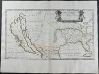
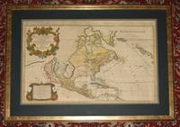
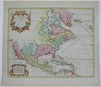
16569429<p>Engraving outlined in original color in the third state with <em>Chez l'Autheur </em>to the cartouche. Sanson's first large format regional map of North America depicting California as an island. The map measures approximately 21.5 x 12.5 in 54.5 x 32 cm with the paper size being 23.5 x 17.75 in 60 x 45 cm. Scarce.</p>
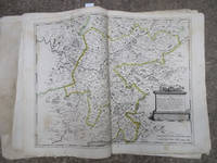
16-6140Paris: 1653. Folio. 30 x 43.2cm. Defective contemporary thick paper covers. Title page and dedication page with losses. Handcolored in outline. One map with loss in lower right corner and one map with tear in lower right corner Sixteen double page maps complete some with waterstains visible verso.Rare to find such a large ensemble of Sanson's maps. Reference: Bibliothèque nationale de France; ark:/12148/btv1b530780775/; Bibliothèque nationale de France département Cartes et plans GE A-592 RES . Paris: 1653. unknown
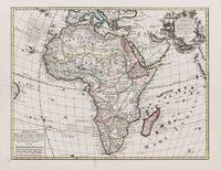
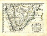
1656B2984Paris: Nicolas Sanson c. 1656. Lower right corner of the first eight leaves strengthened otherwise a very good copy maps and text are clean and crisp. In protective cloth slipcase. Edition: First edition. Binding: Full contemporary calf expertly rebacked with spine in six compartments of raised bands and finely-gilt motifs morocco label on two edges speckled red. Notes: This atlas was dedicated to the Superintendent of Finances at the time Nicolas Fouquet. <br>Regarding a map of South and Central Africa published the year before which bears resemblance to this map of South Africa--‘Pays et Costes des Caffres’--in particular Norwich writes: “This map although a fine example of cartography is based on very little information; for example the desert-like coast of South West Africa is presented as a land rich in rivers. The fictitious states are given fictitious boundaries and the interior is marked with large cities such as Vigiti Magna and Monomotapa. This information led to subsequent exploration in search of these fabulous cities. Although the map is dated three years after the foundation of a settlement at the Cape by Jan van Riebeeck no mention is made of any European settlement anywhere in the south.†Size: 4to Illustration: Recent stencilled title. Complete with 18 maps of Africa and its territories in original outline colour. References: Tooley IV:103; Tooley Africa 100 Peyrounin edition; Norwich 37 & 158. Pages: P. 1-96. Category: Book Africa General; Book Atlas & Cartography Nicolas Sanson hardcover
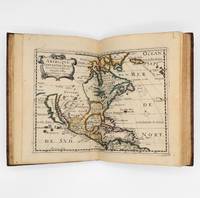
1657375003Paris: Chez L'Autheur 1657. 15 engraved double-page maps hand colored in outline. 4 40 of 42 unpaginated text leaves lacks final two leaves of text. 4to. Contemporary mottled calf gilt raised spine bands repairs at joints. Lacks final two leaves of text after the map of Brazil. 15 engraved double-page maps hand colored in outline. 4 40 of 42 unpaginated text leaves lacks final two leaves of text. 4to. First edition of important and quite handsome 17th-century French atlas of the Americas. This atlas was first published in 1657 and stands as a beautiful cartographic record of America for the 17th century. Sanson was official cartographer to the King. The maps include detailed charts of North South and Central America the West Indies Canada Mexico Florida and the southeast and a map of New Mexico showing most of the Spanish southwest territory with California depicted as an island. An impressive and detailed atlas for the time. The maps are titled as follows:<br /> 1 Americque Septentriole<br /> 2 Le Canada ou Nouvelle France &c.<br /> 3 La Floride<br /> 4 Audience de Mexico<br /> 5 Audience de Guadalajara Nouveau Mexique Californie &c.<br /> 6 Audience de Guatimala<br /> 7 Les Isles Antilles &c.<br /> 8 Amerique Meridionale<br /> 9 Terre Ferme Nouveau royme de Grenade &c.<br /> 10 Guiane divisee en Guiane et Caribane<br /> 11 Le Perou et le cours de la rivre Amazone<br /> 12 Le Chili<br /> 13 Le Brasil<br /> 14 Le Paraguay subdivise en ses principales parties suivant les dernieres relaons<br /> 15 Destroit de Magellan Terre et Isles Magellanicques &c. Sabin 76708; Phillips Atlases 1151; Streeter sale 68 undated edition; Leighley California as an Island plate 9 Chez L'Autheur unknown
000151150Cvi b. Shimshon Tuchfirer. Nachalat Zvi. Venice 1660. In Hebrew. The listing price is for a single volume of this title. The copy is in fair condition without binding. Some imperfections are among the following common defects: holes damaged pages tears water stains foxing worm holes or tracers age spots frayed margins handwritten notes inscriptions censorship stamps. Please contact us for more details on the condition of the book. SKU000151150 unknown
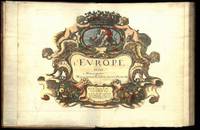
164775287Paris Uten år. 1647-1665. 4to. Samtidig helskinnbind med opphøyde ryggbånd og ryggforgylling. Ryggen rebacked med bruk av den gamle ryggstripen. Håndkolorert gravert dobbeltsidig tittelblad og dedikasjonsblad. Upaginert. 30 bl. Med 12 dobbeltsidige håndkolorerte kart. 4to. Contemporary full calf with raised bands spine gilt. Spine rebacked by using of the old spine. Handcoloured doublepage title and handcoloured doublepage dedication. Not paginated. 30 leaves. With 12 doublepage handcoloured copper engraved maps. Chez Pierre Mariette. Fransk. <br/><br/><em>“Nicolas Sanson le fils 1625 - 1648. Son of Nicolas and his intended heir prevented by his premature death from gunshot wounds. Only three known works. L’Europe 12 maps ca. 1648 compiled by N. Sanson fils engraved by A. Peyrounin theoretically published by Nicolas fils himself but may have been published posthumously by his father republished by Mariette 1660 1665. Tooley’s Dictionary of mapmakers. Revised edition. </em> hardcover
1656006682Paris: Chez l'Autheur 1656. First Edition. Full Calf. Very Good. 4to. 23.5 by 17.5 cm. Unpaginated 100 pages of text plus 2 pp. of ads. With 18 copper engraved maps all two page plates each with hand-colored of boundaries. Maps include one of the entire continent then of its various regions as then known plus the islands off the continent. Also a map of Malta. Bound in contemporary calf. Condition: calf dry and rubbed on spine and joints and edges rubbed. Light to moderate soiling in the margins of the pages. Two bookplates -- one of the Marquis of Lothian the other the Newbattle Abbey Library. Chez l'Autheur unknown
1652006683Paris: Chez l'Autheur 1652. First Edition. Full Calf. Very Good. 4to. 23.5 by 17.5 cm. Unpaginated 102 pages of text plus 2 pp. of ads 1 Royal privilege page. With 17 copper engraved maps all two page plates each with hand-colored of boundaries. Maps include one of the entire continent then of its various regions as then known plus island groups. Separate maps for China and Japan. Bound in contemporary calf. Condition: Rebacked with joints making this obvious. The original spine was re-mounted with some losses. Its blindstamped decoration of fans is discernible but somewhat vague. We think it is possible this decoration had some gilding or color originally but none survives. Still an interesting and unusual feature in our view. Calf dry and rubbed on spine and joints and edges rubbed. Light to moderate soiling in the margins of many pages and on a few pages the soiling invades inward beyond the margins and also in a few instances the marginal soiling is on the heavier side. There are a few archival tape repairs of small chips three on the title leaf one on the following leaf and after that wormhole edge damage was left untouched. That said the defect and repair isn't as glaring as it might sound. The edges elsewhere can have short spans of a chewed appearance. As a book generally we would consider this copy at best Good. As far as the maps go independent of the book we would regard them as Very Good. A few of the maps might individually fall short of such grading; on the other hand all the maps of this copy one can easily imagine someone enthusiastically framing even without an attempt to clean them up. Two bookplates -- one of the Marquis of Lothian the other the Newbattle Abbey Library. Chez l'Autheur unknown
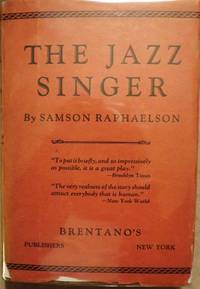
30548Brentano's. RAPHAELSON Samson. THE JAZZ SINGER. NY: Brentano's 1925. Small 8vo. cloth & patterned boards in dust jacket. First Edition. Signed by Raphaelson on the front endpaper and dated Christmas 1925. Basis for the hit play starring George Jessel and Sam Jaffe. The play was later adapted to the famous film starring Al Jolson and Warner Oland. The film generally considered the first "talkie" is certainly one of the milestones in cinematic history. Very Good; some edgewear & shallow chipping number of tears with professional interior repairs d/j. Enclosed in a custom-designed leather and cloth clam-shell box with Al Jolson in black face depicted on the spine and front cover. $4000.00. Brentano's unknown
165676600Paris 1656. 4to. Samtidig mykt helpergamentbind. 100 s. 2 s. annonser. Med 18 dobbeltsidige grensekolorerte kart. 4to. Contemporary limp vellum. Unpaginated. 100 pp. In addition two pages of advertisements. 18 engraved double page maps. Boundaries coloured. Chez l’Autheur. Fransk. <br/><br/><em>Noen få sider med små rifter affiserer ikke teksten eller kartene. Noe gulnet i ytterkantene.A few pages with small tears not affecting text nor maps. Some browning to extremities. Nicolas Sanson d’Abbeville 1600-1667 “considered by many to be the founder of the French school of cartography†Tooley. </em> hardcover
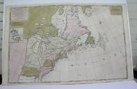
1698M3704Paris 1698. Excellent. Notes: Rather rare original coloured version of this map an important 17th century map of the Great Lakes and East coast with an inset map of Boston.<br><br>Cumming qtd in Arkway: "in spite of its scope and size it has a good deal of information for the Carolina Coast".<br><br>This map by Sanson first appeared in Mortier's sea atlas "Le Neptune Francois"; interestingly it is not generally found in Sanson or Jaillot atlases. Size : 650x924 mm 25.625x36.375 Inches Coloring: Original Hand Coloring Reference: Arkway 58:23 Category: Maps Canada East; Maps United States New England unknown
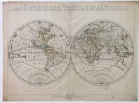
165214178Paris: Sanson 1652. Double hemisphere world map showing the rivers and water bodies of the world. Original outline color. 20 3/4 x 15 3/4". Depicts Australia prior to Tasman's discoveries and labels North Australia "Beach" according to Marco Polo and California as an island. References: Shirley R.W. World 394. Sanson unknown
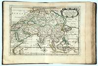
166216493Paris: chez l’Autheur 1662. SECOND EDITION. Complete with 17 double-page engraved maps hand-colored in outline. Contemporary mottled calf corner edges neatly repaired interior has some minor dampstaining mainly on text and on blank verso of maps last blank leaf torn on lower fore-edge. A contemporary signature on first blank leaf. Similar to L’Amerique this atlas of the continent of Asia was first printed in 1652 and reprinted here with a new title page. The maps are all dated 1652 with only one dated 1653 and do not include the address of Mariette. The atlas features maps of India Persia China Japan the Maldives Arabia and the Philippines among others. <br /> <br /> Just prior to publication of this series of works which also included atlases of Europe and Africa Sanson formed a partnership with Pierre Mariette an engraver and printseller. Pursuant to their contract Sanson drew the maps and Mariette engraved and printed them. Each maintained possession of half of the plates and they were allowed to exchange and/or buy from one another. Some bore the address of Sanson others Mariette. But Sanson allowed Mariette to store his plates and Mariette without prior agreement started placing his address on Sanson’s plates. In time a lawsuit which had been prosecuted was settled when both died and their respective sons took over the business.<br /> <br /> This atlas is a fine examples of French mapping by the foremost French cartographer of the seventeenth century. Sanson 1600-1667 “Geographe Ordinaire du Roi†to Louis XIII is considered the founder of French cartography and is generally acknowledged as the originator of the great age of French cartography. chez l’Autheur unknown
2091202133208116Not Available N.A. Soft Cover. Fine. Number of books: 1 Not Available paperback
1680024707London: William Berry 1680. .Kingdoms and States which are found there at present/Described by Sanson/Corrected and amended By William Berry =Kopftitel; Text der figürlich reich verzierten Kartusche oben rechts: Asia Divided into its Principall Regions in which may be seen the extent of the Empires Monarchies Kingdoms and States which at present divide Asia/To the Most serene and Most Sacred Majesty of Charles II./By the Grace of God King of Great Britain France and Ireland/This Map of Asia is humbly Dedicated and Presented By Your Majesties Loyal Subject and Servand William Berry; Text der reich verzierten Kartusche links oben: Scale es folgen Maßstäbe verschiedener Länder/London/Sold by William Berry at the Sign of the Globe between Charing-Cross and White-Hall/1680; SW-Kupferstich-Landkarte nach Nicolas Sanson d'Abbeville gestochen von William Berry; ca. 51 x 39 cm; Falzspuren einige Tintenflecken hauptsächlich ausserhalb des Druckbildes mässige Lichtverfärbung; professionell hinter Glas gerahmt in schwarzem Holzrahmen; äußerst selten; for description in other languages of this extremely rare map please don't hesitate to contact me. . Gut. Landkarte. William Berry unknown
1913238650New York: Privately printed 1913. First edition no. 96 of 200 copies initialed and numbered on the half-title. With frontispiece 19 plates including 2 group portraits double map of Lake George around Bolton Landing at back. 65 pp. 1 vols. 8vo. Original green cloth titled in gilt on upper board. Bixby bookplate of Mohican Point house on front pastedown. Fine. First edition no. 96 of 200 copies initialed and numbered on the half-title. With frontispiece 19 plates including 2 group portraits double map of Lake George around Bolton Landing at back. 65 pp. 1 vols. 8vo. Inscribed on flyleaf "Mr. & Mrs. A. B. P- names partly effaced with sincere regards of Mr. & Mrs. W.K. Bixby St. L. 5/18/14"<br /> "Includes 12 pages of text on fishing for smallmouth bass lake trout and land-locked salmon. one of the few early books to contain as much material on fishing in Lake George" Heller.<br /> An important and rare book. Plum Adirondack Bibliography 568; Bruns S27; Heller 1:716 Privately printed unknown
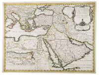
1654G1ADV7RKD7B6Paris 1654. Engraved map 42 x 56 cm coloured in outline. Map of the Turkish Empire showing Ottoman possessions in the Balkans Eastern Mediterranean Egypt and Arabia - marking topography and settlements.l Al Ankary 59; Al-Qasimi 60; Tibbetts 99. unknown
89167Amsterdam Hubert Jaillot Chez Pierre Mortimer et Company. 1692. Copper-engraved map. Engraved surface 34 x 22 inches. Framed with glass and double dark-green and blue mounts. Overall 44 x 33 inches. In very good condition. Stunning large early map of America. Beautifully coloured states and islands with both cartouches and border also coloured. With vertical centre fold/crease. The map lines up in the middle but is slightly offset at top and bottom. A couple of very light minor spots around the main cartouche else map surface is lovely and bright and clean. No offsetting or darkening. A stunning map. With two decorative cartouches with scale. With later hand-colouring. Jaillot's oversized map of North America notable for the large island of California poised off the West Coast first published in 1674. Tooley notes rather critically: “Jaillot who succeeded to Sanson's business makes a rehash of his maps. California is copied from Sanson's map of 1656. The remainder of the map is based on that of 1669. Jaillot retains the 5 lakes with two open at their western ends. He shows New Sweden and New Amsterdam. Curiously he omits Montreal but does insert a few French Missions round the Great Lakes. Large handsome titlepiece with arms of the Dauphin natives and indigenous fauna.” The map was reissued many times and its “long life was to in part to the expense of production for it continued in use long after its geographical information became out of date.” Tooley 37 Plate 44; McLaughlin 55. Amsterdam, Hubert Jaillot, Chez Pierre Mortimer et Company. 1692 unknown
1792M4892Amsterdam 1792. Excellent. Notes: North America revised from the Sanson/Jaillot maps. California is shown as a peninsula but named "isle de California" to the northwest is "Mer de Iesso" and beyond that a small stretch of coastline "Terre de Iesso ou Ieco." The Great Lakes are defined if not with great accuracy a number of settlements in Nouveau Mexico are identified and a R. del Norte flows southwest from a large lake near Taosii to the Gulf of California. Size : 480x580 mm 18.875x22.875 Inches Coloring: Original Hand Coloring Category: Maps North America; Maps Central America; Maps West Indies General unknown
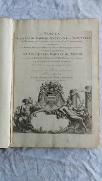
007346Paris Book. Good. Full-Leather. Elephant Folio - over 15 - 23" tall. 106 geographical tables. This copy has tables from various editions with printing dates from 1663 to 1741. The majority of tables date from 1663-1698. Most are in French but many also in Latin. The plates show different versions of the geographical tables. Please inquire for more details. The majority of tables are 20 inches some tables are 16 inches and are pasted on blank pages. The leather binding is worn at the top and bottom of spine and on corners and edges. Hardcover
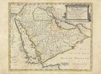
62978Paris Chez Pierre Mariette 1654. Original copper-engraved map of the Arabian Peninsula 43.5 x 59 cm with contemporary outline colour refreshed and adorned with a large columnar style title cartouche. A dark impression. Paper has been washed and strengthened due to foxing. Rare map of the Arabian Peninsula first published in 1654 and one of the first large maps focused specifically on the Arabian Peninsula. Sanson's map of the Arabian Peninsula continued to influence maps of the region throughout the latter part of the 17th century. Here Arabia is divided into three regions: Arabia Petraea the northwestern area encompassing the Sinai Peninsula and Jordan Arabia Deserta the northernmost area just south of the Tigris and Euphrates rivers and Arabia Felix by far the largest territory covering most of the peninsula and extending from the holy cities of Mecca and Medina in the northwest to the coasts of the Arabian Sea and the Gulf of Oman. There is great detail of mountains and rivers although there are clear geographical errors such as the exaggerated extent of the mountain ranges. Numerous villages are depicted including stopping places on the pilgrimage to Mecca Iathreb Badrahenen Gioffa and Cadaid among others as well as towns that appeared for the first time on a map of Arabia Hagair Hadrama Salamia and Iamama. Bahrain is demarcated along the northwestern shore of the Arabian Gulf. Nicolas Sanson was to bring about the rise of French cartography although the fierce competition of the Dutch would last until the end of the century. His success was partly owing to the partnership with the publisher Pierre Mariette. In 1644 the latter had purchased the business of Melchior Tavernier and helped Sanson with financial support in producing the maps. In 1657 Pierre Marriette died however his son also named Pierre co-published Les Cartes Générales de toutes les parties du Monde the following year. It was the first folio French produced world atlas. Tibbetts 98; Ankary p.98 Paris, Chez Pierre Mariette, 1654. unknown
1691M1345Paris 1691. Very Good. Size : 590x885 mm 23.25x34.875 Inches Coloring: Hand Colored in Outline Category: ; Maps South America Continent unknown
1652010748twParis: Sanson. Very Good. 1652. A very rare map from Nicolas Sanson. Imprint bears the date of 1652 although it is possible that this copy came from an atlas in the later 1600s. Light toning and edgewear with one corner slightly chipped. Light soil on lower margin. Hand-colored boundaries. Map borders measure 14" x 20 3/4". California is shown as an island and Terre Australe is a vague line encircling the Antarctic. Terre de Iesso is the name given to the land mass northwest of North America. Sanson 1600-1667 published many map versions of the world and is known as "the father of French cartography." ; 16 1/2" x 22 1/4" . Sanson unknown