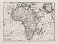
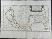
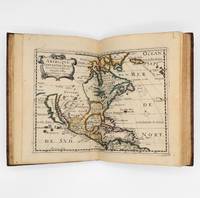
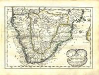
Sanson d'Abbeville NicolasLivre Rare Book
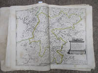
Carte Topographique des Environs de Versailles dite des Chasses Impériales levée et dressée de 1764 à 1773 par les Ingénieurs Géographes des Camps et Armées commandés par feu M. Berthier Colonel leur chef; Terminée en 1807: par ordre de Napoléon Empereur des Français Roi d'Italie et Protecteur de la Confédération du Rhin. Pendant le Ministère de S.A.S.M. le Maréchal Alexandre Berthier Prince de Neuchatel
48819Large atlas of Versailles and the surrounding towns with twelve maps total including one map depicting the overall area covered in the atlas and eleven more detailed maps covering the towns and immediate surroundings of Mantes Poissy St. Denis Crépieres Versailles Paris Montfor l'Amaury Chevreuse Sceaux Rambouillet Arpajon and Corbeil. Very minor scattered soiling or toning very fine condition. Elephant folio sheet size 32 x 22 inches. Original full calf binding with handwritten label affixed to front cover. Some minor scattered soiling and abrasions minor wear consistent with age. Paris Dépôt de la Guerre n.d. circa 1807. This suite of maps was commissioned by Louis XV to represent his hunting territories around Versailles and stemmed from his obsession with hunting coupled with a decision to copy an old map of the Duchy of Rambouillet. The maps are the result of three surveys of the land conducted between 1764 and 1773. The first nine maps including the overview were completed in the late 18th century under the reign of Louis XVI but the work was put on hold at the time of the Revolution when the credits allocated for completing the work were taken away by the National Convention. The last four maps were not completed until 1807 after Napoléon became Emperor. These maps are notable for their precision and the multitude of details represented including roads land use features such as plowing meadows vegetable crops barns and parks and hydrography. For his work on these maps Berthier was granted nobility status. A spectacular and scarce volume of beautiful maps; as of January 2018 WorldCat locates only two holdings in North America. unknown books