105 résultats
1780M5125Paris 1780. Excellent. Size : 490x690 mm 19.25x27.125 Inches Coloring: Hand Colored in Outline Category: ; Maps Asia Middle East Holy Land & Palestine unknown
1705311838Amsterdam: Petrus Schenk 1705. unbound. Map. Engraving with original hand outline. Image measures 18 7/8" x 22 3/4"<br/> <br/> Beautiful map of southeastern Europe extending from Italy to Turkey and from Hungary to Cyprus. Published circa 1705 this map depicts the region during the Ottoman-Habsburg wars. In fair condition. Wear to original centerfold with tape repair and stain at bottom edge. Lower margin worn and frayed not affecting the image. Minor cracking and small loss near center due to oxidization of original viridian green coloring. Some foxing. Publisher's crease to upper right corner. Sold as-is.<br> <br> Petrus Schenk c.1660--1711 was a German engraver and cartographer. He began his training in Amsterdam in the art of mezzotint and soon began working closely with Gerard Valck. The two took advantage of the bustling cartographic trade in the city and quickly expanded their business from portraits and prints into maps and globes. In 1700 Schenk grew the business further by moving to Leipzig Germany and opening a shop. As his sons and grandson returned to the Netherlands to become active engravers as well the Schenk firm developed into one of the best-known publishing houses in 18th-century Amsterdam. This map attests to Schenk's prolific production and skill in both cartographic artistry and business.<br/> <br/> Petrus Schenk unknown
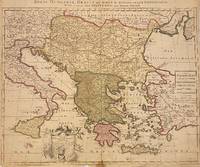
1730910097CGAmsterdam:, Covens u. Mortier, um 1730. Teilkolorierter Kupferstich, 54 x 87 cm, Blattgröße 61 x 87 cm.
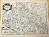
1785M10271Paris c.1785. Very Good. Size : 470x658 mm 18.50x25.91 Inches Coloring: Original Outline Coloring Category: Maps Europe Czech Republic Slovakia; Maps Europe Germany; unknown
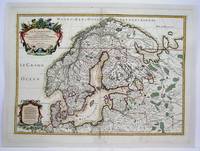
1708M4264Paris 1708. Very Good central fold reinforced mounted on acid free canvas. Size : 474x655 mm 18.625x25.75 Inches Coloring: Hand Colored in Outline Category: ; Maps Europe Scandinavia unknown
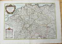
1785M10224Paris: Chez Brion 1785. Very Good. Notes: Detailed large map of Germany with large decorative cartouches. Size : 465x652 mm 18.31x25.67 Inches Coloring: Original Hand Coloring Category: Maps Europe Germany; Chez Brion unknown
1778M4133Paris: Fortin 1778. Very Good. Notes: Map showing Bohemia Silesia Moravia and Lusatia. Size : 420x545 mm 16.5x21.5 Inches Coloring: Hand Colored Category: Maps Europe Poland Lithuania Fortin unknown
170448770Amsterdam, Franciscus Halma, 1704. Folio. (45,5 x 29 cm.). Contemp. full blindtooled Dutch vellum. Raised bands. Spine ends with tears, some cracking along fronthinge, but not loose. Vellum at frontcover a bit soiled. Egraved titlepage (Coxis del., ianen fecit). Printed titlepage in red/black with an engraved vignette. 15,(119),51,(1) pp., 1 engraved plate with portrait and coat of arms. 4 large folded engraved maps. Light yellowing to margins of textleaves, but maps and text fine and clean. (3 of the maps engraved by F. Halma).
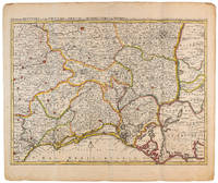
1710009141Amsterdam: Pierre Mortier 1710 Cooper engraving 44.5 x 59.5 cm on paper measuring 54.0 x 64.0 cm with original color in outline minor spotting and creasing remnants of centerfold. A good copy of a map of south-central France the Cévennes Vivarais Occitania published in Amsterdam by Pierre Mortier to illustrate events of the War of the Spanish Succession. Pierre Mortier unknown
1723202384Amsterdam: Mortier Pieter II 1723. unbound. very good. Map. Engraving with hand coloring. Image measures 14.5" x 19.25".<br/> <br/> Includes parts of modern day Morocco Algeria Tunisia and Libya. Nicolas Sanson 1600-1667 is considered the founder of the French school of cartography. In reaction to the prevailing trend of Dutch lavishness Sanson favored minimal details focusing rather on accurate cartography than ornament. Large decorative title cartouche. Map is in good condition with ample margins. Staining along centerfold. Chipped near edges along centerfold.<br/> <br/> Mortier, Pieter II unknown
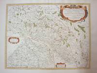
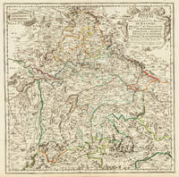
170332775Paris 1703. Tadelloses Exemplar. 420 by 420mm 16½ by 16½ inches. Original antiker Kupferstich in zeitgenössischem Grenzkolrit. Dargestellt wird der bayrische Kreis um 1650 im Norden von Eger bis nach dem benachbarten Insbruck im Süden. Im Westen noch mit Ulm a.d. Donau und im Osten bis Linz. Die einzelnen Bezirksämter u. Bistümer deutlich durch das schöne Grenzkolorit herausgearbeitet. Zeigt Ober- u. Niederbayern sowie die Oberpfalz. Rechts oben große dekorative Rollwerkstitelkartusche links oben kleiner Meilenzeiger. Gestochen von R. Cordier. Nicolas Sanson der Ältere 20. Dezember 1600 in Abbeville Frankreich; 7. Juli 1667 in Paris war ein französischer Kartograph. Seine Vorfahren stammten aus Schottland. In den Jahren 1618 bis 1667 schuf Sanson etwa 300 einzelne Karten sowie Atlanten und illustrierte Texte. Seine Arbeit wurde von seinen Söhnen Nicolas Sanson 1626 Schottland; 27. August 1648 in Paris Adrien Sanson 1708 und Guillaume Sanson 1703 seinem Neffen Pierre Duval 1619; 1683 seinem Enkel Pierre Moulard Sanson 1730 und Gilles Robert de Vaugondy 1688; 1766 fortgeführt. Wikipedia Speculum Orbis/Loeb San.VA53 unknown
1723209708Amsterdam: Mortier Pieter 1723. unbound. very good. Map. Engraving with hand outline. Image measures 14" x 18.75".<br/> <br/> Beautifully detailed map showing the area between the the Black and Caspian Seas including modern day Russia Georgia Azerbaijan Armenia and Turkey. Full original margins have minor stains. Based on the plates by Nicolas Sanson 1600-1667 who is considered the founder of the French school of cartography. In reaction to the prevailing trend of Dutch lavishness Sanson favored minimal details focusing rather on accurate cartography than ornament.<br/> <br/> Mortier, Pieter unknown
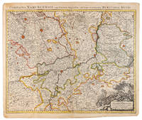
1710009138Amsterdam: Pierre Mortier 1710 Cooper engraving 50.5 x 60.5 cm on paper measuring 54.0 x 63.0 cm with original color in outline minor spotting and creasing remnants of centerfold paper slightly frayed at edges. A good copy of an uncommon map of the province of Namur a region of the Spanish Netherlands published in Amsterdam by Pierre Mortier to illustrate events of the War of the Spanish Succession. Pierre Mortier unknown
170448770Amsterdam Franciscus Halma 1704. Folio. 455 x 29 cm. Contemp. full blindtooled Dutch vellum. Raised bands. Spine ends with tears some cracking along fronthinge but not loose. Vellum at frontcover a bit soiled. Egraved titlepage Coxis del. ianen fecit. Printed titlepage in red/black with an engraved vignette. 15119511 pp. 1 engraved plate with portrait and coat of arms. 4 large folded engraved maps. Light yellowing to margins of textleaves but maps and text fine and clean. 3 of the maps engraved by F. Halma. <br/><br/><em>The maps are the Francois Halma reissues of Sanson's maps from 1683. </em> hardcover
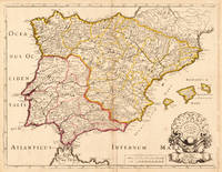
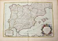
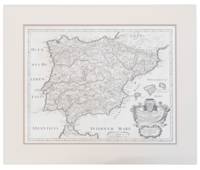
170419604Paris: N. Sanson 1704. Other. In very good condition a slightly creasing in the lower part of the centrefold with minor tiny spots. 410 by 525mm 16¼ by 20¾ inches. 410 by 525mm 16¼ by 20¾ inches. Copper engraving hand colored in outline when published. Interesting and detailed map of ‘Antique SpainÂ’ with Portugal and the Balearic Islands by the French cartographer Nicolaus Sanson d´Abbeville. The map provides us a lot of information of the various place names of cities and small towns the rivers mountains and also engraved borders of the various Spanish provinces. The map impresses with the geographic exactness which is typical for the French cartographer Nicolaus Sanson. In the decorative cartouche which is in shape of a seashell we find the altered date ‘1704Â’ which is a relatively late edition for maps by N. Sanson. The map is probably published in a French composit atlas around this date. N. Sanson unknown
1710M10278Paris: H. Jaillot c.1710. Very Good. Size : 465x655 mm 18.31x25.79 Inches Coloring: Original Hand Coloring Category: Maps Europe Portugal; Maps Europe Spain; H. Jaillot unknown
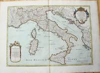
1783M10279Paris: H. Jaillot c.1783. Very Good. Size : 469x655 mm 18.46x25.79 Inches Coloring: Original Hand Coloring Category: Maps Europe Italy; Maps Mediterranean Islands; H. Jaillot unknown
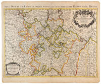
1710009140Amsterdam: Pierre Mortier 1710 Cooper engraving 46.5 x 61.5 cm on paper measuring 54.0 x 64.5 cm with original color in outline minor spotting and creasing remnants of centerfold. A good copy of a map of the Duchy of Lorraine and surrounding territories published in Amsterdam by Pierre Mortier to illustrate events of the War of the Spanish Succession. Pierre Mortier unknown
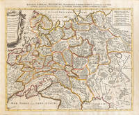
1710009147Amsterdam: Petrus Schenck 1710 Cooper engraving 46.5 x 58.0 cm on paper measuring 51.0 x 63.5 cm with original outline coloring flattened expertly restored and backed with archival tissue paper. The Latin title in the top border reads: "Russiae Albae sive Moscoviae delineatio Geographica accurata et nova…". A good copy of a Moscovie map published in Amsterdam by Petrus Schenck. Petrus Schenck unknown
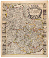
1710009139Amsterdam: Pierre Mortier 1710 Cooper engraving 58.0 x 50.5 cm on paper measuring 63.0 x 54.0 cm with original color in outline minor spotting and creasing remnants of centerfold paper slightly frayed at edges. A good copy of an uncommon map of Savoy and Piedmont published in Amsterdam by Pierre Mortier to illustrate events of the War of the Spanish Succession. Surrounded by twenty-two coats of arms representing various provinces. Pierre Mortier unknown
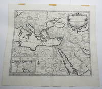
170723156Amsterdam: Pierre Mortier. Very Good with No dust jacket as issued. c.1707. Map. 3 pieces of brown paper tape along upper blank margin.; No date c. 1707. We think this map is possibly from "Le Sainte Bible" edited by David Martin Amsterdam 1707. Dimensions of sheet: 508 x 451mm. Dimensions of printed area: 439 x 368mm. Uncoloured. Copperplate engraved map. Elaborate cartouche. Centrefold. With inset map at lower left "Campemens des Israelites dans le Desert". "The first Pieter Mortier was an 18th-century mapmaker and engraver who was born in Leiden the son of a political refugee from France. He travelled to Paris in 1681-1685 then returned to Amsterdam where he operated as a bookseller from 1685 until 1711. He won the privilege in 1690 of publishing maps and atlases by French publishers in Amsterdam for the Dutch market. He used this privilege to win a similar set of privileges for printing an "illustrated print bible" in 1700." - Wikipedia entry on Pieter or Pierre Mortier accessed October 2021. NB: This map will be posted rolled in a mailing tube. . Pierre Mortier unknown
1713215454Amsterdam: Mortier Pieter 1713. unbound. very good. Map. Engraving with original hand outline. Image measures 14.5" x 18.75".<br/> <br/> Rare map of Paphlagonia an ancient region of northern Anatolia present-day Turkey along the southern coast of the Black Sea. Highlighting the capital city of Sinope this map depicts the region as defined by Strabo: bound by the Parthenius River in the west extending to the Hays river in the east. Sanson depicts the region comprising the Kingdom of Pontus during the rule of Mithridates IV. Neighboring historical regions of Gallatia and Bithynia et Pontus are labeled. Full original margins light scattered foxing. Based on earlier plates by Sanson. This map appeared in "Atlas Antiquus Sacer Ecclesiasticus et Profanus" published in Amsterdam by Pieter Mortier. <br> <br> Nicolas Sanson 1600-1667 who is considered the founder of the French school of cartography. In reaction to the prevailing trend of Dutch lavishness Sanson favored minimal details focusing rather on accurate cartography than ornament. <br> Pierre Mortier 1661-1711 was a Dutch cartographer engraver and printseller who worked in Amsterdam. He used advanced Dutch printing methods to produce high quality editions of contemporary French maps by cartographers such as De L'Isle Sanson Jaillot de Fer and De Wit. His greatest feat was the nautical atlas "Le Neptune Francois" or "Suite de Neptune Francois" considered to contain the most beautiful examples of cartographic art. After his death his widow Amelia continued publishing in partnership with her brother-in-law David until her death in 1719. This map was published during Amelia's tenure at the firm.<br/> <br/> Mortier, Pieter unknown
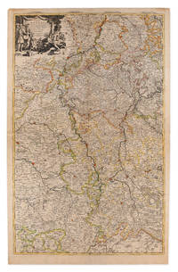
1710009148Amsterdam: Pierre Mortier 1710 Cooper engraving on two joined sheets measuring 59.5 x 95.5 cm with original outline coloring expertly cleaned and flattened. A good copy of a map of western Germany published in Amsterdam by Pierre Mortier to illustrate events of the War of the Spanish Succession. The first state with "2. Carte de la Meuse" added in manuscript. Pierre Mortier unknown
171013749441710. A map of Spain by French cartographer Nicolas Sanson 1600-1667 in a later Italian edition dated 1710. In Excellent condition with even age toning. Double matted. Mat: w 28.25 in. x h 23.5; Map: w 24.25 in. x h 19 in. Shelved at DuPont. 1374944. Arts & Antiques. unknown
1710902221AGAmsterdam:, Pierre Mortier, [um 1710]. Altkolorierter Kupferstich 42,5 x 56,5 cm, Blattgröße 49 x 63 cm.