2 781 résultats
1981G086985206XI3N00Shuter & Shooter Pty Ltd 1981. Paperback. Good. Pages can have notes/highlighting. Spine may show signs of wear. ~ ThriftBooks: Read More Spend Less.Dust jacket quality is not guaranteed. Shuter & Shooter (Pty) Ltd paperback
3346139247.Gpaperback. Good. Access codes and supplements are not guaranteed with used items. May be an ex-library book. paperback
20171-3659613975LAP LAMBERT Academic Publishing 2017. Paperback. New. 176 pages. 8.66x5.91x0.40 inches. LAP LAMBERT Academic Publishing paperback
1696M8798Paris : Pierre Mariette c. 1696. Very Good. Notes: Fine detailed map of the straight of the Bosphorus and the city of Constantinople. Size : 405x528 mm 15.94x20.79 Inches Coloring: Hand Colored Category: Maps Asia Near East Turkey; Pierre Mariette unknown
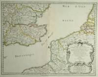
28812Paris: Sanson. 1654. 36.6 x 48 cm. Original outline colour. Double page map of the south east England shown with the adjacent coastline of France and Belgium. Title cartouche to lower right corner. Blank on verso. Wear to centrefold with some loss Paris: (Sanson). 1654 unknown
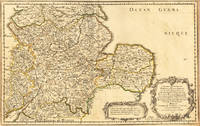
165417463Paris: N. Sanson 1654. Other. In very good condition. 365 by 580mm 14¼ by 22¾ inches. 365 by 580mm 14¼ by 22¾ inches. Copper-engraving handcolored in outline when published. Fine and strong impression of this early decorative mid-seventeenth century map of this English regional map covering the area Chester Darbing Nottingham. by the famous French cartographer Nicolaus Sanson. Very detailled and naming many cities and villages as well many places along the coastline. Showing prominently the eastern part of central England. In the lower right corner with a large floral title cartouche and milage scale. N. Sanson unknown
16546571Paris 1654. Copper engraving 37 x 48 cms modern hand-colour blank verso. Nicolas Sanson 1600-1667 founder of the Sanson dynasty of map-makers is considered by many to be the father of the French school of cartography. He was a prolific and original map-maker admired for the clarity and scientific accuracy of his maps. Map unknown
ria9798218527815_inpPaperback. New. New Book; Fast Shipping from UK; Not signed; Not First Edition; A gray area text"Verily I said unto you. There are some standing here who shall not taste of death till they see the son of Man coming in his kingdom"Heaven's interpretation: When the lord said that there was a rumor that he said that paperback
6202801727.Gpaperback. Good. Access codes and supplements are not guaranteed with used items. May be an ex-library book. paperback
2010DADAX384338746XLAP Lambert Academic Publishing 2010-12-29. paperback. New. 5.91x0.20x8.66. Buy with confidence. Excellent Customer Service & Return policy. LAP Lambert Academic Publishing paperback
384338746X.Gpaperback. Good. Access codes and supplements are not guaranteed with used items. May be an ex-library book. paperback
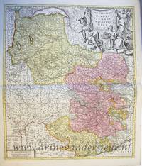
PR120639Map of the States of Savoy Piedmont and Nice. Titled above on the right: ""LES ESTATS DE SAVOYE PIEMONT et le COMTE de NICE Par le Sr: Sanson Geog Ordinaire du Roy.'With address of the publisher on the bottom right: 'a Amsterdam chez Pierre Schenk avec Privilege de .'.On the bottom left the various scales. Hand colored etching and engraving on laid paper; plate mark: 577 x 485 mm total: 625 x 531 mm; besides some smudges along the margins and a folding crease at center in very good condition. unknown
1723202384Amsterdam: Mortier Pieter II 1723. unbound. very good. Map. Engraving with hand coloring. Image measures 14.5" x 19.25".<br/> <br/> Includes parts of modern day Morocco Algeria Tunisia and Libya. Nicolas Sanson 1600-1667 is considered the founder of the French school of cartography. In reaction to the prevailing trend of Dutch lavishness Sanson favored minimal details focusing rather on accurate cartography than ornament. Large decorative title cartouche. Map is in good condition with ample margins. Staining along centerfold. Chipped near edges along centerfold.<br/> <br/> Mortier, Pieter II unknown
8446009811.Gpaperback. Good. Access codes and supplements are not guaranteed with used items. May be an ex-library book. paperback
2006Q-1400070937WaterBrook 2006-08-15. Hardcover. New. In shrink wrap. Looks like an interesting title! WaterBrook hardcover
1025280377.Ghardcover. Good. Access codes and supplements are not guaranteed with used items. May be an ex-library book. hardcover
1025282922.Gpaperback. Good. Access codes and supplements are not guaranteed with used items. May be an ex-library book. paperback
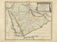
62978Paris Chez Pierre Mariette 1654. Original copper-engraved map of the Arabian Peninsula 43.5 x 59 cm with contemporary outline colour refreshed and adorned with a large columnar style title cartouche. A dark impression. Paper has been washed and strengthened due to foxing. Rare map of the Arabian Peninsula first published in 1654 and one of the first large maps focused specifically on the Arabian Peninsula. Sanson's map of the Arabian Peninsula continued to influence maps of the region throughout the latter part of the 17th century. Here Arabia is divided into three regions: Arabia Petraea the northwestern area encompassing the Sinai Peninsula and Jordan Arabia Deserta the northernmost area just south of the Tigris and Euphrates rivers and Arabia Felix by far the largest territory covering most of the peninsula and extending from the holy cities of Mecca and Medina in the northwest to the coasts of the Arabian Sea and the Gulf of Oman. There is great detail of mountains and rivers although there are clear geographical errors such as the exaggerated extent of the mountain ranges. Numerous villages are depicted including stopping places on the pilgrimage to Mecca Iathreb Badrahenen Gioffa and Cadaid among others as well as towns that appeared for the first time on a map of Arabia Hagair Hadrama Salamia and Iamama. Bahrain is demarcated along the northwestern shore of the Arabian Gulf. Nicolas Sanson was to bring about the rise of French cartography although the fierce competition of the Dutch would last until the end of the century. His success was partly owing to the partnership with the publisher Pierre Mariette. In 1644 the latter had purchased the business of Melchior Tavernier and helped Sanson with financial support in producing the maps. In 1657 Pierre Marriette died however his son also named Pierre co-published Les Cartes Générales de toutes les parties du Monde the following year. It was the first folio French produced world atlas. Tibbetts 98; Ankary p.98 Paris, Chez Pierre Mariette, 1654. unknown
139192875X.Ghardcover. Good. Access codes and supplements are not guaranteed with used items. May be an ex-library book. hardcover
20181-3659970891LAP LAMBERT Academic Publishing 2018. Paperback. New. 76 pages. 8.66x5.91x0.18 inches. LAP LAMBERT Academic Publishing paperback
20141-3838149904Presses Académiques Francophones 2014. Paperback. New. 300 pages. French language. 8.66x5.91x0.68 inches. Presses Académiques Francophones paperback
3838149904.Gpaperback. Good. Access codes and supplements are not guaranteed with used items. May be an ex-library book. paperback
1974ZB504791Heinemann Medical 1974. 109 pp. hardcover ex library else text clean & binding tight. - If you are reading this this item is actually physically in our stock and ready for shipment once ordered. We are not bookjackers. Buyer is responsible for any additional duties taxes or fees required by recipient's country. Heinemann Medical hardcover
194432229France: Ceux de la Resistance 1944. First edition. Color printed boards cloth back edges a little rubbed. 60 unnumbered pages : 12 full-pagebbcolor illustrations ; 32 cm. The authorship is perhaps not surprisingly a little obscure. The authors' full names as above are listed in the 1946 Catalog of Copyright Entries and the on-line catalog of the Bibliothek des Deutschen Historischen Museums while the Staatsbibliothek zu Berlin substitutes "Samson" for "Nebelska". The BNF lists only the pseudonymous attributions. Wanda Stefanowska-Nebelska b.1919 under the nom-de-guerre "Christine" is listed in the database of the Musée de la résistance en ligne as a member of the Polish resistance in France. Maurice Denier if the author here is the same person was a playwright of the 1890s his identity slightly concealed by the reversed spelling. Published by C.D.L.R. Ceux de la Résistance for Christmas 1944. The cover illustrates the two devils on either side of the Cross of Lorraine with "V" for Victory. Two little devils join the FFI Forces Françaises de l'Intérieur and make things hot for the Germans. A 1946 sequel appeared 'Asfer et Sato en Alsace au service secret'. Ceux de la Resistance unknown
1946045270Paris France: Editions De Kerenac. A clean crisp French language card-stock hardcover in very good condition; light shelf wear. Very good DJ in mylar cover; light edge wear and rubbing. . Very Good. Hardcover. 1946. Editions De Kerenac hardcover