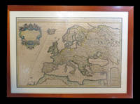
Nicholas Sanson (1600-1667)Biblio.com
2 781 résultats
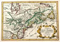
1705M11241Amsterdam c.1705. Very Good. Notes: A reduced version of the most influential 17th century maps of the French and English colonies in North America. The map not only shows details of the Great Lakes but also it is a great source for Indian tribal names and locations. Two names Aouentsiouaeron and Attiouandarons appear here for the first time. Lake Superior and Michigan Lac du Puans are left open-end to the west. It is engraved by Anthony d'Winter. Size : 207x300 mm 8.15x11.81 Inches Coloring: Hand Colored Reference: Burden #575; Kershaw #138. Category: Maps Canada East; Maps North America Great Lakes; unknown
3239Americas: Amsterdam Francois Halma 1705. Copper engraved map of Canada by N. Sanson from Halma's Algemeene Werelde Beschryving Vol. 3 Black and white; title in Dutch; verso blank; strapwork title cartouche. Attractive small map of Canada and the Great Lakes a reduced version of one of the most influential seventeenth century maps of the French and English colonies in North America. It concentrates on the region of greatest French interest. The entire Great Lakes basin and the St. Lawrence River are shown in great detail. The most important aspect of the map is the first appearance of L. Erie ou du Chat as a recognizable lake on an atlas map. This delineation influenced the cartography of the region for more than 100 years and was not superceded until Delisle's "Carte du Canada" in 1703. The map is also an outstanding source for Indian tribal names and locations. Two names:Aouentsiouaeron and Attiouandarons appear here for the first time. Lake Superior and Michigan Lac du Puans are left open-end to the west. Embellished with a nice title cartouche and engraved by Anthoine d'Winter. This is the third state. Published in Francois Halma's Dutch edition of A. Pherotee de la Croix's Nouvelle Methode Pour Apprendre facilement la Geographie Universelle. Dark impression; dampstaining to lower margin just entering plate; centrefold and 2 further folds to fit in binding. Nicolas Sanson d'Abbeville.1600-67 ' father of the French cartography' and founder of the Sanson firm. Atlas ' Cartes générales de toutes les parties du Monde' 1658-70 and a pocket atlas in 4 parts 1652-1705. Sanson's small maps from A. Phérotée de la Croix's Nouvelle Methode Pour Apprendre Facilement la Geographie Universelle. first published in 1652 and engraved by A. Peyrounin were copied several times by various map publishers. Johann David Zunners made copies of Sanson's maps for his German translation of Die Gantze Erd-Kugel in 1679. Johannes Ribbius and Simon de Vries published copies in 1682 and 1683 with new maps engraved by Antoine d'Winter. The plates were later sold to Francois Halma who used them in 1699 and then again in 1705 with the titles re-engraved in Dutch. François Halma 1653 - 1722 Dutch publisher/printer; dealer/auction house. Cartographer and publisher of maps active in Utrecht Amsterdam Franeker and Leeuwarden. Published 'Description de l'Univers' 1700; 'Algemene Wereldtbescrijving' 1705; 'Corpus Inscriptionum' 1707 and 'Lexicon Philosophicum' 1713. Keoman: Hal 1; Phillips 528; Burden #575; Kershaw #138; McCorkle #683.5. Americas Canada Great Lakes New France Niew Vrankryk Amsterdam Francois Halma 1705 unknown
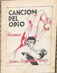
193965714México: Ediciones de la Sociedade de Amigos de España; Talleres Gráficos de la Editorial El Mundo 1939. illus. wrps. The poetry of Jesús Flores Sansón which reflect his strong support of the workers and communist movements in Mexico and the world and his solidarity with the anti-fascists in the Spanish Civil War. 2 color cover by Alberto Beltrán. Only one copy in OCLC USA. Ediciones de la Sociedade de Amigos de España; Talleres Gráficos de la Editorial El Mundo unknown
18-2885Cologne Germany: Galerie Gisela Capitain 2016. . 8vo. 32 pp. Stiff stapled pictorial wraps. Very good. Color illustrations. Presented on the occasion of Art Basel Unlimited 2016 by Galerie Gisela Capitain Cologne and team. Cologne, Germany: Galerie Gisela Capitain, 2016. paperback
2011014567Cape Town: Privately published 2011. 1st Edition. Soft cover. Fine. 162pp. illus. many colour plates. Unblemished. Very scarce. Privately published paperback
2011014915Cape Town: Privately published 2011. 1st Edition. Soft cover. As New. 162pp. illus. many colour plates. Unblemished. Privately published paperback
0415496802.Gpaperback. Good. Access codes and supplements are not guaranteed with used items. May be an ex-library book. paperback
2009DADAX0415496802Routledge 2009-05-26. 1. paperback. New. 6.14x1.05x9.21. Buy with confidence. Excellent Customer Service & Return policy. Routledge paperback
2009x-0415477190Routledge 2009. Hardcover. New. 1st edition. 464 pages. 9.45x6.38x1.14 inches. Routledge hardcover
6078884-nnew. unknown
6328161-nnew. unknown
6078884like new. unknown
6328161like new. unknown
2009G8-00057Routledge 2009-05-26. paperback. New. 6x1x9. Ship within 24hrs. 100% Satisfaction is Our #1 Goal! Routledge paperback
2009SKU1752293Routledge 2009-05-26. paperback. New. 6x1x9. New Book Ships with Tracking Routledge paperback
2009x-0415496802Routledge 2009. Paperback. New. 1st edition. 416 pages. 9.13x6.14x0.94 inches. Routledge paperback
6507214Taylor & Francis Group pp. 464 . Papeback. New. Taylor & Francis Group unknown
6507215Taylor & Francis Group pp. 464 . Hardback. New. Taylor & Francis Group hardcover
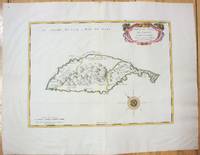
1658M7057Paris 1658. Very Good;. Notes: An early map of the Island of St. Christopher that includes a decorative compass rose in sea area and an ornamental title cartouche in top right decorated with scrolls ribbons and fruit. This is the first printed map of St. Kitts published in "Cartes Generales De Toutes Les Parties Du Monde."<br>With wide margins. Size : 314x429 mm 12.36x16.89 Inches Coloring: Original Outline Coloring cartouche and compass hand coloured Category: Maps West Indies Other Islands; unknown
1780M5125Paris 1780. Excellent. Size : 490x690 mm 19.25x27.125 Inches Coloring: Hand Colored in Outline Category: ; Maps Asia Middle East Holy Land & Palestine unknown
16-6140Paris: 1653. Folio. 30 x 43.2cm. Defective contemporary thick paper covers. Title page and dedication page with losses. Handcolored in outline. One map with loss in lower right corner and one map with tear in lower right corner Sixteen double page maps complete some with waterstains visible verso.Rare to find such a large ensemble of Sanson's maps. Reference: Bibliothèque nationale de France; ark:/12148/btv1b530780775/; Bibliothèque nationale de France département Cartes et plans GE A-592 RES . Paris: 1653. unknown
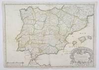
1658356952Paris.: Tavernier. 1658. Dampstain cover mot of the image also some coffee spots otherwise good. 42.5x57.2x.01 cm. Image size 41x55.5 to neatline. An uncommon map of Spain and Portugal with outline color. weight: 0.1 lb. Engraved by Melchior Tavernier. Tavernier. unknown
1690192941690. S.l. Alexis Hubert Jaillot 1680. Une grande carte 892 x 592 mm composÂŽe de deux feuillets contrecollÂŽs sous cadre moderne. Attractive 892 x 592 mm carte de la fin du XVIIÂme avec rehauts aquarellÂŽs du temps. Elle s'orne d'un important cartouche aux armes du Grand Dauphin Louis de France et s'agrÂŽmente en marge gauche de la figuration de vaisseaux ayant pris part ˆ un combat naval. Kupcik Cartes gÂŽographiques anciennes p. 159. Papier trÂs lÂŽgÂrement oxydÂŽ. PrÂŽsence de rares et claires rousseurs ou petites t‰ches. Deux plissures et une infime perforation en marge supÂŽrieure droite. Du reste belle condition. b42961 unknown
1812006820Paris: Chez Jean Md d'Estampes 1812 Engraving 59 x 90 cm old color. The first edition of this map was published in 1674 by Hubert Jaillot under the title "La Russie Blanche ou Moscovie divisee suivant l'étendue des Royaumes Duches." It was incorporated into numerous atlases by Jaillot and his successors until approximately 1720 when it became evidently outdated. However around 1812 it was reissued likely to illustrate the French-Russian war. Chez Jean Md d'Estampes unknown
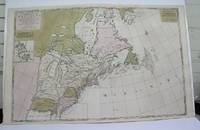
1698M3704Paris 1698. Excellent. Notes: Rather rare original coloured version of this map an important 17th century map of the Great Lakes and East coast with an inset map of Boston.<br><br>Cumming qtd in Arkway: "in spite of its scope and size it has a good deal of information for the Carolina Coast".<br><br>This map by Sanson first appeared in Mortier's sea atlas "Le Neptune Francois"; interestingly it is not generally found in Sanson or Jaillot atlases. Size : 650x924 mm 25.625x36.375 Inches Coloring: Original Hand Coloring Reference: Arkway 58:23 Category: Maps Canada East; Maps United States New England unknown