270 résultats
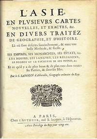
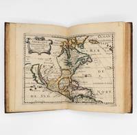
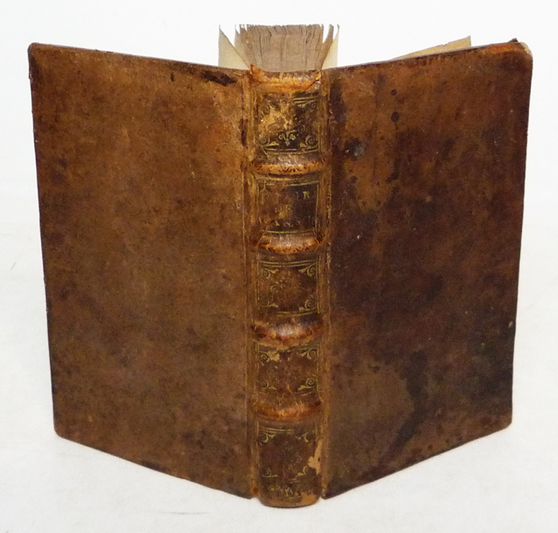
1662bf4740Chez L'auteur Relié 1662 "MAGNIFIQUE ENSEMBLE DES QUATRE CONTINENTS CARTOGRAPHIÉS PAR LE PREMIER CARTOGRAPHE FRANÇAIS, DANS UN ÉTAT DE FRAICHEUR INCOMPARABLE. Quatre volumes petit in-4 (18,5 x 25 cm), reliés en plein veau brun de l'époque. Les reliures sont toutes identiques, dos à 5 nerfs, titrés, roulettes dorées sur les coupes. Nicolas Sanson d'Abbeville est considéré comme le fondateur de la cartographie en France. En 1627, rencontrant Richelieu (il venait d'Abbeville et s'était installé à Paris), il fut présenté par lui à Louis XIII, qui le nomma Géographe Ordinaire du Roi. Il cartographia quatre continents (ici présents : l'Europe, l'Asie, l'Afrique et l'Amérique), et fut même le premier à cartographier certaines parties du globe (ainsi, par exemple, la région des grands lacs canadiens, avec sa carte ""Le Canada ou Nouvelle France"" (carte datant de 1656)). Il fut le premier Français à concevoir le plan d'un atlas mondial. Les cartes et le texte de chaque volume sont entièrement montés sur onglets. Chaque carte reçoit un commentaire explicatif, avec informations sur l'économie, les habitants et les moeurs du pays décrit, tiré des auteurs anciens (Pline, Strabbon...), de récits de voyageurs ou de rapports des missions des jésuites. De plus, chacune des cartes présente les tracés de contours des pays ou régions aquarellés. Les volumes s'organisent comme suit : L'Europe (sans date) : Titre et dédicace gravés sur double page, 12 cartes doubles et 30 feuillets imprimés au recto. L'Asie (1662) : 108 pages (avec erreurs connues de chiffrage et inversion de feuillets) et 17 cartes doubles. L'Afrique (1662) : 96 pages et 17 planches doubles, proposant 18 cartes (car l'une des planches porte deux cartes) (ce volume est le seul à présenter une petite mouillure sur les quelques premières pages). L'Amérique (1662) : non paginé (80 pages) et 15 cartes doubles. Nos exemplaires sont en TRÈS BEL ÉTAT. Les pages sont très fraiches, sans aucune réelle trace, tache, piqûre ni mouillure. Les cartes, particulièrement, sont dans un vraiment très bel état de fraîcheur, avec des couleurs extrêmement éclatantes. Les reliures présentent des traces peu visibles de réparations anciennes. Les volumes ont étés reliés avec contre-gardes, mais sans pages de garde. Ce rare ensemble est véritablement en TRÈS BEL ÉTAT. Livraison a domicile (La Poste) ou en Mondial Relay sur simple demande."
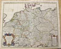
1696206066Amsterdam: Alexis-Hubert Jaillot 1696. unbound. very good. Map. Engraving with hand outline. Image measures 23" x 35".<br/><br/> Stunning map showing the vast extent of the German Empire including parts of Poland Bohemia Hungary Austria Croatia Italy France and the Netherlands. Exquisite and subtle coloring beautifully detailed. Based on a plate by Nicolas Sanson reworked and published in "Atlas Nouveau" by Jaillot. Severe toning due to early acid backing chipping to edges and corners and some tears. Priced as is. Alexis-Hubert Jaillot 1632--1712 was a French sculptor engraver publisher and cartographer. He served as official geographer to King Louis XIV and worked with other prominent mapmakers of the period such as Nicolas Sanson He is best known for his Atlas Nouveau of 1674.<br/><br/> Alexis-Hubert Jaillot unknown books
1696206066Amsterdam: Alexis-Hubert Jaillot 1696. unbound. very good. Map. Engraving with hand outline. Image measures 23" x 35".<br/> <br/> Stunning map showing the vast extent of the German Empire including parts of Poland Bohemia Hungary Austria Croatia Italy France and the Netherlands. Exquisite and subtle coloring beautifully detailed. Based on a plate by Nicolas Sanson reworked and published in "Atlas Nouveau" by Jaillot. Severe toning due to early acid backing chipping to edges and corners and some tears. Priced as is. Alexis-Hubert Jaillot 1632--1712 was a French sculptor engraver publisher and cartographer. He served as official geographer to King Louis XIV and worked with other prominent mapmakers of the period such as Nicolas Sanson He is best known for his Atlas Nouveau of 1674.<br/> <br/> Alexis-Hubert Jaillot unknown
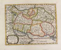
1652M4655Paris 1652. Very Good. Notes: This is an important 17th-century map of Iran published in Paris by Nicolas Sanson the greatest 17th-century French cartographer. The map depicts Iran at the time of Shah Abbas II of the Safavid dynasty. It is interesting to note that present-day Afghanistan and Pakistan and even part of India sit within Iran's borders all of which were lost in due course by the kings of the Qajar dynasty. Also as Sufism was the religion of Iran at the time of the Safavid dynasty the title of the map refers to the "Empire of the Sufi of the Persians". Size : 192x247 mm 7.56x9.72 Inches Coloring: Hand Colored Reference: Ala'i E. 107. Category: Maps Asia Middle East Iran Iraq; unknown
1652006683Paris: Chez l'Autheur 1652. First Edition . Full Calf. Very Good. 4to. 23.5 by 17.5 cm. Unpaginated 102 pages of text plus 2 pp. of ads 1 Royal privilege page. With 17 copper engraved maps all two page plates each with hand-colored of boundaries. Maps include one of the entire continent then of its various regions as then known plus island groups. Separate maps for China and Japan. Bound in contemporary calf. Condition: Rebacked with joints making this obvious. Calf dry and rubbed on spine and joints and edges rubbed. Light to moderate soiling in the margins of the pages. Edge of a few leaves with short stretch slightly chewed-looking. Two bookplates -- one of the Marquis of Lothian the other the Newbattle Abbey Library. <br /><br /> Chez l'Autheur books
16626235Paris: Chez L'autheur 1662. Book. Good. Full-Leather. 4to - over 9¾" - 12" tall. 104 pages. Text only lacking all maps. Sound leather binding a little war at the top of the spine. No publication date assumed 1662. Chez L'autheur Hardcover
1652006683Paris: Chez l'Autheur 1652. First Edition. Full Calf. Very Good. 4to. 23.5 by 17.5 cm. Unpaginated 102 pages of text plus 2 pp. of ads 1 Royal privilege page. With 17 copper engraved maps all two page plates each with hand-colored of boundaries. Maps include one of the entire continent then of its various regions as then known plus island groups. Separate maps for China and Japan. Bound in contemporary calf. Condition: Rebacked with joints making this obvious. The original spine was re-mounted with some losses. Its blindstamped decoration of fans is discernible but somewhat vague. We think it is possible this decoration had some gilding or color originally but none survives. Still an interesting and unusual feature in our view. Calf dry and rubbed on spine and joints and edges rubbed. Light to moderate soiling in the margins of many pages and on a few pages the soiling invades inward beyond the margins and also in a few instances the marginal soiling is on the heavier side. There are a few archival tape repairs of small chips three on the title leaf one on the following leaf and after that wormhole edge damage was left untouched. That said the defect and repair isn't as glaring as it might sound. The edges elsewhere can have short spans of a chewed appearance. As a book generally we would consider this copy at best Good. As far as the maps go independent of the book we would regard them as Very Good. A few of the maps might individually fall short of such grading; on the other hand all the maps of this copy one can easily imagine someone enthusiastically framing even without an attempt to clean them up. Two bookplates -- one of the Marquis of Lothian the other the Newbattle Abbey Library. Chez l'Autheur unknown
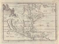
17005097Sanson being d'Abbeville Geograph du Roy. Map covers North America with a small amount of South America included. Has California as an island. 9 3/4 x 7 1/2 inches. Chez Paul Marret
1657375003Paris: Chez L'Autheur 1657. 15 engraved double-page maps hand colored in outline. 4 40 of 42 unpaginated text leaves lacks final two leaves of text. 4to. Contemporary mottled calf gilt raised spine bands repairs at joints. Lacks final two leaves of text after the map of Brazil. 15 engraved double-page maps hand colored in outline. 4 40 of 42 unpaginated text leaves lacks final two leaves of text. 4to. First edition of important and quite handsome 17th-century French atlas of the Americas. This atlas was first published in 1657 and stands as a beautiful cartographic record of America for the 17th century. Sanson was official cartographer to the King. The maps include detailed charts of North South and Central America the West Indies Canada Mexico Florida and the southeast and a map of New Mexico showing most of the Spanish southwest territory with California depicted as an island. An impressive and detailed atlas for the time. The maps are titled as follows:<br /> 1 Americque Septentriole<br /> 2 Le Canada ou Nouvelle France &c.<br /> 3 La Floride<br /> 4 Audience de Mexico<br /> 5 Audience de Guadalajara Nouveau Mexique Californie &c.<br /> 6 Audience de Guatimala<br /> 7 Les Isles Antilles &c.<br /> 8 Amerique Meridionale<br /> 9 Terre Ferme Nouveau royme de Grenade &c.<br /> 10 Guiane divisee en Guiane et Caribane<br /> 11 Le Perou et le cours de la rivre Amazone<br /> 12 Le Chili<br /> 13 Le Brasil<br /> 14 Le Paraguay subdivise en ses principales parties suivant les dernieres relaons<br /> 15 Destroit de Magellan Terre et Isles Magellanicques &c. Sabin 76708; Phillips Atlases 1151; Streeter sale 68 undated edition; Leighley California as an Island plate 9 Chez L'Autheur unknown
1696M10211Amsterdam: Covens & Mortier c.1696. Very Good. Size : 510x605 mm 20.08x23.82 Inches Coloring: Original Outline Coloring Category: Maps Europe Germany; Covens & Mortier unknown
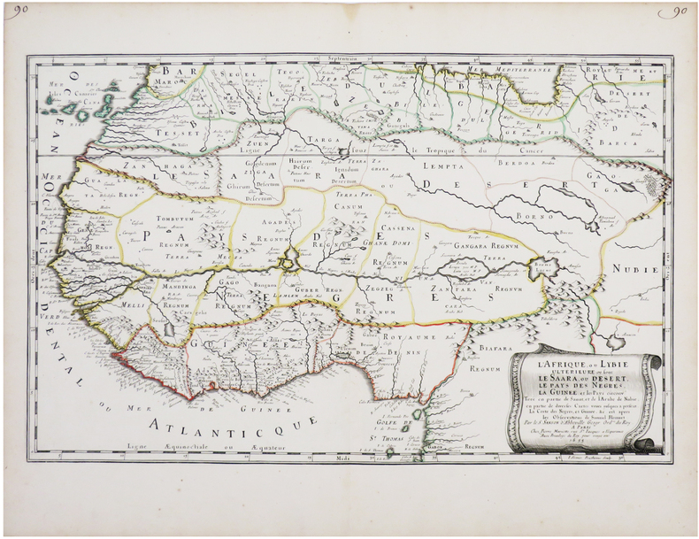
1655LBW-7677Paris, Pierre Mariette, 1655. 342 x 547 mm.
1656006682Paris: Chez l'Autheur 1656. First Edition . Full Calf. Very Good. 4to. 23.5 by 17.5 cm. Unpaginated 100 pages of text plus 2 pp. of ads. With 18 copper engraved maps all two page plates each with hand-colored of boundaries. Maps include one of the entire continent then of its various regions as then known plus the islands off the continent. Also a map of Malta. Bound in contemporary calf. Condition: calf dry and rubbed on spine and joints and edges rubbed. Light to moderate soiling in the margins of the pages. Two bookplates -- one of the Marquis of Lothian the other the Newbattle Abbey Library. <br /><br /> Chez l'Autheur books
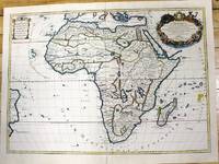
1700M11022Paris c.1700. Very Good. Notes: French map of Africa as a continent. Size : 462x645 mm 18.19x25.39 Inches Coloring: Hand Colored Category: Maps Africa Continent; unknown
1656006682Paris: Chez l'Autheur 1656. First Edition. Full Calf. Very Good. 4to. 23.5 by 17.5 cm. Unpaginated 100 pages of text plus 2 pp. of ads. With 18 copper engraved maps all two page plates each with hand-colored of boundaries. Maps include one of the entire continent then of its various regions as then known plus the islands off the continent. Also a map of Malta. Bound in contemporary calf. Condition: calf dry and rubbed on spine and joints and edges rubbed. Light to moderate soiling in the margins of the pages. Two bookplates -- one of the Marquis of Lothian the other the Newbattle Abbey Library. Chez l'Autheur unknown
1656B2984Paris: Nicolas Sanson c. 1656. Lower right corner of the first eight leaves strengthened otherwise a very good copy maps and text are clean and crisp. In protective cloth slipcase. Edition: First edition. Binding: Full contemporary calf expertly rebacked with spine in six compartments of raised bands and finely-gilt motifs morocco label on two edges speckled red. Notes: This atlas was dedicated to the Superintendent of Finances at the time Nicolas Fouquet. <br>Regarding a map of South and Central Africa published the year before which bears resemblance to this map of South Africa--‘Pays et Costes des Caffres’--in particular Norwich writes: “This map although a fine example of cartography is based on very little information; for example the desert-like coast of South West Africa is presented as a land rich in rivers. The fictitious states are given fictitious boundaries and the interior is marked with large cities such as Vigiti Magna and Monomotapa. This information led to subsequent exploration in search of these fabulous cities. Although the map is dated three years after the foundation of a settlement at the Cape by Jan van Riebeeck no mention is made of any European settlement anywhere in the south.†Size: 4to Illustration: Recent stencilled title. Complete with 18 maps of Africa and its territories in original outline colour. References: Tooley IV:103; Tooley Africa 100 Peyrounin edition; Norwich 37 & 158. Pages: P. 1-96. Category: Book Africa General; Book Atlas & Cartography Nicolas Sanson hardcover
1700LBW-8050Amsterdam, Pierre Schenk, [circa 1700]. 487 x 577 mm.
1618281543Frankfurt-am-Main 5616 1855-56. Boards. Good . 672 pp. twelve issues bound together slight library marks title taped to spine hardcover
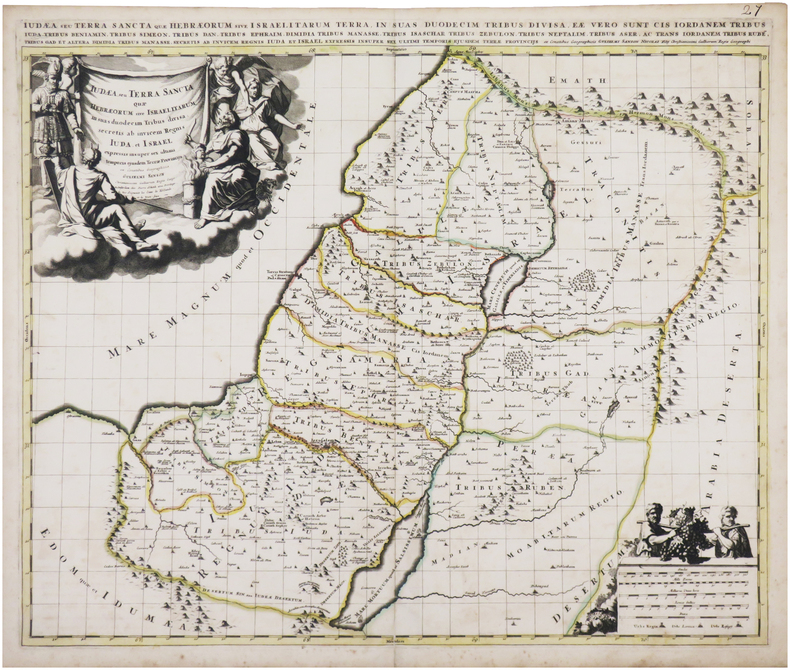
169143500Amsterdam, Huguetan & Mortier, 1691. 56x85 cm. Large engraved map of Terra Sancta with original colours in outline. With two large engraved cartouches. Small repairs to lower part of centerfold.
169143500Amsterdam Huguetan & Mortier 1691. 56x85 cm. Large engraved map of Terra Sancta with original colours in outline. With two large engraved cartouches. Small repairs to lower part of centerfold. <br/><br/><em>This is Jaillot's large version of Sanson's map of Palaestine divided into tribes. </em> unknown
1683LBW-7051683. 189 x 265 mm.
1663283501Paris 1663. unbound. very good. Map. Hand-colored engraving. 15" x 23".<br/><br/> This map of Sicily from the 17th century shows the entire island as well as the southwesternmost tip of the Italian peninsula. The names of the surrounding bodies of water are named in Latin and rivers mountains lakes and towns are noted on the map. Nicolas Sanson 1600-1667 is considered the founder of the French school of cartography. In reaction to the prevailing trend of Dutch lavishness Sanson favored minimal details focusing rather on accurate cartography than ornament. This map is a fine example of his work.<br/><br/> unknown books
1670LBW-587Paris chez l'autheur 1670 circa 393 x 552 mm.
1658M9417Paris: Nicolas Sanson c.1658. Very Good upper fold area expertly repaired. Notes: A fine map of Crete from the mid 17th century. <br>The map also shows nearby islands such as Santorini Stampalia and Milo. The map has a decorative cartouche and details cities borders and geographical features. Size : 394x553 mm 15.51x21.77 Inches Coloring: Hand Colored Category: Maps Europe Greece Macedonia; Nicolas Sanson unknown
1663283501Paris 1663. unbound. very good. Map. Hand-colored engraving. 15" x 23".<br/> <br/> This map of Sicily from the 17th century shows the entire island as well as the southwesternmost tip of the Italian peninsula. The names of the surrounding bodies of water are named in Latin and rivers mountains lakes and towns are noted on the map. <BR> <BR> Nicolas Sanson 1600-1667 is considered the founder of the French school of cartography. In reaction to the prevailing trend of Dutch lavishness Sanson favored minimal details focusing rather on accurate cartography than ornament. This map is a fine example of his work.<br/> <br/> unknown
1682za2213A Paris, chez l'Auteur, aux Galleries du Louvre, vis à vis l'Eglise de St Nicolas Relié 1682 "In-12 (9,8 x 16 cm), reliure plein veau, dos à 4 nerfs orné de caissons dorés, liseré doré sur les coupes, tranches mouchetées, titre comple : ""Introduction à la géographie, première partie. Où sont 1. Indiquées les Sciences dont la Géographie emprunte plusieurs Principes. 2. La Description des differentes Manieres dont cette Science est Représentée. 3. L'Explication des Termes de toutes les Parties de la Geographie. 4. Une Instruction de toutes les Parties de la Geographie. 4. Une Instruction de l'Usage des Cartes."", pagination comme suit : page de titre, préface (6 pp. non numérotées), avis au lecteur (2 pp. non numérotées), table des chapitres (9 pp. non numérotées, fautes à corriger, extrait du Privilege du Roy, 292 pp., table alphabetique (13 pp. non numérotées), avertissement (5 pp. non numérotées). Le plan de cet ouvrage de 320 pages est composé de trois parties. Dans la première, l'auteur place la géographie dans la cosmoraphie, puis il distingue entre globes et cartes, avant de décrire, comme l'avait fait Lubin, le vocabulaire de la géographie. Guillaume Sanson conclut cette partie par un chapitre sur l'usage des cartes. La deuxième partie s'intéresse aux relations entre l'astronomie et la géographie, décrivant le globe soit par par zones, soit par la grille des latitudes et longitudes. Enfin, la troisième partie, dite de géographie naturelle, rassemble pêle-mêle la liste des découpages du globe, selon les grilles évoquées dans la deuxième partie, puis en fonction des continents et des mers, voire selon d'autres critères comme les géographies historique, politique et sacrée, ou linguistique. La description de l'ensemble des Etats du monde y occupe 20 pages (et semble avoir été inspirée par l'Atlas du monde publié par Nicolas Sanson en 1665). Il s'agit donc d'abord d'une géographie assez théorique qui viserait à faire connaître le vocabulaire ainsi que les catégories de la géographie. Pourquoi cette introduction n'offre-t-elle pas plus de description de la géographie du monde ? Parce que la géographie --comme Guillaume Sanson l'écrit dans la préface-- ""est présentement à la Portée de tout le Monde, puisqu'avec cette méthode il ne faut que des yeux et des cartes"" (Sanson 1682). Deux hypothèses en découlent. La première fait de ce livre avant tout un prospectus pour les cartes des Sanson. La seconde y voit une tentative, par la famille Sanson, de captation de la géographie par la cartographie. De plus, on trouve dans l'édition de 1682 un avertissement passionnant de la main de Sanson, situé après la table alphabétique des matières. Il y critique la ""Méthode pour apprendre facilement la géographie"" de Jacques Robbe (1678), ainsi que la ""Description de Univers contenant les différents systèmes du monde"" à paraître (1683) de Manesson-Mallet, le traitant sans retenue de plagiaire. Plus loin, ayant mis en garde des acheteurs de cartes que les copistes étaient foison, Sanson note qu'il fait encore partie des vivants : ""Quelques uns nous effacent hardiment du nombre des Vivans, d'autres ont voulu persuader que nous estions retournez en Province, & qu'il y en avoit qui avoient eu assez d'effronterie pour prendre notre Nom ; de sorte que nous avons fait mettre à la Teste de cette Introduction Que nous demeurons aux Galleries du Louvre, pour desabuser le Public, & faciliter par là de Dessein de ceux qui voudront nous faire l'honneur de venir chez nous pour s'éclaircir de quelques difficultez, ou pour prendre avis touchant nos Ouvrages qu'ils voudront avoir."" ; quelques épidermures au dos, coiffe supérieure et coins du premier plat un peu usés, par ailleurs intérieur frais, bon état général. Livraison a domicile (La Poste) ou en Mondial Relay sur simple demande."