Jaillot,Sanson GuillaumeLivre Rare Book
SANSON d'ABBEVILLE (Nicolas);Livre Rare Book
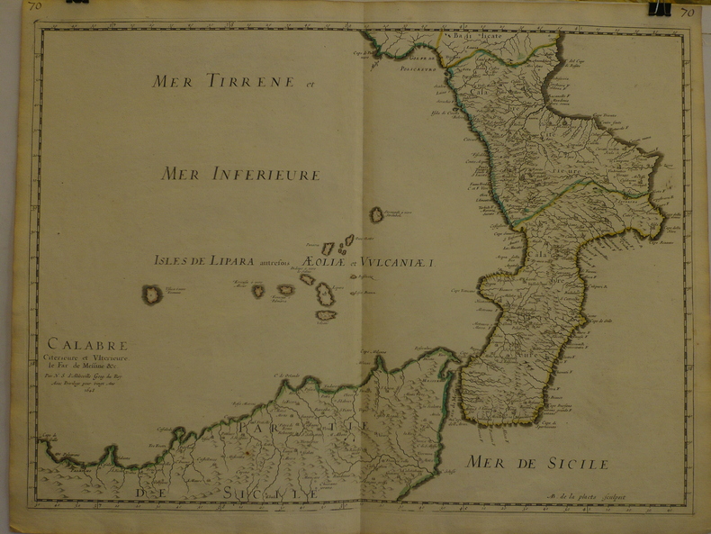
Calabre citérieure et ultérieure, le far de Messine &c.
1648LBW-9691648 409 x 558 mm.
Librairie Le Bail · Paris, France200,00 €
272 résultats
1674ag662Jaillot H. Carte 1674 Carte de 43 x 57 cm en une partie : frontières colorées ; petites déchirures marginales sans gravité, bon exemplaire. Livraison a domicile (La Poste) ou en Mondial Relay sur simple demande.
1651284611651 une carte ancienne gravée sur cuivre (Copper etching) en noir . Format : 44 x 58 cm, par Nicolas SANSON carthographe, 1651 [s.n.] Editeur,
1662280971662 une carte ancienne gravée sur cuivre (Copper etching) en noir . Format : 46,5 x 58 cm, par Nicolas SANSON carthographe, 1662 [s.n.] Editeur,
1648LBW-9691648 409 x 558 mm.
169623767Amsterdam: Covens 1696 -1700. Other. In very good to excellent condition. A small tear at the left side. 392 by 517mm 15½ by 20¼ inches. 392 by 517mm 15½ by 20¼ inches. Copper engraving uncolored as published. Covens unknown
1659122141659 Limites aquarellées. 1 carte gravée sur cuivre, 43 x 53 cms. P. Sanson 1659
1683LBW-6971683 182 x 276 mm.
16986703sans lieu [Amsterdam], sans nom [Pierre Mortier], sans date [circa 1698]. In-8 de [2]-30 pages, 25 cartes, 1 pl., 26 pages, couverture de papier marbré du temps (traces de plis au dos, coins un soupçon cornés).
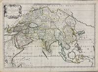
1650005908Paris: Pierre Mariette 1650. First state. Loose Sheet. Very good. Hand colored map on laid paper. Sheet Measurements: 600mm x 440 mm; Plate Measurements: 563mm x 392mm. Antique map titled "Asia Vetus" Ancient Asia by Nicolas Sanson first published circa 1650. Considered a significant piece of cartographic history marking the shift of mapmaking excellence from Amsterdam to Paris in the 17th century. Map Condition: center fold with light reinforcement ancient remains of dried adhesive to corners lower left corner shows small area of paper thinning and some disruption to text very light toning in spots. Discrete prior owner notations in pencil to verso. Please examine photographs for condition in general. Pierre Mariette unknown
1667M8921Paris: Pierre Mariette 1667. Very Good. Notes: An important map of Asia by Nicolas Sanson showing the boundaries of the major historic civilizations of this continent. Examples include Assyria Syria Asia Minor Armenia Arabia Felix Libya Sarmatia Thracia Graecia Persia India China Ethiopia Scythia and Gangem. <br><br>Sanson 1600–1667 was a French cartographer termed by some as the "father of French cartography." His works are known for their incorporation of the most up to date information of the time and their clean modern style. Size : 402x470 mm 15.83x18.50 Inches Coloring: Original Hand Coloring Category: Maps Asia Continent; Pierre Mariette unknown
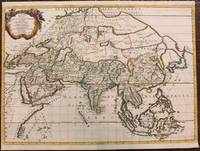
1680024707London: William Berry 1680. .Kingdoms and States which are found there at present/Described by Sanson/Corrected and amended By William Berry =Kopftitel; Text der figürlich reich verzierten Kartusche oben rechts: Asia Divided into its Principall Regions in which may be seen the extent of the Empires Monarchies Kingdoms and States which at present divide Asia/To the Most serene and Most Sacred Majesty of Charles II./By the Grace of God King of Great Britain France and Ireland/This Map of Asia is humbly Dedicated and Presented By Your Majesties Loyal Subject and Servand William Berry; Text der reich verzierten Kartusche links oben: Scale es folgen Maßstäbe verschiedener Länder/London/Sold by William Berry at the Sign of the Globe between Charing-Cross and White-Hall/1680; SW-Kupferstich-Landkarte nach Nicolas Sanson d'Abbeville gestochen von William Berry; ca. 51 x 39 cm; Falzspuren einige Tintenflecken hauptsächlich ausserhalb des Druckbildes mässige Lichtverfärbung; professionell hinter Glas gerahmt in schwarzem Holzrahmen; äußerst selten; for description in other languages of this extremely rare map please don't hesitate to contact me. . Gut. Landkarte. William Berry unknown
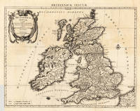
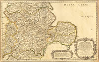
165417463Paris: N. Sanson 1654. Other. In very good condition. 365 by 580mm 14¼ by 22¾ inches. 365 by 580mm 14¼ by 22¾ inches. Copper-engraving handcolored in outline when published. Fine and strong impression of this early decorative mid-seventeenth century map of this English regional map covering the area Chester Darbing Nottingham. by the famous French cartographer Nicolaus Sanson. Very detailled and naming many cities and villages as well many places along the coastline. Showing prominently the eastern part of central England. In the lower right corner with a large floral title cartouche and milage scale. N. Sanson unknown
16546571Paris 1654. Copper engraving 37 x 48 cms modern hand-colour blank verso. Nicolas Sanson 1600-1667 founder of the Sanson dynasty of map-makers is considered by many to be the father of the French school of cartography. He was a prolific and original map-maker admired for the clarity and scientific accuracy of his maps. Map unknown
1696M8798Paris : Pierre Mariette c. 1696. Very Good. Notes: Fine detailed map of the straight of the Bosphorus and the city of Constantinople. Size : 405x528 mm 15.94x20.79 Inches Coloring: Hand Colored Category: Maps Asia Near East Turkey; Pierre Mariette unknown
1691LBW-3673Paris, H. Jaillot, 1691. En deux feuilles jointes de 573 x 884 mm.
166925695Paris: Chez Pierre Mariette 1669. Copper-engraved map period hand colouring in outline. The most important French map of North America of its generation produced by the country's most esteemed family of cartographers.<br/> <br/>This very influential map was the official successor to Nicolas Sanson's 1650 map of North America. When Nicolas Sanson regarded as the father of the renaissance of cartography under Louis XIV died in July 1667 he left his flourishing business in the care of his eldest son Guillaume. The younger Sanson continued his father's partnership with the Mariette family who were prominent Parisian printers. Guillame was determined to publish a new updated edition of his father's Cartes Generales de toutes parties du Monde the first French general atlas originally published in 1657. The map of North America that appeared in the atlas although masterful was now considered to be geographically outdated. The present map which appeared in the second edition of the atlas featured updated toponymy and is geographically based on Nicolas Sanson's wall map of 1666 of which only two copies survive. While California is shown to be an island in line with popular perception unlike the map from 1650 it no longer attempts to build a geographical mythology in the place of the Pacific Northwest which was then totally unknown. Appropriately the magnificent baroque title cartouche which features swags and ribbons held aloft by putti has been placed to fill this enigmatic space. Cartographically the map appears to be based on Sanson's maps of "Le Canada ou Nouvelle France" and "Le Nouveau Mexique et La Floride." Lake Erie is shown in a recognizable form and the entire Great Lakes network is shown in greater detail than his father's map although the western lakes are still open-ended. On the East coast Long Island is shown and the shape of the Outer Banks is improved. Several Indian tribes are identified in New Mexico where the R. del Norte Rio Grande mistakenly flows from an interior lake and empties into the Mar Vermeio ou Mer Rouge Gulf of California. Iceland now appears in the Atlantic as well as a bit of Britain. The map proved to be highly successful and was sourced on numerous occasions by other mapmakers. The present copy is an example of Burden's first state of the map; a second state would be issued in 1690.<br/> <br/>Burden The Mapping of North America I 404; first state McCorkle New England in Early Printed Maps 669.4; McLaughlin California as an Island 45; Wagner Cartography of the Northwest Coast of America 399; Tooley "California as an Island" 8 in TooleyThe Mapping of America. Chez Pierre Mariette unknown books
169025648Paris: Chez Pierre Mariette 1690. Copper-engraved map period hand colouring in outline. Among the most important French maps of North America of the second half of the 17th century produced by the country's most esteemed family of cartographers.<br/> <br/>This very influential map was the official successor to Nicolas Sanson's 1650 map of North America. When Nicolas Sanson regarded as the father of the renaissance of cartography under Louis XIV died in July 1667 he left his flourishing business under the charge of his eldest son Guillaume. The younger Sanson continued his father's partnership with the Mariette family who were prominent Parisian printers. Guillame was determined to publish a new updated edition of his father's Cartes Generales de toutes parties du Monde the first French general atlas originally published in 1657. The map of North America that appeared in the atlas although masterful was now considered to be geographically outdated. The present map which appeared in the second edition of the atlas featured updated toponymy and is geographically based on Nicolas Sanson's wall map of 1666 of which only two copies survive. While California is shown to be an island in line with popular perception unlike the map from 1650 it no longer attempts to build a geographical mythology in the place of the Pacific Northwest which was then totally unknown. Appropriately the magnificent baroque title cartouche which features swags and ribbons held aloft by putti has been placed to fill this enigmatic space. Cartographically the map appears to be based on Sanson's maps of "Le Canada ou Nouvelle France" and "Le Nouveau Mexique et La Floride." Lake Erie is shown in a recognizable form and the entire Great Lakes network is shown in greater detail than his father's map although the western lakes are still open-ended. On the East coast Long Island is shown and the shape of the Outer Banks is improved. Several Indian tribes are identified in New Mexico where the R. del Norte Rio Grande mistakenly flows from an interior lake and empties into the Mar Vermeio ou Mer Rouge Gulf of California. Iceland now appears in the Atlantic as well as a bit of Britain. The map proved to be highly successful and was sourced on numerous occasions by other mapmakers. The present copy is an example of Burden's second state of the map with the date changed to 1690 in the cartouche and with additional place names and other changes: ".with minor alterations Terre de Jesso and Conibas inserted but without a coastline. Detroit d'Anian placed immediately above California and a few changes in spelling . New Albion is inserted in the north of the island and New York replaces New Amsterdam" Tooley.<br/> <br/>Burden The Mapping of North America 404 second state; McCorkle New England in Early Printed Maps 669.4; cf. McLaughlin California as an Island 45; cf. Wagner Cartography of the Northwest Coast of America 399; Tooley "California as an Island" 9 in TooleyThe Mapping of America. Chez Pierre Mariette unknown books
165124777Paris: N. Sanson & P. Mariette 1651. Copper-engraved map with original outline colour. The rare second state of this highly important map of North America by the founder of the French School of cartography.<br/> <br/>This very rare map is the most geographically progressive portrayal of the continent made at its time and was not superseded until Vincenzo Maria Coronelli's map of 1688. Importantly it is the first map to depict the Great Lakes in a recognizable form and the first to name Lake Ontario and Lake Superior. In his rendering of the region Sanson benefited from having received a copy of The Jesuit Relations published in Paris in 1649 a detailed account by French missionaries who had traveled in the region. Most notably this included Father Paul Ragueneau's account of his visit to Niagara Falls and Jean Nicollet's discovery of Lake Michigan "Lac des Puans" in 1634. Down the St. Lawrence River from the lakes Montréal is named the settlement having been founded by the Sieur de Maisonneuve in 1642. Elsewhere to the north a mysterious strait weaves over "New South Wales" on Hudson's Bay terminating in the interior of the continent a blank space labeled as "Mer Glaciale". This alludes to the existence of a much hoped-for Northwest Passage. On the eastern seaboard the map notes "Nouvelle Amsterdam" in the place of present day New York and is the first printed map to label "Nouvelle Suede" referring to the Swedish colony centered on Fort Christina founded on the site of present-day Wilmington Delaware in 1638. To the far southwest Sanson based his depiction on the Father Alonso Benavides Memorial a travel account of New Mexico published in Madrid in 1630. It is the first printed map to label "Santa Fe" which is incorrectly shown to be on the banks of the Rio Grande and the domains of various native tribes such as the "Apache" "Navajo" and the "Taosij" Taos. To the west California is shown as a large island and features some of the same nomenclature as found on Johannes de Laet's map of 1630. A striking aspect of the map is the sinusoidal projection employed by Sanson that essentially places the globe on an elliptical graticule creating a very pleasing aesthetic. The composition is finished by an extremely elegant Baroque title cartouche featuring swags of fruit and vegetation. Nicholas Sanson was born in the town of Abbeville in Picardy. Something of a child prodigy by the age of eighteen he could already be found in Paris drafting his own maps. There he quickly rose to become Royal Geographer to Louis XIII in 1630. He maintained the position upon the ascension of the "Sun King" Louis XIV in 1643 and later served as tutor to the ambitious young monarch. In 1644 he formed a lucrative partnership with Paris publisher Pierre Mariette with the objective of producing a great atlas that could rival those of the Amsterdam houses such as Blaeu and Jansson. The present map was devised as one of the most important maps in the atlas. The first state of the map was printed in 1650 and the present second state appeared a year later. The atlas itself entitled Les Cartes Générales de toutes les parties du Monde was not finally assembled until 1658. It was however a landmark moment in the history of French cartography being the first folio atlas produced in that country. The extremely high quality of Sanson's work motivated other French mapmakers to improve the standard of their production. Sanson also greatly influenced Louis XIV's chief minister Jean-Baptisite Colbert to heavily fund cartographic projects. This gave rise to a great French School of cartography that was to eventually wrest dominance of the mapmaking market from the Dutch by the 1680s. After Sanson's death in 1667 his work was continued by his sons Guillaume d.1703 and Adrian d.1708. The first state of this map is extremely rare with Burden citing but two copies in private American collections. This second state is also quite rare and can be recognized by addition of a coastline north west of California but with Lake Ontario unshaded and with the appearance of a river system. "With his 1650 Map of North America Sanson had introduced a great deal of information concerning the nomenclature of American Indians with words such as Apache and Navajo appearing on printed maps for the first time. He was also the first cartographer to show Santa Fe as the capital of New Mexico . an extraordinary document of the cultural and geographical resources known in the centers of learning in Europe" Martin & Martin.<br/> <br/>Burden The Mapping of North America I 294 state 3; Leighly California as an Island p.33 pl.7; McLaughlin The Mapping of California as an Island 12; Pastoreau Les Atlas Français XVIe-XVIIe Siècles p.387-9; Wagner The Cartography of the Northwest Coast of America to the Year 1800 360 pp.130-2; Wheat Mapping of the Transmississippi West I p.39; cf. Martin & Martin Maps of Texas and the Southwest p. 83 plate 10. N. Sanson & P. Mariette unknown books
165924778Paris: N. Sanson & P. Mariette 1659. Copper-engraved map with original outline colour. The third state of this highly important map of North America by the founder of the French School of cartography.<br/> <br/>This very rare map is the most geographically progressive portrayal of the continent made during its generation and was not superseded until Vincenzo Maria Coronelli's map of 1688. Importantly it is the first map to depict the Great Lakes in a recognizable form and the first to name Lake Ontario and Lake Superior. In his rendering of the region Sanson benefited from having received a copy of The Jesuit Relations published in Paris in 1649 a detailed account by French missionaries who had traveled in the region. Most notably this included Father Paul Ragueneau's account of his visit to Niagara Falls and Jean Nicollet's discovery of Lake Michigan "Lac des Puans" in 1634. Down the St. Lawrence River from the lakes Montréal is named the settlement having been founded by the Sieur de Maisonneuve in 1642. Elsewhere to the north a mysterious strait weaves over "New South Wales" on Hudson's Bay terminating in the interior of the continent a blank space labeled as "Mer Glaciale". This alludes to the existence of a much hoped-for Northwest Passage. On the eastern seaboard the map notes "Nouvelle Amsterdam" in the place of present day New York and is the first printed map to label "Nouvelle Suede" referring to the Swedish colony centered on Fort Christina founded on the site of present-day Wilmington Delaware in 1638. To the far southwest Sanson based his depiction on the Father Alonso Benavides Memorial a travel account of New Mexico published in Madrid in 1630. It is the first printed map to label "Santa Fe" which is incorrectly shown to be on the banks of the Rio Grande and the domains of various native tribes such as the "Apache" "Navajo" and the "Taosij" Taos. To the west California is shown as a large island and features some of the same nomenclature as found on Johannes de Laet's map of 1630. To the north an entirely unknown realm is named "Conibas" a mythical land that lay between North America and Asia. A striking aspect of the map is the sinusoidal projection employed by Sanson that essentially places the globe on an elliptical graticule creating a very pleasing aesthetic. The composition is finished by an extremely elegant Baroque title cartouche featuring swags of fruit and vegetation. Nicholas Sanson was born in the town of Abbeville in Picardy. Something of a child prodigy by the age of eighteen he could already be found in Paris drafting his own maps. There he quickly rose to become Royal Geographer to Louis XIII in 1630. He maintained the position upon the ascension of the "Sun King" Louis XIV in 1643 and later served as tutor to the ambitious young monarch. In 1644 he formed a lucrative partnership with Paris publisher Pierre Mariette with the objective of producing a great atlas that could rival those of the Amsterdam houses such as Blaeu and Jansson. The present map was devised as one of the most important maps in the atlas. The first state of the map was printed in 1650 a second state appeared a year later and the third state in 1659. The atlas itself entitled Les Cartes Générales de toutes les parties du Monde was not finally assembled until 1658. It was however a landmark moment in the history of French cartography being the first folio atlas produced in that country. The extremely high quality of Sanson's work motivated other French mapmakers to improve the standard of their production. Sanson also greatly influenced Louis XIV's chief minister Jean-Baptisite Colbert to heavily fund cartographic projects. This gave rise to a great 'French School' of cartography that was to eventually wrest dominance of the mapmaking market from the Dutch by the 1680s. After Sanson's death in 1667 his work was continued by his sons Guillaume d.1703 and Adrian d.1708. The first state of this map is extremely rare with Philip Burden citing only two copies in private American collections; this third state can be recognized by the addition of hachuring around Lake Ontario.<br/> <br/>Burden The Mapping of North America I 294; Leighly California as an Island p.33 pl.7; McLaughlin The Mapping of California as an Island 12; Pastoreau Les Atlas Français XVIe-XVIIe Siècles p.387-9; Wagner The Cartography of the Northwest Coast of America to the Year 1800 360 pp.130-2; Wheat Mapping of the Transmississippi West I p.39. N. Sanson & P. Mariette unknown books
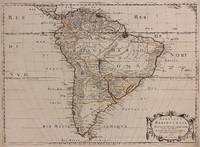
1698M10786Paris 1698. Very Good. Notes: A charming large scale 17th century map of South America with two decorative cartouches and original outline colouring. Size : 460x648 mm 18.11x25.51 Inches Coloring: Original Outline Coloring Category: Maps South America Continent; unknown
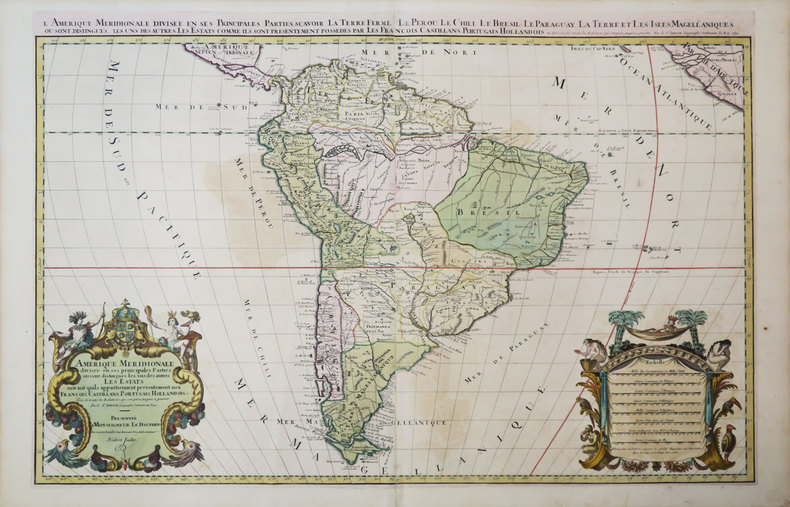
1691M1345Paris 1691. Very Good. Size : 590x885 mm 23.25x34.875 Inches Coloring: Hand Colored in Outline Category: ; Maps South America Continent unknown
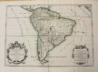
1650309461Paris: Pierre Mariette 1650. unbound. Abraham Peyrounin. Map. Engraving with original outline color. Image measures 15 3/4" x 21 3/4"<br/> <br/> This exceptionally fine map of South America covers the continent in fine detail. Coastlines are extensively labeled and mountains beautifully rendered in profile. The Orinoco and Amazon Rivers as well as Rio de la Plata are prominently rendered. Sanson refrains from drawing a southern coastline to Tierra del Fuego and the relatively unknown Amazon region is depicted in minimal detail. Sanson does however include the mythical lake "Lac de Parime" and the city of gold "Manoa del Dora" between the Orinoco and Amazon rivers. Nice dark impression. In very good condition. Minor dampstain to lower margin not affecting the image and some faint stains near the center of the map - otherwise clean and bright. Hard to find. <Br> <br> Nicolas Sanson 1600-1667 is considered the founder of the French school of cartography. In reaction to the prevailing trend of Dutch lavishness Sanson favored minimal details focusing rather on accurate cartography than ornament.<br/> <br/> Pierre Mariette unknown
166033638ABA Paris chez P. Mariette 1660. Blattgrösse: 44x58 cm. Grenzkolorierte Karte (36,7x55 cm) von Nicolas Sanson, gestochen von Somer.
170054035Amsterdam: 1700. Map of Germany divided into regions which at the time extended over much of the Low Countries. Maps by Sanson in original colour are rare. Nicolas Sanson was founder of the French school of mapmakers at a time when the leadership in European cartography passed from the Low Countries to France. This map was published in Brion's treatise on globes. Nicolas Brion was a famous French mathematical and scientific instrument maker. L'Usage des Globes. Copper engraving. Fine condition. Original colour. Size: 23.5 x 18.5 cm. unknown
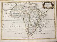
1650M6678Paris: Pierre Mariette c. 1650. Very Good;. Notes: Title cartouche bordered by two outward-facing birds of prey.<br><br>Norwich writes: "This is an early Sanson map. An odd feature is the name Barditus Mons given to a long chain of mountains running continuously from somewhere in Angolato Algoa Bay. No place names appear even on the coast of the southern part of the continent which is labelled 'Agi Symba' a name usually referring to the northern African region and inhabitants are 'Anthropophagi Aethiopes' or cannibals." Size : 396x553 mm 15.59x21.77 Inches Coloring: Hand Colored Reference: Norwich's Map 35. Category: Maps Africa Continent; Pierre Mariette unknown