Desnos, RobertBiblio.com
111 résultats
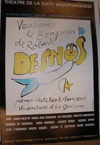
73-2571Paris: Theatre de la Gaite Montparnasse circa 2000. 60x40 cm. Color poster. Good. Text in French. Wear on each corner.Provenance: Jean-Louis Debauve 1926-2016 aka Henry Jean-Louis DebauvveMagistrat honoraire spécialiste de la poésie romantique et du Symbolisme. historien et critique littéraire. - Membre de la Société polymathique du Morbihan - Docteur en droit Paris 1961 Paris: Theatre de la Gaite Montparnasse, [circa 2000?] unknown
8493518549.Gpaperback. Good. Access codes and supplements are not guaranteed with used items. May be an ex-library book. paperback
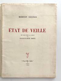
19432562Paris: Robert J. Godet “pour mes amis†1943. First edition. 35 4 pp. Unbound signatures laid into printed wrapper as issued. Some toning to extremities; first plate lacks tissue guard.<br /> <br /> One of one hundred numbered copies reserved for Robert J. Godet of a total edition of 170 copies. One of Desnos’ last collections containing the stirring “Demain.†Gaston-Louis Roux somewhat neglected today was one of Kahnweiler’s artists and contributed the cover to the second issue of Minotaure. Robert J. Godet, “pour mes amis†unknown
6209577377.Gpaperback. Good. Access codes and supplements are not guaranteed with used items. May be an ex-library book. paperback
3388728119.Gpaperback. Good. Access codes and supplements are not guaranteed with used items. May be an ex-library book. paperback
46572Dressé sur les Relations les plus nouvelles de Mrs. de l'Académie Royale des Sciences par L. C. Desnos et J. B. Nolin Géographe. Se fait et se vends chez Desnos rue St. Jacque St. Severin Quartier de la Place Maubert. Paris 1760 avec privilége du Roy. Dedié au Roy par son trés humble trés obéissant et fidel sujet Desnos et monté par lui. Terrestrial globe 265 mm in diameter; engraved gores and two polar calottes with original hand-colouring over plaster base a few old sealed tears without loss; graduated equator tropics of Cancer and Capricorn ecliptic and Premiere Meridian fixe de l'isle de fer the prime meridian on the island of El Hierro which Louis XIII decreed in 1634; two cartouches - including the dedication to the King sometimes found removed during the French Revolution - decorative vignettes of exotic fauna indigenous peoples and maritime vessels numerous coloured tracks of historical and contemporary explorers including Ferdinand Magellan Jacob Le Maire and Willem Schouten Louis de l'Isle de la Croyere Nicolas de Frondat Aleksei Ilyich Chirikov Jean-Baptiste Charles Bouvet de Lozier and Admiral George Anson; papier-mâché meridian ring with printed declination and elevation engraved calendrical papier-mâché horizon ring with zodiac; edges painted red; supported on four papier-mâché quadrant arcs with the printed names of towns and their longitude and latitudes; turned wooden base and finial; total dimensions 600 x 390 mm; a few discreet signs of old restoration including at the North Pole; warm patina; a fine example of this rare terrestrial globe. A vividly illustrated French table globe from the mid-eighteenth century rich in geographical detail that includes the voyages and discoveries of French English Dutch and Russian explorers. Created during the reign of Louis XV by the partnership of Desnos and Nolin two great mapmakers of the period it is a tremendously evocative artefact from the Age of Enlightenment. The globe shows the discoveries made in the Pacific by the early European expeditions prior to those of Cook and the grands voyages of La Perouse Baudin Freycinet and Duperrey. It depicts the newly charted territory of Nouvelle Hollande as it was known from the most recent discoveries: the western coastline as well as the partial coastlines of Van Diemen's Land and New Zealand are based on the discoveries of the Dutch. Also marked are Dampier's Passage separating New Guinea from New Britain and Terre de S. Esprit Australia del Espíritu Santo the island in the New Hebrides originally mistaken by Quiros for the Australian continent. Louis-Charles Desnos 1725-1805 was one of the most prolific and influential map and globe makers of his age at a time when Paris was the major centre for map production in Europe. He married the widow of Nicolas Hardy the son of Jacques Hardy a globe maker active in the years 1738-1745. Desnos acquired Hardy's inventory and tools and expanded the company further through the acquisition of the inventories of the Jaillot family and of Nicolas de Fer. Desnos would be appointed Royal Globemaker to King Christian VII of Denmark and continued publishing throughout the late eighteenth century. Jean-Baptiste Nolin 1686-1762 continued the established business of his father the famous French cartographer engraver publisher and map dealer Jean-Baptiste Nolin 1657-1708. Collections: The only globe by Desnos recorded in Australian public collections is in the National Gallery of Victoria acquired from us in 2023. Another example of this globe is held in Libraries and Archives Canada. Provenance: Jean R. Perrette his bookplate pasted under the base of the globe. Jean R. Perrette's important collection of rare travel and exploration books was sold through Christie's New York in 2016 Sale 12259 Important Travel Exploration and Cartography April 5 2016. The globe is photographed in the catalogue in situ in Mr. Perrette's Library. Reference: van der Krogt Old globes in The Netherlands 1984 pp. 104-105 unknown
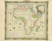
1766101196<p>Engraved map slight outline coloring decorative rococo boarder with landscape style cartouche 12" x 10.7". Decent margins but bottom margin a little narrow minor aging light pencil notation in right margin; overall in excellent condition with a very strong impression. While the interior of the map doesn't show a substantial amount of geographical detail this appears typical of the period. There are some large rivers and lakes that are identified. The Nile appears to rise from two small lakes in the Mts de la Lune above the Equator. In the south there aren't a lot of places named but there are still some tribal names present.</p>
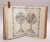
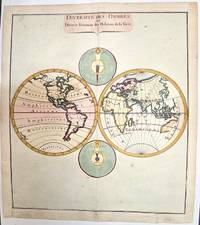
95730Paris Chez le Sr Desnos Ingénieur-Géographe pour les Glôbes et Sphéres et Libraire de sa Majesté Danois 1781. 4to. 23 x 30 cm. Engraved title-page 26 engraved double-paged and hand-coloured maps. Contemporary half calf gilt spine red leather label. Rubbed. . <br/><br/><em>1. Le systême de Ptolémée Thico-Brahé Copernic et Descartes. 2. Sphéres de Ptolémée et de Copernic. 3. Sphéres droite et paralléle. 4. Démonstration géométrique des spéres. 5. Glôbe terrestre et Céleste. 6. A. Position réspective des peuples de la terre. B. Suite de la planche précédente. 7. Hémisphère Occidental. 8. Hémisphère Occidental. 9. Mappe-Monde. 10. L`Europe. 11. La France. 12. La Suisse. 13. L`Italie. 14. L`Espagne. 15. Les Isles Britannique. 16. Les Pays-Bas. 17. L`Allemagne. 18. La Hongrie. 19. La Pologne. 20. La Dannemarc. 21. La Suède et Norvége. 22. La Russie Européene. 23. La Turquie Eoropéene. 24. L`Asie. 25. L`Afrique. 26. L`Amerique. </em> hardcover
71-6389Paris: French Publisher circa 1770. Hand-colored engraving. 28 x 39 cm sheet. Very Good center crease fold light surface soiling light specks of foxing small tears along sheet edges. [Paris: French Publisher, circa 1770]. unknown
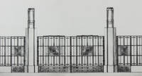
193039432Paris: Editions Charles Moreau 1930. First edition. Hardcover. g- to vg. Folio 17 2/8 x 12 6/8". 4pp Title and list of contents 36 loose leaves Plates as issued. Original quarter black cloth over illustrated paper covered boards. String ties. Illustrated title. This remarkable work is a pictorial survey of French Art Deco locksmith and ironworks in the late 1920s and early 1930s. The 36 striking photographic plates reproduced in heliotype depict numerous realized projects and projects of hand railings ironwork stairs gates doors and doorways executed by some of the most famous architects and craftsmen of the period such as: Raymond Subes Lucien Bechmann Henri Pacon Léon Gaudibert P. Jumelle R. Genuys Louis-Hippolyte Boileau Germain Debré Jean Dunand J. Rey Joseph Marrast Jean Walter Jean Prouvé Le Corbusier P. Jeanneret Dominique Chollet et Mathon Nics Frères Robert Mallet-Stevens Walter Gropius Henri Martin Michel Roux-Spitz G. Perzel Szetlak Pierre Patout Joseph Bassompierre Sirvin et de Rutte Joseph-Charles de Montarnal Bezault Frères Freynet et Deperthes P. et G. Bloch L. Praeger Molinie et Nicod Gilbert Poillerat Albert Laprade G. Vaudoyer Schenck E. Arrighi Henri Palausi Auguste Bluysen J. Lacoste Edgar Brandt Louis Plousey and Urbain Cassan. Moderate rubbing and age-toning along edges of portfolio. Head of spine slightly frayed. Lower margin of front cover and lower fore-edge of back board slightly water-stained. Water-staining to lower margin of text pages not affecting text slightly affecting the tip of the lower margin of plates throughout not affecting images. Text and captions in French. Portfolio in overall good- interior in good plates in good to very good images in very good condition. Editions Charles Moreau hardcover
2011758106.Gpaperback. Good. Access codes and supplements are not guaranteed with used items. May be an ex-library book. paperback
2329388659.Gpaperback. Good. Access codes and supplements are not guaranteed with used items. May be an ex-library book. paperback
176620022Paris 1766. No Binding. Fine. Folio - over 12 - 15" tall. Artist: Desnos Louis Charles - 1805 Paris; issued in: Paris; dated: 1766 27x16 inches or 56x40cm plus matting and frame. <br/> <br/> unknown
1994021440Atlas 1994 168 pp. 4 surrealist novels. Covers have some light shelf wear. Atlas paperback
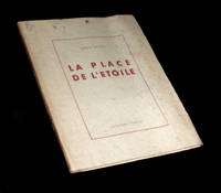
1945225011945. Rodez Collection Humour 1945. Un vol. au format pt in-4 242 x 192 mm de 91 pp. brochÂŽ sous couverture ˆ rabats rempliÂŽs. Edition originale pour laquelle il n'est pas fait mention d'un tirage en grands papiers. ''MÂŽconnue rarement jouÂŽe "La Place de l'ƒtoile" fut ÂŽcrite ˆ la fin des annÂŽes 1920 par Robert Desnos l'un de nos plus grands poÂtes surrÂŽalistes. Ce chef-d'Ãuvre de dr™lerie insolite se compose de neuf scÂnes o se croisent d'improbables personnages ˆ la fois proches et fuyants en une balade ÂŽtoilÂŽe aux multiples branches.'' Plats prÂŽsentant de discrÂtes rousseurs ainsi qu'un ÂŽclat lÂŽgÂrement altÂŽrÂŽ. Papier lÂŽgÂrement jauni. TrÂs rares rousseurs dans le texte. Nonobstant belle condition. b42961 unknown
1780M1807Paris 1780. Very Good both right and left margins are extended. Notes: Louis Charles Desnos 1725-1805 was a French geographer of the 18th century. A Parisian map seller bookseller; and globe maker. He made globes for the King of Denmark Christian VII. Size : 262x305 mm 10.31x12.01 Inches Coloring: Hand Colored Category: Maps World unknown
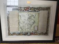
176667669Paris: c.1766. A fine and handsome map of the British Isles with an inset of Orkneys and Shetland islands and a very ornate title cartouche. The map is flanked by informative text in French pertaining to the British Isles.The map is surrounded with a very pleasing "framed" effect border decoration. Published in the "Atlas Generale Civil et Ecclesiastique". Size: 390 x 575 mm. Copperplate engraving with later hand colour. Good condition. unknown
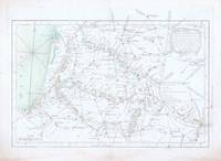
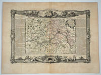
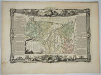
176820082Paris: Desnos 1768. Attractive map of this famed Loire River and chateaux area of France. Includes Angers Saumur Tours Blois Orleans and Sancerre. Long columns of descriptive text along the left and right of the map. Map measure 17 x 15.5" with large border. Attractive "military" motif border original color on the map. Very good condition. Desnos unknown
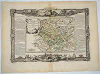
176820083Paris: Desnos 1768. Attractive map of this famed area of France. Includes the area from Normandie in the west to the champagne region of Rhiems in the east. Long columns of descriptive text along the left and right of the map. Map measure 17 x 15.5" with large border. Attractive "military" motif border original color on the map. Very good condition. Desnos unknown
176818494Paris: Desnos 1768. Attractive map of this area of southern France. Long columns of descriptive text along the left and right of the map. Map measure 17 x 15.5" with large border. Attractive "military" motif border original color on the map. Desnos unknown
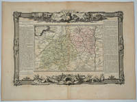
176818496Paris: Desnos 1768. Attractive map of this area of France. Includes Beaujolais Clermont Riom Aurillac Roanne Montbrison. Long columns of descriptive text along the left and right of the map. Map measure 17 x 15.5" with large border. Attractive "military" motif border original color on the map. Very good condition. Desnos unknown
176818498Paris: Desnos 1768. Attractive map of this area of France. Includes Bordeaux La Rochelle Bayonne Limoges Angouleme Bourg. Long columns of descriptive text along the left and right of the map. Map measure 17 x 15.5" with large border. Attractive "military" motif border original color on the map. Very good condition. Desnos unknown
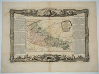
176618495Paris: Desnos 1766. Attractive map of this area of northeastern France. Includes Dunkirk Aire the Ardenne forest Maubeuge Philippeville Lille. Long columns of descriptive text along the left and right of the map. Map measure 17 x 15.5" with large border. Attractive "military" motif border original color on the map. Desnos unknown
1984258724Presses du monteil 1984. Etat Correct bords frottés couverture jaunie livres percé de 4 trous à chaque coins intérieur frais. in8. 1984. Broché. traduction de Erna Liebscher Presses du monteil unknown
2503588<p>LAfrique dressee pour letude e la geographie with an attractive cartouche and decorative engraved Roccoco frame wholly intact which is quite unusual. This attractive map is based on Delisles modern 1700 map and is by Louis Brion de la Tour cartographer royal and published by Louis Desnos in 1776. Not in Tooley.</p><p>1766. 27.5 x 24 cm. Printed on heavy paper and in fine condition; later colouring. Book No: 2503588</p> unknown