DesnosBiblio.com
29 résultats
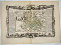
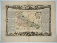
176618495Paris: Desnos 1766. Attractive map of this area of northeastern France. Includes Dunkirk Aire the Ardenne forest Maubeuge Philippeville Lille. Long columns of descriptive text along the left and right of the map. Map measure 17 x 15.5" with large border. Attractive "military" motif border original color on the map. Desnos unknown
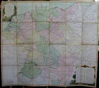
1791M5426Paris 1791. Very Good disected and laid on original canvas folding map. Notes: A decoratvie cartoche is on the upper left corner and a decorative map legend is located in the lower right. Size : 745x850 mm 29.25x33.5 Inches Coloring: Original Hand Coloring Category: Maps Folding Map; Maps Europe West Benelux General; Maps Europe West Germany; Maps Europe West Switzerland; Maps Europe West Austria unknown
176620022Paris 1766. No Binding. Fine. Folio - over 12 - 15" tall. Artist: Desnos Louis Charles - 1805 Paris; issued in: Paris; dated: 1766 27x16 inches or 56x40cm plus matting and frame. <br/> <br/> unknown
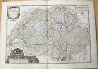
1764M10199Paris c. 1764. Very Good. Notes: An important and decorative map of Switzerland published in mid 18th century. The map originally was drawn by De Fer and later updated and improved by Desnos. Size : 485x670 mm 19.09x26.38 Inches Coloring: Hand Colored Category: Maps Europe Switzerland; unknown
176667669Paris: c.1766. A fine and handsome map of the British Isles with an inset of Orkneys and Shetland islands and a very ornate title cartouche. The map is flanked by informative text in French pertaining to the British Isles.The map is surrounded with a very pleasing "framed" effect border decoration. Published in the "Atlas Generale Civil et Ecclesiastique". Size: 390 x 575 mm. Copperplate engraving with later hand colour. Good condition. unknown
1760M5799Paris: Desnos 1760. Very Good. Notes: French map of Poland Lithuania and the surrounding region.<br>1760 edition of rare Nicolas De Fer's map. Size : 480x590 mm 18.875x23.25 Inches Coloring: Hand Colored in Outline Category: Maps Europe Poland Lithuania Desnos unknown
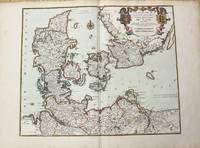
1780M10230Paris 1780. Very Good. Notes: Louis Charles Desnos 1725-1805 was a cartographer and maker of globes and mathematical instruments who settled in Paris where he worked for among other famous patrons the King of Denmark Christian VII as a Royal Globemaker. Size : 472x579 mm 18.58x22.80 Inches Coloring: Original Hand Coloring Category: Maps Europe Scandinavia Countries; unknown
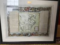
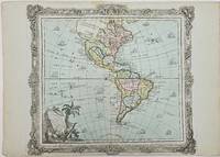
1786357069Brion. 1786. Short tear with no loss to centerfold marginal toning otherwise very good. 29x40.8x0.1 cm. Image size: 28x31.5 cm. Engraved map of the Americas with a decorative border. Old color. The details of the Pacific Northwest are speculative and poorly defined. Decorative title cartouche. Several ships sail the ocean. weight: 0.1 lb. Brion. unknown
1766101196<p>Engraved map slight outline coloring decorative rococo boarder with landscape style cartouche 12" x 10.7". Decent margins but bottom margin a little narrow minor aging light pencil notation in right margin; overall in excellent condition with a very strong impression. While the interior of the map doesn't show a substantial amount of geographical detail this appears typical of the period. There are some large rivers and lakes that are identified. The Nile appears to rise from two small lakes in the Mts de la Lune above the Equator. In the south there aren't a lot of places named but there are still some tribal names present.</p>
176818497Paris: Desnos 1768. Attractive map of this famed wine area of France. Includes Besancon Baumes Bourg Charillon Langres Tonnerre Dijon Auxonne. Long columns of descriptive text along the left and right of the map. Map measure 17 x 15.5" with large border. Attractive "military" motif border original color on the map. Very good condition. Desnos unknown
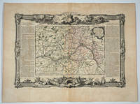
176820082Paris: Desnos 1768. Attractive map of this famed Loire River and chateaux area of France. Includes Angers Saumur Tours Blois Orleans and Sancerre. Long columns of descriptive text along the left and right of the map. Map measure 17 x 15.5" with large border. Attractive "military" motif border original color on the map. Very good condition. Desnos unknown
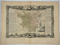
176820083Paris: Desnos 1768. Attractive map of this famed area of France. Includes the area from Normandie in the west to the champagne region of Rhiems in the east. Long columns of descriptive text along the left and right of the map. Map measure 17 x 15.5" with large border. Attractive "military" motif border original color on the map. Very good condition. Desnos unknown
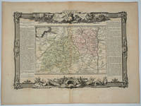
176818494Paris: Desnos 1768. Attractive map of this area of southern France. Long columns of descriptive text along the left and right of the map. Map measure 17 x 15.5" with large border. Attractive "military" motif border original color on the map. Desnos unknown
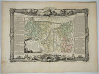
176818496Paris: Desnos 1768. Attractive map of this area of France. Includes Beaujolais Clermont Riom Aurillac Roanne Montbrison. Long columns of descriptive text along the left and right of the map. Map measure 17 x 15.5" with large border. Attractive "military" motif border original color on the map. Very good condition. Desnos unknown
176818498Paris: Desnos 1768. Attractive map of this area of France. Includes Bordeaux La Rochelle Bayonne Limoges Angouleme Bourg. Long columns of descriptive text along the left and right of the map. Map measure 17 x 15.5" with large border. Attractive "military" motif border original color on the map. Very good condition. Desnos unknown
1770910503CG[Um 1770]. Altkolorierter Kupferstich 28,5 x 31 cm, Blattgröße 29 x 39,5 cm.
178555445à Paris: Chez Desnos 1785. Fine. Chez Desnos à Paris 1785 6 x 11 cm In-24 relié New edition illustrated with 2 double maps and 156 maps engraved recto-verso all heightened in colors. One frontispiece and one engraved title. Contemporary publisher's binding in full red morocco. Smooth spine decorated. Brown morocco title label. Gilt edges. One restoration at foot and one at corner. Gilding sometimes faded. Good copy. Chez Desnos unknown
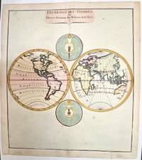
1780M1807Paris 1780. Very Good both right and left margins are extended. Notes: Louis Charles Desnos 1725-1805 was a French geographer of the 18th century. A Parisian map seller bookseller; and globe maker. He made globes for the King of Denmark Christian VII. Size : 262x305 mm 10.31x12.01 Inches Coloring: Hand Colored Category: Maps World unknown
1770910507CG[Um 1770]. Altkolorierter Kupferstich 35,5 x 51,5 cm, Blattgröße 39 x 56 cm.
176522130Paris 1765. 4to. Grangé Guillyn Desnos et al. Contemporary gold- and blind-tooled marbled calf sewn on 5 supports with the corresponding raised bands on the spine a red morocco title label on the spine lettered in gold a blind-tooled triple fillet border on both boards gold-tooled board edges red edges marbled end papers. With a double-page frontispiece by Le Charpentier after De Sève with a view of the Place de la Concorde in Paris 2 large folding engraved maps of France by Rizzi Zannoni 40 double-page engraved maps and charts of France 10 folding road maps 2 "Cartes odographiques" with the distances between French cities and 3 double-page engraved part-titles all but the frontispiece and titles in a contemporary hand colouring. 2 works in 1 volume the first in 3 parts. 15 1 blank 3 1 blank 8 10; 16 pp. 56 plates First edition of a rare atlas of France mapping out the country from all possible useful points of view. The work includes "analytical" maps which divide France in many ways showing not only the various geographical and political divisions of the country but also the military ecclesiastical juridical genealogical commercial and financial divisions and even hunting territories. The atlas also includes a small sea-atlas with 3 charts showing the French coasts as well as a French road atlas mapping out all the travelling routes of France. The maps were all made under the direction of Louis Charles Desnos 1725-1805 but they were drawn by various mapmakers. Several of the analytical maps and all sea charts were drawn by Rizzi Zannoni and all the road maps by Michel Royal geographer and engineer of the Paris Observatoire. This important geographical compendium drawn primarily from the cartographic collections of Desnos is structured around three series of maps: the Tableau analytique de la France Le petit Neptune and L'indicateur fidèle. All maps 52 in total were newly made and dated 1763-5. In the present composition published by Louis Brion de la Tour ca. 1745-1823 the atlas is in first edition and exactly as issued with all maps including the part-titles dated 1765. Most maps are set within broad ornamental borders and are attractively hand-coloured. After the maps three additional texts follow: the Prospectus du guide des voyageurs pour des routes royales & particulières de la France & autres a Catalogue alphabetique des routes royales et particulières and a Catalogue alphabetique du supplement des 1380 villes de France. Of particular interest is the added catalogue of the stock of Mr. Desnos who was a Paris publisher bookseller and engineer geographer of globes and spheres at Paris. All parts of the present atlas are offered for sale in the catalogue separately as well. With remnants of 2 bookplates mounted on the front pastedown an ownership annotation "Mailly" on the title page. The boards are somewhat scratched with some loss of material. Two maps are browned. Otherwise in very good condition.l Cf. Phillips 2990-2993 all three parts separate with the "Neptune" and "L'Indicateur" dated 1766; Quérard I 515. hardcover