122 résultats
1761273345Paris: Louis Charles Desnos 1761. unbound. Copper plate engraving with original hand color. Image measure 14.25" x 20.75".<br/><br/> This lovely 1761 map by Claude Buy de Mornas depicts the Nile Delta in northern Egypt. The map presents the science arts and monuments of Egypt and as such does not identify cities towns or other locations. Includes illustrations of pyramids pharaohs and a labyrinth. The city of Memphis is labeled and mountains are rendered in profile. Along the left and right is French text and the whole is surrounded by a beautiful floral border.<br><br>The notable feature of this map is the mapping of the large Lake Moeris. Today a small lake named 'Birket Qarun' near modern day Hawara appears at the location of Lake Moeris. Nearby is the legendry 'Labyrinth'. The lost Labyrinth appears in many classical texts including those of Herodatus Strabo Diodorus and Pliny. Described to be megalithic complex designed by Imandes for the Pharaoh Amenemhet III the Labyrinth is believed to have contained thousands of rooms filled with hieroglyphs and ancient Egyptian sculptures. Herodotus wrote about it in the fifth century B.C.: <br><br>" Furthermore they resolved to leave a memorial of themselves in common and in pursuance of this resolve they made a labyrinth a little above Lake Moeris and situated near what is called the City of the Crocodiles. I saw it myself and it is indeed a wonder past words; for if one were to collect together all of the buildings of the Greeks and their most striking works of architecture they would all clearly be shown to have cost less labor and money than this labyrinth. Yet the temple at Ephesus and that in Samos are surely remarkable. The pyramids too were greater than words can tell and each of them is the equivalent of many of the great works of the Greeks; but the labyrinth surpasses the pyramids also. It has 12 roofed courts with doors facing one another 6 to the north and 6 to the south and in a continuous line. There are double sets of chambers in it some underground and some above and their number is 3000; there are 1500 of each. We ourselves saw the aboveground chambers for we went through them so we can talk of them but the underground chambers we can speak of only from hearsay. For the officials of the Egyptians entirely refused to show us these saying that there were in them the coffins of the kings who had built the labyrinth at the beginning and also those of the holy crocodiles. So we speak from hearsay of these underground places; but what we saw aboveground was certainly greater than all human works. The passages through the rooms and the winding goings-in and out through the courts in their extreme complication caused us countless marvelings as we went through from the court into the rooms and from the rooms into the pillared corridors and then from these corridors into other rooms again and from the rooms into other courts afterwards. The roof of the whole is stone as the walls are and the walls are full of engraved figures and each court is set round with pillars of white stone very exactly fitted. At the corner where the labyrinth ends there is nearby a pyramid 240 feet high and engraved with great animals. The road to this is made underground.<br><br> Such was the labyrinth; but an even greater marvel is what is called Lake Moeris beside which the labyrinth was built. The circuit of this lake is a distance of about 420 miles which is equal to the whole seaboard of Egypt. The length of the lake is north and south and its depth at the deepest is 50 fathoms 300 feet. That it is handmade and dug it itself is the best evidence. For in about the middle of the lake stand 2 pyramids that top the water each one by 50 fathoms 300 feet and each built as much again underwater; and on top of each there is a huge stone figure of a man sitting on a throne. So these pyramids are 100 fathoms 600 feet high and these 100 fathoms are the equivalent of a 600-foot furlong the fathom measuring 6 feet or four cubits the cubit being six spans. The water in the lake is not fed with natural springs for the country here is terribly waterless but it enters the lake from the Nile by a channel; and for 6 months it flows into the lake and then another 6 it flows again into the Nile. During the 6 months that it flows out it brings into the royal treasury each day a silver talent for the fish from it; and when the water flows in it brings 20 minas a day."<BR><BR>Despite many archelogical surveys being conducted at site no evidence of the Labyrinth has been confirmed till today. The French text along the sides also includes a brief description of the Labyrinth. <br><br>The map appears in the 1761 edition of "Atlas Methodique et Elementaire de Geographie et d'Histoire" published by Louis Charles Desnos. The map is in good condition with minor wear along the original centerfold and minor spotting. Some edge wear. Stain in lower margin not affecting printed image. Original plate mark is visible. <br><br>Louis Charles Desnos 1725 - 1805 was a cartographer and globe maker from Paris France. He was the Royal Globe Maker for the King of Denmark Christian VII and published a large number of maps during his time.<br/><br/> Louis Charles Desnos unknown books
1761269935Paris: Louis Charles Desnos 1761. unbound. Copper plate engraving with original hand color. Image measure 15" x 21.5".<br/><br/> This impressive chart by Desnos and Brion de la Tour depicts the astronomical model developed by Nicolaus Copernicus. The Copernican Heliocentrism shows a stationary Sun at the center of the Universe with all the planets rotating around it. The Copernicus model is believed to have given birth to modern astronomy as it departed from the prevailing Ptolemaic system which for centuries placed the Earth at the center. The whole is surrounded by text with remarks and descriptions of the map and enclosed in a decorative border which was only added to the deluxe editions of his atlas.<br><br>The map is in good condition with minor wear and creasing along the centerfold. Centerfold split at bottom not affecting printed image. Original plate mark is visible. <br><br>Louis Charles Desnos 1725 - 1805 was a cartographer and globe maker from Paris France. He was the Royal Globe Maker for the Kind of Denmark Christian VII and published a large number of maps during his time. Louis Brion de la Tour 1756-1823 is best known for his 'Atlas General' published in collaboration with Louis Charles Desnos. He held the title of Royal Cartographer to the King of France. This is an uncommon example of their collaborative work.<br/><br/> Louis Charles Desnos unknown books
1767297404Paris: Louis Charles Desnos 1767. unbound. Engraving with original hand color. Image measures 8 3/4" x 11 1/4"<br/><br/> Interesting and highly detailed map of Paris with prominent buildings roads and gardens labeled. Published by Louis Charles Desnos after a 1748 map by Jean-Baptiste Crepy. This later printing includes an inset at lower left corner showing the 'Gouvernement de Paris' or the broader metropolitan area surrounding the city attribued to Brion engineer geographer of Roy 1765. Some staining. <br><br>Louis Charles Desnos 1725 - 1805 was a cartographer and globe maker from Paris France. He was the Royal Globe Maker for the King of Denmark Christian VII and published a large number of maps during his time.<br/><br/> Louis Charles Desnos unknown books
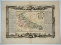
176618495Paris: Desnos 1766. Attractive map of this area of northeastern France. Includes Dunkirk Aire the Ardenne forest Maubeuge Philippeville Lille. Long columns of descriptive text along the left and right of the map. Map measure 17 x 15.5" with large border. Attractive "military" motif border original color on the map. Desnos unknown
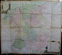
1791M5426Paris 1791. Very Good disected and laid on original canvas folding map. Notes: A decoratvie cartoche is on the upper left corner and a decorative map legend is located in the lower right. Size : 745x850 mm 29.25x33.5 Inches Coloring: Original Hand Coloring Category: Maps Folding Map; Maps Europe West Benelux General; Maps Europe West Germany; Maps Europe West Switzerland; Maps Europe West Austria unknown
176620022Paris 1766. No Binding. Fine. Folio - over 12 - 15" tall. Artist: Desnos Louis Charles - 1805 Paris; issued in: Paris; dated: 1766 27x16 inches or 56x40cm plus matting and frame. <br/> <br/> unknown
1762CLL-287Paris, à l'enseigne du Globe, 1762 In-4 de 122 pp., veau marbré, filet à froid en encadrement sur les plats, dos à nerfs orné de caissons de fleurons dorés, pièce de titre de maroquin citron, tranches rouges (reliure de l'époque).
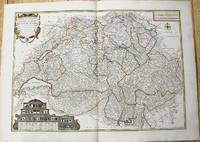
1764M10199Paris c. 1764. Very Good. Notes: An important and decorative map of Switzerland published in mid 18th century. The map originally was drawn by De Fer and later updated and improved by Desnos. Size : 485x670 mm 19.09x26.38 Inches Coloring: Hand Colored Category: Maps Europe Switzerland; unknown
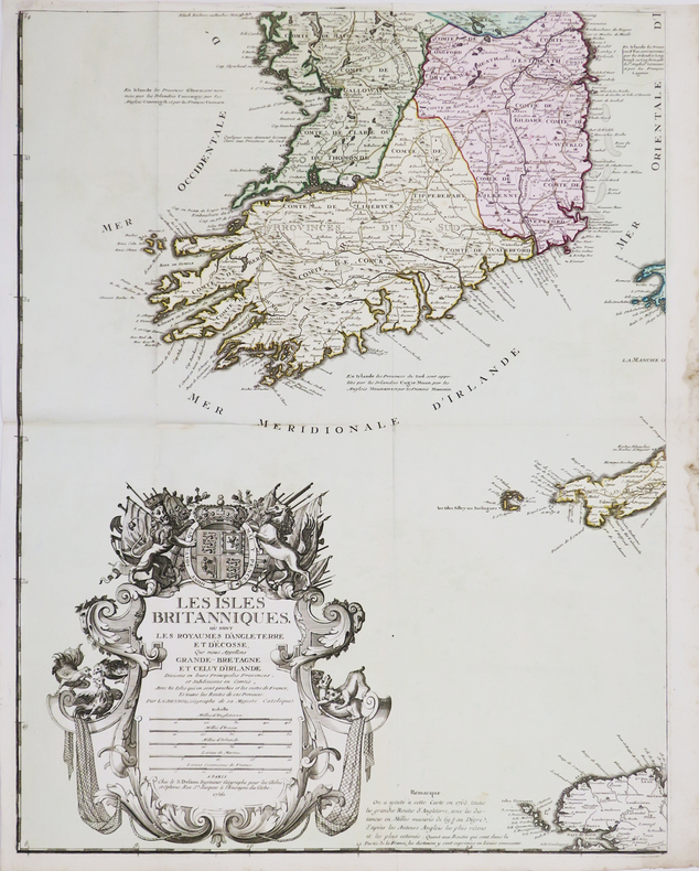
176667669Paris: c.1766. A fine and handsome map of the British Isles with an inset of Orkneys and Shetland islands and a very ornate title cartouche. The map is flanked by informative text in French pertaining to the British Isles.The map is surrounded with a very pleasing "framed" effect border decoration. Published in the "Atlas Generale Civil et Ecclesiastique". Size: 390 x 575 mm. Copperplate engraving with later hand colour. Good condition. unknown
1760M5799Paris: Desnos 1760. Very Good. Notes: French map of Poland Lithuania and the surrounding region.<br>1760 edition of rare Nicolas De Fer's map. Size : 480x590 mm 18.875x23.25 Inches Coloring: Hand Colored in Outline Category: Maps Europe Poland Lithuania Desnos unknown
1792LBW-4312Paris, Desnos, 1792. 498 x 603 mm.
1766LBW-4461Paris, S. Desnos, 1766. En quatre feuilles pouvant être jointes pour former une carte de 1,06 x 0,86 m.
1780M10230Paris 1780. Very Good. Notes: Louis Charles Desnos 1725-1805 was a cartographer and maker of globes and mathematical instruments who settled in Paris where he worked for among other famous patrons the King of Denmark Christian VII as a Royal Globemaker. Size : 472x579 mm 18.58x22.80 Inches Coloring: Original Hand Coloring Category: Maps Europe Scandinavia Countries; unknown
1782LBW-4311Paris, Desnos, 1782. 510 x 731 mm.
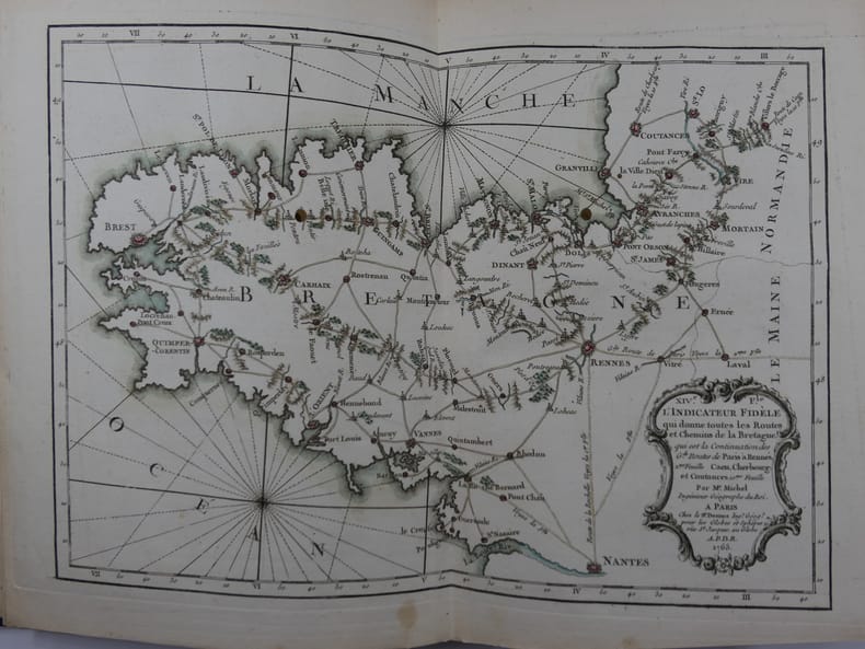
176581119Paris, Rue Saint-Jacques à L'Enseigne du Globe, 1765, in-4 (21x27,5cm), reliure tardive (19e s.) en demi-chagrin bleu nuit à dos long, titre et filets à l'or, plats papier marbré oeil de chat, Contient 19 cartes montées sur onglets, certaines dépliantes : une Carte Générale de France, IIe Feuille: Route de Paris à Rennes. IIIe F. Route de Paris à Bordeaux et Toulouse. IVe F. Route de la Diligence de Lion. Ve F. Le Carosse de Strasbourg. VIe F. Routes de Champagne, Lorraine, Franche-Comté, partie de la Bourgogne et de l'Alsace. VIIe F. Troisième Route de Paris à Strasbourg. VIIIe F. 3e Route de Paris à Strasbourg. IXe F. Grande Route des Prov. de Picardie, de Thiérache, d'Artois, de Hainaut, de la Flandre et des Pays-Bas. Xe F. Route des Provinces de Normandie, Boulonois, partie de la Flandres et Picardie, et Route de Paris à Londres. XIe F. Détail de la première Route d'Amsterdam à Marseille. XIIe F. suite Route Amst. à Mars. XIIIe F. Grande Route de Strasbourg à Wienne. XIVe F. Carte de Bretagne. XVe F. Routes et Chemins des Communications, compris entre les 4 grandes routes de Paris à Nantes et Rennes. XVIe F. Carte de Gacogne. XVIIe F. Qui donne les Routes et Chemins, tant Royaux que Particuliers, compris entre les deux grandes Routes de Paris à Toulouse. XVIIIe F. Qui donne les continuations des Routes Orientales et Méridionales des Grandes Routes de Paris à Marseille. Suit : un Prospectus du Guide des Voyageurs (1ff), un Catalogue Alphabétique des Routes Royales et Particulières (3ff), un Catalogue alphabétique du Supplément des 1380 Villes et Routes de France (4ff). MANQUE la Première Feuille, représentant Paris et les villages de la Banlieue.
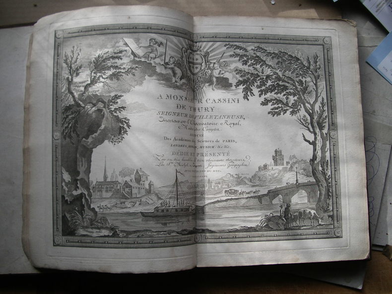
177056931770 A paris, à l'enseigne du globe, 1770. In-4, 21 double feuilles hors-texte montées sur onglets et gravées sur cuivre, page de titre, page de dédicace à M. de Cassini de Thury inscrite dans un beau décor, carte générale de la france avec couleurs et 18 feuilles des routes royales avec cartouche et rehauts en couleurs. 8 pages (prospectus et privilège, catalogue alphabétique du supplément des 1380 villes et routes de france). Reliure XIX° siècle demi parchemin dos lisse, pièce de titre maroquin rouge, titre or. Mouillure claire angulaire atteignant 11 feuilles.
1768130631768 basane mouchetée, dos à n. (mouillure marginale aux 3 premiers ff.). in-4, titre, frontispice, 1 carte, 18 cartes montées sur onglet la plupart dépliantes, 6 et 10 pp. Paris Au globe 1768
178546404674Paris, (Desnos), 1785 ; in-4, demi-basane brune, pièce de titre Atlas des postes. (Reliure de l’époque) Titre gravé sur double page, 1 double page gravée illustrée avec dédicace à M. Cassini de Thury (départ de la diligence et du coche d’eau), 20 cartes sur double ou triple page TOUTES SOIGNEUSEMENT ENLUMINÉES À L’AQUARELLE, 15 pp. de texte par BRION, 17 pp. prospectus du guide des Voyageurs.Cinquième édition revue et corrigée de cet atlas très important qui a paru pour la première fois en 1764. - Fordham p. 70Les cartes donnent tous les itinéraires des routes de France avec dans les marges, les tableaux des services de voitures publiques, messageries... (type de véhicule, jours et heures des départs). Reliure usagée, intérieur frais.
1790LBW-4943Paris, Sr. Desnos, 1790. 498 x 644 mm.
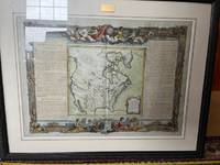
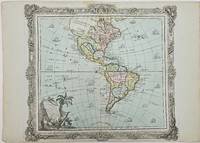
1786357069Brion. 1786. Short tear with no loss to centerfold marginal toning otherwise very good. 29x40.8x0.1 cm. Image size: 28x31.5 cm. Engraved map of the Americas with a decorative border. Old color. The details of the Pacific Northwest are speculative and poorly defined. Decorative title cartouche. Several ships sail the ocean. weight: 0.1 lb. Brion. unknown
1766LBW-7417Paris, Desnos, 1766. 482 x 710 mm.
1766101196Engraved map slight outline coloring decorative rococo boarder with landscape style cartouche 12" x 10.7". Decent margins but bottom margin a little narrow minor aging light pencil notation in right margin; overall in excellent condition with a very strong impression. While the interior of the map doesn't show a substantial amount of geographical detail this appears typical of the period. There are some large rivers and lakes that are identified. The Nile appears to rise from two small lakes in the Mts de la Lune above the Equator. In the south there aren't a lot of places named but there are still some tribal names present. books
1766101196<p>Engraved map slight outline coloring decorative rococo boarder with landscape style cartouche 12" x 10.7". Decent margins but bottom margin a little narrow minor aging light pencil notation in right margin; overall in excellent condition with a very strong impression. While the interior of the map doesn't show a substantial amount of geographical detail this appears typical of the period. There are some large rivers and lakes that are identified. The Nile appears to rise from two small lakes in the Mts de la Lune above the Equator. In the south there aren't a lot of places named but there are still some tribal names present.</p>
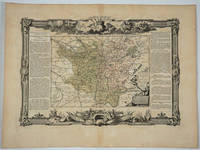
176818497Paris: Desnos 1768. Attractive map of this famed wine area of France. Includes Besancon Baumes Bourg Charillon Langres Tonnerre Dijon Auxonne. Long columns of descriptive text along the left and right of the map. Map measure 17 x 15.5" with large border. Attractive "military" motif border original color on the map. Very good condition. Desnos unknown
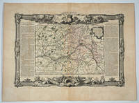
176820082Paris: Desnos 1768. Attractive map of this famed Loire River and chateaux area of France. Includes Angers Saumur Tours Blois Orleans and Sancerre. Long columns of descriptive text along the left and right of the map. Map measure 17 x 15.5" with large border. Attractive "military" motif border original color on the map. Very good condition. Desnos unknown