Gause, Frank ABiblio.com

969 résultats
1018258906.Gpaperback. Good. Access codes and supplements are not guaranteed with used items. May be an ex-library book. paperback
054890717X.Gpaperback. Good. Access codes and supplements are not guaranteed with used items. May be an ex-library book. paperback
1018253270.Ghardcover. Good. Access codes and supplements are not guaranteed with used items. May be an ex-library book. hardcover
1164181424.Gpaperback. Good. Access codes and supplements are not guaranteed with used items. May be an ex-library book. paperback
0471295701.Ghardcover. Good. Access codes and supplements are not guaranteed with used items. May be an ex-library book. hardcover
196351643New York: John Wiley & Sons Inc. As New. 1963. Hardcover. FREE UPGRADE to Courier/Priority Shipping Upon Request IN STOCK AND IMMEDIATELY AVAILABLE FOR SHIPMENT - 365 pages. -- with a bonus offer-- . John Wiley & Sons, Inc. hardcover
2013x-1615991247Loving Healing Pr 2013. Paperback. New. 440 pages. 9.84x6.97x1.22 inches. Loving Healing Pr paperback
19476422like new. unknown
188792700X.Ghardcover. Good. Access codes and supplements are not guaranteed with used items. May be an ex-library book. hardcover
1615991247.Ghardcover. Good. Access codes and supplements are not guaranteed with used items. May be an ex-library book. hardcover
0267899742.Ghardcover. Good. Access codes and supplements are not guaranteed with used items. May be an ex-library book. hardcover
1021096547.Ghardcover. Good. Access codes and supplements are not guaranteed with used items. May be an ex-library book. hardcover
1140488996New. Brand new and still unused unknown
1914682701914. GOLDER Frank A. Russian Expansion on the Pacific 1641-1850. An Account of the Earliest and Later Expeditions made by the Russians along the Pacific Coast of Asia and North America; Including some Related Expeditions to the Arctic Regions. Cleveland: A. H. Clark 1914. 1st ed. Illus. Maps. 368pp. Fine untrimmed copy in orig. cloth. T. e. g. Howes G-223. unknown
2008x-0470074833Wiley-Interscience 2008. Hardcover. New. 1st edition. 560 pages. 9.50x6.50x1.00 inches. Wiley-Interscience hardcover
2008DADAX0470074833Wiley 2008-02-15. 1. hardcover. New. 6.40x1.30x9.50. Buy with confidence. Excellent Customer Service & Return policy. Wiley hardcover
1275552218.Gpaperback. Good. Access codes and supplements are not guaranteed with used items. May be an ex-library book. paperback
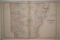
1878222554Philadelphia: O.W. Gray & Son 1878. unbound. very good. Map. Engraving with original hand coloring. Image measures 16.25" x 24.25".<br/> <br/> Nice map of Arkansas divided into counties and townships showing all major towns and cities routes railroads and waterways. Minor crease to top corners.<br/> <br/> O.W. Gray & Son unknown
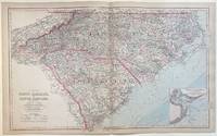
1884303738Philadelphia: O.W. Gray & Son 1884. unbound. Map. Engraving with original hand coloring. Image measures 17 1/4" x 28 3/8"<br/> <br/> Large double-page map of of the Carolinas divided into counties and townships. Shows all major towns and cities routes railroads and waterways. Topography and marshlands are impressively depicted with relief shown by hachure. The coastline is rendered in great detail with inlets shoals lighthouses and other features labeled. This map includes an inset of Charleston Harbor and its approaches including depths by soundings. <br> <br> Ormando W. Gray was a map publisher active in the later half of the 19th century. A civilian engineer and surveyor he worked with several other map publishers like Henry Walling and Colton. His state and county atlases are well known. Frank A. Gray presumably a relative produced many maps that were published by the family firm O.W. Gray & Sons. This map is a lovely example of their work.<br/> <br/> O.W. Gray & Son unknown
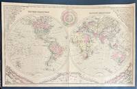
328201Washington: O.W. Gray & Son. William H. Holmes. Map. Hand colored engraving. Sheet measures 17" x 27 1/4"<br/> <br/> Fascinating double hemisphere map surrounded by infographics showing comparative rivers mountains and local times. The maps are highly detailed with countries regions major cities rivers and topography labeled. In the upper corners the world's rivers are unfurled and laid out in order of total length creating a triangular shape that is mirrored on the bottom half of the chart by an arrangement of the world's mountains. Divided by continent and hemisphere the mountains are arranged from smallest to tallest with peaks and heights labeled. Mountains of the United States of lower elevations than global mountain ranges are included along the center bottom. In the top center a time diagram that appears as a clock shows estimations of local time of the fifty principal cities of the world. <BR> The map is in very good condition with minor wear to centerfold. <br> <br> Ormando W. Gray was a map publisher active in the later half of the 19th century. A civilian engineer and surveyor he worked with several other map publishers like Henry Walling and Colton. His state and county atlases are well known. Frank A. Gray presumably a relative produced many maps that were published by the family firm O.W. Gray & Sons.<br/> <br/> O.W. Gray & Son unknown
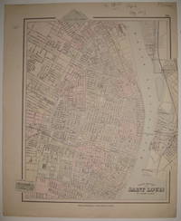
1883227686Philadelphia: O.W. Gray & Son 1883. unbound. very good. Map. Engraving with original hand coloring. Image measures 15 5/8" x 13".<br/> <br/> Beautifully detailed map of St. Louis colored according to wards. Shows street grid railroads parks reservoirs and public institutions. Small tear and crease to right edge light stain to left margin.<br/> <br/> O.W. Gray & Son unknown
9768125292.Gpaperback. Good. Access codes and supplements are not guaranteed with used items. May be an ex-library book. paperback
193983491Cornell Universirty. Good. 1939. stapled/soft Cover. T31 . Cornell Universirty paperback
2023__344647515XHanser Fachbuchverlag 2023. Hardcover. New. German language. 9.53x6.73x0.75 inches. Hanser Fachbuchverlag hardcover
0306406993.Ghardcover. Good. Access codes and supplements are not guaranteed with used items. May be an ex-library book. hardcover