War Office (Compiler)Biblio.com
11 490 résultats
2016x-1847349668Naval and Military Press 2016. Paperback. New. 362 pages. 8.50x5.50x0.75 inches. Naval and Military Press paperback
2006x-1847341993Naval & Military Pr 2006. Hardcover. New. 164 pages. 9.21x6.14x0.44 inches. Naval & Military Pr hardcover
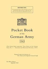
1943024283London: H.M.S.O. Good. 1943. First Edition. Softcover. n.p. approx.250-300 pages fold-out tables actually one manual and two "amendments" manuals which are three hole punched and string-tied together. The first is the "Pocket Book of the German Army 1943" the second is same title but "Amendments No. 1" and the third is "Amendments No. 2. The first has stiff card covers the Amendments are simply stapled pages without the stiff card covers. A previous owners small ink stamp throughout including on covers . H.M.S.O. paperback
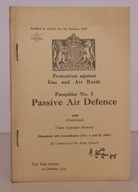
194144549HMSO 1941. 8vo. with plans and diagrams in the text some very light age soiling; original wrappers printed in black wire-stitched as issued a near fine copy. First issued in 1939. S.O. Code: 53968. These pamphlets are effectively the service equivalents of the ARP Precautions leaflets issued to the general population. SCARCE IN THIS CONDITION. [HMSO], unknown
B9781020580390Hardback. New. hardcover
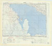
60029London: War Office 1957. 2 maps 62 x 72.5 cm printed recto verso in colour on one single sheet of rayon artificial silk marked "Restricted " in red. Published by the War Office in 1957 the present map shows large swathes of what are now the United Arab Emirates on a scale of 1:1000000. To the recto is a map entitled 'Hofuf' which shows the Persian Gulf Qatar Peninsula Bahrain Island part of the north-eastern coast of Saudi Arabia and a small part of Oman. To the verso is a map entitled 'Bandar Abbas' showing the Persian Gulf the Straights of Hormuz the Gulf of Oman and bordering countries. Both maps had first been produced by the War Office in 1945 and were revised only slightly for use here. Some light trivial fraying and small fold mark to upper margin not affecting map generally an excellent copy. During the Second World War the British War Office began to produce Escape and Evasion maps for its soldiers and personnel printed on Rayon acetate. Because of the silky nature of this material however which was chosen for its durability and portability they came to be known as silk maps. The War Office and later the Department of Defence continued to produce these throughout the twentieth century covering many regions across the world. The maps take the standard form of British Escape and Evasion maps with relief represented by hachures altitude tints and spot heights which height given in metres. Among the significant features shown are borders highways important roads railway tracks airports rivers bodies of water and telegraph lines. These are identified in keys alongside both maps where relevant information such as "fresh water" is emphasised. Alongside these keys there are other helpful resources for military personnel in the area whether by design or due to an emergency landing. These include a glossary of Romanised Arabic terms and diagrams placing the region shown in its wider geographical context. In 1932 Said bin Taimur became the Sultan of Muscat of Oman his Sultanate stretching down the entirety of Oman's eastern coast. His reign was supported by the British Government which maintained significant control over his land installing its ministers in his government. British interest the area was mainly motivated by the promise of oil with the Iraq Petroleum Company IPC being 23% British-owned and over the following decades the Sultan and the Company searched the deserts in the hope of striking a new and lucrative deposit. After failing to discover any significant resources within his direct domain however Said bin Taimur with the backing of the IPC raised an army to occupy the Imamate of Oman where he hoped to find oil at last. Thus in 1954 the Jebel Adkhdar War or Oman War broke out as the local Omanis and their leader Imam Ghalib ALhinai fought against the combined forces of the Sultanate and the British Army to protect their land from the would-be occupiers. Eventually Arab states including Egypt Saudi Arabia and Iraq came to the support of the Imamate but the war nevertheless stretched on until 1959 when a final effort by. The British SAS brought the conflict to a decisive end. The treatise and agreements signed in the aftermath of the war were heavily weighted towards British interests giving them trading rights the islands of Kuria Muria and extensive power over the Sultanate's ministries. The Sultanate was thus transformed into a de facto British colony. The present map produced in the very middle of the conflict shows much of the theatre of the Jebel Adkhdar War. It is not entirely clear however why the cities of Hofuf and Bandar Abbas both of which are indeed shown on their respective maps are selected as the titles for each. Neither seems to have played a role in the war and in fact the latter was a small fishing port of about 17000 people during the late 1950s. They are by no means the only cities to be shown with a wealth of toponyms covering the maps and so it remains a mystery why they have been singled out as titles. [London]: War Office, 1957. unknown
1163125547.Gpaperback. Good. Access codes and supplements are not guaranteed with used items. May be an ex-library book. paperback
A9781163125540New. unknown
B9781163125540New. unknown
B9781169282926New. unknown
116928292X.Ghardcover. Good. Access codes and supplements are not guaranteed with used items. May be an ex-library book. hardcover
143048232X.Gpaperback. Good. Access codes and supplements are not guaranteed with used items. May be an ex-library book. paperback
191196577London: War Office 1911. 1st edition. Very Nice Copy. small octavo. orig. cloth ix 453pp. b/w plates text ills. colour diags. index Excellent manual incl. photos & drwgs. of horse & camel-drawn ambulances. A nice tight copy War Office hardcover
192569311London: H. M. S. O. 1925. reprint. Very Good. small octavo. original boards ix 383pp. b/w pls. text ills. col. diags. index Excellent manual incl. photos & drwgs. of horse & camel-drawn ambulances. New material on gas warfare. Boards a little worn o/w VG H. M. S. O. hardcover
B9781020750205Hardback. New. hardcover
B9781022865129Paperback / softback. New. paperback
1164945688.Gpaperback. Good. Access codes and supplements are not guaranteed with used items. May be an ex-library book. paperback
1437146821.Gpaperback. Good. Access codes and supplements are not guaranteed with used items. May be an ex-library book. paperback
2006x-1847344534Naval & Military Pr 2006. Hardcover. New. 456 pages. 10.00x7.00x1.00 inches. Naval & Military Pr hardcover
ria9781847344533_inpHardcover. New. New Book; Fast Shipping from UK; Not signed; Not First Edition; N/A hardcover
B9781847344533Hardback. New. hardcover
1843429268.Gpaperback. Good. Access codes and supplements are not guaranteed with used items. May be an ex-library book. paperback
1847344534.Ghardcover. Good. Access codes and supplements are not guaranteed with used items. May be an ex-library book. hardcover