48 775 résultats
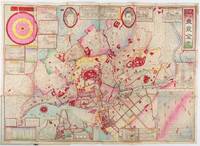
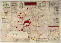
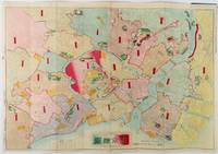
1890214188東京. Tokyo.: 大倉四郎兵衛. Ōkura Shirobei. Meiji 23 1890. Attractive scarce hand coloured map 50 x 70cm folded 16.5 x 9cm original upper cover with paper title label a little marked small mark in margin minor wear a very good and attractive copy. This 1890 map of Tokyo depicts an expanding metropolitan city during the mid-Meiji period. The Royal Palace is prominently marked in the centre in a shade of red. Major shrines and temples are highlighted in green while rivers along with some illustrations of sailing boats are represented in blue. Larger sailing ships possibly of foreign origin can be seen approaching Tokyo port. Ward names are indicated in red and red lines delineate the ward and county borders. The map provides detailed town names and streets. . 大倉四郎兵衛. [Ōkura Shirobei]. unknown
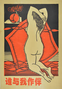
220333No date. Late 20th Century. Colour silk screen poster 78 x 54cm occasional little creases on edges and trifle spottings little discolouration on margins otherwise in very good condition. Controversial Chinese poster featuring a nude in an alluring pose. . unknown
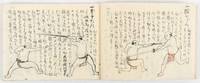
177621Japan. Late Edo or early Meiji. Ink and watercolour illustrations and manuscript text on over 50 double folded leaves in a modern handmade Japanese four hole stab binding book with paper covered card covers 12 x 17.5cm. A very nice copy in very good condition. This attractive manuscript illustrated work is probably a handwritten copy of a textbook on the Shibukawa-style jutte techniques. It appears to have been made either in the late Edo or early Meiji period although the binding appears to be recent. The Shibukawa style of martial arts jujitsu originated in the late 17th century and the style engages various weapons including spears and jutte. The Shibukawa style continues to be practiced in Japan to this day. <br> <br>A jutte or jitte is a small metal weapon generally used for protection against sword attacks. It was used by the police during the Edo period. In this textbook various techniques of jutte use are explained in text and illustration. In the latter section some use of arms to wrestle the counterpart are explained. This volume includes an explanation of the use of a jutte against an arrow and even gun fire! . unknown
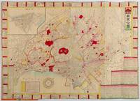
1892214181東京. Tokyo.: 山嵜暁三郎. Yamazaki Akizaburo. Meiji 25 1892. Colour woodblock map 50 x 71cm folds into card covers with plain cloth spine. 18 x 12cm. Occasional small holes at folds some colour offsetting in places a little marking and staining along upper margin upper left section of upper cover stained with a little subsequent staining to map. A bright and attractive map which looks better than this sounds. This 1892 map of Tokyo shows a growing metropolitan city which attracts many tourists from outside. Portraits of the Emperor and the Empress are featured prominently at the top. There are 11 inset illustrations of major buildings and sites surrounding the main map with a round chart which shows directions and distances to them. Another chart lists place names in wards and counties in Tokyo. The Royal Palace is featured in the center and the palace and major buildings are coloured in red. An inset map of Yokohama sits on the lower left. . 山嵜暁三郎. [Yamazaki Akizaburo]. hardcover
1893214413東京. Tokyo.: 奎暉閣. Keikikaku. Revised Edition. Meiji 26 1893. Folding engraved map of Tokyo in Japanese and English with woodblock colour 51.7 x 71.7cm folds into 18.5 x 10cm original covers title and publishing details upper cover. Neatly repaired on the reverse along some of the folds with a little minor loss occasional minor spotting otherwise very good. This is a map of Tokyo which was originally published in 1887 and revised in 1893. The map could be used for a tourist self-guide map as 39 illustrations of major sites and buildings are surrounding the map. Main landmarks including the Royal Palace are coloured in deep red. Some residents' names are recorded in some blocks. Three charts of text in Japanese on the bottom right give the names of the neighbourhoods to be found within each of Tokyo's wards. An inset at the top left shows a map of Yokohama. . 奎暉閣. [Keikikaku]. unknown
1892196563山中善三郎. Yamanaka Zenzaburo. Meiji 25 1892. Colour woodblock folding map of Tokyo with inset city plan of Yokohama a plan of the Diet a chart with many town names and a selection of images of sites. 51 x 71.5cm folds into 18.2 x 12cm paper covered covers paper title label on upper cover has some insect damage and fading wear at fold points with some tiny holes now neatly secured on the reverse with washi. The 1892 map of Tokyo provides an intricate view of the central and surrounding areas of the Tokyo metropolitan region. The map's focal point is the Royal Palace distinguished by its vivid red hue. Alongside this select military facilities also stand out in red. The map's legends unveil sections of Meiji Tokyo. Aristocrats' residences police stations and telegraph stations are marked reflecting the city's diverse functions. Shrines and temple are also indicated. Interestingly the map presents portraits of Emperor Meiji attired in Western clothing and Empress Meiji adorned in traditional kimono. These depictions flank the map's title. Accentuating the map's narrative are sixteen illustrations thoughtfully dispersed around the periphery showcasing Tokyo's key landmarks and significant structures. . 山中善三郎. [Yamanaka Zenzaburo]. hardcover
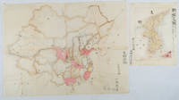
1902220266Japan. No date. Circa1902. Two very attractive colour folded manuscript maps one showing China and the other Korea. <br> <br>Map of China: Watercolour map 48 x 63.5cm. Closed tear now professionally repaired. <br> <br>Map of Korea: Finely detailed watercolour map a few tiny holes very neatly repaired on the verso with archival washi. 33 x 24.5cm Two delicate hand-painted maps one of China and one of Korea produced by a Japanese student cartographer named Koike Tokushige 小池徳重. <br> <br>The undated map of China appears to have been produced in the first five years of the twentieth century: a time when Japan had recently colonized Taiwan and when Japanese economic and political interest in the region was rapidly expanding. The inscription on the map suggests that it was a third year college project. But the high level of detail suggests that the artist had considerable experience of map making. The map of China shows the main provinces rivers major transport routes the Great Wall and the location of key cities although the names of the cities are not included. It also shows outlines of the Korean Peninsula Taiwan and the Japanese island of Kyushu but not the rest of Japan. <br> <br>The map of Korea is more detailed. It provides an accurate outline of the Korean Peninsula with careful hatching indicating changes in elevation. Rivers and major road routes are shown on the map and the locations of major towns are marked though only Busan and Incheon are named. Dotted lines show coastal sea routes and routes between Kyushu and Busan and between Incheon and China. The map shows the Gyeongin railway line between Seoul and Incheon which was completed in 1899 and route of the Gyeongbu railway line between Busan and Seoul whose construction started from both ends in 1901. But the map depicts only small sections of this line close to Seoul and Busan as being completed with the rest more lightly outlined to show the projected route implying that the map was drawn around 1901-1902 and certainly before the Gyongbu line was opened in 1904. <br> <br>Inserted text gives the land area and population of Korea. Rather strangely though the figure given for the Korean population is vastly underestimated. Ikeda gives this as 5.7 million when in fact at that time is was around 18 million. . unknown
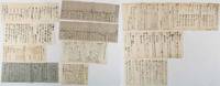
214226Japan. 10 manuscript sheets of varying size minor wear at edges some occasional browning but overall very good. This distinctive collection of ten handwritten documents spans a pivotal transitional period in Japanese history from the final years of the Edo period to the early Meiji era. The documents reflect a wide variety of official and diplomatic concerns such as coastal defence arrangements in response to the increasing arrival of foreign ships records concerning the surrender of regional lords following internal conflict the landing of a British diplomatic mission and a manuscript copy of an imperial letter involving the Shimazu clan of Satsuma and the influential court noble Iwakura Tomomi. <br><br>Among the more significant items is a document thought to detail the Dajōkan’s Great Council of State policies for handling foreign incursions including a list of regional officials operating under its authority. Other documents provide brief profiles of foreign diplomatic representatives in Japan and a chronological summary of treaty exchanges with the United States. <br><br><br>Names of major historical significance appear across the documents including Iwakura Tomomi 岩倉具視 Shimazu Jusan’I 島津従三位 Sanjō Saneyoshi 三条実美 and three notable British figures: Sir Harry Parkes William George Aston and Ernest Mason Satow. As a group these manuscripts offer valuable insight into the shifting political and diplomatic landscape of mid-19th-century Japan. . unknown
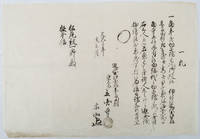
1863218660Japan. Bunkyu 3 1863. Manuscript in black ink 32 x 46cm small area of worming at lower right of the sheet light browning and wear at lower left margin overall very good. This document certifies that a family of three comprising parents and a young boy residing in Ōmi Domain present-day Shiga Prefecture are not Christians and are affiliated with a Jōdo sect Buddhist temple the temple name is unclear. The document is dated March 1863 and bears the signature of the head priest of the temple. <br> <br>Such certificates commonly known as terauke were issued between 1671 and 1873 as part of the Tokugawa authorities' system for suppressing Christianity. They also functioned as a means of population registration linking individuals and households to Buddhist institutions for administrative and taxation purposes. . unknown
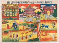
1572159932長野.Nagano.: 中澤廣太.Kota Nakazawa. 昭和十一 1936. Brightly coloured souvenir printed sheet showing scenes from the Zenkō-ji Temple showing 8 individual illustrations some show the location within the temple. A little minor wear including a few closed tears along edges very good. Text in Japanese. 53.5 x 38.5cm. 善光寺 "Zenkō-ji Temple" located in Nagano is an old Japanese Buddhist temple which was built in 7th century. The temple belongs to both the Tendai and Jodo Shinshu schools of Buddhism. It enshrines the images of the 阿弥陀如来"Amitābha Buddha". One of the primary Buddha statues at the Zenkō-ji Temple is a 秘仏 hibutsu "a hidden Buddha" which is reportedly shown to the public once every six or seven years. <br> <br>Upper right section: 仁王門 Niōmon the Japanese name of a Buddhist temple gate guarded by two wooden warriors. <br>Upper middle section: 御本堂 Gohondō the Japanese name of the main hall of a Buddhist temple. <br>Upper left section: 御内陣開帳 Gonaijin kaicho. Secret Buddha statues are enshrined in special place in the temple and are shown at regular intervals to the public. <br>Lower middle section:御開帳行列Gokaichoo gyoretsu. The procession of showing the secret Buddha statue. . 中澤廣太.[Kota Nakazawa]. unknown
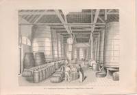
71-3103London: The Penny Magazine circa 1842. Steel engraving. 135 x 193 mm. sheet. Very Good.Provenance: From the collection of the Late Frederick G. Ruffner Jr. founder of Gale Research Detroit. [London: The Penny Magazine, circa 1842]. unknown
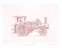
71-6348San Francisco: Self Published 1974. Color etching. 12.5 x 16 cm sheet. Signed titled dated in pencil and annotated ‘AP’. Very Good. [San Francisco: Self Published, 1974]. unknown
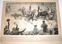
71-9008New York: Harper’s Weekly December 4 1875. Double-page wood engraving on newsprint. Text on verso. 40 x 54 cm sheet. Good age toning along the sheet edges tears to sheet edges. New York: Harper’s Weekly, December 4, 1875. unknown
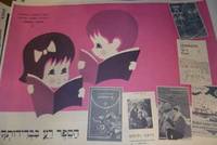
73-3509Tel Aviv: 20th Century Israeli Publisher circa 1970s-1980s. 50x70 cm. Color poster. Very Good. Text in Hebrew. Tel Aviv?: 20th Century Israeli Publisher, [circa 1970s-1980s] unknown
New Turkish Original bdg. HC. 4to. (29 x 21 cm). In Turkish. [xxx], 592, [1] p., examples of Ottoman demographic documents (Defter in romanized Ottoman Turkish with facsimile in Ottoman Turkish.). Ünye nüfus defteri, (1834). Demographic registers of Ottoman Ünye (district of Ordu city) in 1834, after 3 years later from the first census in the period of Sultan Mahmud II. A very heavy volume.
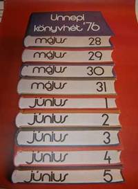
73-3662Budapest: 20th Century Hungarian Publisher 1976. 81x46 cm. Color poster. Very Good. Slight fold on upper right corner. Text in Hungarian. [Budapest?: 20th Century Hungarian Publisher?], 1976 unknown
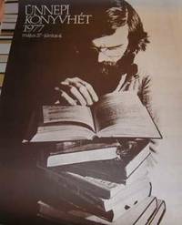
73-3663Budapest: 20th Century Hungarian Publisher 1977. 81x46 cm. Black and white poster. Very Good. Text in Hungarian. [Budapest?: 20th Century Hungarian Publisher?], 1977 unknown
170196371Cöllen [Köln], Johannis Weidenfeldt, 1701. Vortitel, 1 illustr. Kupfertitel, Drucktitel in Rot u. Schwarz gedruckt, [5] Bl., 1072 S., [12] Bl. Register. 22 cm. Schweins-Ldr. auf Holzdeckeln mit 2 intakten Metallschließen, ornamentaler Blindprägung und Ganz-Rotschnitt.
19888208DBKöln., Museum Ludwig., 1988. 27 x 21 cm. 335 S. Illustrierter OKarton., 8208D 1. Auflage. Sehr gutes, frisches Exemplar.
199467471BBSalzweg., Tutte Druckerei GmbH., 1994. 28 x 23 cm. [116] unpaginierte S. OKarton., 67471B 1. Auflage. Gutes Exemplar.
1999498EBKöln / Bonn., Rheinland-Verlag / Landschaftsverband Rheinland., 1999. 21 x 30 cm. 24 unpaginierte S. Illustrierter OPappband., 498E 1. Auflage. Einbandkanten mit minimalen Bereibungen, sonst sehr gutes Exemplar.
199869332ABo. O., o. V., 1998. 82,8 x 68,2 cm. [1] unpaginiertes Blatt., 69332A Erste Auflage. Sehr gutes Exemplar.
200296080Tübingen, Konkursbuchverlag, 2002. 152 S. 21 cm. Illustr. Orig.-Klappenbroschur.
FH-091o.J. Linolschnitt, 1918, auf Japan, mit Bleistift signiert, und als ?Orig.-Linol.Handdr.? bezeichnet. Darstellungsgröße 26,7:22,9 cm, auf den Darstellungsrand geschnitten. - Knickfalte in der linken unteren Ecke.