Verzeichniss aller GegenständeAntiquariat.de

1 154 résultats
18405888Amtlich bekannt gemacht. Verkaufspreis 12 Kr. Nürnberg, Druck der Campeschen Officin, (1840). 8vo. (21,0 x 12,5 cm). IV S., 1 Bl. Verbesserungen, 1 leeres Bl., 112 S. Typographischer Orig.-Umschlag.
1854RECH0443Prag, André 1854. XXVI, 339 S., HLn. d. Zt., berieben, kl. Schabstelle am Vorderdeckel, Ecken u. Kanten etwas bestoß., am Spiegel u. flieg. Vors. einige schriftliche Verm., Innentit. u. letzte S. mehrf. gestemp., innen sehr guter Zustand. 1 Beilage: Barta, R., Übungsaufgaben zum Studium des Wechselrechtes. 18 S., OBrosch., kjlammergeh., versaubt u. leicht vergilbt.
1873002874Washington DC: Published by Order of the Secretary of War 1873. First Edition. Good. Six maps for: Monday February 17 1873 - 11 P. M.; Tuesday February 18 1873 - 7:35 A. M.; Tuesday February 18 1873 - 4:35 P. M.; Wednesday February 19 1873 - 7:35 A. M.; Wednesday February 19 1873 - 4:35 P. M.; Wednesday February 19 1873 - 11 P. M.; 8 3/4 x 11 1/2; relief shown by hachures and gradient tints; small reference table in the lower half of the image; edges brittle with small chips and cuts; overall in good to very good condition. A scarce collection of maps their publication began in January of 1871 with no less than 3 maps being published every day. Samuel Morse's invention of the telegraph had made it possible to easily observe gather and transmit data from different points over the entire country. A small note at the head read: "All observations made at the same moment of actual not local time." Released by the US Army's Signal Service the maps were intented to be primarily used by farmers and merchants. They were published in at least three different sizes and formats the current being one of the smaller ones. These particular maps showed precipitation and wind velocity at various elevation points. Published by Order of the Secretary of War unknown books
1873002874Washington DC: Published by Order of the Secretary of War 1873. First Edition. Good. Six maps for: Monday February 17 1873 - 11 P. M.; Tuesday February 18 1873 - 7:35 A. M.; Tuesday February 18 1873 - 4:35 P. M.; Wednesday February 19 1873 - 7:35 A. M.; Wednesday February 19 1873 - 4:35 P. M.; Wednesday February 19 1873 - 11 P. M.; 8 3/4 x 11 1/2; relief shown by hachures and gradient tints; small reference table in the lower half of the image; edges brittle with small chips and cuts; overall in good to very good condition. A scarce collection of maps their publication began in January of 1871 with no less than 3 maps being published every day. Samuel Morse's invention of the telegraph had made it possible to easily observe gather and transmit data from different points over the entire country. A small note at the head read: "All observations made at the same moment of actual not local time." Released by the US Army's Signal Service the maps were intented to be primarily used by farmers and merchants. They were published in at least three different sizes and formats the current being one of the smaller ones. These particular maps showed precipitation and wind velocity at various elevation points. Published by Order of the Secretary of War unknown
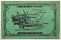
188132777Albany N.Y.: Van Benthuyson Printing House 1881. Cf. Romaine p. 19 for other catalogues issued by this Hoosick Falls NY manufacturer. Printed green wrappers stapled. General wear & soiling. Agent ink signature to bottom of front wrapper. Occasional po pencil annotation. A VG copy. 32 pp. Illustrated. 8vo. <br/><br/> Van Benthuyson Printing House unknown books
188560768Rugby England: Walding 1885. Trade card. 16mo 5 1/2 x 4 1/2 inches. 3 pp. the two interior pages advertise the fox hunting clothier Walding with short testimonial statements all dated 1879 and the rear wrapper advertises and solicits subscriptions for the Hunt Servant's Benevolent Society." "Walding begs to inform Masters of Hounds and Gentlemen much in the saddle that he makes Hunting and Riding Garments his special study and supplies over fifty of the principal Hunts in the Kingdom." Very good. Original chromolithographic illustrated wrapper picturing vignettes from the hunt. #7955. <br/><br/> Walding hardcover books
18987416Berlin, Verlag und Druck von J. Stankiewicz, 1898. mit sehr vielen Textabbildungen. (schwarze) HLwd. d. Zt., 501 S., Gr.8°
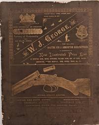
1897505Dover Kent England: W. J. George 1897. 4to. 285 x 225 mm. 11 x 8 ¾ inches. 24 pp. Illustrated throughout with lithographic images of sporting rifles and equipment. Original green coated paper wrappers title information and images I gold ink on front cover; wrapper edges rubbed with minor tears paper spine rubbed away wrappers nearly detached. Attractively produced gun catalogue issued by one of Great Britain's most storied rifle manufacturers and gunsmith to the Queen. The illustration are highly detailed especially for the various shot guns offered for sale. Jonathan Ulhman. Bibliography of Books on Cartridges or Ammunition International Ammunition Association Inc. p.1. https://cartridgecollectors.org/. W. J. George unknown books
1897505Dover Kent England: W. J. George 1897. 4to. 285 x 225 mm. 11 x 8 ¾ inches. 24 pp. Illustrated throughout with lithographic images of sporting rifles and equipment. Original green coated paper wrappers title information and images I gold ink on front cover; wrapper edges rubbed with minor tears paper spine rubbed away wrappers nearly detached. Attractively produced gun catalogue issued by one of Great Britain's most storied rifle manufacturers and gunsmith to the Queen. The illustration are highly detailed especially for the various shot guns offered for sale. Jonathan Ulhman. Bibliography of Books on Cartridges or Ammunition International Ammunition Association Inc. p.1. https://cartridgecollectors.org/. W. J. George unknown
1806PHO-2337A Paris, Colnet, 1806. 3 vol. in-8, 558pp., 469pp., 362pp., demi-basane fauve à coins parchemin ivoire, dos lisse, pièce de titre brune, dos frottés, coins et coupes usés, pièces de tomaisons incomplètes, défauts dont rousseurs, mouillure claire au début de t.3 et fin t.2, petites taches d’encre et fentes sans manque sur la carte). Ouvrage illustré d'une carte dépliante et de 3 plans illustrant la ville de Caracas, le port de la Goayre, la rade et la ville de Porto Cabello.
180255719New York: Printed and Sold by G. F. Hopkins 1802. First American edition. Leather bound. Very good. 296pp. Octavo 22 cm In a later 3/4 leather binding with brown cloth over boards. New endsheets and flyleaves. The boards are a bit warped. Repair to title and dedication pages. With map present at the front. Wright-Howes M 133. "First crossing of the continent from ocean to ocean by a white man. The narrative portion was prepared for publication by William Combe from Makenzie's notes." - Wright-Howes p. 362. Printed and Sold by G. F. Hopkins unknown
186320073Paris, Michel Lévy frères, 1863 ; grand et fort in-8, demi-chagrin réglisse et plats de percaline lie-de-vin, dos très décoré et doré, tranches dorées, décor à froid sur les plats (reliure de l'époque) ; [IV], VIII, 546 pp. 27 gravures sur bois hors-texte y compris le frontispice et 1 carte dépliante, dessins in texte.
1811PHO-2107Paris, Le Normant, 1811. Folio (51 x 34 cm), f. de faux-titre, frontispice, f. de titre et 82 planches sur 64 feuilles dont la grande carte par Lapie. Relié demi veau, dos lisse avec titre, coiffes usés, coins usés, début de fente, papiers des plats défraichis, mouillures.
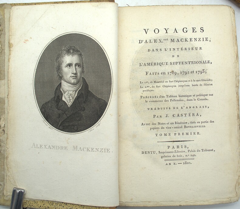
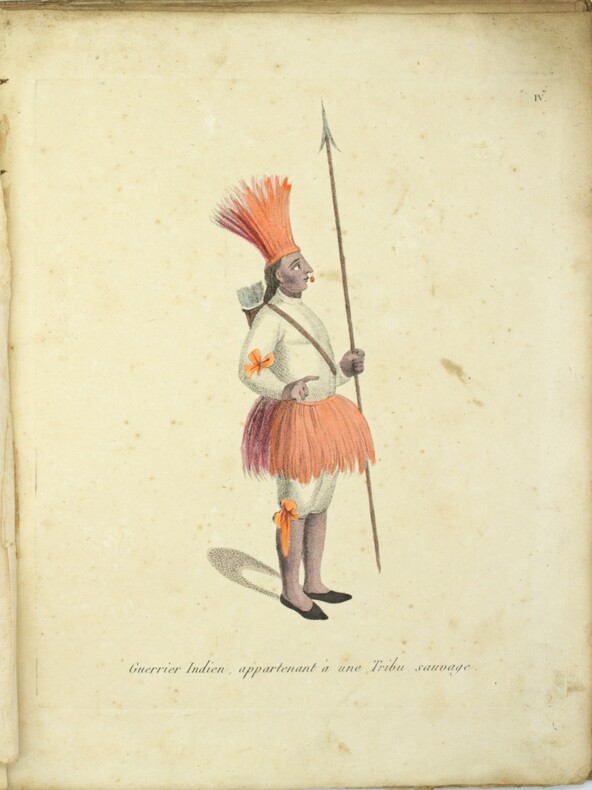
1802PHO-2218Paris, Dentu, an X (1802), 4 volumes in-8 reliés demi cuir, dos lisses ornés avec titre et tomaison, XX + 409 + 420 + 388 pages illustrées d'un portrait de l'auteur, en frontispice, par Laurence gravé par Adam, et de 2 grandes cartes sur 3 (déchirures, mouillures), le tome I contient un vocabulaire Algonquin, Knisteneaux et Chipiouyane et le tome 4 contient les cartes. Tome 1 reliure différente (non rogné), plats frottés, coins usés, charnières usées, coiffe arasée, bords de la reliure du tome 1 abimés, rousseurs, petite mouillure.
1809PHO-1737Paris, J.G. Dentu, 1809. 3 volumes TEXTE, 2 vol. in-8°,[2]-xii-385, [2]-427 pp. , brochage d’attente orange, étiquette avec titre au dos, quelques frottement. ATLAS, 1 vol. in-4° (290x225),12 planches sous serpente en couleurs et une carte de Lapie, reliure d’attente, titre sur le plat, dos manquant, coutures apparentes, la carte est volante et datée de 1829, elle provient d’un autre ouvrage
1826PHO-1888Paris, Dondey-Dupré, 1826-1827. Grand in-4 (33x25cm), 32 pp. + [1] f., pl., demi-basane fauve, dos lisse orné de filets et de petits fers dorés, auteur et titre dorés, coiffe de tête manquante, quelques rousseurs sur les planches, fente au pli de la carte). Provenance : A. de Sibeud de Ferriol (Grenoble, 1817-1880 ; ex-libris gravé).
1827PHO-2282Paris, Dondey-Dupré, 1826-1827. Texte : 3 volumes in-8, demi veau et coins époque, dos lisse avec titre et tomaison, tranches marbrées, ex-libris armorié (Hugh Grosvenor, 1st Duke of Westminster), frottements aux coiffes et aux plats. Atlas : Grand in-4 (33x25cm), 32 pp. + [1] f., pl., demi-basane fauve, dos lisse orné de filets et de petits fers dorés, auteur et titre dorés, coiffe de tête manquante, quelques rousseurs sur les planches, fente au pli de la carte). Provenance : A. de Sibeud de Ferriol (Grenoble, 1817-1880 ; ex-libris gravé).
1801PHO-1139Paris, Dentu, 1801. 2 vol. in-8, (2) ff., 226 pp. ; (2) ff., 320 pp., 2 cartes, un plan et 8 pl. dépl., mouillures claires, relié demi-veau à coins de l'époque , dos lisse avec pièce d’auteur et titre , mouillure au 1er tome sur les 10 premiers feuillets , déchirures aux plis de 2 gravures.
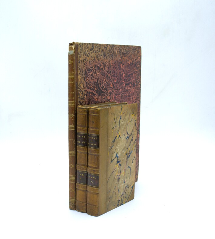
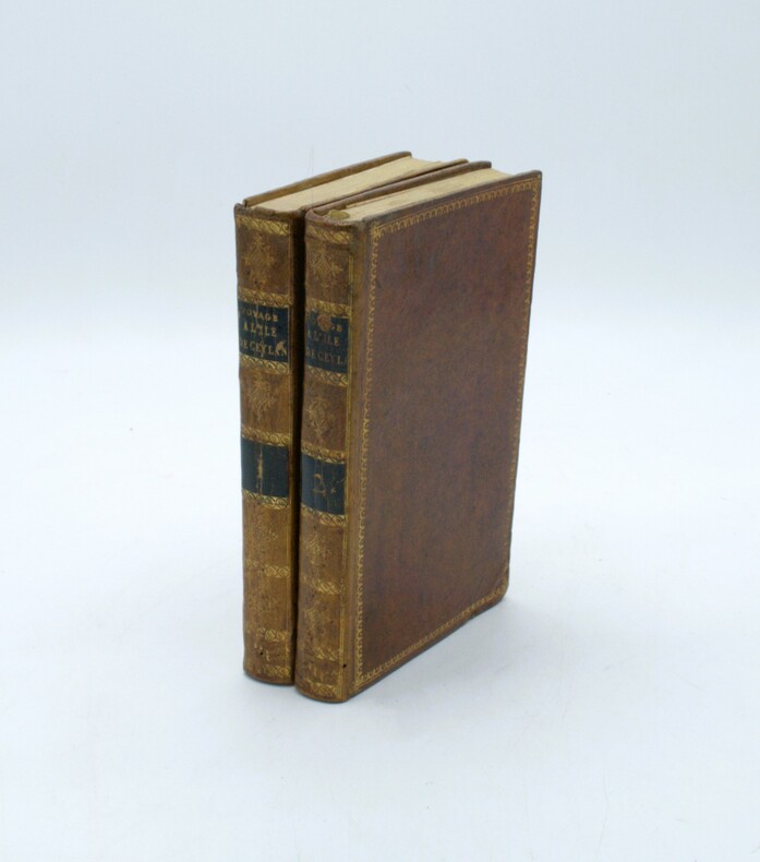
1803PHO-1636Paris, Dentu, an XI (1803). 2 volumes in-8 (191 x 124 mm). 4 cartes et plans repliés hors texte : une carte de l'île de Ceylan par Arrowsmith et de la pêche des perles et les plans des ports de Trinquemale et Colombo, basane mouchetée de l'époque, dos lisses ornés avec pièces de titre et tomaison, dentelles dorées sur les plats, frottements et vieille épidermure au tome 2.
1843PHO-2377Paris, L. Passard et Lavigne, 1843 4 volumes in-8° (21x13,5cm), demi maroquin vert, dos à nerfs orné avec titre et tomaison. Frottements, petit accroc au dos t1, coiffe usée t4, charnière fragile t2 & 4. Carte dépliante entoilée rangée dans son étui de toile noire (facsimilé). Peu courant.
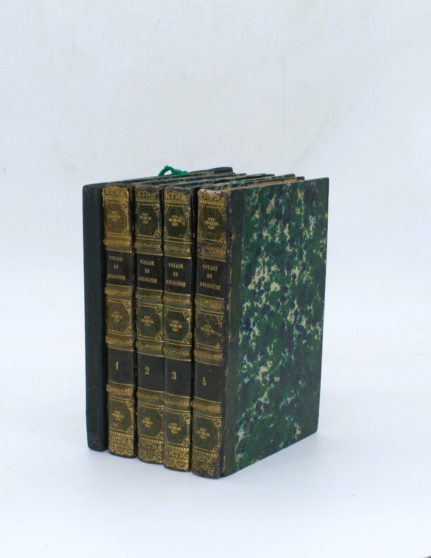
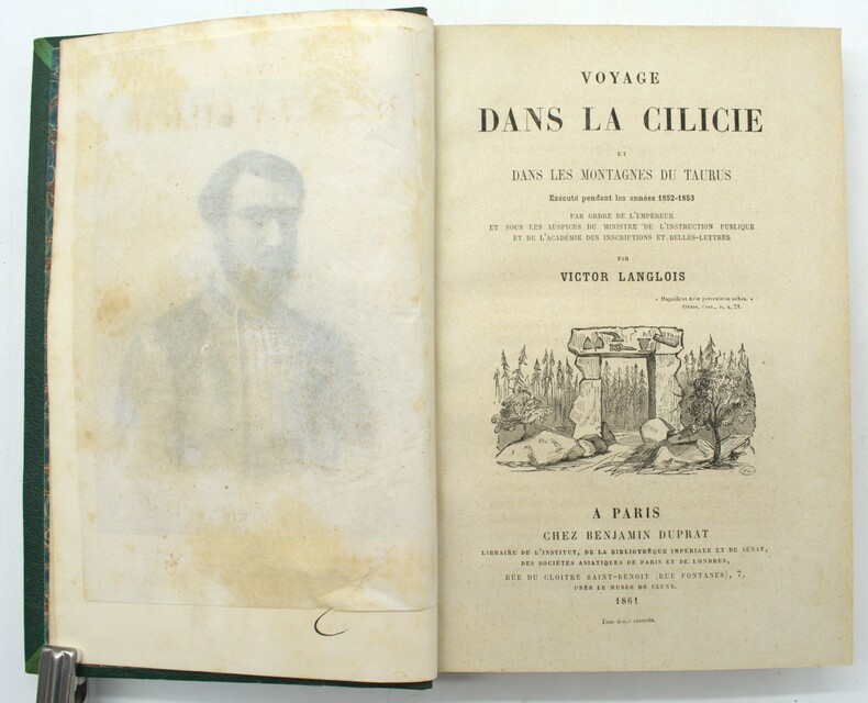
1861PHO-1746Paris, Chez Benjamin Duprat, 1861, in-8, X-478 pp., relié demi chagrin vert, illustré de 28 planches d’après les dessins de l’auteur , dos à nerfs avec titre et auteur, quelques brunissures aux planches, petites rousseurs. Victor Langlois nous livre le récit de son expédition arc
1822PHO-1486Paris, Artus Bertrand, 1822. 2 vol. in-8, xvi, 415, [1]; [4], 355, brochage éditeur, illustré de 3 planches et une carte dépliante, rousseurs.
1846PHO-2261Paris, Arthus Bertrand, 1846. In-8° (24x15,5cm) de vij, 1 bl., 512 pp. Demi-chagrin brun, dos à 5 faux-nerfs orné, titre doré, année dorée en pied, tranches mouchetées. Avec l'Atlas in-folio (34x25cm) de 2 cartes dépliantes et 11 lithographies en couleurs. Demi-chagrin vert, dos à faux-nerfs, titre doré. Étiquette de bibliothèque. Édition originale, rare. Envoi de l'auteur au vol. de texte. Des rousseurs, petit cerne à l'Atlas, dos légèrement insolé aux volumes de texte.
1810PHO-1272Paris, Clament, 1810. 3 vol. In-8° (202 x 136 mm) TOME 1:301pp TOME 2 : [2], 390 pp. ; TOME 3 : 291 pp., avec 4 tableaux et 1 (2) carte dépliante de Mentelle and Chanlaire (Inde) sur papier bleuté , contours coloriés , Tome 1 , relié, demi cuir , dos lisse avec pièce de titre et tomaison, tome 2 et 3 en brochage d’attente papier bleu (non rogné , manque au dos , dos cassé tome 2)
1830PHO-1108Paris, Pillet aîné, 1830. 2 volumes in-8 (210x130), LX-294-1ff , 2ff-361pp-1ff , brochage éditeur , L'ouvrage est orné de deux frontispices dépliants , la planche de pirogue qui manque souvent et la carte de manniloco , petits défauts à la reliure , petites rousseurs mais bel exemplaire avec en fin du tome 2 le catalogue de Pillet avec l’annonce de la parution du voyage de Freyssinet Hill, n°481 ,Sabin, n°20176 ,Chadenat, n°561.