1 461 résultats
195459734Couverture crème souple et imprimée en couleurs. Pages non-ébarbées. Papier bruni. Contenu orné de 76 gravures en noir et blanc in- et hors-texte.
202403521Paris, Stardom, 1995 ; in-4, cartonnage de l'éditeur. Ce surprenant coffret, en hommage aux indiens, comprends 18 images offset de couleur (6 de chaque auteur) + 2 planches de justificatif de tirage (dont une numérotée sur 500 exemplaires et signée par les différents auteurs, ici numéro 190/500) Le tout emballé dans un beau tissu + 6 CD (Barney Bush, Tony Hymas…) emballés également dans un beau tissu aux mêmes motifs.
2020x-9402417893Springer 2020. Hardcover. New. 211 pages. 9.25x6.25x0.50 inches. Springer hardcover

20209753GB2020. Dordrecht Springer 2020. XI 211 p. Hardcover. Versand aus Deutschland / We dispatch from Germany via Air Mail. Einband bestoßen daher Mängelexemplar gestempelt sonst sehr guter Zustand. Imperfect copy due to slightly bumped cover apart from this in very good condition. Stamped. Mobile Communication in Asia: Local Insights Global Implications. hardcover
2021x-9402417923Springer Nature 2021. Paperback. New. 222 pages. 9.25x6.10x0.47 inches. Springer Nature paperback
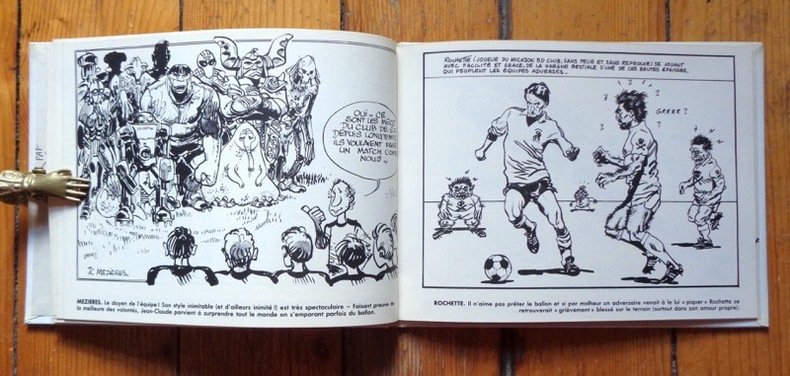
19877195Balland / ORTF, 1987. In-8 à l'italienne, cartonnage couleurs. Petit défaut d'origine au bord du premier plat (voir image), pour le reste en très belle condition.
1987H-419-418FUTURO GALLI 1987. Hardcover. Very Good. Former library book. Volume 45. Ammareal gives back up to 15% of this item's net price to charity organizations. FUTURO GALLI hardcover
BN107230FUTURO GALLI. Hardcover. Mickson BD football-club numéro 45 <br/><br/>Mickson BD football-club numéro 45 FUTURO GALLI hardcover
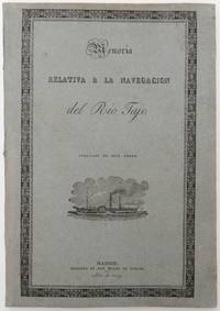
18291489Madrid: Imprenta de Don Miguel de Burgos 1829. First edition. Atlas imprint: A Paris: Imp. Lith. de Engelmann & Cie. Lithographes de la Chambre et du Cabinet du Roi 1829. 10 desultorily numbered but complete 11–118 p. Text volume: In publisher’s illustrated wrappers. Atlas: In publisher’s printed wrappers. Lithographed throughout. Text volume: Pastedowns discolored also a few quires. Browning to some quires at print space. Cover artistically restored. In fine condition. Atlas: Wrappers stained. A brown stain to lower left corner of the front cover it affects the first leaves. Pastedowns discolored. Occasional brown spots throughout. Browning to some leaves at the rear. Artistically restored overall in very good condition. First edition. Atlas imprint: A Paris: Imp. Lith. de Engelmann & Cie. Lithographes de la Chambre et du Cabinet du Roi 1829. 10 desultorily numbered but complete 11–118 p. Text volume: In publisher’s illustrated wrappers. Atlas: In publisher’s printed wrappers. Lithographed throughout. 4 I–XII I–IX 1 1–63 1 1–210 p. <p><br /> Extremely scarce documentation of the topographical survey and the design of the navigation on the entire length of the Tagus River. Both volumes in original wrappers.<br /> <p><br /> <p><br /> The Napoleonic Wars and the loss of the American colonies resulted in a political turmoil and economic disaster in Spain in the first half of the 19th century. A shift in the economics and the modernization of the country seemed to be the path to overcome the crisis. Among many signs of progress an attempt was to make the Tagus River Rio Tajo the longest river in the Iberian Peninsula navigable by steamships on its entire length from Aranjuez to Lisbon to facilitate the transport of people and goods thus strengthen the country’s internal market.<br /> <p><br /> <p><br /> The plan was designed by Francisco Javier de Cabanes 1781–1834 a multitalented Spanish military historian in cooperation with an engineer AgustÃn Marco-Artu. Although the plan has never been realized the present work shows Cabanes' profound and systematic preparations. The text volume contains a prologue and detailed indexes and the sixty-three pages of the report on the project “Memoria relativa á la navegacion del Rio Tajo†which is divided into twelve sections and the conclusion exposing the advantages and the obstacles of the plan and the possibilities of its realization. This part is followed by the appendix the most extensive part of the book with extraordinary value. It contains a collection of 177 documents related to the plans and survey of the navigability of Tagus from the earliest attempt by Juan Bautista Giovanni Battista Antonelli in 1581–1582 through Luis Carduchi’s and Carlos Simón Pontero’s surveys in 1641 and 1755 to Cabanes’ own survey executed by AgustÃn Marco-Artu in 1828. The maps of 1641 1755 and the 1828 surveys with short explanations are included in the lithographed atlas.<br /> <p><br /> <p><br /> Both volumes are preserved in their original wrappers which is remarkably rare and particularly significant especially in the case of the atlas as the Paris imprint of Engelmann is only indicated on its cover. In many collections the two volumes are bound together thus this information became lost and the lithographed maps are attributed to Miguel de Burgos in Madrid the printer of the text volume. The text tome is bound into blue paper the panels are framed with an ornamental double-rule. The front is illustrated with a steamer the rear panel with naval equipment as an allusion to its content.<br /> <p><br /> <p><br /> Ref.: Palau 38563.<br /> <p><br /> <p><br /> Bibl.: López Gómez A.: La navegación por el Tajo. El reconocimiento de Carduchi en 1641 y otros proyectos. Madrid: Real Academia de la Historia 1998. pp. 151–152.; Pastrana L.: El proyecto del Brigadier Francisco de Cabanes para navegar el RÃo Tajo mediante embarcaciones a vapor 1828. Iberoamérica Social: revista-red de estudios sociales IX pp. 178–194.<br /> <p>. Imprenta de Don Miguel de Burgos unknown
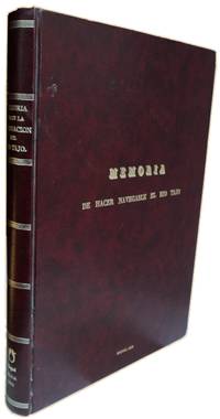
1006JC336<p>Las ventajas de esta Empresa y las concesiones hechas á la misma para realizar la navegación Por el Brigadier de infantería de los Reales ejércitos Don Francisco Javier de Cabanes. Publícase de Real Órden. MADRID. IMPRENTA DE DON MIGUEL DE BURGOS Año de 1829. FAC-SIMILE EDITADO PELA TAGOL S. A. LISBOA 1991.</p>_x000d_<p>De 34x245 cm. Com xii 63 x 210 118 págs. Encadernação do editor.</p>_x000d_<p>Ilustrado com 118 mapas topográficos.</p>_x000d_<p>Editado pela Tagol Companhia de Oleaginosas do Tejo S. A. - empresa do grupo Mendes Godinho. Coordenadores João Vargas Moniz e Maria Luísa de Saldanha execução gráfica: Litografia Antunes em Rio Maior. Tiragem de 700 exemplares.</p>_x000d_<p>Obra com o fac-símile dos mapas de reconhecimento topográfico das margens do rio Tejo.</p>_x000d_<p>Ilustrado com um atlas em extratexto com os levantamentos topográficos das margens do rio Tejo.</p>_x000d_<p>Reúne três de quatro reconhecimentos topográficos existentes:</p>_x000d_<p>- 1641 pelos engenheiros Luis Carduchi Julio Martelli e o Licenciado Eugénio Salcedo.</p>_x000d_<p>- 1755 por D. José Briz e D. Pedro Simó Y Gil associados a D. Miguel Fernandez Olmo.</p>_x000d_<p>- 1828 Don Agustin Marco Artu em companhia de outros especialistas.</p>_x000d_<p>Segundo Cabanes não foi encontrado o primeiro reconhecimento do Rio Tejo efectuado pelo engenheiro Juan Baptista Antonelli nos anos de 1581 e 1582 facto pelo qual não consta da obra.</p> I-26-B-2 unknown
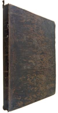
1507JC014<p><strong>DESDE ARANJUEZ HASTA EL ATLÃNTICO las ventajas de esta Empresa y las concesiones hechas á la misma para realizar la navegacion</strong>. Por el Brigadier de infanterÃa de los Reales ejércitos Don Francisco Javier de Cabanes. PUBLÃCASE DE REAL ÓRDEN. MADRID IMPRENTA DE DON MIGUEL DE BURGOS Año de 1829. - junto com <strong>PLANOS QUE REPRESENTAN LOS RECONOCIMIENTOS DE LAS RIBERAS DEL RIO TAJO.</strong> Verificados en 1641 = 1755 y 1828. Con objeto de arreglar la navegacion de este Rio. Año de 1829. Atlas.</p>_x000d_<p>In fólio de 33x23 cm. Com xii 63 ix 210 págs. atlas com 118 litografias numeradas impressas em I 59 fólios.</p>_x000d_<p>Encadernação da época inteira de pele com acabamento em raiz de nogueira um pouco cansada.</p>_x000d_<p>Exemplar apresenta alguma acidez natural do papel utilizado na impressão da obra.</p>_x000d_<p>Ilustrado com um atlas em extratexto com os levantamentos topográficos das margens do rio Tejo.</p>_x000d_<p>Obra muito rara especialmente quando acompanhada do atlas das ilustrações. Não existe exemplar na BNP.</p>_x000d_<p>A obra reúne três de quatro reconhecimentos topográficos existentes:</p>_x000d_<p>- 1641 pelos engenheiros Luis Carduchi Julio Martelli e o Licenciado Eugénio Salcedo.</p>_x000d_<p>- 1755 por D. José Briz e D. Pedro Simó Y Gil associados a D. Miguel Fernandez Olmo.</p>_x000d_<p>- 1828 Don Agustin Marco Artu em companhia de outros especialistas.</p>_x000d_<p>Segundo Cabanes não foi encontrado o primeiro reconhecimento do Rio Tejo efectuado pelo engenheiro Juan Baptista Antonelli nos anos de 1581 e 1582 facto pelo qual não consta da obra.</p>_x000d_<p>EN In folio 33x23 cm with xii 63 ix 210 pp atlas with 118 litographies. numbered and printed in I 59 folios.</p>_x000d_<p>Binding: contemporary full calf with walnut tree root workmanship slightly worn.</p>_x000d_<p>Copy with some foxing due to the type of paper used.</p>_x000d_<p>Illustrated with an atlas hors-text depicting the topographic surveys carried out on the banks of Tagus River.</p>_x000d_<p>A very rare work especially with the atlas. BNP does not have any copy.</p>_x000d_<p>This work gathers three of the four existing topographic surveys:</p>_x000d_<p>- 1641 carried out by engineer Luis Carduchi and engineer Julio Martelli together with graduated Eugénio Salcedo.</p>_x000d_<p>- 1755 by D. José Briz and D. Pedro Simó Y Gil together with D. Miguel Fernandez Olmo.</p>_x000d_<p>- 1828 Don Agustin Marco Artu together with other specialists.</p>_x000d_<p>According to Cabanes it wasn"t found the first survey of the Tagus River which has been carried out by engineer Juan Baptista Antonelli in 1581 e 1582 reason why it was not included in this work.</p>_x000d_<p>Palau 1950 Tomo III pp. 8 ent. 38563: « fol. xii 63-ix p. Apendice 210 p. y 118 planos. 40 pts P. Vindel 1925».</p> M-8-C-29 unknown
1932ROD0117820ALBIN MICHEL. 1932. In-12. Broché. Etat d'usage, Couv. convenable, Dos frotté, Quelques rousseurs. 380 pages. 60 gravures en noir et blanc dans et hors texte.. . . . Classification Dewey : 925-Savants, explorateurs
1932R260217402ALBIN MICHEL EDITEUR. 1932. In-8. Broché. Etat d'usage, Couv. défraîchie, Dos frotté, Quelques rousseurs. 382 pages - 60 planches de gravures en noir et blanc - renfort adhésif sur le 1er plat. . . . Classification Dewey : 610-Sciences médicales. Médecine
38087Editions Albin Michel, 1932. Format 14x18 cm, broche, 382 pages. Une fente au dos. Etat correct.
BBG9AP
CPB16GM
3219Université Paris Ouest - Nanterre la Défense 2009
192819991928 Paris, Albin Michel, 1928, volume in-8 broché, 559 pages, couverture illustrée, très bon état
211897Paris, A. Michel, s.d. in-12, XII-559 pp., ill. in et h.-t., demi-basane fauve marbrée, dos lisse orné d'arabesques et d'un encadrement dorés, tête dorée (reliure de l'éditeur).
245061Paris, A. Michel, s.d. in-12, XII-559 pp., ill. in et h.-t., demi-chagrin rouge, dos à nerfs orné de symboles révolutionnaires, tête dorée, couv. cons. (reliure de l'époque). Dos un peu passé.
192840036Albin Michel, s.d. (v. 1928), pt in-8°, xii-559 pp, 2e édition refondue et très notablement augmentée, 5 planches et 60 gravures et fac-similés hors texte ou dans le texte, reliure demi-percaline verte, dos lisse avec pièce de titre chagrin havane, couv. conservées (rel. de l'époque), bon état
1928R150191340ALBIN MICHEL. 1928. In-8. Broché. Etat d'usage, Couv. convenable, Dos abîmé, Intérieur frais. 559 pages- quelques planches en noir et blanc hors texte. . . . Classification Dewey : 923-Politiciens, economistes, juristes, enseignants
0274568837.Ghardcover. Good. Access codes and supplements are not guaranteed with used items. May be an ex-library book. hardcover
0484357379.Ghardcover. Good. Access codes and supplements are not guaranteed with used items. May be an ex-library book. hardcover
0243006934.Gpaperback. Good. Access codes and supplements are not guaranteed with used items. May be an ex-library book. paperback