Ptolemy; Girolamo RuscelliBiblio.com
335 résultats
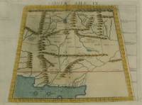
1574M7273Venice: Ruscelli c. 1574. Very Good;. Notes: Italian text on verso.<br>Girolamo Ruscelli 1518–1566 was an Italian mathematician and cartographer active in Venice during the early 16th century. Ruscelli is best known for his important revision of Ptolemy's Geographia published posthumously in 1574. Size : 192x264 mm 7.56x10.39 Inches Coloring: Hand Colored Category: Maps Asia Middle East Caucasus.; Ruscelli unknown
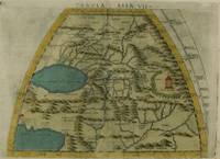
1574M7276Venice: Ruscelli c. 1574. Very Good;. Notes: Italian text on verso.<br>Girolamo Ruscelli 1518–1566 was an Italian mathematician and cartographer active in Venice during the early 16th century. Ruscelli is best known for his important revision of Ptolemy's Geographia published posthumously in 1574. Size : 191x266 mm 7.52x10.47 Inches Coloring: Hand Colored Category: Maps Asia Central Turkmenistan Uzbekistan Tajikistan Kyrgyzstan Kazakhstan; Maps Asia Central Afghanistan Pakistan; Maps Asia Central India & Sri Lanka / Ceylon; Ruscelli unknown
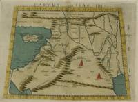
1574M7274Venice: Ruscelli c. 1574. Very Good;. Notes: Italian text on verso.<br>Girolamo Ruscelli 1518–1566 was an Italian mathematician and cartographer active in Venice during the early 16th century. Ruscelli is best known for his important revision of Ptolemy's Geographia published posthumously in 1574. Size : 192x266 mm 7.56x10.47 Inches Coloring: Hand Colored Category: Maps Asia Middle East Holy Land & Palestine;Maps Asia Middle East Jordan Syria Lebanon;Maps Asia Near East Turkey; Ruscelli unknown
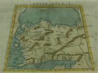
1574M7271Venice: Ruscelli c. 1574. Very Good;. Notes: Italian text on verso.<br>Girolamo Ruscelli 1518–1566 was an Italian mathematician and cartographer active in Venice during the early 16th century. Ruscelli is best known for his important revision of Ptolemy's Geographia published posthumously in 1574. Size : 190x266 mm 7.48x10.47 Inches Coloring: Hand Colored Category: Maps Asia Near East Turkey; Ruscelli unknown
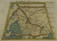
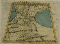
1574M7272Venice: Ruscelli c. 1574. Very Good;. Notes: Italian text on verso.<br>Map of the ancient region of Asiatic Sarmatia.<br>Girolamo Ruscelli 1518–1566 was an Italian mathematician and cartographer active in Venice during the early 16th century. He was also an alchemist writing pseudonymously as Alessio Piemontese.<br>Claudius Ptolemy better known mononymously as Ptolemy was a Greco-Roman mathematician astronomer astrologer geographer and music theorist who wrote about a dozen scientific treatises three of which were important to later Byzantine Islamic and Western European science. Size : 188x262 mm 7.40x10.31 Inches Coloring: Hand Colored Category: Maps Russia; Ruscelli unknown
1574M7278Venice: Ruscelli c. 1574. Very Good;. Notes: Italian text on verso.<br>Girolamo Ruscelli 1518–1566 was an Italian mathematician and cartographer active in Venice during the early 16th century. Ruscelli is best known for his important revision of Ptolemy's Geographia published posthumously in 1574. Size : 188x264 mm 7.40x10.39 Inches Coloring: Hand Colored Category: Maps Asia Central Afghanistan Pakistan; Ruscelli unknown
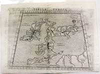
1574M11040Venice c.1574. Very Good. Notes: Map of the British Isles United Kingdom based on Ptolemy's map.<br>Girolamo Ruscelli 1518–1566 was an Italian mathematician and cartographer active in Venice during the early 16th century. Ruscelli is best known for his important revision of Ptolemy's Geographia published posthumously in 1574. Size : 190x262 mm 7.48x10.31 Inches Coloring: Black & White Category: Maps Europe United Kingdom; unknown
1598M8431Venice: G. Fratelli; G.A. Magini c. 1598. Very Good. Notes: Ptolemaic Map of Tabula Asiae X Plate 10 from "Geografia cioe Descrittione Universale della Terra" published by Magini c.1598. Text in Italian.<br><br><br><br> Size : 140x173 mm 5.50x6.80 Inches Coloring: Black & White Category: Maps Asia Central Afghanistan Pakistan; Maps Asia Central India & Sri Lanka / Ceylon; G. Fratelli; G.A. Magini unknown
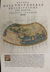
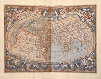
1597M7336Venice: Gio. Battista & Giorgio Galignani c. 1597. Very Good;. Notes: Text in Italian.<br>From Magini's "Geografia cioe Descrittione Universale della Terra".<br>The first edition of this map was printed with Latin text with the later issues printed in Italian.<br>"This quarto edition of Ptolemy was edited by the distinguished Italian geographer Giovanni Magini who also published as part of the same work the first reduced-size version of Mercator's atlas. The four world maps -- one ancient and three modern engravings -- are all by Girolamo Porro neatly copying other earlier works." Shirley Size : 135x175 mm 5.31x6.89 Inches Coloring: Hand Colored Reference: Shirley 193; Phillips 405. Category: Maps World; Gio. Battista & Giorgio Galignani unknown
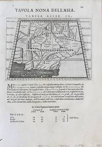
1598M8430Venice.: G. Fratelli; G.A. Magini c. 1598. Very Good. Notes: Ptolemaic Map of Tabula Asiae IX Plate 9 from "Geografia cioe Descrittione Universale della Terra" published by Magini c.1598. Text in Italian. Size : 140x173 mm 5.50x6.80 Inches Coloring: Black & White Category: Maps Asia Central Afghanistan Pakistan; Maps Asia Central Turkmenistan Uzbekistan Tajikistan Kyrgyzstan Kazakhstan; Maps Asia Central India & Sri Lanka / Ceylon; G. Fratelli; G.A. Magini unknown
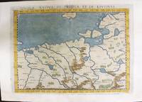
1574M11141Venice: Ruscelli c. 1574. Very Good. Notes: Italian text on verso.<br>Map of Prussia Poland Lithuania part of of Estonia and the Baltic Region.<br>Girolamo Ruscelli 1518–1566 was an Italian mathematician and cartographer active in Venice during the early 16th century. Ruscelli is best known for his important revision of Ptolemy's Geographia published posthumously in 1574. Size : 190x263 mm 7.48x10.35 Inches Coloring: Hand Colored Category: Maps Europe Poland Lithuania; Ruscelli unknown
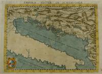
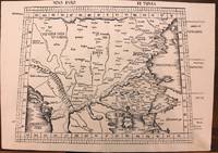
1574M7268Venice: Ruscelli c. 1574. Very Good;. Notes: Italian text on verso.<br>Girolamo Ruscelli 1518–1566 was an Italian mathematician and cartographer active in Venice during the early 16th century. Ruscelli is best known for his important revision of Ptolemy's Geographia published posthumously in 1574. Size : 190x261 mm 7.48x10.28 Inches Coloring: Hand Colored Category: Maps Europe Balkans; Ruscelli unknown
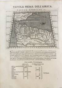
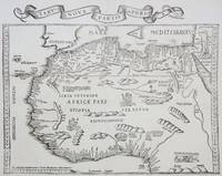
1598M8434Venice: G. Fratelli; G.A. Magini c. 1598. Very Good. Notes: Ptolemaic Map of the North west part of Africa Morocco Tabula Aphricae I Plate 1 from "Geografia cioe Descrittione Universale della Terra" published by Magini c.1598. Text in Italian.<br><br><br> Size : 140x173 mm 5.50x6.80 Inches Coloring: Black & White Category: Maps Africa North; Maps Africa West; G. Fratelli; G.A. Magini unknown
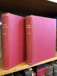
18131346487Paris: Chez Henri Grand 1813 1816. First French Edition. Hardcover. Octavo Two Volumes. In Very Good condition. Bound in full 20th-century red library bindings with gilt lettering to spine. Boards show mild shelf wear and soiling. Very mild age toning to text blocks. Facing text in Greek and French. Contains mathematical diagrams. Shelved in Case 10. 1346487. Shelved Dupont Bookstore. Chez Henri Grand hardcover
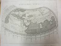
1597M7073Venice 1597. Very Good; a tear in the lower margin not effecting the map. Notes: Ptolemaic map following the classical format. The Indian Ocean is landlocked with a continuous coastline joining Africa to South East Asia. Toprobana present day Sri Lanka is a very large island in the Indian Ocean and the Indian sub-continent is completely missing although the Ganges river is shown. The Mediterranean is well depicted but greatly exaggerated in length. In Africa the Nile is shown originating in mountains below the Equator. Finely engraved in the Italian style with a stippled sea by Girolamo Porro. The map is on a full sheet of Italian text. Italian text on verso. Size : 138x178 mm 5.43x7.01 Inches Coloring: Black & White Reference: Shirley #193. Category: Maps World; unknown
1513M8825Strasburg: Martin Waldseemuller c. 1513. Excellent. Notes: StolenA fine and strong impression of this rare map of Eastern Europe from the 1513 edition of Waldseemüller's modern atlas Geographia.<br><br>The verso is blank. The watermark is similar to fleur de lis sitting on a multi headed star.<br><br>Large Ptolemaic map depicting Europe and Balkan from the Adriatic Sea to the Black Sea.<br><br>The Atlas ' GEOGRAPHIE OPUS NOVISSIMA TRADUCTIONE E GRECORUM ARCHETYPIS ' one of the most important edition of Ptolemy Atlases.was published by Johannes Schott in Strasburg 1513.<br> Size : 434x618 mm 17.09x24.33 Inches Coloring: Black & White Category: Maps Europe Greece Macedonia; Maps Europe Balkans; Maps Europe Romania; Maps Europe Hungary; Martin Waldseemuller unknown
1535M6976Lyons: Melchior & Gaspar Trechsel c. 1535. Very Good;. Notes: No text on verso.<br><br>This is based on Waldseemuller's map Norwich 286 with borders and ornaments by Holbein and Graf. The reissued map includes six kings seated on their thrones a rhinoceros a cyclops and two oxen. <br><br>"As northern Africa was better known than southern Africa at that period it has more geographical information in the interior. Various kingdoms are described with a multitude of coastal names and as with the southern part . these are placed within the coastline. The Mediterranean and Red Seas are prominently featured as well as a number of islands on the northwest coast -- Madeira the Canaries etc. -- which at that time were already well known to the Portuguese in their initial efforts to discover a route to the Indies." Norwich Size : 320x400 mm 12.60x15.75 Inches Coloring: Black & White Reference: Norwich 286 Category: Maps Africa North; Melchior & Gaspar Trechsel unknown
1953S11818New York:: New York Public Library 1953. 1953. 8vo. 86 pp. Printed wrappers; corner bent some minor soiling. INSCRIBED BY THE AUTHOR TO WILLIAM DUANE STAHLMAN. Very good. New York Public Library, 1953. unknown books
1562046246Venice: Valgrisi 1562. Early Edition. Single map leaf from one of the Ruscelli pocket editions of Ptolemy - likely the 2nd edition printed in 1562 the first was 1561 the 3rd 1564. Light soiling - a very good impression. Image area is 10.5' x 8". Size: Quarto 4to. Quantity Available: 1. Shipped Weight: Under 1 kilo. Category: Geography & Maps; Inventory No: 046246. Valgrisi unknown books
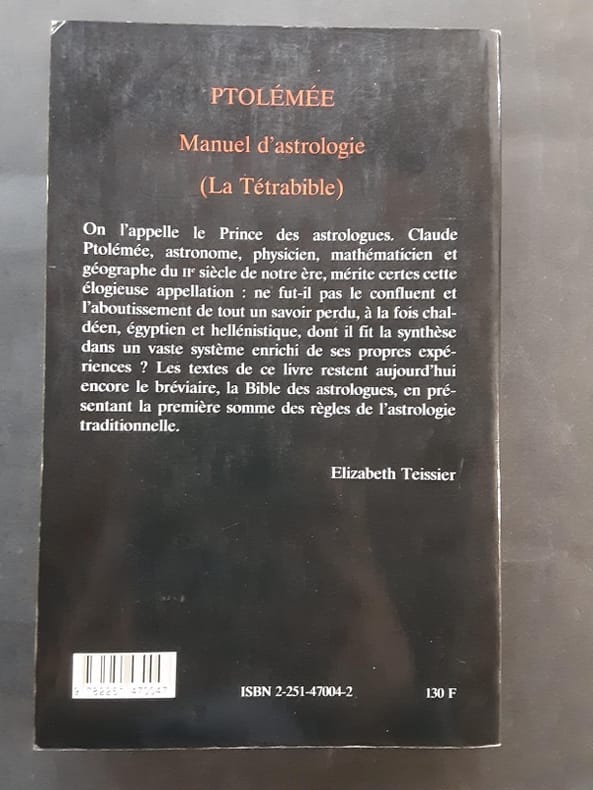
16845Paris Le Club du Livre - Philippe Lebaud 1972 grand in 4 Un volume reliure plein maroquin havane ornée de l'éditeur, dos à nerfs, tête dorée, sous chemise doublée, étui toilé, 220 pages. Ouvrage illustré de 20 lithographies hors-texte en couleurs par Jean Picart Le Doux (tirage par Fernand Mourlot). Traduction de Nicolas Bourdin de Vilennes revue et accompagnée de deux études par André Barbault, les quatres livres des jugements des astres de Ptolémée ou le Tetrabiblos. Collection gravure contemporaine. Tirage limité à 300 exemplaires numérotés, celui-ci un des 225 exemplaires numérotés sur Rives, et signé par l'illustrateur. (poids du Colis: 4 kilogrammes). Exemplaire à l'état de neuf ( Photographies sur demande / We can send pictures of this book on simple request )
19833638099Valencia.: Vicent García. 1983. Hardcover. Falta el facsimil con los mapas . Good. 46 cm. 1 v. il. col. map. col. Encuadernación en tapa dura de editorial holandesa. Libro de estudios del facsimil. Introducción por Víctor Navarro Brotóns ; traducción y notas por Angel Aguirre Alvarez Víctor Navarro Brotóns y Enrique Rodríguez Galdeano. Tít. de la cub. : Atlas de Claudio Ptolomeo . Falta el facsimil con los mapas . ISBN: 8485094352 v.1 Geografía del mundo antiguo. Geografía regional en general. Geografía universal 913.1"01" Mapas. Atlas geográficos. Globos terráqueos 912100:528.9:091.07 Vicent García. hardcover
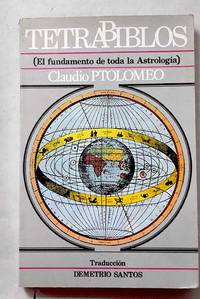
19873674210Madrid.: Barath. 1987. Paperback. Cubierta deslucida. Good. 21 cm. 302 p. Encuadernación en tapa blanda de editorial ilustrada. Tetrabiblos. Traducción y notas de Demetrio Santos. Astrología. Obras anteriores a 1800. Santos Demetrio. 1924-2016. Quadripartitum. Astronomía . Cubierta deslucida. ISBN: 8485799011 9788485799015 null 133.52035.3"01" null 52 Ptolomeo Claudio null 52"01" Barath. paperback
ABAA-75TH-VBF-18<p>Leiden; Amsterdam: Isaac Elzevir; Jodocus Hondius 1618-1619.</p><p>2 folio volumes: I/ 7 ll. including 1 portrait of Petrus Bertius 253 pp. 1 l.; II/ 28 double-page maps 28 pp. 20 ll. 2 ll.; 46 pp. 8 map segments spread over 4 double-pages 20 pp. 1 full-page map between pp. 10 and 11 1 l. <em>"Abrahami Ortelii Geographise veteris Tabvlae aliquot</em>" in 35 ll. including a half-title and 14 double-page maps complete.</p><p>Full ivory vellum decorated and varnished spines covers of the first volume renewed<em>. Elegant contemporary binding.</em></p><p>408 x 275 mm.</p><p><strong>A complete copy containing 28 double-page maps originally published by Mercator in 1578</strong> 19 maps 15 double-page of Ortelius' <em>Parergon</em> a folding map and the 4 double-page maps that make up the famous <em>Tabula Peutingeriana</em>. The <em>Tabula</em> reproduces the renown manuscript map of the XII century now preserved at the Albertina in Vienna which incorporates an original Roman road map of the third century printed for the first time in 1591 by Welser in Venice.</p><p><strong>First edition of the famous and extremely rare "Theatrum Geographiae Veteris".</strong></p><p><strong>A copy in superb contemporary colors complete in particular with the often missing folding map of Egypt from this 1618-1619 Ptolemy extremely rare and considered by the great bibliographer Sabin as</strong> "<em>An important and valuable work</em>".</p><p>" An important and valuable work containing 47 maps in all. The 28 maps in the first part are on double pages with one exception and were evidently printed from the same plates as those in the editions of 1578 1584 and 1605. They comprise the "<em>Vniversalis Tabvla ivxta Ptolemaeum</em>" ten of Europe five of Africa one of which is on a single leaf entitled "Appendix. III. Tabvlae Afr :" verso blank and twelve of Asia. The Peutingerian tables in 4 double-page plates were engraved and published for the first time nearly twenty years before and contain the imprint <em>Antverpiae è Typographeio nostro</em>. <em>Kal. Decemb</em>. In some copies the map "Scheda Prior" is accompanied by another entitled "Scheda Posterior" probably taken from another work.</p><p>The 14 maps of Ortelius comprise : <em>Evropa</em> sig. QQ; <em>Britannica Insvlae</em> RR; <em>Hispania</em> SS ; <em>Gallia Strabonis</em> VV ; <em>Belgivm</em> YY ; <em>Germania</em> 2.7. ; <em>Italia</em> CCC ; <em>Sicilia</em> DDD; <em>Dacia et Moesia</em> EEE; <em>Pontvs Evxinvs</em> FFF; <em>Thracia</em> GGG; <em>Graecia</em> HHH; <em>Africa Propria</em> III; and <em>Palaestina</em> KKK.</p><p>The backs of these maps and the intervening leaves contain the descriptive text. Most of them had been engraved for earlier editions of Ortelius's Atlas and some are dated 1590 1595 1596 1603 etc. In some copies the maps "<em>Britannicae Insvlae</em>" "<em>Hispania</em>" "<em>Germania</em>" "<em>Sicilia</em>" and "<em>Palaestina</em>" are slightly different and have the descriptive text on the backs in double columns and in larger type - perhaps taken from the 1624 edition of the "<em>Theatri Orbis Terrarvm Parergon</em>" of Ortelius. The portrait of Mercator is the same as in the edition of 1605. Brunet describes a copy in which the verso of the dedication leaf contained a portrait of Petrus Bertius. " Sabin</p><p><strong>Our copy contains this rare portrait of Petrus Bertius on the verso of the dedication to Louis XIII at the beginning of the first volume.</strong></p><p>Collation : 2 preliminary leaves comprising the general title verso blank and the engraved title with a globe to the first volume verso blank no sig. ; the dedication to Louis XIII on one leaf with a portrait of Petrus Bertius on the back followed by the preface in 5 leaves sig. and in twos ; the Greek and Latin text in parallel columns pp. 1-253 verso blank followed by the title to the maps in Greek and Latin with verses on the back sig. A-X in sixes and Z in two ; 28 maps on 55 leaves mostly with descriptive text on the backs sig. A-Bb in twos and a single leaf between P and Q ; Mercator's annotations on the maps comprising the half title with portrait of Mercator on the verso and pp. 3-28 sig. Cc-Dd in sixes and Ee in two ; the " Index Locorum " etc. in 20 leaves sig. AA-CC in sixes and DD in two; the engraved title to the second volume verso blank; the "Itineraria dvo Antonini Pii" pp. 2 1-46 sig. DD3 in four EE-GG in sixes and HH in two; the "Tabulae Pevtingerianae" comprising 8 segments of a map in 4 double-page plates on 8 leaves with text on the backs sig. II-MM in twos ; the " Praefatio in fragmenta Tabulae itinerariae antiquae pp. 1-4 " Prioris Schedae Explicatio " pp. 5-16 and "Posterioris Schedae Explicatio" pp. 17-20 sig. NN in six and OO in four with a map entitled "Scheda Prior" on a separate leaf between pages 4 and 5 verso blank; sig. PP in one QQ-SS in twos TT in one VV in two XX in three YY-ZZ in twos AAA-BBB in ones and CCC-KKK in twos; and one leaf containing "Ad Lectorem" etc. on the recto and the colophon on the verso sig. LLL.</p><p><strong>Precious complete atlas in sumptuous contemporary colors and binding extremely rare. </strong></p><p>FR</p><p>Leiden; Amsterdam: Isaac Elzevir; Jodocus Hondius 1618-1619.</p><p>2 volumes in-folio : I/ 7 ff. dont 1 portrait de Petrus Bertius 253 pp. ; 1 f. ; II/ 28 cartes sur double-page 28 pp. 20 ff. 2 ff. ; 46 pp. 8 segments d'une carte répartis sur 4 double-pages 20 pp. 1 carte à pleine page entre les pp. 10 et 11 1 f. "<em>Abrahami Ortelii Geographise veteris Tabvlae aliquot</em>" en 35 ff. comprenant un faux-titre et</p><p>14 cartes sur double-page complet.</p><p>Plein vélin ivoire dos décorés et vernis plats du tome premier renouvelés. <em>Élégante Reliure de l'époque.</em></p><p>408 x 275 mm.</p><p><strong>A complete copy containing 28 double-page maps originally published by Mercator in 1578</strong> 19 maps 15 double-page of Ortelius' <em>Parergon</em> a folding map and the 4 double-page maps that make up the famous <em>Tabula Peutingeriana</em>. The <em>Tabula</em> reproduces the renown manuscript map of the XII century now preserved at the Albertina in Vienna which incorporates an original Roman road map of the third century printed for the first time in 1591 by Welser in Venice.</p><p><strong>Edition originale du " Theatrum Geographiae Veteris " fort célèbre et rarissime.</strong></p><p><strong>Exemplaire en superbe coloris de l'époque complet notamment de la carte dépliante de l'Égypte qui manque souvent de ce Ptolémée de 1618-1619 fort rare et considéré par le grand bibliographe Sabin comme</strong> " <em>An important and valuable work ".</em></p><p>" <strong>An important and valuable work containing 47 maps in all.</strong> The 28 maps in the first part are on double pages with one exception and were evidently printed from the same plates as those in the editions of 1578 1584 and 1605. They comprise the "<em>Vniversalis Tabvla ivxta Ptolemaeum</em>" ten of Europe five of Africa one of which is on a single leaf entitled "Appendix. III. Tabvlae Afr :" verso blank and twelve of Asia. The Peutingerian tables in 4 double-page plates were engraved and published for the first time nearly twenty years before and contain the imprint <em>Antverpiae è Typographeio nostro</em>. <em>Kal. Decemb</em>. In some copies the map "Scheda Prior" is accompanied by another entitled "Scheda Posterior" probably taken from another work.</p><p>The 14 maps of Ortelius comprise : <em>Evropa</em> sig. QQ; <em>Britannica Insvlae</em> RR; <em>Hispania</em> SS ; <em>Gallia Strabonis</em> VV ; <em>Belgivm</em> YY ; <em>Germania</em> 2.7. ; <em>Italia</em> CCC ; <em>Sicilia</em> DDD; <em>Dacia et Moesia</em> EEE; <em>Pontvs Evxinvs</em> FFF; <em>Thracia</em> GGG; <em>Graecia</em> HHH; <em>Africa Propria</em> III; and <em>Palaestina</em> KKK.</p><p>The backs of these maps and the intervening leaves contain the descriptive text. Most of them had been engraved for earlier editions of Ortelius's Atlas and some are dated 1590 1595 1596 1603 etc. In some copies the maps "<em>Britannicae Insvlae</em>" "<em>Hispania</em>" "<em>Germania</em>" "<em>Sicilia</em>" and "<em>Palaestina</em>" are slightly different and have the descriptive text on the backs in double columns and in larger type - perhaps taken from the 1624 edition of the "<em>Theatri Orbis Terrarvm Parergon</em>" of Ortelius. The portrait of Mercator is the same as in the edition of 1605. Brunet describes a copy in which the verso of the dedication leaf contained a portrait of Petrus Bertius. " Sabin</p><p><strong>Notre exemplaire comporte ce rare portrait de Petrus Bertius au verso de la dédicace à Louis XIII au début du premier volume.</strong></p><p>Collation : 2 preliminary leaves comprising the general title verso blank and the engraved title with a globe to the first volume verso blank no sig. ; the dedication to Louis XIII on one leaf with a portrait of Petrus Bertius on the back followed by the preface in 5 leaves sig. and in twos ; the Greek and Latin text in parallel columns pp. 1-253 verso blank followed by the title to the maps in Greek and Latin with verses on the back sig. A-X in sixes and Z in two ; 28 maps on 55 leaves mostly with descriptive text on the backs sig. A-Bb in twos and a single leaf between P and Q ; Mercator's annotations on the maps comprising the half title with portrait of Mercator on the verso and pp. 3-28 sig. Cc-Dd in sixes and Ee in two ; the " Index Locorum " etc. in 20 leaves sig. AA-CC in sixes and DD in two; the engraved title to the second volume verso blank; the "Itineraria dvo Antonini Pii" pp. 2 1-46 sig. DD3 in four EE-GG in sixes and HH in two; the "Tabulae Pevtingerianae" comprising 8 segments of a map in 4 double-page plates on 8 leaves with text on the backs sig. II-MM in twos ; the " Praefatio in fragmenta Tabulae itinerariae antiquae pp. 1-4 " Prioris Schedae Explicatio " pp. 5-16 and "Posterioris Schedae Explicatio" pp. 17-20 sig. NN in six and OO in four with a map entitled "Scheda Prior" on a separate leaf between pages 4 and 5 verso blank; sig. PP in one QQ-SS in twos TT in one VV in two XX in three YY-ZZ in twos AAA-BBB in ones and CCC-KKK in twos; and one leaf containing "Ad Lectorem" etc. on the recto and the colophon on the verso sig. LLL.</p><p><strong>Précieux atlas complet en somptueux coloris et reliure de l'époque d'une grande rareté.</strong></p> hardcover
1819RO80255816Imprimerie de A. Bobée. 1819. In-4. Relié. Etat d'usage, Coins frottés, Dos fané, Quelques rousseurs. xliv + 88 + 54 + 20 + 183 + 18 + 37 pages. Quelques tables dépliantes hors texte. Titre doré au dos, pièce de titre verte. Trois photos disponibles.. . . . Classification Dewey : 904-Recueils de récits d'événements
1993128993Les Belles Lettres, coll. « Aux Sources de tradition » 1993 In-8 broché 22 cm sur 13,9. 261 pages. Couverture légèrement passée. État correct d’occasion.