263 résultats
286p. Signed by the author Hardcover Very good condition good
1997Q-038097438XAvon Books 1997-11-01. Hardcover. New. In shrink wrap. Looks like an interesting title! Avon Books hardcover

DADAX150112918XSimon & Schuster 2016-02-16. hardcover. New. 5.75x1.00x9.00. Buy with confidence. Excellent Customer Service & Return policy. Simon & Schuster hardcover
2001Q-0380978229William Morrow 2001-07-24. Hardcover. New. In shrink wrap. Looks like an interesting title! William Morrow hardcover
0747544476.Ghardcover. Good. Access codes and supplements are not guaranteed with used items. May be an ex-library book. hardcover
20101-0307451321Crown Pub 2010. Hardcover. New. 256 pages. 8.50x5.75x1.00 inches. Crown Pub hardcover
2011Q-030745133XCrown 2011-06-07. Paperback. New. In shrink wrap. Looks like an interesting title! Crown paperback
2010Q-0307451321Crown 2010-06-08. Hardcover. New. In shrink wrap. Looks like an interesting title! Crown hardcover
2012Q-145161652XAtria Books 2012-02-14. Hardcover. New. In shrink wrap. Looks like an interesting title! Atria Books hardcover
2013Q-1451616538Atria 2013-03-19. Paperback. New. In shrink wrap. Looks like an interesting title! Atria paperback
1999Q-0935748962Sothebys Pubns 1999-12-30. paperback. New. In shrink wrap. Looks like an interesting title! Sothebys Pubns paperback
1402748825.Gpaperback. Good. Access codes and supplements are not guaranteed with used items. May be an ex-library book. paperback
1990Q-0062508660Harpercollins 1990-12-01. Hardcover. New. In shrink wrap. Looks like an interesting title! Harpercollins hardcover
1990220523068Harpercollins 1990-12-01. Hardcover. New. 8x5x0. ~ NEW Inside and Out! Clean & Crisp Pages. E-mail for more info./pics Harpercollins hardcover
In 4° (234 x 163 mm), 3 parti in 1 volume.; [8], 358, [2] pagine; [28] carte; 47, [49] pagine, 64 carte geografiche a doppia pagina delle quali 27 raffiguranti il mondo antico e 37 raffiguranti il mondo moderno con la descrizione al retro, 12 xilografie e diagrammi nel testo, marche tipografiche (alcuni difetti.). Solida legatura coeva in pergamena con unghie (sguardie nuove).
Q-0029222702The Free Press 1965-03-01. Paperback. New. New. In shrink wrap. Looks like an interesting title! The Free Press paperback
1564265015Venice: Giordano Ziletti 1564. hardcover. very good. 3 parts in 1. Each part has a separate title page with large printer's device. Part 2: Espositioni et Introduttioni Universali di Girolamo Ruscelli sopra tutta la Geografia di Tolomeo. Part 3: Discorso Universale di M. Gioseppe Moleto mathematico. Illustrated with 63 of 64 fine double-leaf copper engraved maps including the rare "World in Hemispheres". Additional large in-text engravings and decorative initials throughout. 8 358 110 204 48 index 47 pages. Short thick 4to bound in old calf with gilt devices on covers neatly re-cased binding well-rubbed but very sound; very clean copy virtually free of foxing; one map ink stained; lacks the final world map "Carta Marina" a.e.g. Venetia: Appresso Giordano Ziletti 1564. Text in Italian. Bookplate of Otto Orren Fisher pasted on inside cover. Manuscript note in ink on title page reads: Ex Libris Stephan Tiapas.<br/> <br/> Second edition of Ruscelli's Italian translation very similar to the edition of 1561 and containing the same series of maps. The double- page maps are partly based on those of Jacopo Gastaldi in the edition of 1548 but on a larger scale. According to Nordenskiold two important innovations were introduced by the 1561 edition into cartographical literature. One: the division of the Map of the World in two hemispheres. Two: The re-issue of the Zeno Map of the Arctic Regions which had appeared first 3 years before. "If the remarkable map in this little work had not received extensive circulation under the sanction of Ptolemy's name it would probably have been forgotten. During nearly a whole century it exercised an influence on the mapping of the northern countries to which there are few parallels in the history of cartography".<br> <br> Girolamo Ruscelli c. 1504-1566 was a Venetian editor whose maps are primarily based on those by Jacopo Gastaldi 1548 but with many of his own additions and reproduced on a larger scale. Ruscelli introduces several important innovations in this volume through his 37 "modern" maps which cover Europe Africa Asia and the New World. Ruscelli includes a double hemisphere world map which was the first of its kind to be used in an atlas and "Carta Marina Nuova Tavola" a rare sea chart of the world. He includes a revised version of the Zeno map of the Arctic first published in 1558. The Zeno map describes the purported journey of the author's ancestors in the 1390s to Greenland Iceland the mythical islands of Frisland and Icaria and what is now thought to be Newfoundland and Labrador. While Zeno shows Greenland connected to Norway Ruscelli has updated the map by eliminating this land bridge. Despite its inaccuracies and inclusion of mythical lands the Zeno map persisted as the prevailing map of the Arctic and Greenland for many years. Six other New World maps include the South American continent Brazil Central America and the Baja Peninsula the eastern coast of North America Cuba and Hispaniola. Claudius Ptolemy 90-168 CE was a Roman geographer and mathematician living in Egypt who compiled his knowledge and theories about the world's geography into one seminal work. Although his maps did not survive his mathematical projections and location coordinates did. During the Renaissance revival of Greek and Roman works "Geographia" was rediscovered by monks and based upon Ptolemy's detailed instructions the maps were recreated. The first printed edition of "Geographia" with maps was published in Bologna in 1477. A rare and exciting edition for any collector. Sabin 66504<br/> <br/> Giordano Ziletti unknown
1564265015Venice: Giordano Ziletti 1564. hardcover. very good. 3 parts in 1. Each part has a separate title page with large printer's device. Part 2: Espositioni et Introduttioni Universali di Girolamo Ruscelli sopra tutta la Geografia di Tolomeo. Part 3: Discorso Universale di M. Gioseppe Moleto mathematico. Illustrated with 63 of 64 fine double-leaf copper engraved maps including the rare "World in Hemispheres". Additional large in-text engravings and decorative initials throughout. 8 358 110 204 48 index 47 pages. Short thick 4to bound in old calf with gilt devices on covers neatly re-cased binding well-rubbed but very sound; very clean copy virtually free of foxing; one map ink stained; lacks the final world map "Carta Marina" a.e.g. Venetia: Appresso Giordano Ziletti 1564. Text in Italian. Bookplate of Otto Orren Fisher pasted on inside cover. Manuscript note in ink on title page reads: Ex Libris Stephan Tiapas.<br/><br/> Second edition of Ruscelli's Italian translation very similar to the edition of 1561 and containing the same series of maps. The double- page maps are partly based on those of Jacopo Gastaldi in the edition of 1548 but on a larger scale. According to Nordenskiold two important innovations were introduced by the 1561 edition into cartographical literature. One: the division of the Map of the World in two hemispheres. Two: The re-issue of the Zeno Map of the Arctic Regions which had appeared first 3 years before. "If the remarkable map in this little work had not received extensive circulation under the sanction of Ptolemy's name it would probably have been forgotten. During nearly a whole century it exercised an influence on the mapping of the northern countries to which there are few parallels in the history of cartography".<br><br>Girolamo Ruscelli c. 1504-1566 was a Venetian editor whose maps are primarily based on those by Jacopo Gastaldi 1548 but with many of his own additions and reproduced on a larger scale. Ruscelli introduces several important innovations in this volume through his 37 "modern" maps which cover Europe Africa Asia and the New World. Ruscelli includes a double hemisphere world map which was the first of its kind to be used in an atlas and "Carta Marina Nuova Tavola" a rare sea chart of the world. He includes a revised version of the Zeno map of the Arctic first published in 1558. The Zeno map describes the purported journey of the author's ancestors in the 1390s to Greenland Iceland the mythical islands of Frisland and Icaria and what is now thought to be Newfoundland and Labrador. While Zeno shows Greenland connected to Norway Ruscelli has updated the map by eliminating this land bridge. Despite its inaccuracies and inclusion of mythical lands the Zeno map persisted as the prevailing map of the Arctic and Greenland for many years. Six other New World maps include the South American continent Brazil Central America and the Baja Peninsula the eastern coast of North America Cuba and Hispaniola. Claudius Ptolemy 90-168 CE was a Roman geographer and mathematician living in Egypt who compiled his knowledge and theories about the world's geography into one seminal work. Although his maps did not survive his mathematical projections and location coordinates did. During the Renaissance revival of Greek and Roman works "Geographia" was rediscovered by monks and based upon Ptolemy's detailed instructions the maps were recreated. The first printed edition of "Geographia" with maps was published in Bologna in 1477. A rare and exciting edition for any collector. Sabin 66504<br/><br/> Giordano Ziletti unknown books
1561220449Venice: Vincenzo Valgrisi 1561. hardcover. very good. Venice: Vincenzo Valgrisi 1561. 3 parts in 1 volume: "La Geografia" by Ptolemy Ruscelli's "Espositioni et Introduttioni Universali" and "Discorso Universale di M. Gioseppe Moleto mathematico". Short thick 4to bound in full contemporary vellum with red speckled edges modern description pasted on spine. Features 64 double page maps: 27 Ptolemaic maps showing the ancient world as Ptolemy knew it including one world map 37 "modern" maps with two world maps and several woodcut diagrams illustrations and decorative initials. First Italian edition. Binding well-worn at edges. Small wormholes in a few pages of text. Library stamp manuscript notes and seal in red ink on title page. Marginal dampstains and occasional foxing with small pencil and contemporary ink notations in margins and on some maps. In general maps are clean and bright. Bookplate of Otto Orren Fisher and ink inscription dated 1724.<br/><br/> Girolamo Ruscelli c. 1504-1566 was a Venetian editor. He introduces several important innovations in this volume through his 37 "modern" maps which cover Europe Africa Asia and the New World. Ruscelli includes a double hemisphere world map which was the first of its kind to be used in an atlas and "Carta Marina Nuova Tavola" a rare sea chart of the world. He includes a revised version of the Zeno map of the Arctic first published in 1558. The Zeno map describes the purported journey of the author's ancestors in the 1390s to Greenland Iceland the mythical islands of Frisland and Icaria and what is now thought to be Newfoundland and Labrador. While Zeno shows Greenland connected to Norway Ruscelli has updated the map by eliminating this land bridge. Despite its inaccuracies and inclusion of mythical lands the Zeno map persisted as the prevailing map of the Arctic and Greenland for many years. Six other New World maps include the South American continent Brazil Central America and the Baja Peninsula the eastern coast of North America Cuba and Hispaniola. Claudius Ptolemy 90-168 CE was a Roman geographer and mathematician living in Egypt who compiled his knowledge and theories about the world's geography into one seminal work. Although his maps did not survive his mathematical projections and location coordinates did. During the Renaissance revival of Greek and Roman works "Geographia" was rediscovered by monks and based upon Ptolemy's detailed instructions the maps were recreated. The first printed edition of "Geographia" with maps was published in Bologna in 1477. A rare and exciting edition for any collector.<br/><br/> Vincenzo Valgrisi unknown books
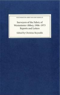
2019__1783274204Boydell and Brewer 2019. Hardcover. New. 385 pages. 9.50x6.50x1.25 inches. Boydell and Brewer hardcover
19552143888Paris: Éditions du Cerf ohne Jahr (ca. 1955). 100, (4) Seiten. Unbeschnitten. 8° (19,5 x 13 cm). Orig.-Broschur. [Softcover / Paperback].
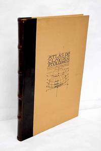
19833638099Valencia.: Vicent García. 1983. Hardcover. Falta el facsimil con los mapas . Good. 46 cm. 1 v. il. col. map. col. Encuadernación en tapa dura de editorial holandesa. Libro de estudios del facsimil. Introducción por Víctor Navarro Brotóns ; traducción y notas por Angel Aguirre Alvarez Víctor Navarro Brotóns y Enrique Rodríguez Galdeano. Tít. de la cub. : Atlas de Claudio Ptolomeo . Falta el facsimil con los mapas . ISBN: 8485094352 v.1 Geografía del mundo antiguo. Geografía regional en general. Geografía universal 913.1"01" Mapas. Atlas geográficos. Globos terráqueos 912100:528.9:091.07 Vicent García. hardcover
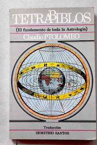
19873674210Madrid.: Barath. 1987. Paperback. Cubierta deslucida. Good. 21 cm. 302 p. Encuadernación en tapa blanda de editorial ilustrada. Tetrabiblos. Traducción y notas de Demetrio Santos. Astrología. Obras anteriores a 1800. Santos Demetrio. 1924-2016. Quadripartitum. Astronomía . Cubierta deslucida. ISBN: 8485799011 9788485799015 null 133.52035.3"01" null 52 Ptolomeo Claudio null 52"01" Barath. paperback