Ptolemy; Girolamo RuscelliBiblio.com
235 résultats
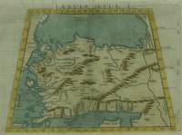
1574M7271Venice: Ruscelli c. 1574. Very Good;. Notes: Italian text on verso.<br>Girolamo Ruscelli 1518–1566 was an Italian mathematician and cartographer active in Venice during the early 16th century. Ruscelli is best known for his important revision of Ptolemy's Geographia published posthumously in 1574. Size : 190x266 mm 7.48x10.47 Inches Coloring: Hand Colored Category: Maps Asia Near East Turkey; Ruscelli unknown
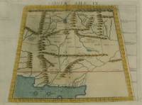
1574M7278Venice: Ruscelli c. 1574. Very Good;. Notes: Italian text on verso.<br>Girolamo Ruscelli 1518–1566 was an Italian mathematician and cartographer active in Venice during the early 16th century. Ruscelli is best known for his important revision of Ptolemy's Geographia published posthumously in 1574. Size : 188x264 mm 7.40x10.39 Inches Coloring: Hand Colored Category: Maps Asia Central Afghanistan Pakistan; Ruscelli unknown
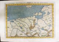
1574M11141Venice: Ruscelli c. 1574. Very Good. Notes: Italian text on verso.<br>Map of Prussia Poland Lithuania part of of Estonia and the Baltic Region.<br>Girolamo Ruscelli 1518–1566 was an Italian mathematician and cartographer active in Venice during the early 16th century. Ruscelli is best known for his important revision of Ptolemy's Geographia published posthumously in 1574. Size : 190x263 mm 7.48x10.35 Inches Coloring: Hand Colored Category: Maps Europe Poland Lithuania; Ruscelli unknown
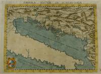
1574M7268Venice: Ruscelli c. 1574. Very Good;. Notes: Italian text on verso.<br>Girolamo Ruscelli 1518–1566 was an Italian mathematician and cartographer active in Venice during the early 16th century. Ruscelli is best known for his important revision of Ptolemy's Geographia published posthumously in 1574. Size : 190x261 mm 7.48x10.28 Inches Coloring: Hand Colored Category: Maps Europe Balkans; Ruscelli unknown
1985332694Pennsylvania: Franklin Library 1985. First Edition; First Printing. Hardcover. Near Fine Leather Bound. Printed on archival paper with gilded edges. The endsheets are of moire fabric with a silk ribbon page marker. Smyth sewing and concealed muslin joints to ensure the highest quality binding. This book is in full leather with hubbed spines.; The Great Books of the Western World. Franklin Library hardcover
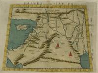
1574M7274Venice: Ruscelli c. 1574. Very Good;. Notes: Italian text on verso.<br>Girolamo Ruscelli 1518–1566 was an Italian mathematician and cartographer active in Venice during the early 16th century. Ruscelli is best known for his important revision of Ptolemy's Geographia published posthumously in 1574. Size : 192x266 mm 7.56x10.47 Inches Coloring: Hand Colored Category: Maps Asia Middle East Holy Land & Palestine;Maps Asia Middle East Jordan Syria Lebanon;Maps Asia Near East Turkey; Ruscelli unknown
1985204502Franklin Center Pennsylvania: Franklin Library 1985. First Edition; First Printing. Hardcover. Near Fine Leather Bound. Printed on archival paper with gilded edges. The endsheets are of moire fabric with a silk ribbon page marker. Smyth sewing and concealed muslin joints to ensure the highest quality binding. This book is in full leather with hubbed spines.; Great Books of the Western World. Franklin Library hardcover
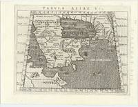
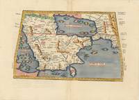
62444Venice 1596. FIRST EDITION THUS. Original engraved map of the Arabian Peninsula 16 x 21.5 cm. overall with Latin text to verso. Embellished with sea monster to lower right corner. An excellent copy. This early map engraving is from Claudius Ptolemaeus Ptolemy and Giovanni Antonio Magini's Geographiae universae tum veteris tum novae absolutissimum opus duobus voluminibus distinctum. The work was published in Venice by S. Galignani de Karera's Heirs in 1596. This is the first Magini edition. "The copperplate maps prepared for this edition and engraved by Girolamo Porro are on a smaller scale and somewhat better executed than those in the editions of 1562" Phillips. [Venice, 1596]. unknown
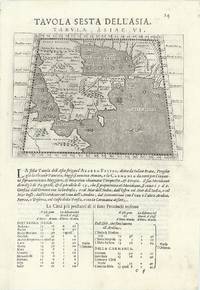
63967Venice 1596. Original engraved map of the Arabian Peninsula 12.5 x 17.5 cm on single leaf 29 x 20.5 cm with Italian text beneath. Verso printed with a map of Central Asia 'Tavola Settima Dell'Asia. Tabula Asiae VII' 12.5 x 17.5 cm. A very good example. This early map engraving is from Claudius Ptolemaeus Ptolemy and Giovanni Antonio Magini's Geographiae universae tum veteris tum novae absolutissimum opus duobus voluminibus distinctum. The work was published in Venice by S. Galignani de Karera's Heirs in 1596. This is the first Magini edition. "The copperplate maps prepared for this edition and engraved by Girolamo Porro are on a smaller scale and somewhat better executed than those in the editions of 1562" Phillips. [Venice, 1596]. unknown
19731602050041West of England Press 1973. Hardcover. Like New. Facsimile of the 1520 edition. Burgundy cloth with crimson spine label. 46 cm. Hardcover. No dust jacket. Good binding and cover. Spine cocked. Includes maps and original Latin text as well as essays on the history of the work. Clean unmarked pages. This is an over sized or heavy book that requires additional postage for international delivery outside the US. West of England Press hardcover
174209570London: Printed for John and Paul Knapton at the Crown 1742 Book. Good. Hardcover. in the original full leather with five raised bands modestly worn both hinges cracked but holding no significant foxing all folding maps present and untorn very little wear inside. Printed for John and Paul Knapton at the Crown hardcover
18131346487Paris: Chez Henri Grand 1813 1816. First French Edition. Hardcover. Octavo Two Volumes. In Very Good condition. Bound in full 20th-century red library bindings with gilt lettering to spine. Boards show mild shelf wear and soiling. Very mild age toning to text blocks. Facing text in Greek and French. Contains mathematical diagrams. Shelved in Case 10. 1346487. Shelved Dupont Bookstore. Chez Henri Grand hardcover
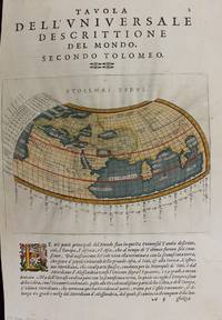
1597M7336Venice: Gio. Battista & Giorgio Galignani c. 1597. Very Good;. Notes: Text in Italian.<br>From Magini's "Geografia cioe Descrittione Universale della Terra".<br>The first edition of this map was printed with Latin text with the later issues printed in Italian.<br>"This quarto edition of Ptolemy was edited by the distinguished Italian geographer Giovanni Magini who also published as part of the same work the first reduced-size version of Mercator's atlas. The four world maps -- one ancient and three modern engravings -- are all by Girolamo Porro neatly copying other earlier works." Shirley Size : 135x175 mm 5.31x6.89 Inches Coloring: Hand Colored Reference: Shirley 193; Phillips 405. Category: Maps World; Gio. Battista & Giorgio Galignani unknown
1786019210<p>London UK: M. Sibley 1786. Second Edition. Hardcover. Very Good. 219pp; Handsomely rebound in textured maroon boards with gilt titling to spine boards square clean & bright previous owner's name to title page pages lightly age-toned text unmarked binding is tight VG condition. Scarce antique volume on astrology originally written in Greek by Claudius Ptolemy c. 100-170s AD a Greco-Roman mathematician astronomer astrologer geographer and music theorist. This edition translated by John Whalley 1653-1724 "professor of physic and astrology and others" but with a reputation as a notorious Irish quack. The original Greek title was Tetrabiblos the Latin title was Quadripartitum and the volume is also known as Apotelesmatika.</p> M. Sibley hardcover
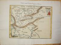
152556635Strasbourg. 1525. Originalt tresnitt. Arkets størrelse : 535 cm X 395 cm. Latin. <br/><br/><em>Latinsk tekst. Bretten noe gulnet et par brunpletter.Med Kypros.Map of Palestine Mesopotamia and Babylonia in present day Middle East.Relief shown pictorially.Includes names of places and natural features.Descriptive text within ornamental borders on verso.Appears in the author's Geographia translated by Willibald Pirckheimer with annotations by Joannes Regiomontanus. Argentoragi i.e. Strasbourg : Iohannes Grieningerus communibus Iohannis Koberger impensis excudebat anno a Christi Natiuitate 1525 tertio Kalendas Apriles. Boston Public Library. </em> unknown
200181701Planeta–De Agostini 2001. Planeta–De Agostini unknown
1541M7225Lyon: Michael Servetus c. 1541. Very good minor wormholing on upper margin. Notes: StolenThe only text on verso is the number "33". The publisher Michael Villanovus or Servetus was tried by Calvin for heresy and burned at the stake with several of his books. Size : 307x363 mm 12.09x14.29 Inches Coloring: Hand Colored Category: Maps Europe Poland Lithuania; Maps Europe Hungary; Maps Europe Romania; Maps Europe Ukraine; Maps Europe Czech Republic Slovakia; Michael Servetus unknown
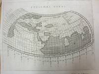
1597M7073Venice 1597. Very Good; a tear in the lower margin not effecting the map. Notes: Ptolemaic map following the classical format. The Indian Ocean is landlocked with a continuous coastline joining Africa to South East Asia. Toprobana present day Sri Lanka is a very large island in the Indian Ocean and the Indian sub-continent is completely missing although the Ganges river is shown. The Mediterranean is well depicted but greatly exaggerated in length. In Africa the Nile is shown originating in mountains below the Equator. Finely engraved in the Italian style with a stippled sea by Girolamo Porro. The map is on a full sheet of Italian text. Italian text on verso. Size : 138x178 mm 5.43x7.01 Inches Coloring: Black & White Reference: Shirley #193. Category: Maps World; unknown
200690171Museum. New. 2006. Paperback. 0954904141 . FREE UPGRADE to Courier/Priority Shipping Upon Request - IN STOCK AND IMMEDIATELY AVAILABLE FOR SHIPMENT - Flawless copy brand new pristine never opened -- 72 pp. ; 70 illus. -- with a bonus offer-- . Museum paperback
1584Map1002Cologne: Goldefridi Kempensis 1584. 2nd Edition . No Binding. Fine. Folio. AN ORIGINAL MAP. Original hand colouring. 47x40cms Folding double page.PLEASE EMAIL FOR PHOTOS. <br/> <br/> Goldefridi Kempensis unknown
154115881Vienna 1541. Very good condition. The second map to show just southern Africa; it is based on the Waldseemuller modern map of southern Africa and derived from Ptolemy. Decoratively illustrated with African kings serpents an elephant and a Christian soldier riding a sea monster towards Madagascar. Three large rivers arise from a mountain range labeled 'Fontes Nili' source of the Nile other mountain ranges and coastal towns named in Latin or Portuguese. With the figure of the King of Portugal riding a sea monster towards Madagascar. <br /> <br /> Based on the slightly larger map from 1513 published in "Ptolemy's Geographia". The atlas was reprinted in 1520 1522 1525 1535 and 1541. This wood block was cut in 1525 for the publisher J.Grünninger. This being the variant of 1541 now without the banner title but title in letter type and blank verso.<br /> <br /> From the last edition of Ptolemy's "Geography" with maps by Laurens Fries and the text edited by Michael Servetus. Servetus was accused of heresy and burnt at the stake. Calvin ordered that copies of the book should be burnt with him although this copy seems to have eluded the flames. <br /> <br /> Wood block map with early hand color. Blank on the verso with the number 39 at the lower right corner. Image size: 16 7/8 x 13". Paper size: 21 1/4 x 15". Strengthened on the verso very faint browning at middle of center fold otherwise very good. Betz p. 55-56. Tooley "Map Collectors' Circle No. 30 Printed Maps of the Continent of Africa Part II" p. 61-62. Karrow "Mapmakers of the Sixteenth Century" unknown
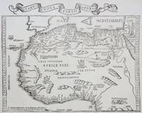
1535M6976Lyons: Melchior & Gaspar Trechsel c. 1535. Very Good;. Notes: No text on verso.<br><br>This is based on Waldseemuller's map Norwich 286 with borders and ornaments by Holbein and Graf. The reissued map includes six kings seated on their thrones a rhinoceros a cyclops and two oxen. <br><br>"As northern Africa was better known than southern Africa at that period it has more geographical information in the interior. Various kingdoms are described with a multitude of coastal names and as with the southern part . these are placed within the coastline. The Mediterranean and Red Seas are prominently featured as well as a number of islands on the northwest coast -- Madeira the Canaries etc. -- which at that time were already well known to the Portuguese in their initial efforts to discover a route to the Indies." Norwich Size : 320x400 mm 12.60x15.75 Inches Coloring: Black & White Reference: Norwich 286 Category: Maps Africa North; Melchior & Gaspar Trechsel unknown
151354087Strasbourg. 1513. Originalt tresnitt. Arkets størrelse : 60 cm X 425 cm. Norsk. <br/><br/><em>“Martin Waldseemüller a highly accomplished scholar of geography merged the science of mapmaking and the art of printing in his 1513 atlas one of the most groundbraking documents in the history of cartography. He intended this atlas as a new edition of Ptolemy’s Geographia but included the addition of 20 modern maps which were not based upon the tradition of Ptolemy. Waldseemüller’s use of a quadratic plane projection was also a noteworthy advance.â€Martin Waldseemüller 1470-1520.Liten rift ved nedre marg. Et lite ormehull i venstre marg. Et par slitasjer i øvre marg. </em> unknown
62979Vienna 1525-1541. Original woodcut Ptolemaic map of the Arabian Peninsula 40 x 55.5 cm with later hand-colouring; Latin title text and additional woodcut decorations to verso. Some minimal discrete paper repairs to upper portion of centrefold generally a very good copy. Early Ptolemaic woodblock map of the Arabian Peninsula here called Arabia Felix. The map is presented on a trapezoidal projection with parallels and meridians forerunners of lines of longitude and latitude enumerated in the borders. The map shows the Arabian Peninsula wider in the southeast and shows a somewhat distorted shape for the Arabian Gulf. Details include topography the major towns while the rivers and many islands are imaginary. This map is based on the slightly larger map from 1513 published in "Ptolemy's Geographia". The atlas was reprinted in 1520 1522 1525 1535 and 1541. This wood block was cut in 1525 for the publisher J.Grünninger. This being the variant of 1541 now without the banner title and wood cut ornaments on the verso. [Vienna, 1525-1541]. unknown
1519045673Venice: Aldus & Andreas Torresano 1519. First Edition. Hardcover Full Leather. Very Good Condition. Contemporary calf worn paneled with a central Venetian device. Corners worn through rubbing to hinges old paper spine labels lacking ties but sound overall. Very light dampstain in top margin in latter sections scattered very minor foxing heavier to endpapers but generally bright and clean. 301 19 leaves. Ahmanson-Murphy 183 Adams P1860 The first Aldine edition of Pontano's commentary on the Ptolemaic Centiloquium and Pontano's De rebus coelestibus two of the central astrological texts of the Renaissance. This volume was meant to complement the two volume edition of Pontano's works published by Aldine the year previous. Size: Quarto 4to. Previous owner's signature in ink. Quantity Available: 1. Shipped Weight: Under 1 kilo. Category: Science & Technology; Astronomy; Philosophy. Inventory No: 045673. <br/><br/> Aldus & Andreas Torresano hardcover