PTOLEMYBiblio.com

235 résultats
8053615. PTOLEMY. GEOGRAPHIA UNIVERSALIS VETUS ET NOVA complectens<br /> Claudii Ptolemaei Alexandrini enarrationis libros VIII. Quorum<br /> primus noua translatione Pirckheimheri et accessione commentarioli<br /> illustrior quàm hactenus fuerit redditus est . Succedunt tabulae<br /> Ptolemaicae opera Sebastiani Munsteri nouo paratae modo. His<br /> adiectae sunt plurimae nouae tabulae. Basileae: apud Henricum<br /> Petrum 1540.<br /> <br /> 20 of 48 maps present: 5. Gallia 6. Germaniam Magnam 11. Iazyges<br /> Metanastas Daciam 17. Ionid Trapesus 18 Sarmatia Asiaticam 19.<br /> Colchidem Iberiam 22. Arabia Felix 23. Margianam Bactriana 25.<br /> Ariam Paropanisadas 26. Indiam Gangem Flu 29. Europa Prima 31.<br /> Hispanium 33. Helvetiae 34. Germania 35. Alsatia 36. Teria<br /> Rheni 37. Quartia Rheni 38. Brabantia et Geldria 39. Svevia et<br /> Bavaria 40. Franconia.<br /> <br /> All maps have descriptive letterpress printed within a decorative<br /> frame on reverse.<br /> Most maps have some worming at the center.<br /> Map 5 Gallia cannot be opened fully; at some point it was glued<br /> together along the center fold when a new backingstrip was laid<br /> down.<br /> <br /> Small folio: 2a4a-c6A-N6 - maps - 62A-2B32C8 30.3.cm. unknown
105903Lutetiæ Apud Gulielmum Cauellat 1556. 8 76 leaves. Illustrated with geometrical figures in the text. Contemporary vellum. Rebacked. Name erased from title-page. Occasional light foxing. . hardcover
173076110Amsterdam:: Apud. R. & J. Wetstenios & Guil. Smith 1730. original pale blue boards; leather spine perished; sewn over tapes which are still largely intact. This copy lacks the last two leaf of the Index and the final blank leaf. . Folio. Added engraved illustrated title leaf; 28 fine maps on 56 leaves. Apud. R. & J. Wetstenios & Guil. Smith, hardcover
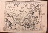
1513M8825Strasburg: Martin Waldseemuller c. 1513. Excellent. Notes: StolenA fine and strong impression of this rare map of Eastern Europe from the 1513 edition of Waldseemüller's modern atlas Geographia.<br><br>The verso is blank. The watermark is similar to fleur de lis sitting on a multi headed star.<br><br>Large Ptolemaic map depicting Europe and Balkan from the Adriatic Sea to the Black Sea.<br><br>The Atlas ' GEOGRAPHIE OPUS NOVISSIMA TRADUCTIONE E GRECORUM ARCHETYPIS ' one of the most important edition of Ptolemy Atlases.was published by Johannes Schott in Strasburg 1513.<br> Size : 434x618 mm 17.09x24.33 Inches Coloring: Black & White Category: Maps Europe Greece Macedonia; Maps Europe Balkans; Maps Europe Romania; Maps Europe Hungary; Martin Waldseemuller unknown
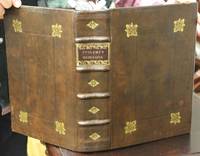
1621B6798Padova: Paolo & Francesco Galignani. 1621. . Some toning interior otherwise clean and crisp. Edition: Second Italian edition. Binding: Recent full calf boards. Matching upper and lower with double blind panels gilt floral devices at corners of inner panel. Spine with 4 raised bands abbreviated title in gilt on maroon label in 2 remaining compartments with gilt devices and blind rules. Notes: Translated from Latin into Italian by Leonardo Cernoti Vinitiano.<br>Text in Italian. <br>A fine example of this monumental atlas and treatise on cartography considered to be the most influential cartographic and geographical account of the ancient world originally written by Ptolemy in Greek around 150 AD. <br><br>Claudius Ptolemy c.100 – c.170 AD was a mathematician astronomer astrologer and geographer living in the city of Alexandria then the Roman province of Egypt under Roman rule who wrote a number of scientific treatises that greatly influenced Byzantine Islamic and Western European science. His Geografia written around 150 AD is a thorough discussion on maps and the geographic knowledge of the Greco-Roman world and also serves as a handbook on how to draw maps using geographic coordinates for parts of the Roman world known at the time. Geografia draws from an earlier work by Marinus of Tyre now lost to us as well as various Roman and Persian gazetteers.<br>Geografia is divided into 8 books: book I is a treatise on cartography describing the methods used to assemble and arrange Ptolemy's data; from Book II through the beginning of Book VII a gazetteer provides longitude and latitude values for the world known to the ancient Romans; the rest of book VII provides details on three projections to be used for the construction of a map of the world varying in complexity and fidelity; book VIII constitutes an atlas of regional maps. The maps include a recapitulation of some of the values given earlier in the work which were intended to be used as captions to clarify the map's contents and maintain their accuracy during copying.<br>Geografia was translated into Arabic in the 9th century and Latin around 1406 and was a highly influential resource on the cartographic traditions of the medieval Caliphate and Renaissance Europe.<br><br> Size: Small Folio 301x 206 mm Illustration: Complete with 64 engraved maps 27 Ptolemaic 37 modern including the rare double-page world map “Orbis Terrae Compendiosa Descriptio†engraved by Girolamo Porro in addition to 14 in-text illustrations plus title vignette and chapter headpieces. Folio pagination. La Seconda Parte Della Geografia di Cl. Tolomeo…: title dated 1620; period marginalia in margins of 126v; 154 mispag. 174. Pg. 13 of Commentarii et Annotationi… unnumbered. Volume: 2 parts in 1 volume. References: Sabin 66506; Phillips Atlases 405; Adams M-118; Shirley 193-96 Pages: Blank 2. Title. 1597 dedication to Marco Cornaro from Gio. Battista & Giorgio Galignani. 1621 dedication to Marco Cornaro from Paolo & Francesco Galignani. Blank. Della Geografia di Claudio Tolomeo: p. 1-62. Commentarii et Annotationi dell’Eccell. Sig. Gio. Antonio Magini Padouano…: p. 1-21. Blank 2. Table of contents. Index 27. La Seconda Parte Della Geografia di Cl. Tolomeo…: p. 2-212. Blank. Index 59. Blank 3. Category: Book Atlas & Cartography; Paolo, & Francesco Galignani. hardcover
1562220508Venice: Vincenzo Valgrisi 1562. hardcover. very good-. Venice: Vincenzo Valgrisi 1562. 2 parts with separate pagination. Short thick 4to bound in 19th century vellum with red edges. Features 64 double page maps: 27 Ptolemaic maps showing the ancient world as Ptolemy knew it including one world map 37 "modern" maps with two world maps and several woodcut diagrams illustrations and decorative initials. Text in Latin. Staining throughout affecting some of the maps. Title page cropped .5" at right margin. Bookplate of Otto Orren Fisher and ink inscription of Charles Singer.<br/> <br/> Giuseppe Moleto Josephus Moletius 1531-1588 was an Italian mathematician who based the text of this edition on the 1525 translation by Wilibald Pirckheimer. Moleto's draws upon Ruscelli's enlarged maps of his 1561 edition which in turn were based upon those by Jacopo Gastaldi. Moleto has also included some of Girolamo Ruscelli's innovations from his own edition: the double hemisphere world map and "Carta Marina Nuova Tavola" a rare sea chart of the world. Also from Ruscelli is a revised version of the Zeno map of the Arctic first published in 1558. The Zeno map describes the purported journey of the author's ancestors in the 1390s to Greenland Iceland the mythical islands of Frisland and Icaria and what is now thought to be Newfoundland and Labrador. While Zeno shows Greenland connected to Norway Ruscelli updated the map by eliminating this land bridge. Despite its inaccuracies and inclusion of mythical lands the Zeno map persisted as the prevailing map of the Arctic and Greenland for many years. Six other New World maps include the South American continent Brazil Central America and the Baja Peninsula the eastern coast of North America Cuba and Hispaniola. Moleto juxtaposes the Ptolemaic maps with the contemporary offering easy comparison between ancient and new. Claudius Ptolemy 90-168 CE was a Roman geographer and mathematician living in Egypt who compiled his knowledge and theories about the world's geography into one seminal work. Although his maps did not survive his mathematical projections and location coordinates did. During the Renaissance revival of Greek and Roman works "Geographia" was rediscovered by monks and based upon Ptolemy's detailed instructions the maps were recreated. The first printed edition of "Geographia" with maps was published in Bologna in 1477. A rare and exciting edition for any collector.<br/> <br/> Vincenzo Valgrisi unknown
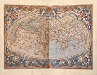
1564265015Venice: Giordano Ziletti 1564. hardcover. very good. 3 parts in 1. Each part has a separate title page with large printer's device. Part 2: Espositioni et Introduttioni Universali di Girolamo Ruscelli sopra tutta la Geografia di Tolomeo. Part 3: Discorso Universale di M. Gioseppe Moleto mathematico. Illustrated with 63 of 64 fine double-leaf copper engraved maps including the rare "World in Hemispheres". Additional large in-text engravings and decorative initials throughout. 8 358 110 204 48 index 47 pages. Short thick 4to bound in old calf with gilt devices on covers neatly re-cased binding well-rubbed but very sound; very clean copy virtually free of foxing; one map ink stained; lacks the final world map "Carta Marina" a.e.g. Venetia: Appresso Giordano Ziletti 1564. Text in Italian. Bookplate of Otto Orren Fisher pasted on inside cover. Manuscript note in ink on title page reads: Ex Libris Stephan Tiapas.<br/> <br/> Second edition of Ruscelli's Italian translation very similar to the edition of 1561 and containing the same series of maps. The double- page maps are partly based on those of Jacopo Gastaldi in the edition of 1548 but on a larger scale. According to Nordenskiold two important innovations were introduced by the 1561 edition into cartographical literature. One: the division of the Map of the World in two hemispheres. Two: The re-issue of the Zeno Map of the Arctic Regions which had appeared first 3 years before. "If the remarkable map in this little work had not received extensive circulation under the sanction of Ptolemy's name it would probably have been forgotten. During nearly a whole century it exercised an influence on the mapping of the northern countries to which there are few parallels in the history of cartography".<br> <br> Girolamo Ruscelli c. 1504-1566 was a Venetian editor whose maps are primarily based on those by Jacopo Gastaldi 1548 but with many of his own additions and reproduced on a larger scale. Ruscelli introduces several important innovations in this volume through his 37 "modern" maps which cover Europe Africa Asia and the New World. Ruscelli includes a double hemisphere world map which was the first of its kind to be used in an atlas and "Carta Marina Nuova Tavola" a rare sea chart of the world. He includes a revised version of the Zeno map of the Arctic first published in 1558. The Zeno map describes the purported journey of the author's ancestors in the 1390s to Greenland Iceland the mythical islands of Frisland and Icaria and what is now thought to be Newfoundland and Labrador. While Zeno shows Greenland connected to Norway Ruscelli has updated the map by eliminating this land bridge. Despite its inaccuracies and inclusion of mythical lands the Zeno map persisted as the prevailing map of the Arctic and Greenland for many years. Six other New World maps include the South American continent Brazil Central America and the Baja Peninsula the eastern coast of North America Cuba and Hispaniola. Claudius Ptolemy 90-168 CE was a Roman geographer and mathematician living in Egypt who compiled his knowledge and theories about the world's geography into one seminal work. Although his maps did not survive his mathematical projections and location coordinates did. During the Renaissance revival of Greek and Roman works "Geographia" was rediscovered by monks and based upon Ptolemy's detailed instructions the maps were recreated. The first printed edition of "Geographia" with maps was published in Bologna in 1477. A rare and exciting edition for any collector. Sabin 66504<br/> <br/> Giordano Ziletti unknown
157418848Venetia Venice Giordano Ziletti 1574-73. 4to. Hcalf from ab 1820. Gilt back. Slight rubbing to spine. 78350 pp. and 65 double-page engraved maps with text on verso of plates 130 pp5665 pp. 6 textlvs. at end with brownspots in right margin sometimes a little browning to pages few brownspots and a few textlvs. with minor wormtracts. Complete with all 65 maps called for each measuring ab. 19 x 26 cm. A great part of the maps have some background shadowing from the printers ink mainly due to the fact that this is the third Ruscelli-edition where the plates have been used before. 3 printer's wood-cut devices and 20 smaller and larger woodcuts in the text. 2 woodcuts with Ptolemy shown observing. <br/><br/><em>Third edition of Ruscelli's translation from Venice 1561. The maps are printed from the same plates with the exception of Ptolemy's map of the world for which Malomba had returned to the original conical projection of Ptolemy. Moreover one map is added: the map of "Territorio di Roma". In general the maps are enlarged copies of Gastaldi's maps from the edition of 1548 which came out in 8vo. The Ruscelli translation contains an important innovation namely the division of the world map into two parts one for the Old World and one for the New as seen on the plate "Tavola Universal" depicting the 2 hemispheres. The atlas contains 27 ptolemaic maps and 38 new. 1 World 1 Hemisphere 10 Europe 4 Africa 12 Asia and 38 others. 10 of the maps relate to America.Philipps I:380. Sabin 66505. Nordenskiöld Nr. 34 p.27. </em> unknown
ABAA-75TH-VBF-18<p>Leiden; Amsterdam: Isaac Elzevir; Jodocus Hondius 1618-1619.</p><p>2 folio volumes: I/ 7 ll. including 1 portrait of Petrus Bertius 253 pp. 1 l.; II/ 28 double-page maps 28 pp. 20 ll. 2 ll.; 46 pp. 8 map segments spread over 4 double-pages 20 pp. 1 full-page map between pp. 10 and 11 1 l. <em>"Abrahami Ortelii Geographise veteris Tabvlae aliquot</em>" in 35 ll. including a half-title and 14 double-page maps complete.</p><p>Full ivory vellum decorated and varnished spines covers of the first volume renewed<em>. Elegant contemporary binding.</em></p><p>408 x 275 mm.</p><p><strong>A complete copy containing 28 double-page maps originally published by Mercator in 1578</strong> 19 maps 15 double-page of Ortelius' <em>Parergon</em> a folding map and the 4 double-page maps that make up the famous <em>Tabula Peutingeriana</em>. The <em>Tabula</em> reproduces the renown manuscript map of the XII century now preserved at the Albertina in Vienna which incorporates an original Roman road map of the third century printed for the first time in 1591 by Welser in Venice.</p><p><strong>First edition of the famous and extremely rare "Theatrum Geographiae Veteris".</strong></p><p><strong>A copy in superb contemporary colors complete in particular with the often missing folding map of Egypt from this 1618-1619 Ptolemy extremely rare and considered by the great bibliographer Sabin as</strong> "<em>An important and valuable work</em>".</p><p>" An important and valuable work containing 47 maps in all. The 28 maps in the first part are on double pages with one exception and were evidently printed from the same plates as those in the editions of 1578 1584 and 1605. They comprise the "<em>Vniversalis Tabvla ivxta Ptolemaeum</em>" ten of Europe five of Africa one of which is on a single leaf entitled "Appendix. III. Tabvlae Afr :" verso blank and twelve of Asia. The Peutingerian tables in 4 double-page plates were engraved and published for the first time nearly twenty years before and contain the imprint <em>Antverpiae è Typographeio nostro</em>. <em>Kal. Decemb</em>. In some copies the map "Scheda Prior" is accompanied by another entitled "Scheda Posterior" probably taken from another work.</p><p>The 14 maps of Ortelius comprise : <em>Evropa</em> sig. QQ; <em>Britannica Insvlae</em> RR; <em>Hispania</em> SS ; <em>Gallia Strabonis</em> VV ; <em>Belgivm</em> YY ; <em>Germania</em> 2.7. ; <em>Italia</em> CCC ; <em>Sicilia</em> DDD; <em>Dacia et Moesia</em> EEE; <em>Pontvs Evxinvs</em> FFF; <em>Thracia</em> GGG; <em>Graecia</em> HHH; <em>Africa Propria</em> III; and <em>Palaestina</em> KKK.</p><p>The backs of these maps and the intervening leaves contain the descriptive text. Most of them had been engraved for earlier editions of Ortelius's Atlas and some are dated 1590 1595 1596 1603 etc. In some copies the maps "<em>Britannicae Insvlae</em>" "<em>Hispania</em>" "<em>Germania</em>" "<em>Sicilia</em>" and "<em>Palaestina</em>" are slightly different and have the descriptive text on the backs in double columns and in larger type - perhaps taken from the 1624 edition of the "<em>Theatri Orbis Terrarvm Parergon</em>" of Ortelius. The portrait of Mercator is the same as in the edition of 1605. Brunet describes a copy in which the verso of the dedication leaf contained a portrait of Petrus Bertius. " Sabin</p><p><strong>Our copy contains this rare portrait of Petrus Bertius on the verso of the dedication to Louis XIII at the beginning of the first volume.</strong></p><p>Collation : 2 preliminary leaves comprising the general title verso blank and the engraved title with a globe to the first volume verso blank no sig. ; the dedication to Louis XIII on one leaf with a portrait of Petrus Bertius on the back followed by the preface in 5 leaves sig. and in twos ; the Greek and Latin text in parallel columns pp. 1-253 verso blank followed by the title to the maps in Greek and Latin with verses on the back sig. A-X in sixes and Z in two ; 28 maps on 55 leaves mostly with descriptive text on the backs sig. A-Bb in twos and a single leaf between P and Q ; Mercator's annotations on the maps comprising the half title with portrait of Mercator on the verso and pp. 3-28 sig. Cc-Dd in sixes and Ee in two ; the " Index Locorum " etc. in 20 leaves sig. AA-CC in sixes and DD in two; the engraved title to the second volume verso blank; the "Itineraria dvo Antonini Pii" pp. 2 1-46 sig. DD3 in four EE-GG in sixes and HH in two; the "Tabulae Pevtingerianae" comprising 8 segments of a map in 4 double-page plates on 8 leaves with text on the backs sig. II-MM in twos ; the " Praefatio in fragmenta Tabulae itinerariae antiquae pp. 1-4 " Prioris Schedae Explicatio " pp. 5-16 and "Posterioris Schedae Explicatio" pp. 17-20 sig. NN in six and OO in four with a map entitled "Scheda Prior" on a separate leaf between pages 4 and 5 verso blank; sig. PP in one QQ-SS in twos TT in one VV in two XX in three YY-ZZ in twos AAA-BBB in ones and CCC-KKK in twos; and one leaf containing "Ad Lectorem" etc. on the recto and the colophon on the verso sig. LLL.</p><p><strong>Precious complete atlas in sumptuous contemporary colors and binding extremely rare. </strong></p><p>FR</p><p>Leiden; Amsterdam: Isaac Elzevir; Jodocus Hondius 1618-1619.</p><p>2 volumes in-folio : I/ 7 ff. dont 1 portrait de Petrus Bertius 253 pp. ; 1 f. ; II/ 28 cartes sur double-page 28 pp. 20 ff. 2 ff. ; 46 pp. 8 segments d'une carte répartis sur 4 double-pages 20 pp. 1 carte à pleine page entre les pp. 10 et 11 1 f. "<em>Abrahami Ortelii Geographise veteris Tabvlae aliquot</em>" en 35 ff. comprenant un faux-titre et</p><p>14 cartes sur double-page complet.</p><p>Plein vélin ivoire dos décorés et vernis plats du tome premier renouvelés. <em>Élégante Reliure de l'époque.</em></p><p>408 x 275 mm.</p><p><strong>A complete copy containing 28 double-page maps originally published by Mercator in 1578</strong> 19 maps 15 double-page of Ortelius' <em>Parergon</em> a folding map and the 4 double-page maps that make up the famous <em>Tabula Peutingeriana</em>. The <em>Tabula</em> reproduces the renown manuscript map of the XII century now preserved at the Albertina in Vienna which incorporates an original Roman road map of the third century printed for the first time in 1591 by Welser in Venice.</p><p><strong>Edition originale du " Theatrum Geographiae Veteris " fort célèbre et rarissime.</strong></p><p><strong>Exemplaire en superbe coloris de l'époque complet notamment de la carte dépliante de l'Égypte qui manque souvent de ce Ptolémée de 1618-1619 fort rare et considéré par le grand bibliographe Sabin comme</strong> " <em>An important and valuable work ".</em></p><p>" <strong>An important and valuable work containing 47 maps in all.</strong> The 28 maps in the first part are on double pages with one exception and were evidently printed from the same plates as those in the editions of 1578 1584 and 1605. They comprise the "<em>Vniversalis Tabvla ivxta Ptolemaeum</em>" ten of Europe five of Africa one of which is on a single leaf entitled "Appendix. III. Tabvlae Afr :" verso blank and twelve of Asia. The Peutingerian tables in 4 double-page plates were engraved and published for the first time nearly twenty years before and contain the imprint <em>Antverpiae è Typographeio nostro</em>. <em>Kal. Decemb</em>. In some copies the map "Scheda Prior" is accompanied by another entitled "Scheda Posterior" probably taken from another work.</p><p>The 14 maps of Ortelius comprise : <em>Evropa</em> sig. QQ; <em>Britannica Insvlae</em> RR; <em>Hispania</em> SS ; <em>Gallia Strabonis</em> VV ; <em>Belgivm</em> YY ; <em>Germania</em> 2.7. ; <em>Italia</em> CCC ; <em>Sicilia</em> DDD; <em>Dacia et Moesia</em> EEE; <em>Pontvs Evxinvs</em> FFF; <em>Thracia</em> GGG; <em>Graecia</em> HHH; <em>Africa Propria</em> III; and <em>Palaestina</em> KKK.</p><p>The backs of these maps and the intervening leaves contain the descriptive text. Most of them had been engraved for earlier editions of Ortelius's Atlas and some are dated 1590 1595 1596 1603 etc. In some copies the maps "<em>Britannicae Insvlae</em>" "<em>Hispania</em>" "<em>Germania</em>" "<em>Sicilia</em>" and "<em>Palaestina</em>" are slightly different and have the descriptive text on the backs in double columns and in larger type - perhaps taken from the 1624 edition of the "<em>Theatri Orbis Terrarvm Parergon</em>" of Ortelius. The portrait of Mercator is the same as in the edition of 1605. Brunet describes a copy in which the verso of the dedication leaf contained a portrait of Petrus Bertius. " Sabin</p><p><strong>Notre exemplaire comporte ce rare portrait de Petrus Bertius au verso de la dédicace à Louis XIII au début du premier volume.</strong></p><p>Collation : 2 preliminary leaves comprising the general title verso blank and the engraved title with a globe to the first volume verso blank no sig. ; the dedication to Louis XIII on one leaf with a portrait of Petrus Bertius on the back followed by the preface in 5 leaves sig. and in twos ; the Greek and Latin text in parallel columns pp. 1-253 verso blank followed by the title to the maps in Greek and Latin with verses on the back sig. A-X in sixes and Z in two ; 28 maps on 55 leaves mostly with descriptive text on the backs sig. A-Bb in twos and a single leaf between P and Q ; Mercator's annotations on the maps comprising the half title with portrait of Mercator on the verso and pp. 3-28 sig. Cc-Dd in sixes and Ee in two ; the " Index Locorum " etc. in 20 leaves sig. AA-CC in sixes and DD in two; the engraved title to the second volume verso blank; the "Itineraria dvo Antonini Pii" pp. 2 1-46 sig. DD3 in four EE-GG in sixes and HH in two; the "Tabulae Pevtingerianae" comprising 8 segments of a map in 4 double-page plates on 8 leaves with text on the backs sig. II-MM in twos ; the " Praefatio in fragmenta Tabulae itinerariae antiquae pp. 1-4 " Prioris Schedae Explicatio " pp. 5-16 and "Posterioris Schedae Explicatio" pp. 17-20 sig. NN in six and OO in four with a map entitled "Scheda Prior" on a separate leaf between pages 4 and 5 verso blank; sig. PP in one QQ-SS in twos TT in one VV in two XX in three YY-ZZ in twos AAA-BBB in ones and CCC-KKK in twos; and one leaf containing "Ad Lectorem" etc. on the recto and the colophon on the verso sig. LLL.</p><p><strong>Précieux atlas complet en somptueux coloris et reliure de l'époque d'une grande rareté.</strong></p> hardcover
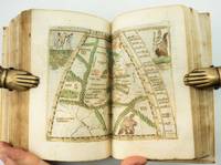
1548ST20876Venice: Giovanni Baptista Pedrezano 1548. First Complete Edition in Italian. Translated by Pietro Andrea Mattioli. Binding size: 175 x 116 mm. 6 7/8 x 4 5/8". ENTIRELY COMPLETE: binder's blank 816 pp. collating as dagger8 A-DD8 DD8 being blank 240 pp. as maps a-h8. <br/> Modern 19th century vellum over flexible boards three raised double bands new pastedowns and free endpapers. Woodcut initials throughout occasional diagrams one full-page decorative woodcut side-borders to title-page fine woodcut portrait of Ptolemy observing the heavens and 60 DOUBLE-PAGE COPPER-ENGRAVED MAPS BY GIACOMO GASTALDI ALL COLORED BY A CONTEMPORARY HAND the land masses enhanced with small depictions of ships mermaids sea monsters strange human figures wild and domestic animals including fish an elephant leopard and chicken and other charming embellishments Pedrezano's large woodcut device on colophon leaf 2D7r and verso of final leaf the maps with landmarks and place names each map guarded by a thin vellum strip taken from a 14th century manuscript executed in a fine scribal hand. Front flyleaf with the early signature of Lelio Capilupi presumably belonging to the book's first or at least early owner and very possibly being that of the Mantuan poet humanist and courtier Lelio Capilupi 1497-1560 known for his "Centones ex Virgilio." Adams P-2234; Alden & Landis 548/31; Burden North America 16 & 17; EDIT16 CNCE 47524; Harrisse BAV 285; JCB3 I:153; Mortimer Italian 404; Nordenskiold 2:214; Phillips Atlases 369; Sabin 66502; Shirley Mapping of the World 87 & 88; Streeter sale 1. Spine and part of the covers with some darkening apparently as an antiquing effect but the binding completely solid and entirely harmless. Intermittent faint dampstain at various places on the page though the vast majority of leaves unaffected map of British Isles with very small repaired hole caused by acidic paint only visible if you look for it bottom margin of three maps and one left margin of another neatly reinforced a handful of margins a bit smudged other trivial imperfections but an extremely attractive copy internally the paper remarkably strong and fresh and with virtually none of the signs of use so often seen with early atlases.<br/> <br/> Because of its innovative size its extensive use of copper engravings instead of woodcuts its introduction of nearly three dozen modern maps and especially its new images of the Americas this is a landmark cartographical publication--and the copy we offer is an extremely rare example of the work enriched with full contemporary hand coloring. It is the first complete printing in Italian following Berlinghieri’s verse paraphrase of 1482 of Ptolemy's universally recognized atlas of the classical world and much more important it is the first version of the work small enough to be practicably carried by hand or in a purse or pocket. In addition although a very small number of earlier atlases exist with copper engravings no previous one is engraved to the extent seen here with five dozen double-page maps presenting dramatically finer detail for example in more refined coastlines and more cleanly realized decorative elements than was possible with images cut from wood. As Nordenskiold notes our 1548 edition was a kind of rediscovery of the virtues of the intaglio cartographic image with no engraved atlas having been printed in the 16th century before ours. In terms of content of central importance here are first engraved maps of parts of North and South America providing legitimacy to Nordenskiold's characterization of our work as "the very first atlas of the New World." There are seven major America-related cartographical achievements in our Pedrezano edition five of them being the modern World map map 59; the other world map "Carta marina" which is the first sea chart depicting the modern world map 60; "Tierra nova" the first separate map of the South American Continent map 54; "Nueva Hispania" the earliest separate map of the Gulf Coast Mexico and the present American Southwest map 55; and "Tierra nueva" the earliest individual map of the east coast of North America from north Florida to Labrador map 56 showing the discoveries of Giovanni da Verrazzano and Jacques Cartier. These last three plus a map of Cuba and one of Hispaniola represent the earliest printed American regional maps. Beyond the American images the 1548 "Geografia" also includes an atypically exo-European eclecticism highlighted by what is apparently the first separate map of the Indian peninsula along with the first separate map devoted to Arabia and the first reference to Singapore on a printed map. The maps were the work of Giacomo Gastaldi ca. 1500 - 1566 Cosmographer to the Venetian Republic and the most prominent Italian cartographer of the period known especially for keeping up to date with the latest geographical discoveries and incorporating them into his maps. While 26 of the 60 maps are based on Ptolemy distinctive here and in other editions within their trapezoidal frames the greater number 34 are the modern work of Gastaldi. The book is consequently one of the very best examples of the integration of the period's Age of Discovery with the groundwork laid by Classical writers. Gastaldi was also responsible for updating and adding modern place names an enormous undertaking as is reflected in the 127-page index here. The history of world exploration owes an immeasurable debt to Claudio Tolomeo ca. 90 - ca. 168 AD who included in his "Geografia" what was known about the geography of the world during the Roman Empire of his lifetime and except for some excavated carved maps Ptolemy's are essentially all we have as a source for the world trodden by the ancients. Manuscripts of his work are known to date as early as ca. 1300 and there were multiple 15th century printings. But all incunabular editions were very large books volumes to be beheld rather than be held and used in any portable context. Waldseemuller's 1513 Strassburg edition was just as weighty. By contrast our edition offered its owner a much more practical format and yet because of its broadening world of 60 maps it was nevertheless the most comprehensive atlas--and the most important one--published between Waldseemuller's and the monumental Ortelius "Theatrum" of 1570. Copies of the 1548 Ptolemy appear on the market from time to time though they typically are beset with condition problems. What seems never to appear--at least so far as we've been able to ascertain--are copies of the book with contemporary coloring. Surely even with a small format atlas issued for functional purposes there must have been copies that were colored on occasion. The Morgan Library does own a copy--apparently once possessed by Marie de Medici--that is colored and it is possible that such copies silently reside in other admittedly sometimes very brief records of institutional holdings but we were unable to find any evidence of such. Likewise and perhaps more telling we were unable to find any copies with period color in auction records which certainly would have prominently announced such an important feature. The Streeter copy and the Wardington copy for example were uncolored. In sum this is a cartographic work of signal importance in especially attractive condition with no small amount of charm in its maps' various real and imagined inhabitants and offered in a colored state that seems virtually never to appear for sale. Giovanni Baptista Pedrezano unknown