335 résultats
1998Q-0691002606Princeton University Press 1998-10-19. Paperback. New. In shrink wrap. Looks like an interesting title! Princeton University Press paperback
1998SKU0228145Princeton University Press 1998-10-19. Paperback. Good. Textbook May Have Highlights Notes and/or Underlining BOOK ONLY-NO ACCESS CODE NO CD Ships with Tracking Princeton University Press paperback
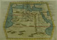
1574M7260Venice: Ruscelli c. 1574. Very Good;. Notes: Italian text on verso.<br>Girolamo Ruscelli 1518–1566 was an Italian mathematician and cartographer active in Venice during the early 16th century. Ruscelli is best known for his important revision of Ptolemy's Geographia published posthumously in 1574. Size : 189x261 mm 7.44x10.28 Inches Coloring: Hand Colored Category: Maps Africa North Egypt;Maps Africa North; Ruscelli unknown
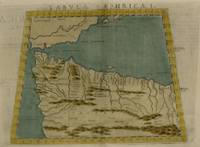
1561M7261Venice: Ruscelli 1561. Very Good;. Notes: Italian text on verso.<br>Girolamo Ruscelli 1518–1566 was an Italian mathematician and cartographer active in Venice during the early 16th century. Ruscelli is best known for his important revision of Ptolemy's Geographia published posthumously in 1574. Size : 188x165 mm 7.40x6.50 Inches Coloring: Hand Colored Category: Maps Africa North; Ruscelli unknown
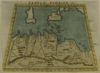
1574M7259Venice: Ruscelli c. 1574. Very Good;. Notes: Italian text on verso.<br>Girolamo Ruscelli 1518–1566 was an Italian mathematician and cartographer active in Venice during the early 16th century. Ruscelli is best known for his important revision of Ptolemy's Geographia published posthumously in 1574. Size : 190x253 mm 7.48x9.96 Inches Coloring: Hand Colored Category: Maps Africa North; Maps Mediterranean Islands; Ruscelli unknown
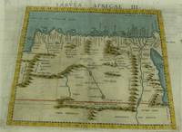
1574M7258Venice: Ruscelli c. 1574. Very Good;. Notes: Italian text on verso.<br>Girolamo Ruscelli 1518–1566 was an Italian mathematician and cartographer active in Venice during the early 16th century. Ruscelli is best known for his important revision of Ptolemy's Geographia published posthumously in 1574. Size : 187x262 mm 7.36x10.31 Inches Coloring: Hand Colored Category: Maps Africa North; Ruscelli unknown
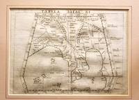
1561M11293Venice 1561. Very Good. Notes: Detailed and early map of Southeast Asia and the Malay Peninsula.<br>The map shows Ptolemy's idea of a landlocked Indian Ocean. <br>Girolamo Ruscelli 1518–1566 was an Italian mathematician and cartographer active in Venice during the early 16th century. Ruscelli is best known for his important revision of Ptolemy's Geographia published posthumously in 1574. Size : 173x232 mm 6.81x9.13 Inches Coloring: Black & White Category: Maps Asia South East Malaysia & Singapore; Maps Asia Central India & Sri Lanka / Ceylon; unknown
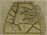
1574M7277Venice: Ruscelli c. 1574. Very Good;. Notes: Italian text on verso.<br>Girolamo Ruscelli 1518–1566 was an Italian mathematician and cartographer active in Venice during the early 16th century. Ruscelli is best known for his important revision of Ptolemy's Geographia published posthumously in 1574. Size : 190x260 mm 7.48x10.24 Inches Coloring: Hand Colored Category: Maps Asia Central Tibet & Himalayas; Maps Asia Far East China; Ruscelli unknown
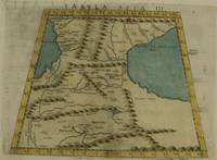
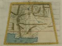
1574M7273Venice: Ruscelli c. 1574. Very Good;. Notes: Italian text on verso.<br>Girolamo Ruscelli 1518–1566 was an Italian mathematician and cartographer active in Venice during the early 16th century. Ruscelli is best known for his important revision of Ptolemy's Geographia published posthumously in 1574. Size : 192x264 mm 7.56x10.39 Inches Coloring: Hand Colored Category: Maps Asia Middle East Caucasus.; Ruscelli unknown
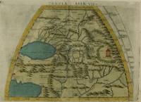
1574M7276Venice: Ruscelli c. 1574. Very Good;. Notes: Italian text on verso.<br>Girolamo Ruscelli 1518–1566 was an Italian mathematician and cartographer active in Venice during the early 16th century. Ruscelli is best known for his important revision of Ptolemy's Geographia published posthumously in 1574. Size : 191x266 mm 7.52x10.47 Inches Coloring: Hand Colored Category: Maps Asia Central Turkmenistan Uzbekistan Tajikistan Kyrgyzstan Kazakhstan; Maps Asia Central Afghanistan Pakistan; Maps Asia Central India & Sri Lanka / Ceylon; Ruscelli unknown
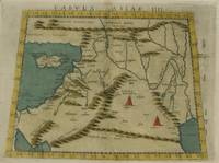
1574M7274Venice: Ruscelli c. 1574. Very Good;. Notes: Italian text on verso.<br>Girolamo Ruscelli 1518–1566 was an Italian mathematician and cartographer active in Venice during the early 16th century. Ruscelli is best known for his important revision of Ptolemy's Geographia published posthumously in 1574. Size : 192x266 mm 7.56x10.47 Inches Coloring: Hand Colored Category: Maps Asia Middle East Holy Land & Palestine;Maps Asia Middle East Jordan Syria Lebanon;Maps Asia Near East Turkey; Ruscelli unknown
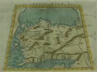
1574M7271Venice: Ruscelli c. 1574. Very Good;. Notes: Italian text on verso.<br>Girolamo Ruscelli 1518–1566 was an Italian mathematician and cartographer active in Venice during the early 16th century. Ruscelli is best known for his important revision of Ptolemy's Geographia published posthumously in 1574. Size : 190x266 mm 7.48x10.47 Inches Coloring: Hand Colored Category: Maps Asia Near East Turkey; Ruscelli unknown
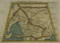
1574M7272Venice: Ruscelli c. 1574. Very Good;. Notes: Italian text on verso.<br>Map of the ancient region of Asiatic Sarmatia.<br>Girolamo Ruscelli 1518–1566 was an Italian mathematician and cartographer active in Venice during the early 16th century. He was also an alchemist writing pseudonymously as Alessio Piemontese.<br>Claudius Ptolemy better known mononymously as Ptolemy was a Greco-Roman mathematician astronomer astrologer geographer and music theorist who wrote about a dozen scientific treatises three of which were important to later Byzantine Islamic and Western European science. Size : 188x262 mm 7.40x10.31 Inches Coloring: Hand Colored Category: Maps Russia; Ruscelli unknown
1574M7278Venice: Ruscelli c. 1574. Very Good;. Notes: Italian text on verso.<br>Girolamo Ruscelli 1518–1566 was an Italian mathematician and cartographer active in Venice during the early 16th century. Ruscelli is best known for his important revision of Ptolemy's Geographia published posthumously in 1574. Size : 188x264 mm 7.40x10.39 Inches Coloring: Hand Colored Category: Maps Asia Central Afghanistan Pakistan; Ruscelli unknown
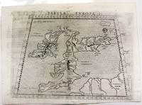
1574M11040Venice c.1574. Very Good. Notes: Map of the British Isles United Kingdom based on Ptolemy's map.<br>Girolamo Ruscelli 1518–1566 was an Italian mathematician and cartographer active in Venice during the early 16th century. Ruscelli is best known for his important revision of Ptolemy's Geographia published posthumously in 1574. Size : 190x262 mm 7.48x10.31 Inches Coloring: Black & White Category: Maps Europe United Kingdom; unknown
1598M8431Venice: G. Fratelli; G.A. Magini c. 1598. Very Good. Notes: Ptolemaic Map of Tabula Asiae X Plate 10 from "Geografia cioe Descrittione Universale della Terra" published by Magini c.1598. Text in Italian.<br><br><br><br> Size : 140x173 mm 5.50x6.80 Inches Coloring: Black & White Category: Maps Asia Central Afghanistan Pakistan; Maps Asia Central India & Sri Lanka / Ceylon; G. Fratelli; G.A. Magini unknown
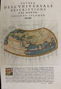
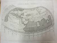
1597M7336Venice: Gio. Battista & Giorgio Galignani c. 1597. Very Good;. Notes: Text in Italian.<br>From Magini's "Geografia cioe Descrittione Universale della Terra".<br>The first edition of this map was printed with Latin text with the later issues printed in Italian.<br>"This quarto edition of Ptolemy was edited by the distinguished Italian geographer Giovanni Magini who also published as part of the same work the first reduced-size version of Mercator's atlas. The four world maps -- one ancient and three modern engravings -- are all by Girolamo Porro neatly copying other earlier works." Shirley Size : 135x175 mm 5.31x6.89 Inches Coloring: Hand Colored Reference: Shirley 193; Phillips 405. Category: Maps World; Gio. Battista & Giorgio Galignani unknown
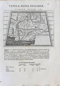
1598M8430Venice.: G. Fratelli; G.A. Magini c. 1598. Very Good. Notes: Ptolemaic Map of Tabula Asiae IX Plate 9 from "Geografia cioe Descrittione Universale della Terra" published by Magini c.1598. Text in Italian. Size : 140x173 mm 5.50x6.80 Inches Coloring: Black & White Category: Maps Asia Central Afghanistan Pakistan; Maps Asia Central Turkmenistan Uzbekistan Tajikistan Kyrgyzstan Kazakhstan; Maps Asia Central India & Sri Lanka / Ceylon; G. Fratelli; G.A. Magini unknown
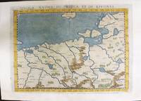
1574M11141Venice: Ruscelli c. 1574. Very Good. Notes: Italian text on verso.<br>Map of Prussia Poland Lithuania part of of Estonia and the Baltic Region.<br>Girolamo Ruscelli 1518–1566 was an Italian mathematician and cartographer active in Venice during the early 16th century. Ruscelli is best known for his important revision of Ptolemy's Geographia published posthumously in 1574. Size : 190x263 mm 7.48x10.35 Inches Coloring: Hand Colored Category: Maps Europe Poland Lithuania; Ruscelli unknown
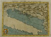
1574M7268Venice: Ruscelli c. 1574. Very Good;. Notes: Italian text on verso.<br>Girolamo Ruscelli 1518–1566 was an Italian mathematician and cartographer active in Venice during the early 16th century. Ruscelli is best known for his important revision of Ptolemy's Geographia published posthumously in 1574. Size : 190x261 mm 7.48x10.28 Inches Coloring: Hand Colored Category: Maps Europe Balkans; Ruscelli unknown
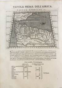
1598M8434Venice: G. Fratelli; G.A. Magini c. 1598. Very Good. Notes: Ptolemaic Map of the North west part of Africa Morocco Tabula Aphricae I Plate 1 from "Geografia cioe Descrittione Universale della Terra" published by Magini c.1598. Text in Italian.<br><br><br> Size : 140x173 mm 5.50x6.80 Inches Coloring: Black & White Category: Maps Africa North; Maps Africa West; G. Fratelli; G.A. Magini unknown
18131346487Paris: Chez Henri Grand 1813 1816. First French Edition. Hardcover. Octavo Two Volumes. In Very Good condition. Bound in full 20th-century red library bindings with gilt lettering to spine. Boards show mild shelf wear and soiling. Very mild age toning to text blocks. Facing text in Greek and French. Contains mathematical diagrams. Shelved in Case 10. 1346487. Shelved Dupont Bookstore. Chez Henri Grand hardcover
1597M7073Venice 1597. Very Good; a tear in the lower margin not effecting the map. Notes: Ptolemaic map following the classical format. The Indian Ocean is landlocked with a continuous coastline joining Africa to South East Asia. Toprobana present day Sri Lanka is a very large island in the Indian Ocean and the Indian sub-continent is completely missing although the Ganges river is shown. The Mediterranean is well depicted but greatly exaggerated in length. In Africa the Nile is shown originating in mountains below the Equator. Finely engraved in the Italian style with a stippled sea by Girolamo Porro. The map is on a full sheet of Italian text. Italian text on verso. Size : 138x178 mm 5.43x7.01 Inches Coloring: Black & White Reference: Shirley #193. Category: Maps World; unknown
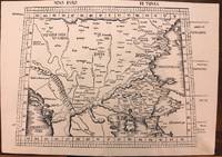
1513M8825Strasburg: Martin Waldseemuller c. 1513. Excellent. Notes: StolenA fine and strong impression of this rare map of Eastern Europe from the 1513 edition of Waldseemüller's modern atlas Geographia.<br><br>The verso is blank. The watermark is similar to fleur de lis sitting on a multi headed star.<br><br>Large Ptolemaic map depicting Europe and Balkan from the Adriatic Sea to the Black Sea.<br><br>The Atlas ' GEOGRAPHIE OPUS NOVISSIMA TRADUCTIONE E GRECORUM ARCHETYPIS ' one of the most important edition of Ptolemy Atlases.was published by Johannes Schott in Strasburg 1513.<br> Size : 434x618 mm 17.09x24.33 Inches Coloring: Black & White Category: Maps Europe Greece Macedonia; Maps Europe Balkans; Maps Europe Romania; Maps Europe Hungary; Martin Waldseemuller unknown
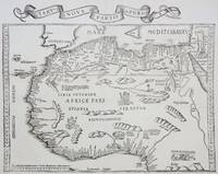
1535M6976Lyons: Melchior & Gaspar Trechsel c. 1535. Very Good;. Notes: No text on verso.<br><br>This is based on Waldseemuller's map Norwich 286 with borders and ornaments by Holbein and Graf. The reissued map includes six kings seated on their thrones a rhinoceros a cyclops and two oxen. <br><br>"As northern Africa was better known than southern Africa at that period it has more geographical information in the interior. Various kingdoms are described with a multitude of coastal names and as with the southern part . these are placed within the coastline. The Mediterranean and Red Seas are prominently featured as well as a number of islands on the northwest coast -- Madeira the Canaries etc. -- which at that time were already well known to the Portuguese in their initial efforts to discover a route to the Indies." Norwich Size : 320x400 mm 12.60x15.75 Inches Coloring: Black & White Reference: Norwich 286 Category: Maps Africa North; Melchior & Gaspar Trechsel unknown