Mann, PtolemyBiblio.com

335 résultats
2024__0903696746Hurtwood Pr Ltd 2024. Hardcover. New. 208 pages. 11.50x9.25x9.09 inches. Hurtwood Pr Ltd hardcover
0903696746.Ghardcover. Good. Access codes and supplements are not guaranteed with used items. May be an ex-library book. hardcover
46530570-nnew. unknown
46530570like new. unknown
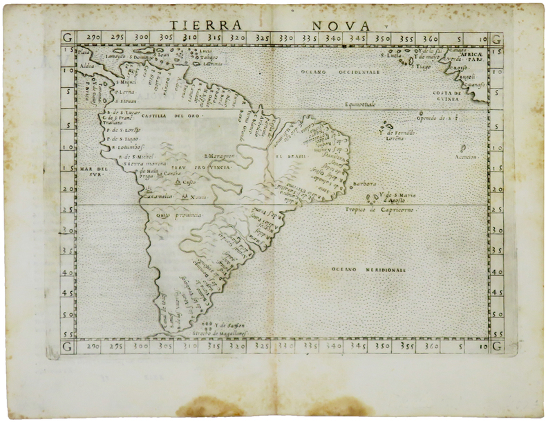
1561LBW-5048[Venise, 1561]. 184 x 245 mm.
1915181190Munich: J.B. Obernetter 1915. Hardcover. VG- covers have heavy wear but pages of text and illustrations are clean and clear. Front cover is unnattached and heavy chipping to spine. Tan boards with brown lettering 2 preliminary leaves 180 pp many uncut bw illustrations and diagrams. Text is in Portuguese. Title translates to: "Treaty of the sphera with Theorica of the sun and the moon and the first book of Geographia by Claudio Ptolomeo." History of Portuguese nautical science at the time of the great discoveries. J.B. Obernetter hardcover
1915181190Munich: J.B. Obernetter 1915. Hardcover. VG- covers have heavy wear but pages of text and illustrations are clean and clear. Front cover is unnattached and heavy chipping to spine. Tan boards with brown lettering 2 preliminary leaves 180 pp many uncut bw illustrations and diagrams. Text is in Portuguese. Title translates to: "Treaty of the sphera with Theorica of the sun and the moon and the first book of Geographia by Claudio Ptolomeo." History of Portuguese nautical science at the time of the great discoveries. J.B. Obernetter hardcover books
[Anno MCCCCLXXXII augusti vero kalendas XVII impressum Ulme per ingeniosum virum Leonardum Hol. (Ulm, Lienhart Holle, 16 luglio 1482)]. Foglio del "Tolomeo di Ulm" (prima edizione, del 16 luglio) recante la carta geografica della penisola indocinese impressa in xilografia a doppia pagina su una facciata e il relativo testo descrittivo, stampato su una pagina dell'altra facciata. Il foglio misura mm. 401x523; l'immagine, misura, al filetto esterno della xilografia, mm. 380x300 (nel punto più corto in larghezza) e mm. 380x372 (nel punto più lungo in larghezza). Coloritura a mano originale. Sulla xilografia sono visibili delle ossidazioni dovute alla presenza al verso del foglio d'una cornice e d'una iniziale a stampa miniate con un colore verde che col tempo ha ossidato la carta. Nel 1482 Lienhart Holle pubblicò ad Hulm una edizione della Geografia di Tolomeo basata sulle carte di Nicolaus Germanus (c. 1420 - c. 1490) che aveva prodotto a Firenze una serie di magnifici atlanti manoscritti su pergamena negli anni 60 e 70 del Quattrocento. Il modello sul quale furono esemplate le carte di Hulm fu l'atlante manoscritto che Nicolaus aveva offerto al papa Paolo II e che pare fosse stato inviato appositamente in Germania (senza essere mai più rispedito a Roma: è conservato allo Schloss Wolfegg). L'edizione di Ulm è il primo atlante pubblicato a Nord delle Alpi e il primo con le carte impresse in xilografia (i due incunaboli precedenti della Geografia di Tolomeo - Bologna 1477 e Roma 1478 - recavano carte incise in rame). L'incisore delle xilografie fu probabilmente Johann Schnitzer di Armsheim (il planisfero reca la sua firma). Una delle mappe più ricercate della penisola indocinese, la terza in assoluto, in ordine di tempo, che sia stata impressa in un atlante a stampa. Per quanto riguarda il Tolomeo stampato ad Ulm cfr. Gof P1084; HC *13539; BMC II 538; IC.9309; Schreiber 5031; Sabin 66472; Nordenskiold Collection II, 199.Sheet of "Ptolemy of Ulm" (first edition, July the 16th, 1482) bearing the geographical map of the Indochinese peninsula printed in double-page woodcut on one side and the relative descriptive text, printed on one page of the other side. The sheet measures mm. 401x523; the image measures, to the external fillet of the woodcut, mm. 380x300 (at the shortest point in width) and mm. 380x372 (at the longest point in width). Original hand coloring. On the woodcut you can see some oxidations due to the presence on the back of the sheet of a frame and of an initial illuminated with a green color that over time has oxidized the paper. In 1482 Lienhart Holle published in Hulm an edition of Ptolemy's Geography based on the maps of Nicolaus Germanus (c. 1420 - c. 1490) who had produced in Florence a series of magnificent handwritten atlases on parchment in the 1460s and 1470s. The model on which Hulm's maps were patterned was the manuscript atlas that Nicolaus had offered to Pope Paul II and which seems to have been specially sent to Germany (without ever being sent back to Rome: it is kept at Schloss Wolfegg). The Ulm edition is the first atlas published north of the Alps and the first with the maps printed in woodcut (the two previous incunabula of Ptolemy's Geography - Bologna 1477 and Rome 1478 - had copper engraved maps). The engraver of the woodcuts was probably Johann Schnitzer of Armsheim (the planisphere bears his signature). One of the most sought after maps of the Indochinese peninsula, the third ever, in order of time, which has been imprinted in a printed atlas.
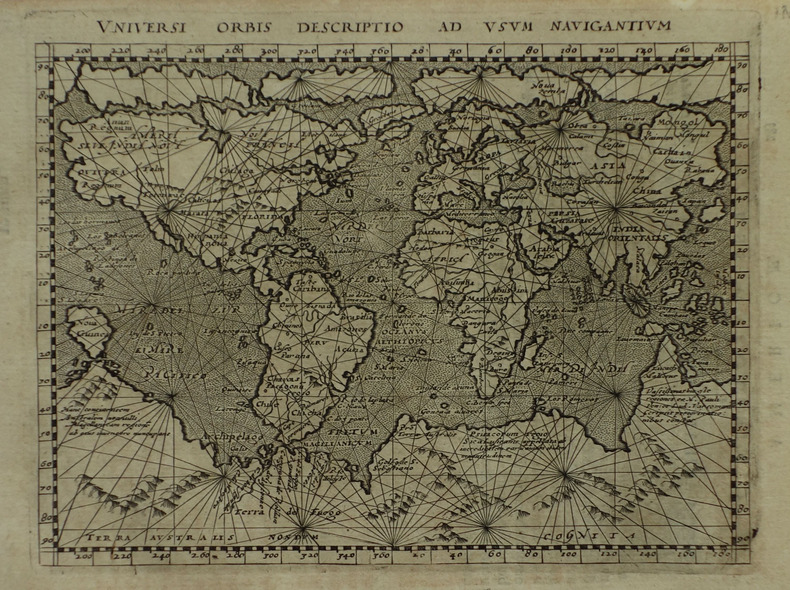
1617LBW-1922[Arnhem, Joannes Jansson, 1617]. 131 x 172 mm.
1991Ancient World cptg<p>Ancient World cptg Claudius Ptolemy active 2nd century. <strong>The Geography.</strong> Translated and edited by Edward Luther Stevenson; with an introduction by Joseph Fischer. Mineola N.Y.: Dover; Toronto: General Pub. Company; London: Constable 1991 1 atlas xvi 167 ca. 121 p.: ill. maps; This The Dover reprint came from the library of a bibliophile who had a wonderful collection of printed books on the history of maps. The original paperback volume was rebound in a handsome blue library buckram with wrappers bound in gilt lettering on spine. Measures 9 ½" x 12 ½". Fine copy. <strong>$50.00 Box 5678</strong></p><p><u>Notes</u></p><p>Translation of the <em>Geographia</em> and dedication of the 1460 ms. ed. <em>Codex Ebnerianus</em> prepared by Donnus Nicholas Nicolaus Germanus.</p><p>"Translation based upon . Latin and Greek texts" and later editions--P. xiii.</p><p>At head of title: Claudius Ptolemy.</p><p>Unabridged republication in reduced dimensions of the limited ed.: Geography of Claudius Ptolemy. New York: New York Public Library 1932.</p><p>Includes reproductions of maps and some text from the <em>Codex</em> <em>Ebnerianus</em> and reproductions of two maps from 16th cent. printed eds. of the <em>Geographia</em>: the Ruysch world map from the 1508 ed. and the Lorenz Fries world map from the 1522 ed.</p><p><u>Subjects</u></p><p>Ptolemy active 2nd century. <em>Geographia</em></p><p>Manuscripts Latin -- Facsimiles</p><p>Early maps -- Facsimiles</p><p>Atlases -- Early works to 1800</p><p>Geography Ancient</p><p>Geography Ancient -- Maps</p><p>Author / Creator</p><p>Nicolaus Germanus active 15th century. </p><p>Stevenson Edward Luther 1858-1944. </p><p>Fischer Joseph 1858-1944 </p><p>New York Public Library </p><p>Other title</p><p><em>Claudius Ptolemy the Geography.</em></p><p>Other title</p><p><em>Codex Ebnerianus</em> New York Public Library </p><p>ISBN : 0486268969 pbk. :</p> Dover; General Pub. Company; Constable hardcover