Herzogtümer Sachsen-Coburg und Gotha - Bachmann, HaraldAntiquariat.de

192 résultats
199350908Augsburg : Maro-Verl. 1993. 488 S. : Ill. ; 24 cm gebundene Ausgabe, Hardcover/Pappeinband, Exemplar in gutem Erhaltungszustand
1993BN253006Augsburg : Maro-Verl. 1993. 1993. Herzog Ernst II. von Sachsen-Coburg und Gotha 1818 - 1893 und seine Zeit : Jubiläumsschrift im Auftrag der Städte Coburg und Gotha. hrsg. von Harald Bachmann . <br/><br/>Herzog Ernst II. von Sachsen-Coburg und Gotha 1818 - 1893 und seine Zeit : Jubiläumsschrift im Auftrag der Städte Coburg und Gotha. hrsg. von Harald Bachmann . Herzogtümer Sachsen-Coburg und Gotha - Bachmann Harald Augsburg : Maro-Verl. unknown
1925154382Gotha & Stuttgart: Verlag Friedrich Andreas Perthes 1925. XXIV, 103 Seiten. Frakturdruck. 8° (17,5-22,5 cm). Orig.-Broschur. [Softcover / Paperback].
190896718Gotha: Perthes 1908. (2), 74 Seiten. 8° (17,5-22,5 cm). Orig.-Interimsbroschur. [Softcover / Paperback].
19303115080Gotha: Leopold Klotz 1930. XII, 87 Seiten. Gr. 8° (23,5 x 15 cm). Orig.-Broschur. [Softcover / Paperback].
19682311280081Hermann Haack Geographisch-Kartographische Anstalt Gotha 1968. Maps. Acceptable. 149 x 207 cm. Color map mounted on muslin wooden rods top and bottom. Tear at top of map near wooden rod some chips. Scale 1:3000000. E 65--E 150/N 57--N 15 Relief shown by shading hypsometric tints form lines and spot heights. 84 inches wide by 65 inches tall. The . Note: This is a large heavy map. Additional postage will apply depending on delivery location. Hermann Haack Geographisch-Kartographische Anstalt Gotha unknown
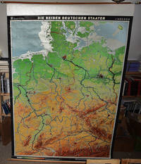
19682310050066VEB Hermann Haack Geographisch-Kartographische Anstalt Gotha 1968. Maps. Very Good. 20th Century Germany 160 x 225 cm. Mounted on muslin wood rods top and bottom Scale of sectional maps 1:450000. Relief shown by spot heights. Area includes part of the neighbouring countries in outline. Shows international boundaries administrative divisions towns by population symbols roads classified railways classified and landmarks. Editors: 1953-56 H.R. Fischer with W. Steinbruck; 1958-59 K. Witthauer; 1961- W. Steinbruck. VEB Hermann Haack Geographisch-Kartographische Anstalt, Gotha, unknown
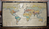
19672309280029Haack Gotha 1967. Maps. Very Good. 122 x 210 cm. Color map mounted on muslin wood rods top and bottom. Cartography by Olbricht and Haefke. Relief shown by contours shading gradient tints and spot heights. Depths shown by gradient tints and soundings. "VLN 1001 . Nr.8/64/67-10/67-1000." Scale 1:20000000. Note: This is a large heavy map. Additional postage will apply depending on delivery location Haack, Gotha unknown
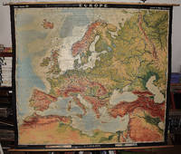
19642309210067A.J. Nystrom ; Justus Perthes Chicago Darmstadt Germany 1964. Maps. Very Good. Large pull down topographic color map of modern Europe. Fitted with metal rod for wall mounting. 185 x 208 cm. 73 1/2 x 81 1/2 inches. Mounted on muslin and fitted with rods. Relief shown by shading gradient tints and spot heights. Depths shown by gradient tints. Shows direction of ocean currents in the Mediterranean Sea and in the Atlantic Ocean. Note: This is a large heavy map. Additional postage will apply depending on delivery location. A.J. Nystrom ; Justus Perthes, Chicago, Darmstadt, Germany unknown
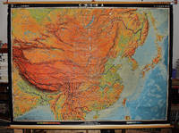
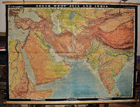
19562311280031EB Hermann Haack Geographisch-Kartographische Anstalt Gotha 1956. Maps. Very Good. Physical map of Asia and India 160 x 220 cm. Mounted on linen wood rods top and bottom. Middle hanging ring broken. Scale 1:3000000 E 25 00'--E 95 00'/ N 45 00'--N 10 00'. Shows international boundaries principal cities transportation facilities railways roads desert tracks waterways and petroleum pipe lines. Relief shown by hachures and spot heights. Depths shown by gradient tints form lines and soundings. Note: This is a large heavy map. Additional postage will apply depending on delivery location. EB Hermann Haack, Geographisch-Kartographische Anstalt, Gotha unknown
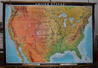
19642309280003Hermann Haack Geographisch-Kartographische Anstalt Gotha 1964. Maps. Very Good. Large physical map of the United States with state boundaries capitals and principal cities. 132 x 198 cm. Mounted on muslin wood rods top and bottom. Small tear crumbled edge on right outer margin. Scale 1:2500000. Denoyer-Geppert no. 15501. <br> Note: This is a large heavy map. Additional postage will apply depending on delivery location Hermann Haack Geographisch-Kartographische Anstalt Gotha unknown
199438940Opladen : Leske und Budrich, 1994. 407 S. : Ill., graph. Darst., Kt. ; 21 cm broschiert
19692124186Darmstadt: Wissenschaftliche Buchgesellschaft (WBG) (Lizenzausgabe der Deutschen Verlags-Anstalt) 1969. VIII, 398 Seiten. Gr. 8° (22,5-25 cm). Orig.-Leinenband. [Hardcover / fest gebunden].
1970645ABKöln 1970. 4°. Mit zahlr. (tls. farb.) Abb. 284 S. OLwd.- Gutes Ex.
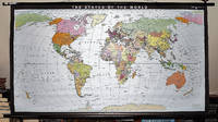
19932309280035Haack-Painke Firm Justus Perthes Gotha Germany 1993. Maps. Very Good. Political Map of the World in vivid color 146 x 78 cm. Color map mounted on rods top and bottom. Scale 1:24000000 W 180--E 180/N 80--S 70. "Best.-Nr. 362331144." Note: This is a large heavy map. Additional postage will apply depending on delivery location. Haack-Painke (Firm), Justus Perthes (Gotha, Germany) unknown
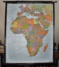
19932311280067Justus Perthes Gotha Germany 1993. Maps. Like New. Africa and Most of Europe 120 x 97 cm. Mounted color map metal roller. Scale 1:10000000. W 30--E 70/N 50--S 40. Relief shown by shading and spot heights. Note: This is a large heavy map. Additional postage will apply depending on delivery location. Justus Perthes, Gotha, Germany unknown
19144037Gothaisches Tageblatt, Gotha, 1914. ca. 27,5 x 38,5 cm (HxB), in der Mitte einmal gefaltet, an einer Seite sind die Blätter durch mehrfache (Privat?)-Klammerung zusammen geheftet. Beginn der Extrablätter: 23.10.1914, 2.45 Uhr nachmittags (`Von den Kriegsschauplätzen`). Letztes Blatt datiert vom 7. Dezember 1914, 4.45 früh (`Unser Sieg über Lodz`). Umrahmung der Nachrichten durch einen schwarzen und einen roten Rahmen. Am 5., 8., 21.,22., 27 November sowie 3. und 4. Dezember fehlt die farbige Umrandung der Mitteilungen. Zum Teil mehrere Extrablätter am Tage. Das Papier ist zeitbedingt vergilbt und brüchig. Randeinrisse und -fehlstellen nahezu durchgängig, Einrisse in der Knickfalte. Von äußerster Seltenheit. Trotz der zahlreichen Papiermängel ein seltenes Originaldokument. Very rare documents about the first Worldwar, seen from the Gotha newspaper. 1. Auflage
1910R160206807GOTHA. 1910. In-16. Broché. Etat passable, Livré sans Couverture, Dos satisfaisant, Intérieur frais. 1224 pages.Vendu en l'état. Absence de dos et de plats.. . . . Classification Dewey : 52-Annuaire
1978Khe05277München (Franz Ehrenwirth) 1978 (= Erste Auflage). 8°, Originalkarton mit illustriertem Originalumschlag (Hardcover) 157 S., 34 Illustrationen in Holzschnitt und 12 Lithographien, ISBN 3431020283 1
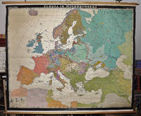
19632309280023Hermann Haack Geographisch-Kartographische Anstalt Gotha 1963. Maps. Good. Early Modern Europe in the 16th century 158 x 197 cm. Color map mounted on muslin wood rods top and bottom. Scale 1:3 000 000. <br> Note: This is a large heavy map. Additional postage will apply depending on delivery location Hermann Haack, Geographisch-Kartographische Anstalt, Gotha unknown
19263132851Gotha: Leopold Klotz 1926. 17 Seiten. Frakturdruck. Mit 1 Tafel. 8° (17,5-22,5 cm). Orig.-Broschur. [Softcover / Paperback].
192754903ABBerlin-Schöneberg, Peter J. Oestergaard Verlag, 1927. 8° (19x13), 295 S., mit zahlr. Bildtafeln in braunem Kupfertiefdruck, flex OLdr mit goldPrägung, Kopfgoldschnitt, nahezu ungelesen, schönes gepflegtes Exemplar,
192756691ABBerlin-Schöneberg, Peter J. Oestergaard Verlag, 1927. 8° (19x13), 295 S., mit zahlr. Bildtafeln in braunem Kupfertiefdruck, OHldr mit reicher goldRückenPrägung, fest sauber und gepflegt,
191655332ABBerlin, Verlag von Gebrüder Paetel (Dr. Georg Paetel), 1916., 1916. 8° (18x12), S. 418 - 444, OKart (Brosch), eingebunden in schlichte rote HartleinenBroschur, sauber und gepflegt,
190757261ABLeipzig, G. Müller-Mann'sche Verlagsbuchhandlung (F. Müller-Mann, Hofbuchhändler), (1907). 8° (20x14), 151 S., schlichte OKart (Brosch), Umschlag etwas lichtverfärbt, vord Deckel mit handschriftl Titel, unbeschnitten/unaufgeschnitten, offensichtlich ungelesen,