192 résultats
1978Khe05277München (Franz Ehrenwirth) 1978 (= Erste Auflage). 8°, Originalkarton mit illustriertem Originalumschlag (Hardcover) 157 S., 34 Illustrationen in Holzschnitt und 12 Lithographien, ISBN 3431020283 1
190757261ABLeipzig, G. Müller-Mann'sche Verlagsbuchhandlung (F. Müller-Mann, Hofbuchhändler), (1907). 8° (20x14), 151 S., schlichte OKart (Brosch), Umschlag etwas lichtverfärbt, vord Deckel mit handschriftl Titel, unbeschnitten/unaufgeschnitten, offensichtlich ungelesen,
190926287Frierichroda i. Th., W. Zinke Nachf. Hugo Wollmer, 1909. Farbige Ansichtskarte, gelaufen, von Friedrichroda nach Braunlage. Verlagsnummer No. 50. Mit Knickspuren und Abrieb, etwas fleckig.
19203114455Gotha: Friedrich Andreas Perthes 1920. (4), 414 Seiten. Frakturdruck. Mit Porträtfrontispiz. Gr. 8° (22,5-25 cm). Orig.-Pappband mit Goldprägung. [Hardcover / fest gebunden].
19144037Gothaisches Tageblatt, Gotha, 1914. ca. 27,5 x 38,5 cm (HxB), in der Mitte einmal gefaltet, an einer Seite sind die Blätter durch mehrfache (Privat?)-Klammerung zusammen geheftet. Beginn der Extrablätter: 23.10.1914, 2.45 Uhr nachmittags (`Von den Kriegsschauplätzen`). Letztes Blatt datiert vom 7. Dezember 1914, 4.45 früh (`Unser Sieg über Lodz`). Umrahmung der Nachrichten durch einen schwarzen und einen roten Rahmen. Am 5., 8., 21.,22., 27 November sowie 3. und 4. Dezember fehlt die farbige Umrandung der Mitteilungen. Zum Teil mehrere Extrablätter am Tage. Das Papier ist zeitbedingt vergilbt und brüchig. Randeinrisse und -fehlstellen nahezu durchgängig, Einrisse in der Knickfalte. Von äußerster Seltenheit. Trotz der zahlreichen Papiermängel ein seltenes Originaldokument. Very rare documents about the first Worldwar, seen from the Gotha newspaper. 1. Auflage
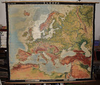
19642309210067A.J. Nystrom ; Justus Perthes Chicago Darmstadt Germany 1964. Maps. Very Good. Large pull down topographic color map of modern Europe. Fitted with metal rod for wall mounting. 185 x 208 cm. 73 1/2 x 81 1/2 inches. Mounted on muslin and fitted with rods. Relief shown by shading gradient tints and spot heights. Depths shown by gradient tints. Shows direction of ocean currents in the Mediterranean Sea and in the Atlantic Ocean. Note: This is a large heavy map. Additional postage will apply depending on delivery location. A.J. Nystrom ; Justus Perthes, Chicago, Darmstadt, Germany unknown
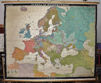
19632309280023Hermann Haack Geographisch-Kartographische Anstalt Gotha 1963. Maps. Good. Early Modern Europe in the 16th century 158 x 197 cm. Color map mounted on muslin wood rods top and bottom. Scale 1:3 000 000. <br> Note: This is a large heavy map. Additional postage will apply depending on delivery location Hermann Haack, Geographisch-Kartographische Anstalt, Gotha unknown
19962133357Gotha: Forschungs- und Landesbibliothek 1996. 256 (4) Seiten. Mit 1 Frontispizportrait und einigen Abbildungen im Text. Gr. 8° (21 x 15 cm). Orig.-Broschur. [Softcover / Paperback].
190228409Berlin, F. Fontane & Co., 1902. 8°. Mit 12 Illustrationen und 6 Facsimile-Beilagen. XIV, 474 S., Halbleinenband der Zeit. Erste Ausgabe. Exlibris auf dem Innendeckel. Wohlerhaltenes Exemplar.
191655332ABBerlin, Verlag von Gebrüder Paetel (Dr. Georg Paetel), 1916., 1916. 8° (18x12), S. 418 - 444, OKart (Brosch), eingebunden in schlichte rote HartleinenBroschur, sauber und gepflegt,
200019798Hildburghausen, Verlag Frankenschwelle, 2000. 156 S. 4°, gebundene Ausgabe
2000130309Hildburghausen: Verlag Frankenschwelle, 2000. 156 S. ; 27,5 x 21,5 cm ; Pp. ;
1999297197Berlin : Kulturstiftung der Länder, 1999. 39 Seiten. Mit zahlreichen farbigen Abbildungen. 28 cm Originalbroschur.
192557222ABLondon, Macmillan and Co, 1925. 8° (23x16), xii, 831 p., with 3 full page maps, 6 plates in photogravure by Emery Walker, 2 mounted facsimiles autograph letters, 1 folded genealogical table, publisher's hardbound red cloth with gilt decoration, top edge gilt, vol 1 of 2, (1. ed.) tight and clean, well cared,
1925154382Gotha & Stuttgart: Verlag Friedrich Andreas Perthes 1925. XXIV, 103 Seiten. Frakturdruck. 8° (17,5-22,5 cm). Orig.-Broschur. [Softcover / Paperback].
1963159424Stuttgart, Berlin, Köln & Mainz: Kohlhammer & Gotha: Klotz 1963. Seiten 282-315. Gr. 8° (22,5-25 cm). Klammergeheftete Lagen. [Softcover / Paperback].
19083107537Gotha: Friedrich Andreas Perthes 1908. VII, 141 Seiten. 8° (17,5-22,5 cm). Zeitgenössischer Halbleinenband mit goldgeprägtem Rückentitel, Leinenecken und Marmorpapierbezug. [Hardcover / fest gebunden].
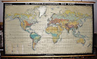
19672309280029Haack Gotha 1967. Maps. Very Good. 122 x 210 cm. Color map mounted on muslin wood rods top and bottom. Cartography by Olbricht and Haefke. Relief shown by contours shading gradient tints and spot heights. Depths shown by gradient tints and soundings. "VLN 1001 . Nr.8/64/67-10/67-1000." Scale 1:20000000. Note: This is a large heavy map. Additional postage will apply depending on delivery location Haack, Gotha unknown
19032133206Gotha: Friedrich Andreas Perthes 1903. IV, 77, (2) Seiten. 8° (17,5-22,5 cm). Orig.-Broschur. [Softcover / Paperback].
192762431Gotha, Engelhard-Reyhersche Hofbuchdruckerei, 1927. 2 Bll., 211 TextS. Mit 1 gefalt. Faks. u. zahlr. Abb. auf 16 Taf. OLn.
1999Q-3872860321Koch Neff & Oetinger & Co 1999-05-01. Hardcover. New. In shrink wrap. Looks like an interesting title! Koch, Neff & Oetinger & Co hardcover
1936143070Gotha: Leopold Klotz Verlag 1936. 91 Seiten. Gr. 8° (22,5-25 cm). Priv.-Halbleinenband. [Hardcover / fest gebunden].
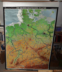
19682310050066VEB Hermann Haack Geographisch-Kartographische Anstalt Gotha 1968. Maps. Very Good. 20th Century Germany 160 x 225 cm. Mounted on muslin wood rods top and bottom Scale of sectional maps 1:450000. Relief shown by spot heights. Area includes part of the neighbouring countries in outline. Shows international boundaries administrative divisions towns by population symbols roads classified railways classified and landmarks. Editors: 1953-56 H.R. Fischer with W. Steinbruck; 1958-59 K. Witthauer; 1961- W. Steinbruck. VEB Hermann Haack Geographisch-Kartographische Anstalt, Gotha, unknown
1927148416Gotha: Verlag der Evang. Buchhandlung P. Ott 1927. 119 Seiten. Frakturdruck. 8° (17,5-22,5 cm). Orig.-Broschur. [Softcover / Paperback].
192037401Langensalza, Beyer, 1920. 22, XVII S. 22 x 14 cm, unbeschnittene Broschur [5 Warenabbildungen]