141 résultats
197324000Paris Librairie C. Klincksieck 1973 in-4° 133 pp , illustrations photographiques en noir tome XVI, seizième année
1909ABE-1615085997828 PAGES FORMAT 28,5 CM X 38 CM-EN COUVERTURE "LE LANCEMENT DU "NEPTUNE" A PORTSMOUTH"-EN COUVERTURE INTERIEURE "LES FETES COMMEMORATIVES AUX ETATS-UNIS", 2 PHOTOS-PAGES D'AUTREFOIS PAR G. LENOTRE: CHEZ CAGLIOSTRO-NOS TROUPES INDIGENES, 3P PAR R. DE CHASALONS, 12 PHOTOS, SENEGALAIS, ALGERIENS, ANNAMITES-LES ESPAGNOLS AU MAROC, 2P, 8 PHOTOS-INAUGURATION DE LA SYNAGOGUE EN PRESENCE DU TSAR DE BULGARIE, SOFIA, 2 PHOTOS-L'INCENDIE D'UN CIRQUE A LIMOGES, PHOTO-LES FETES AMERICAINES, 1P, 3 PHOTOS-L'INAUGURATION DU MUSEE SHACKLETON A LONDRES, 2P PAR J.-V. SERS, 5 PHOTOS-AU SALON D'AUTOMNE, 2P PAR JEAN-JOSE FRAPPA, 4 PHOTOS, ANTTI FAVEN, RENE DEBRAUX, JULIETTE BLUM-LA STATUE DE VICTOR HUGO AU PALAIS-ROYAL, 1P PAR LEON DE MONTARLOT, 2 PHOTOS "UNE OEUVRE D'ART DISCUTEE"-THEATRE: "SUZETTE" DE BRIEUX, PHOTO YVONNE DE BRAY
Urbain Le Verrier, mathématicien et physicien, est à l'origine de la découverte, en 1846, d'une « nouvelle planète, non encore nommée et responsable des perturbations inexpliquées d'Uranus ». Ce sont ses travaux qui vont permettre à l'astronome berlinois Johann Galle de localiser Neptune. Elu député de la Manche en 1839, « sous l'étiquette des Amis de l'ordre », il est à l'Assemblée « un promoteur zélé du télégraphe et des chemins de fer (…) Partisan du coup d’État du 2 décembre, Le Verrier est sous le Second Empire l’un des principaux soutiens du pouvoir au sein du monde savant ». In Francearchives.fr
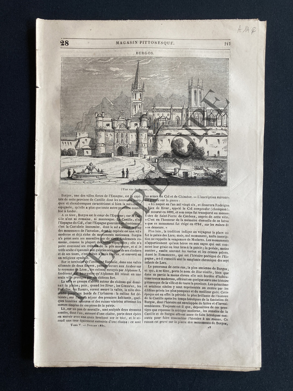
1837ABE-17549188718 PAGES-SANS COUVERTURE-BURGOS/GRAVURE-LES PARASITES-LES DEUX ECOLIERS DE WESTMINSTER-LA GROTTE DE NEPTUNE/GRAVURE-REGLES DE L'ART DE NAGER/4P/GRAVURES BRASSE
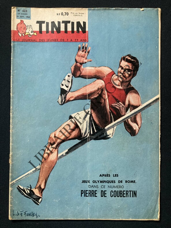
1960ABE-172156007975448 PAGES-IN 4-PIERRE DE COUBERTIN, BD 4 PAGES-MICHEL VAILLANT ROUTE DE NUIT, 2 PAGES-QUAND NEPTUNE EST MAITRE A BORD!, 2 PAGES, 6 PHOTOS, DESSIN-LAS VEGAS LA CITE DU JEU OU L'ON PEUT AUSSI JOUER AU COW-BOY, 3P, 9 PHOTOS-DONALD CAMPBELL A ECHAPPE DE JUSTESSE A LA MORT!, 1/2 PAGE, 2 PHOTOS-LA REGIE RENAULT LANCE L'ONDINE, 1P, 3 PHOTOS-PETIT MANQUE COIN INF G DEUXIEME DE COUVERTURE
169316114(No date, no place, (1693). Very large engraved seechart, measuring 60,5 x 85,5 cm. in original outline colouring with inset view of the River Dee at Chester. The chart showing the whole of Ireland and the Westcoast of England from Cornwall to Cuningham in the north. A fine impression on good thick paper, bearing the watermark: BYCOLUMBIER. Folded down the center.
169316120Large engraved seechart, measuring 46 x 89 cm. in original outline colouring. The chart showing the South-east coast of England from Sandwich to Clay. With inset view of The Thames between London and Greane Island. A fine impression on good thick paper with watermark: BYCOLUMBIER. Folded down the center.
169316116(No place, no date(1693)). Very large engraved seechart, measuring 60 x 86,5 cm. in original outline colouring. The chart showing the Northern part of England from Lancaster to Banf, of Ireland from Blackrock to Carlingford and all the Islands to the north: Shetland, Orkney, Faroe etc. etc. A fine impression on good thick paper with the watermark: BYCOLUMBIER. Folded down the center.
169316118Very large engraved seechart, measuring 61 x 87,5 cm. in original outline colouring with large inset view of the harbour of Kinsal and Kinsal River. The chart showing the Westcoast of Ireland from Bay of Roonstahound to Kiriec (in lower left corner C. Berey scr.) A fine impression on good thick paper with the watermark: BYCOLUMBIER. fOLDED DOWN THE CENTER.
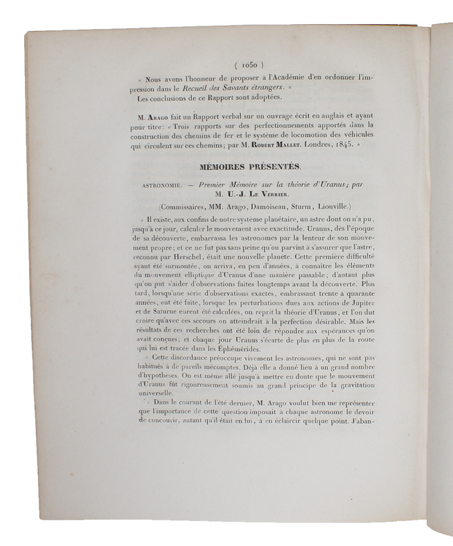
184549635Paris, Bachelier, 1845 a. 1846. 4to. No wrappers. In: ""Comptes rendus hebdomadaires des séances de l’Académie des sciences"", Vol. 21, No 19, Vol. 22, No 22, Vol. 23, Nos 9, 14, 16 a. 17. (6 entire issues offered). Le verrier's papers: pp. 1050-1055 (No 19), pp. 907-919 (no 22), pp. 428-438 (No 9), pp. 657-659, 659-643, 676 (No 14), pp. 741, 741-754, 754 (No 16), pp. 798-799, 799-800 (No 17). With title-pages to vol. 21,22 a. 23. Titlepages with a small stamp in upper corner and a perforated stamp to lower margin. Light yellowing to title-pages, otherwise clean and fine on good paper.
184647206Paris, Bachelier, 1846. 4to. No wrappers. In: ""Comptes Rendu hebdomadaires des Séances de l’Académie des Sciences"", Vol. 22, No 22. Pp. (893-) 928. (Entire issue offered). Le Verrier's paper: pp. 907-018.
184548802(Paris, Bachelier), 1845. 4to. No wrappers. In: ""Comptes rendus hebdomadaires des séances de l’Académie des sciences"", Vol. 21, No 19. Pp. (1009-) 1082 (entire issue offered). With titlepage to vol. 21. Le Verrier's paper: pp. 1050-1055. Stamp to top of titlepage.
169332305A Paris, (but Amsterdam, Pierre Mortier), 1693. 58x88 cm. Kobberstukket søkort over Øresund med den Skånsk/Hallandske kystline og den Sjællandske fra Møn i syd til Hesselø i nord. I pragtfuld fuld håndkolorering. Øverst i midten er indsat Amager og Saltholm i større målestok. Kortet ""ligger ned"", er orienteret øst/vest. Med kompasrose og vindretninger angivet.
169347353A Paris, (but Amsterdam, Pierre Mortier), 1693. 58x88 cm. Kobberstukket søkort over Øresund med den Skånsk/Hallandske kystline og den Sjællandske fra Møn i syd til Hesselø i nord. I pragtfuld fuld håndkolorering. Øverst i midten er indsat Amager og Saltholm i større målestok. Kortet ""ligger ned"", er orienteret øst/vest. Med kompasrose og vindretninger angivet.
169316116No place no date1693. Very large engraved seechart measuring 60 x 865 cm. in original outline colouring. The chart showing the Northern part of England from Lancaster to Banf of Ireland from Blackrock to Carlingford and all the Islands to the north: Shetland Orkney Faroe etc. etc. A fine impression on good thick paper with the watermark: BYCOLUMBIER. Folded down the center. <br/><br/><em>The "Neptune Francois" was published in 1693 and its charts are larger and more lavishly decorated than those of any preceding book of its kind. The chart is without year place and "par Ordre du Roi" pointing to a later impression but issued from the original copperplate. It is also without "Imprimerie Royale" belonging to the imprints from 1792. Koeman IV425:9. </em> unknown
169316120Large engraved seechart measuring 46 x 89 cm. in original outline colouring. The chart showing the South-east coast of England from Sandwich to Clay. With inset view of The Thames between London and Greane Island. A fine impression on good thick paper with watermark: BYCOLUMBIER. Folded down the center. <br/><br/><em>The "Neptune Francois" was published in 1693 and its charts are larger and more lavishly decorated than those of any preceding book of its kind. This chart is without year place and "par Ordre du Roi" pointing to a later issue but issued from the original copperplate. It is also without "Imprimerie Royale" belonging to the imprints from 1792. Koeman IV425:8. </em> unknown
169316114No date no place 1693. Very large engraved seechart measuring 605 x 855 cm. in original outline colouring with inset view of the River Dee at Chester. The chart showing the whole of Ireland and the Westcoast of England from Cornwall to Cuningham in the north. A fine impression on good thick paper bearing the watermark: BYCOLUMBIER. Folded down the center. <br/><br/><em>The "Neptune Francois" was published in 1693 and its charts are larger and more lavishly decorated then those of any preceding book of its kind.This cart is without year place and "par ordre du Roi" pointing to a later print but issued from the original copperplate. It is also without "Imprimerie Royale" belonging to the most recent impression from 1792. Koeman IV425:10. </em> unknown
169316118Very large engraved seechart measuring 61 x 875 cm. in original outline colouring with large inset view of the harbour of Kinsal and Kinsal River. The chart showing the Westcoast of Ireland from Bay of Roonstahound to Kiriec in lower left corner C. Berey scr. A fine impression on good thick paper with the watermark: BYCOLUMBIER. fOLDED DOWN THE CENTER. <br/><br/><em>The "Neptune Francois" was published in 1693 and its charts are larger and more lavishly decorated than those of any preceding book of its kind. The chart is without year place and "par Ordre du Roi" pointing to a later issue but issued from the original copperplate. It is also without "Imprimerie Royale" belonging to the imprints from 1792. Koeman IV425:11. </em> unknown
1846365003Paris: Bachelier Imprimeur-Libraire . Quai des Augustins 1846. First edition with half-title. pp. i-ii 1-3 4-254. 1 vols. 8vo. Contemporary half brown calf and marbled boards black spine label. Ownership signature of Alexander Evans on title page. Rubbed. Very good. First edition with half-title. pp. i-ii 1-3 4-254. 1 vols. 8vo. "I show that that one can only account for the movements of Uranus by introducing the perturbing action of a new planet" p. 5.<br /> French astronomer Urbain Le Verrier 1811-77 successfully predicted the location of an eighth solar planet now called Neptune. The seventh planet Uranus had been discovered telescopically in 1781 by William Herschel. Le Verrier demonstrated that the perturbations of the orbit of Uranus could be explained by the existence of a further celestial body and performed the mathematical calculations. The existence of the planet was confirmed by observation in September 1846 I.G. Galle writing to Le Verrier from Berlin "The planet whose position you communicated really exsts" p. 248. This book gathers four memoranda of "partial publications" read at the Academie des Sciences between November 1845 and October 1846 with a fifth part dated 5 October 1846. He notes that "this success permits us to hope that after thirty or forty years of observations of the new planet one will be able to use it in turn for the discovery of the planet after it in terms of distance from the Sun. And so on; sadly one will come upon bodies invisible by reason of their immense distance from the Sun but whose orbits will over centuries be charted with great exactness through the theory of secular inequalities" p. 254.<br /> <br /> "undeniably one of the major scientific events of the nineteenth century" Lequeux p. 22. <br /> <br /> Uncommon and with nice contemporary American provenance the original owner likely being Alexander Evans 1818-1888 engineer and attorney member of Congress from Maryland 1847-53 and an amateur astronomer who travelled to Illinois to observe the total eclipse in 1869. OCLC reports a dozen locations over several records most in France. For Le Verrier see James Lequeux Le Verrier-Magnificent and Detestable Astronomer Springer 2013 Bachelier, Imprimeur-Libraire ... Quai des Augustins unknown
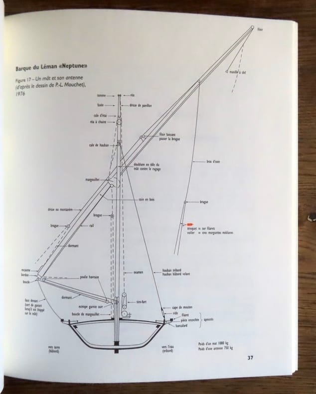
199921788Genève, Fondation Neptune, 1999. Grand in-8 broché, couverture illustrée. Quelques passages surlignés au stabylo. Nombreuses illustrations en noir.
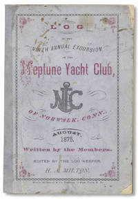
3730876<p>New York: Willis McDonald & Co. Printers 1875. 5 6–121pp. 5¾ x 4 inches. Printed wrappers. Front wrap stained and small edge-chips; spine expertly replaced with tissue; good with very good text block.</p> <p>Proper title: Neptune Club’s “Log.†Ninth Annual Cruise to Nantucket and Martha’s Vineyard with Contributions from Members and Friends. </p> <p>All “logs†of the Neptune Club are rare we locate a scattered handful with this year being unrecorded in any institutional holdings and with significantly more content when compared to logs from previous years.</p> <p>The Neptune Club was comprised of wealthy Connecticut citizens who traveled each summer during the 1860s to 1890s to Martha’s Vineyard and Nantucket. Their “log book†was written after each cruise documenting “their adventures mostly consisting of touring fishing and fine dining at fancy beachside resorts up the coast from Norwalk to Nantucket. Cottage City was a primary destination where the club would stay a week or more each season.†Participants for this year’s cruise hailed from Connecticut and Massachusetts. The Club’s Commodore Charles H. Tompkins earned his wealth in the wholesale drug trade business. Baer Martha’s Vineyard Tales… </p> unknown
Together 5 vols., 8vo., First Editions, with 31 figures, and 30 folding maps and plans in separate wallets; navy cloth gilt, upper boards blocked in gilt, gilt backs [text volumes], original printed wrappers [map, diagram and errata wallets], a fine copy in the publisher's pictorial slip-case as issued. Admiralty Battle Summaries were written relatively soon after the events they describe (the last of the present collection was produced in 1952) and are based on official documentary material which did not become available to the public at large until 1968. They were written by authors who understood thoroughly their topics, as follows: Operation 'Neptune': Commander L.J. Pitrcairn-Jones; The Campaign in North-West Europe: Commander J.H. Lloyd-Owen; Operation 'Dragoon': Commander W.E.H. Westall. In due course, the volumes became basic reference sources for the authors of the Cabinet Office series of OFFICIAL HISTORIES OF THE SECOND WORLD WAR
19532003280013Salem Mass. : Peabody Museum of Salem and Essex Institute 1953. Hardcover. Good. Nautical Reference and History 138 issues bound in 130 volumes. Nearly complete run of the journal from 1953-1982 also includes vol. IX issue 4 1949 and 20 later issues from 1984 - 1993. Volumes XIII - XLIII lacking 3 issues; Lacking volume XXXV no. 1; XLI no. 3; and XLII no. 2. Four years bound in navy cloth 1953 1954 1955 1956. All other volumes in publisher's wraps. 28 cm. Some damp wrinkling waviness to a few of the issues. <br> About the Journal: "From 1941 to 2002 The American Neptune was America's premier journal of maritime history and arts. The journal's articles written with clarity and scholarly substance are of interest to all who enjoy accounts of ships the seas and those who've sailed them - for mercantile gain their nation's interest or the love of voyaging and exploration. They cover a wide range of subjects art and artifacts people events geographical areas American and international and time periods prehistory through modern day and were written for scholars professionals and enthusiasts. The journal founded by a group that included Samuel Eliot Morison and Walter Muir Whitehill was issued as a quarterly Winter Spring Summer Fall." - Phillips Collection Peabody Essex Museum. <br> Most of the volumes are from the library of Thomas A. Stevens. Mr. Stevens was a writer and historian and an authority on Connecticut River commerce and transportation. <br> This is an oversized or heavy book which requires additional postage for international delivery outside the US. Salem, Mass. : Peabody Museum of Salem and Essex Institute hardcover
1973TB22762Salem Mass.: The Peabody Museum of Salem January 1973 to January 1976. A complete run of 13 issues of The American Neptune all in very good or better conditions in heavy printed paper wraps with glued bindings. Without dust jackets as issued. This collection includes: Vol. XXXII Numbers 1 2 3 and 4. Volume XXXIV Numbers 1 2 3 and 4. Volume XXXV Numbers 1 2 3 and 4; and Volume XXXVI Number 1. The Peabody Museum of Salem paperback books
8vo., with numerous coloured and monochrome photographs and illustrations throughout; pictorial wrappers, a near fine copy