141 résultats
169316114No date no place 1693. Very large engraved seechart measuring 605 x 855 cm. in original outline colouring with inset view of the River Dee at Chester. The chart showing the whole of Ireland and the Westcoast of England from Cornwall to Cuningham in the north. A fine impression on good thick paper bearing the watermark: BYCOLUMBIER. Folded down the center. <br/><br/><em>The "Neptune Francois" was published in 1693 and its charts are larger and more lavishly decorated then those of any preceding book of its kind.This cart is without year place and "par ordre du Roi" pointing to a later print but issued from the original copperplate. It is also without "Imprimerie Royale" belonging to the most recent impression from 1792. Koeman IV425:10. </em> unknown
169316118Very large engraved seechart measuring 61 x 875 cm. in original outline colouring with large inset view of the harbour of Kinsal and Kinsal River. The chart showing the Westcoast of Ireland from Bay of Roonstahound to Kiriec in lower left corner C. Berey scr. A fine impression on good thick paper with the watermark: BYCOLUMBIER. fOLDED DOWN THE CENTER. <br/><br/><em>The "Neptune Francois" was published in 1693 and its charts are larger and more lavishly decorated than those of any preceding book of its kind. The chart is without year place and "par Ordre du Roi" pointing to a later issue but issued from the original copperplate. It is also without "Imprimerie Royale" belonging to the imprints from 1792. Koeman IV425:11. </em> unknown
169332305A Paris, (but Amsterdam, Pierre Mortier), 1693. 58x88 cm. Kobberstukket søkort over Øresund med den Skånsk/Hallandske kystline og den Sjællandske fra Møn i syd til Hesselø i nord. I pragtfuld fuld håndkolorering. Øverst i midten er indsat Amager og Saltholm i større målestok. Kortet ""ligger ned"", er orienteret øst/vest. Med kompasrose og vindretninger angivet.
169347353A Paris, (but Amsterdam, Pierre Mortier), 1693. 58x88 cm. Kobberstukket søkort over Øresund med den Skånsk/Hallandske kystline og den Sjællandske fra Møn i syd til Hesselø i nord. I pragtfuld fuld håndkolorering. Øverst i midten er indsat Amager og Saltholm i større målestok. Kortet ""ligger ned"", er orienteret øst/vest. Med kompasrose og vindretninger angivet.
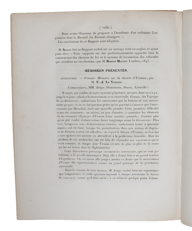
184548802(Paris, Bachelier), 1845. 4to. No wrappers. In: ""Comptes rendus hebdomadaires des séances de l’Académie des sciences"", Vol. 21, No 19. Pp. (1009-) 1082 (entire issue offered). With titlepage to vol. 21. Le Verrier's paper: pp. 1050-1055. Stamp to top of titlepage.
184647206Paris, Bachelier, 1846. 4to. No wrappers. In: ""Comptes Rendu hebdomadaires des Séances de l’Académie des Sciences"", Vol. 22, No 22. Pp. (893-) 928. (Entire issue offered). Le Verrier's paper: pp. 907-018.
184549635Paris, Bachelier, 1845 a. 1846. 4to. No wrappers. In: ""Comptes rendus hebdomadaires des séances de l’Académie des sciences"", Vol. 21, No 19, Vol. 22, No 22, Vol. 23, Nos 9, 14, 16 a. 17. (6 entire issues offered). Le verrier's papers: pp. 1050-1055 (No 19), pp. 907-919 (no 22), pp. 428-438 (No 9), pp. 657-659, 659-643, 676 (No 14), pp. 741, 741-754, 754 (No 16), pp. 798-799, 799-800 (No 17). With title-pages to vol. 21,22 a. 23. Titlepages with a small stamp in upper corner and a perforated stamp to lower margin. Light yellowing to title-pages, otherwise clean and fine on good paper.
169316118Very large engraved seechart, measuring 61 x 87,5 cm. in original outline colouring with large inset view of the harbour of Kinsal and Kinsal River. The chart showing the Westcoast of Ireland from Bay of Roonstahound to Kiriec (in lower left corner C. Berey scr.) A fine impression on good thick paper with the watermark: BYCOLUMBIER. fOLDED DOWN THE CENTER.
169316116(No place, no date(1693)). Very large engraved seechart, measuring 60 x 86,5 cm. in original outline colouring. The chart showing the Northern part of England from Lancaster to Banf, of Ireland from Blackrock to Carlingford and all the Islands to the north: Shetland, Orkney, Faroe etc. etc. A fine impression on good thick paper with the watermark: BYCOLUMBIER. Folded down the center.
169316120Large engraved seechart, measuring 46 x 89 cm. in original outline colouring. The chart showing the South-east coast of England from Sandwich to Clay. With inset view of The Thames between London and Greane Island. A fine impression on good thick paper with watermark: BYCOLUMBIER. Folded down the center.
169316114(No date, no place, (1693). Very large engraved seechart, measuring 60,5 x 85,5 cm. in original outline colouring with inset view of the River Dee at Chester. The chart showing the whole of Ireland and the Westcoast of England from Cornwall to Cuningham in the north. A fine impression on good thick paper, bearing the watermark: BYCOLUMBIER. Folded down the center.
197324000Paris Librairie C. Klincksieck 1973 in-4° 133 pp , illustrations photographiques en noir tome XVI, seizième année
1909ABE-1615085997828 PAGES FORMAT 28,5 CM X 38 CM-EN COUVERTURE "LE LANCEMENT DU "NEPTUNE" A PORTSMOUTH"-EN COUVERTURE INTERIEURE "LES FETES COMMEMORATIVES AUX ETATS-UNIS", 2 PHOTOS-PAGES D'AUTREFOIS PAR G. LENOTRE: CHEZ CAGLIOSTRO-NOS TROUPES INDIGENES, 3P PAR R. DE CHASALONS, 12 PHOTOS, SENEGALAIS, ALGERIENS, ANNAMITES-LES ESPAGNOLS AU MAROC, 2P, 8 PHOTOS-INAUGURATION DE LA SYNAGOGUE EN PRESENCE DU TSAR DE BULGARIE, SOFIA, 2 PHOTOS-L'INCENDIE D'UN CIRQUE A LIMOGES, PHOTO-LES FETES AMERICAINES, 1P, 3 PHOTOS-L'INAUGURATION DU MUSEE SHACKLETON A LONDRES, 2P PAR J.-V. SERS, 5 PHOTOS-AU SALON D'AUTOMNE, 2P PAR JEAN-JOSE FRAPPA, 4 PHOTOS, ANTTI FAVEN, RENE DEBRAUX, JULIETTE BLUM-LA STATUE DE VICTOR HUGO AU PALAIS-ROYAL, 1P PAR LEON DE MONTARLOT, 2 PHOTOS "UNE OEUVRE D'ART DISCUTEE"-THEATRE: "SUZETTE" DE BRIEUX, PHOTO YVONNE DE BRAY
Urbain Le Verrier, mathématicien et physicien, est à l'origine de la découverte, en 1846, d'une « nouvelle planète, non encore nommée et responsable des perturbations inexpliquées d'Uranus ». Ce sont ses travaux qui vont permettre à l'astronome berlinois Johann Galle de localiser Neptune. Elu député de la Manche en 1839, « sous l'étiquette des Amis de l'ordre », il est à l'Assemblée « un promoteur zélé du télégraphe et des chemins de fer (…) Partisan du coup d’État du 2 décembre, Le Verrier est sous le Second Empire l’un des principaux soutiens du pouvoir au sein du monde savant ». In Francearchives.fr
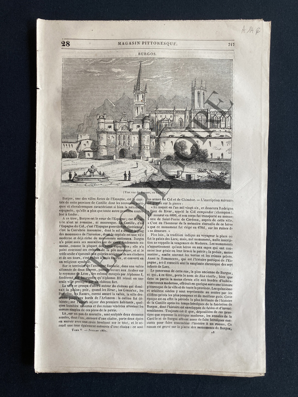
1837ABE-17549188718 PAGES-SANS COUVERTURE-BURGOS/GRAVURE-LES PARASITES-LES DEUX ECOLIERS DE WESTMINSTER-LA GROTTE DE NEPTUNE/GRAVURE-REGLES DE L'ART DE NAGER/4P/GRAVURES BRASSE
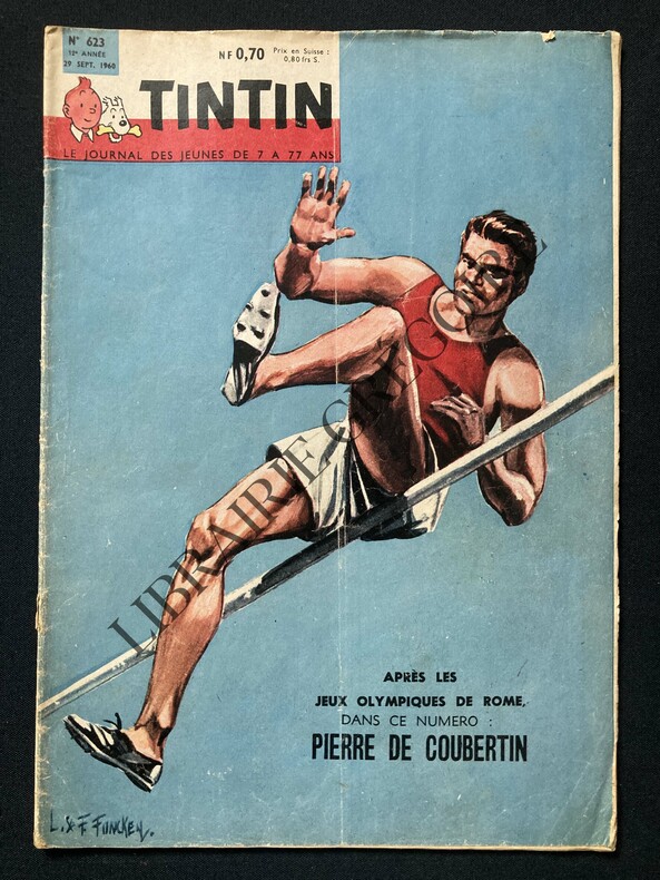
1960ABE-172156007975448 PAGES-IN 4-PIERRE DE COUBERTIN, BD 4 PAGES-MICHEL VAILLANT ROUTE DE NUIT, 2 PAGES-QUAND NEPTUNE EST MAITRE A BORD!, 2 PAGES, 6 PHOTOS, DESSIN-LAS VEGAS LA CITE DU JEU OU L'ON PEUT AUSSI JOUER AU COW-BOY, 3P, 9 PHOTOS-DONALD CAMPBELL A ECHAPPE DE JUSTESSE A LA MORT!, 1/2 PAGE, 2 PHOTOS-LA REGIE RENAULT LANCE L'ONDINE, 1P, 3 PHOTOS-PETIT MANQUE COIN INF G DEUXIEME DE COUVERTURE