141 résultats
169332305A Paris, (but Amsterdam, Pierre Mortier), 1693. 58x88 cm. Kobberstukket søkort over Øresund med den Skånsk/Hallandske kystline og den Sjællandske fra Møn i syd til Hesselø i nord. I pragtfuld fuld håndkolorering. Øverst i midten er indsat Amager og Saltholm i større målestok. Kortet ""ligger ned"", er orienteret øst/vest. Med kompasrose og vindretninger angivet.
169347353A Paris, (but Amsterdam, Pierre Mortier), 1693. 58x88 cm. Kobberstukket søkort over Øresund med den Skånsk/Hallandske kystline og den Sjællandske fra Møn i syd til Hesselø i nord. I pragtfuld fuld håndkolorering. Øverst i midten er indsat Amager og Saltholm i større målestok. Kortet ""ligger ned"", er orienteret øst/vest. Med kompasrose og vindretninger angivet.
169347353A Paris but Amsterdam Pierre Mortier 1693. 58x88 cm. Kobberstukket søkort over Øresund med den Skånsk/Hallandske kystline og den Sjællandske fra Møn i syd til Hesselø i nord. I pragtfuld fuld håndkolorering. Øverst i midten er indsat Amager og Saltholm i større målestok. Kortet "ligger ned" er orienteret øst/vest. Med kompasrose og vindretninger angivet. <br/><br/><em>Det berømte søkort over Sundet fra Jaillot's "Neptune Francois" men i P. Mortier's samtidige udgivelse heraf fra Amsterdam med tilføjelsen "Levée et Gravée" i kartouchen. Jaillot's to søkort over Danmark gav anledning til en kritik af Jens Sørensens opmåling idet Admiralitete forelagde ham de franske og påtalte at Sørensens kort næppe kunne være korrekte. Det var de imidlertid. Her er for første gang trykt det mere korrekte Amagerkort der foranlediger at øen på næsten alle senere kort gengives stor og rund. </em> unknown
169332305A Paris but Amsterdam Pierre Mortier 1693. 58x88 cm. Kobberstukket søkort over Øresund med den Skånsk/Hallandske kystline og den Sjællandske fra Møn i syd til Hesselø i nord. I pragtfuld fuld håndkolorering. Øverst i midten er indsat Amager og Saltholm i større målestok. Kortet "ligger ned" er orienteret øst/vest. Med kompasrose og vindretninger angivet. <br/><br/><em>Det berømte søkort over Sundet fra Jaillot's "Neptune Francois" men i P. Mortier's samtidige udgivelse heraf fra Amsterdam med tilføjelsen "Levée et Gravée" i kartouchen. Jaillot's to søkort over Danmark gav anledning til en kritik af Jens Sørensens opmåling idet Admiralitete forelagde ham de franske og påtalte at Sørensens kort næppe kunne være korrekte. Det var de imidlertid. Her er for første gang trykt det mere korrekte Amagerkort der foranlediger at øen på næsten alle senere kort gengives stor og rund. </em> unknown
1693LBW-2927[1693]. 590 x 880 mm.
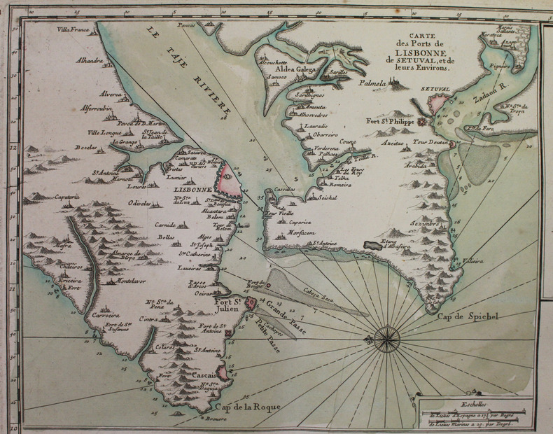
169316116(No place, no date(1693)). Very large engraved seechart, measuring 60 x 86,5 cm. in original outline colouring. The chart showing the Northern part of England from Lancaster to Banf, of Ireland from Blackrock to Carlingford and all the Islands to the north: Shetland, Orkney, Faroe etc. etc. A fine impression on good thick paper with the watermark: BYCOLUMBIER. Folded down the center.
169316120Large engraved seechart, measuring 46 x 89 cm. in original outline colouring. The chart showing the South-east coast of England from Sandwich to Clay. With inset view of The Thames between London and Greane Island. A fine impression on good thick paper with watermark: BYCOLUMBIER. Folded down the center.
169316116No place no date1693. Very large engraved seechart measuring 60 x 865 cm. in original outline colouring. The chart showing the Northern part of England from Lancaster to Banf of Ireland from Blackrock to Carlingford and all the Islands to the north: Shetland Orkney Faroe etc. etc. A fine impression on good thick paper with the watermark: BYCOLUMBIER. Folded down the center. <br/><br/><em>The "Neptune Francois" was published in 1693 and its charts are larger and more lavishly decorated than those of any preceding book of its kind. The chart is without year place and "par Ordre du Roi" pointing to a later impression but issued from the original copperplate. It is also without "Imprimerie Royale" belonging to the imprints from 1792. Koeman IV425:9. </em> unknown
169316120Large engraved seechart measuring 46 x 89 cm. in original outline colouring. The chart showing the South-east coast of England from Sandwich to Clay. With inset view of The Thames between London and Greane Island. A fine impression on good thick paper with watermark: BYCOLUMBIER. Folded down the center. <br/><br/><em>The "Neptune Francois" was published in 1693 and its charts are larger and more lavishly decorated than those of any preceding book of its kind. This chart is without year place and "par Ordre du Roi" pointing to a later issue but issued from the original copperplate. It is also without "Imprimerie Royale" belonging to the imprints from 1792. Koeman IV425:8. </em> unknown
102 pages. Features: New Horizons in British Aviation - article with great photos; Holiday on Floats; Let's Learn to Fly - part 7; "We Can't Fly Without Airports" Series - Chippewa Airport; Report from Ottawa; The Boeing Stratofreighter; New RAF Elementary Trainer - Percival Prentice; 11,000 mile flight of the Truculent Turtle - U.S. Navy Lockheed Neptune; Weatherman Rules Atlantic Flight; Flying Luscombe's Silvaire; Waco's Silver Jubilee Model Aristocraft; and more. Many pages of great ads including a great full-page ad for Fairey featuring a photo of the H.M.C.S. Warrior, the first carrier in the Royal Canadian Navy. Small faint ink stamp to front cover and ad on first page. Average wear. Binding intact. A sound vintage copy. Magazine
8vo., with numerous coloured and monochrome photographs and illustrations throughout; pictorial wrappers, a near fine copy
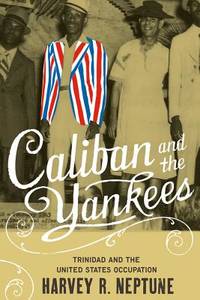
ria9780807857885_inpPaperback. New. New Book; Fast Shipping from UK; Not signed; Not First Edition; Presenting the story of the installation and operation of US bases in the Caribbean colony of Trinidad during World War II this title examines how the people of this British island contended with the colossal force of American empire-b paperback
1458718840.Gpaperback. Good. Access codes and supplements are not guaranteed with used items. May be an ex-library book. paperback
0807830801.Ghardcover. Good. Access codes and supplements are not guaranteed with used items. May be an ex-library book. hardcover
2007Q-0807857882University of North Carolina Press 2007-03-12. Paperback. New. New. In shrink wrap. Looks like an interesting title! University of North Carolina Press paperback
2007x-0807857882Univ of North Carolina Pr 2007. Paperback. New. 1st edition. 288 pages. 9.25x6.25x0.75 inches. Univ of North Carolina Pr paperback
4to., First Edition, with numerous photographs and maps throughout; blue cloth, gilt back, a near fine copy in unclipped dustwrapper. Enser, p.291.
8vo., First Edition, with numerous illustrations in the text; cloth, gilt back, a near fine copy in dustwrapper. This work remains the most comprehensive single-volume guide to the various types of landing craft, support ships and amphibians developed for seaborne landings. Enser, p.11; Law 1092
19532003280013Salem Mass. : Peabody Museum of Salem and Essex Institute 1953. Hardcover. Good. Nautical Reference and History 138 issues bound in 130 volumes. Nearly complete run of the journal from 1953-1982 also includes vol. IX issue 4 1949 and 20 later issues from 1984 - 1993. Volumes XIII - XLIII lacking 3 issues; Lacking volume XXXV no. 1; XLI no. 3; and XLII no. 2. Four years bound in navy cloth 1953 1954 1955 1956. All other volumes in publisher's wraps. 28 cm. Some damp wrinkling waviness to a few of the issues. <br> About the Journal: "From 1941 to 2002 The American Neptune was America's premier journal of maritime history and arts. The journal's articles written with clarity and scholarly substance are of interest to all who enjoy accounts of ships the seas and those who've sailed them - for mercantile gain their nation's interest or the love of voyaging and exploration. They cover a wide range of subjects art and artifacts people events geographical areas American and international and time periods prehistory through modern day and were written for scholars professionals and enthusiasts. The journal founded by a group that included Samuel Eliot Morison and Walter Muir Whitehill was issued as a quarterly Winter Spring Summer Fall." - Phillips Collection Peabody Essex Museum. <br> Most of the volumes are from the library of Thomas A. Stevens. Mr. Stevens was a writer and historian and an authority on Connecticut River commerce and transportation. <br> This is an oversized or heavy book which requires additional postage for international delivery outside the US. Salem, Mass. : Peabody Museum of Salem and Essex Institute hardcover
1634810597.Gpaperback. Good. Access codes and supplements are not guaranteed with used items. May be an ex-library book. paperback
20162-1634810597Zaftig Publishing 2016. Paperback. New. 446 pages. 8.00x5.00x1.01 inches. Zaftig Publishing paperback
8vo., First Edition thus, with 12 photographs and 12 maps; printed wrappers, a near fine copy. Photocopy facsimiles of the original edition of 1956. Covers the three major airborne operations in NW Europe during World War II: NEPTUNE (D-Day), MARKET GARDEN (Arnhem) and VARSITY (Rhine Crossing). Well illustrated and with much statistical detail of troops and transports.
1634810422.Gpaperback. Good. Access codes and supplements are not guaranteed with used items. May be an ex-library book. paperback
20162-1634810422Zaftig Publishing 2016. Paperback. New. 180 pages. 8.00x5.00x0.41 inches. Zaftig Publishing paperback
8vo., First Edition, with frontispiece and maps in the text; brown cloth, gilt back, a fine copy in unclipped dustwrapper.