Sanson, KevinBiblio.com
946 résultats
0520399005.Gpaperback. Good. Access codes and supplements are not guaranteed with used items. May be an ex-library book. paperback
2024x-0520399005University of California Press 2024. Paperback. New. 228 pages. 8.00x5.50x0.50 inches. University of California Press paperback
46662661-nnew. unknown
0520290852.Gpaperback. Good. Access codes and supplements are not guaranteed with used items. May be an ex-library book. paperback
18344319FB1834. Brüssel Louis Hauman et Compe 1834. 12°. 132 S. Pappband der Zeit mit montiertem goldgeprägtem Rückentitel Ecken und Kanten stärker bestoßen und berieben. Umlaufender Rotschnitt. Durchgehend geringfügig fleckig und stellenweise mit sehr leichten Knickspuren. Sonst innen in guter Erhaltung. unknown
18364318FB1836. Paris J.-B. Baillière 1836. 8°. 1 Tafel fehlend 352 S. Moderne Steifbroschur mit aufgezogenem Originaltitel Titel gebräunt. Durchgehend leicht fleckig. Sonst in schöner Erhaltung. unknown
2012465773.Gpaperback. Good. Access codes and supplements are not guaranteed with used items. May be an ex-library book. paperback
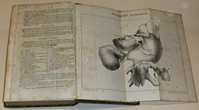
89399Paris, Ebrard 1838/ Fourchet, Libraire-Editeur, 1838 / J.B. Baillière, 1839/Imprimerie de Béthune et Plon, 1839 /Deville-Cavellin, 1837/Chez l'Auteur et J.-B. Baillière, 1838 /Chez Werdet, 1830, 11 plaquettes reliées ensemble dans un volume in-8 de 135x215 mm environ,135-157(1)-100(1)-47+ 2 planches dépliantes-40-99-96-16-12-32-32 pages,+1 planche dépliante, demi basane chocolat, dos lisse avec titres dorés en grande partie effacés, gardes marbrées. Des rousseurs, une coiffe légèrement ébréchée, fente de 3 cm sur un mors, dos épidermé, coupes et coins émoussés, des tampons d'appartenance, ex-libris et date manuscrits sur la première page de faux-titre.
2012105280Somogy Editions D'Art. New. 2012. Paperback. 2757205617 . FREE UPGRADE to Courier/Priority Shipping Upon Request - IN STOCK AND IMMEDIATELY AVAILABLE FOR SHIPMENT - Flawless copy brand new pristine never opened -- Text in French. 176 pages. -- with a bonus offer-- . Somogy Editions D'Art paperback
3838178408.Gpaperback. Good. Access codes and supplements are not guaranteed with used items. May be an ex-library book. paperback
6131577927.Gpaperback. Good. Access codes and supplements are not guaranteed with used items. May be an ex-library book. paperback
2011DADAX6131577927Omniscriptum 2011-06-22. paperback. New. 5.91x0.63x8.66. Buy with confidence. Excellent Customer Service & Return policy. Omniscriptum paperback
0190310847New. Brand new and still unused unknown
0190310847.Gpaperback. Good. Access codes and supplements are not guaranteed with used items. May be an ex-library book. paperback
1876905336.Gpaperback. Good. Access codes and supplements are not guaranteed with used items. May be an ex-library book. paperback
019030457XNew. Brand new and still unused unknown
166710027Paris 1667. No Binding. Near Fine. 12 ½ x 17 inches. Original outline color; excellent. Earliest map of Martinique listed in Phillips featuring attractive original color and an elegant cartouche. This map depicts the situation on the island before 1660 when it was still largely inhabited by natives and only about half of it had been claimed by colonists for sugar cane farming. The map goes so far as to mark with a printed line the partition dividing the "demeure des François" and the "demeure des savages." However by 1660 the entirety of the native population was either dead expelled or in slavery and Martinique was a full-fledged sugar cane-farming European colony. Phillips Maps P. 389. unknown
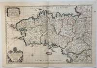
1693324404Paris: Alexis-Hubert Jaillot 1693. Map. Engraving with hand colored outline. Image measures 21" x 31"<br/> <br/> This large 17th century double-page map features the Brittany region of France. Cities towns abbeys government buildings rivers ports and harbors are labeled. Mountains forests and wetlands are depicted pictorially. The attention to detail in topography and population centers hints at the abundance of the region known for its production of Muscadet wine cheese boar seafood and other agricultural products. Executed by Nicolas Sanson in dedication to his son this map was published by Alexis-Hubert Jaillot in Paris and later reproduced in Amsterdam by Jaillot and Pierre Mortier. This early edition is scarce and hard to find. In very good condition with some offsetting to left side and a spot in the right margin. <br> <br> Nicolas Sanson 1600-1667 is considered the founder of the French school of cartography. In reaction to the prevailing trend of Dutch lavishness Sanson favored minimal details focusing rather on accurate cartography than ornament.<br/> <br/> Alexis-Hubert Jaillot unknown
2000Q-0967763908Quailmark Books Llc 2000-01-01. hardcover. New. In shrink wrap. Looks like an interesting title! Quailmark Books Llc hardcover
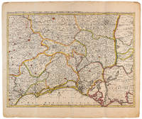
1710009141Amsterdam: Pierre Mortier 1710 Cooper engraving 44.5 x 59.5 cm on paper measuring 54.0 x 64.0 cm with original color in outline minor spotting and creasing remnants of centerfold. A good copy of a map of south-central France the Cévennes Vivarais Occitania published in Amsterdam by Pierre Mortier to illustrate events of the War of the Spanish Succession. Pierre Mortier unknown
170054035Amsterdam: 1700. Map of Germany divided into regions which at the time extended over much of the Low Countries. Maps by Sanson in original colour are rare. Nicolas Sanson was founder of the French school of mapmakers at a time when the leadership in European cartography passed from the Low Countries to France. This map was published in Brion's treatise on globes. Nicolas Brion was a famous French mathematical and scientific instrument maker. L'Usage des Globes. Copper engraving. Fine condition. Original colour. Size: 23.5 x 18.5 cm. unknown
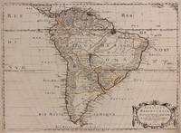
1691M1345Paris 1691. Very Good. Size : 590x885 mm 23.25x34.875 Inches Coloring: Hand Colored in Outline Category: ; Maps South America Continent unknown
1650309461Paris: Pierre Mariette 1650. unbound. Abraham Peyrounin. Map. Engraving with original outline color. Image measures 15 3/4" x 21 3/4"<br/> <br/> This exceptionally fine map of South America covers the continent in fine detail. Coastlines are extensively labeled and mountains beautifully rendered in profile. The Orinoco and Amazon Rivers as well as Rio de la Plata are prominently rendered. Sanson refrains from drawing a southern coastline to Tierra del Fuego and the relatively unknown Amazon region is depicted in minimal detail. Sanson does however include the mythical lake "Lac de Parime" and the city of gold "Manoa del Dora" between the Orinoco and Amazon rivers. Nice dark impression. In very good condition. Minor dampstain to lower margin not affecting the image and some faint stains near the center of the map - otherwise clean and bright. Hard to find. <Br> <br> Nicolas Sanson 1600-1667 is considered the founder of the French school of cartography. In reaction to the prevailing trend of Dutch lavishness Sanson favored minimal details focusing rather on accurate cartography than ornament.<br/> <br/> Pierre Mariette unknown
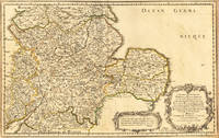
165417463Paris: N. Sanson 1654. Other. In very good condition. 365 by 580mm 14¼ by 22¾ inches. 365 by 580mm 14¼ by 22¾ inches. Copper-engraving handcolored in outline when published. Fine and strong impression of this early decorative mid-seventeenth century map of this English regional map covering the area Chester Darbing Nottingham. by the famous French cartographer Nicolaus Sanson. Very detailled and naming many cities and villages as well many places along the coastline. Showing prominently the eastern part of central England. In the lower right corner with a large floral title cartouche and milage scale. N. Sanson unknown
16546571Paris 1654. Copper engraving 37 x 48 cms modern hand-colour blank verso. Nicolas Sanson 1600-1667 founder of the Sanson dynasty of map-makers is considered by many to be the father of the French school of cartography. He was a prolific and original map-maker admired for the clarity and scientific accuracy of his maps. Map unknown