Sanson, Nicolas dAbbevilleBiblio.com
946 résultats
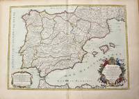
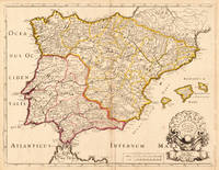
170419604Paris: N. Sanson 1704. Other. In very good condition a slightly creasing in the lower part of the centrefold with minor tiny spots. 410 by 525mm 16¼ by 20¾ inches. 410 by 525mm 16¼ by 20¾ inches. Copper engraving hand colored in outline when published. Interesting and detailed map of ‘Antique SpainÂ’ with Portugal and the Balearic Islands by the French cartographer Nicolaus Sanson d´Abbeville. The map provides us a lot of information of the various place names of cities and small towns the rivers mountains and also engraved borders of the various Spanish provinces. The map impresses with the geographic exactness which is typical for the French cartographer Nicolaus Sanson. In the decorative cartouche which is in shape of a seashell we find the altered date ‘1704Â’ which is a relatively late edition for maps by N. Sanson. The map is probably published in a French composit atlas around this date. N. Sanson unknown
1104771187.Gpaperback. Good. Access codes and supplements are not guaranteed with used items. May be an ex-library book. paperback
1166040631.Gpaperback. Good. Access codes and supplements are not guaranteed with used items. May be an ex-library book. paperback
1647WB16371Lutetiae Parisiorum: Sumptibus & Impensis Autoris 1647. Hardcover. Good. 16mo. Old leather; quite worn. pp 16 246 2. Liber primus only. <br/><br/> Sumptibus & Impensis Autoris hardcover
1663283501Paris 1663. unbound. very good. Map. Hand-colored engraving. 15" x 23".<br/> <br/> This map of Sicily from the 17th century shows the entire island as well as the southwesternmost tip of the Italian peninsula. The names of the surrounding bodies of water are named in Latin and rivers mountains lakes and towns are noted on the map. <BR> <BR> Nicolas Sanson 1600-1667 is considered the founder of the French school of cartography. In reaction to the prevailing trend of Dutch lavishness Sanson favored minimal details focusing rather on accurate cartography than ornament. This map is a fine example of his work.<br/> <br/> unknown
1656006682Paris: Chez l'Autheur 1656. First Edition. Full Calf. Very Good. 4to. 23.5 by 17.5 cm. Unpaginated 100 pages of text plus 2 pp. of ads. With 18 copper engraved maps all two page plates each with hand-colored of boundaries. Maps include one of the entire continent then of its various regions as then known plus the islands off the continent. Also a map of Malta. Bound in contemporary calf. Condition: calf dry and rubbed on spine and joints and edges rubbed. Light to moderate soiling in the margins of the pages. Two bookplates -- one of the Marquis of Lothian the other the Newbattle Abbey Library. Chez l'Autheur unknown
1652006683Paris: Chez l'Autheur 1652. First Edition. Full Calf. Very Good. 4to. 23.5 by 17.5 cm. Unpaginated 102 pages of text plus 2 pp. of ads 1 Royal privilege page. With 17 copper engraved maps all two page plates each with hand-colored of boundaries. Maps include one of the entire continent then of its various regions as then known plus island groups. Separate maps for China and Japan. Bound in contemporary calf. Condition: Rebacked with joints making this obvious. The original spine was re-mounted with some losses. Its blindstamped decoration of fans is discernible but somewhat vague. We think it is possible this decoration had some gilding or color originally but none survives. Still an interesting and unusual feature in our view. Calf dry and rubbed on spine and joints and edges rubbed. Light to moderate soiling in the margins of many pages and on a few pages the soiling invades inward beyond the margins and also in a few instances the marginal soiling is on the heavier side. There are a few archival tape repairs of small chips three on the title leaf one on the following leaf and after that wormhole edge damage was left untouched. That said the defect and repair isn't as glaring as it might sound. The edges elsewhere can have short spans of a chewed appearance. As a book generally we would consider this copy at best Good. As far as the maps go independent of the book we would regard them as Very Good. A few of the maps might individually fall short of such grading; on the other hand all the maps of this copy one can easily imagine someone enthusiastically framing even without an attempt to clean them up. Two bookplates -- one of the Marquis of Lothian the other the Newbattle Abbey Library. Chez l'Autheur unknown
1710M10278Paris: H. Jaillot c.1710. Very Good. Size : 465x655 mm 18.31x25.79 Inches Coloring: Original Hand Coloring Category: Maps Europe Portugal; Maps Europe Spain; H. Jaillot unknown
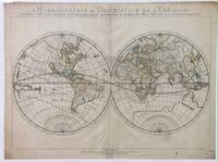
1652010748twParis: Sanson. Very Good. 1652. A very rare map from Nicolas Sanson. Imprint bears the date of 1652 although it is possible that this copy came from an atlas in the later 1600s. Light toning and edgewear with one corner slightly chipped. Light soil on lower margin. Hand-colored boundaries. Map borders measure 14" x 20 3/4". California is shown as an island and Terre Australe is a vague line encircling the Antarctic. Terre de Iesso is the name given to the land mass northwest of North America. Sanson 1600-1667 published many map versions of the world and is known as "the father of French cartography." ; 16 1/2" x 22 1/4" . Sanson unknown
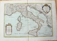
1783M10279Paris: H. Jaillot c.1783. Very Good. Size : 469x655 mm 18.46x25.79 Inches Coloring: Original Hand Coloring Category: Maps Europe Italy; Maps Mediterranean Islands; H. Jaillot unknown
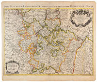
1710009140Amsterdam: Pierre Mortier 1710 Cooper engraving 46.5 x 61.5 cm on paper measuring 54.0 x 64.5 cm with original color in outline minor spotting and creasing remnants of centerfold. A good copy of a map of the Duchy of Lorraine and surrounding territories published in Amsterdam by Pierre Mortier to illustrate events of the War of the Spanish Succession. Pierre Mortier unknown
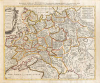
1710009147Amsterdam: Petrus Schenck 1710 Cooper engraving 46.5 x 58.0 cm on paper measuring 51.0 x 63.5 cm with original outline coloring flattened expertly restored and backed with archival tissue paper. The Latin title in the top border reads: "Russiae Albae sive Moscoviae delineatio Geographica accurata et nova…". A good copy of a Moscovie map published in Amsterdam by Petrus Schenck. Petrus Schenck unknown
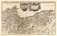
169625836Paris: Hubert Jaillot 1696. Other. In excellent condition. 545 by 874mm 21 by 34 inches. 545 by 874mm 21 by 34 inches. Hand-Colored Original Copperplate Engraving by Nicolas d Abbeville Sanson depicting Le Duche de Pomeranie divis en ses Principales Parties Dress sur les Memoires les plus Nouveaux. Par le Sr. Sanson. Geographe Ordinaire du Roy. A Paris Chez H Iaillot. joignant les grands Augustins aux deux Globes Avec Privilege du Roy Pourvingt Ans 1696. Published Paris Hubert Jaillot 1696. Sheet: 545 by 874mm 21 by 34 inches. A fine and original hand-colored example of Sanson's celebrated cartographic work documenting this region of Germany with the precision and decorative artistry characteristic of the 16900s. Nicolas d Abbeville Sanson was a cartographer active in the 1600s working in the tradition of European copper-engraved cartography. Their maps are valued by collectors for their historical accuracy and decorative quality.This original copperplate engraving with original hand coloring depicts the region of Le Duche de Pomeranie divis en ses Principales Parties Dress sur les Memoires les plus Nouveaux. Par le Sr. Sanson. Geographe Ordinaire du Roy. A Paris Chez H Iaillot. joignant les grands Augustins aux deux Globes Avec Privilege du Roy Pourvingt Ans 1696. published in Paris Hubert Jaillot 1696. The map records the political and geographic boundaries of the region as understood in 1696 offering a fascinating window into the history of German territorial organization. Sheet measures 545 by 874mm 21 by 34 inches. In good condition overall with minor signs of age appropriate for a 17th-century engraving. Ready to frame. Hubert Jaillot unknown
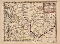
1657326341Paris 1657. unbound. Map. Original outline coloring. Sheet measures 8 3/4" x 12 1/8". Image measures 8" x 10 5/8". Paris: Nicolas Sanson 1657.<br/> <br/> This rare 17th century map by Nicolas Sanson with original color depicts the region showing present day Paraguay Uruguay with parts of Brazil and Argentina. Mountains are rendered pictorially and cities rivers and notations describing indigenous populations are labeled. In very good condition.<br> <br> Nicolas Sanson 1600-1667 is considered the founder of the French school of cartography. In reaction to the prevailing trend of Dutch lavishness Sanson favored minimal details focusing rather on accurate cartography than ornament.<br/> <br/> unknown
165756721Histoire et Geographie de l'Amerique. 1657. Attractive map of Paraguay. Title cartouche at top right. Maps by Sanson in original colour are rare. Nicolas Sanson was founder of the French school of mapmakers at a time when the leadership in European cartography passed from the Low Countries to France. Copper engraving. Fine condition; very light offsetting. Original outline colour. Size: 28.5 x 21.5 cm. 11 x 8½ inches unknown
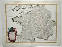
1665M1736Paris: Mariette Pierre 1665. Excellent; some light browning on upper margin. Size : 410x535 mm 16.125x21 Inches Coloring: Original Hand Coloring Category: ; Maps Europe France Mariette, Pierre unknown
1700104160<p>Copper engraved map double page 24" x 20" hand colored and large uncolored title cartouches. Some minor soiling a little wear along centerfold with old verso repair normal aging; very good. Samson 1600-1667 is often referred to as the father of French cartography. Louis XIII was impressed with his work and appointed him "Geographe Ordinaire du Roi". During his career Sanson would produce about 300 maps and his major atlas "Cartes Generales de Toutes les Parties du Monde" would represent an important part of his body of work. While two of his sons continued publication of his maps after his death Pieter Schenk 1655-1718 an important publisher and engraver in his own right published this map. The map is attractively colored and gives a detailed view of the provinces of France. The map is also decorated with a large title cartouche. Bagrow p. 185. map hist website.</p>
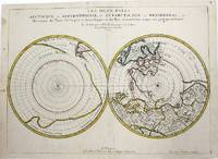
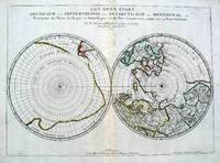
1657M954Paris 1657. Very Good; some occasional mild browning. Notes: 17th century French map of Arctic and Antarctic regions. It was published in Cartes générales de toutes les parties du monde. <br><br>Nicolas Sanson 1600–1667 was a renowned French cartographer termed by some as the "father of French cartography." His works are known for their incorporation of the most up to date information of the time and their clean modern style. Size : 390x537 mm 15.375x21.125 Inches Coloring: Hand Colored in outline Category: ; Maps Polar Arctic Regions; Maps Polar Antarctic Regions unknown
16575033Paris 1657. Par N. Sanson d'Abbeville Geographe ordre du Roy. Spence 3017 lists a slightly different title but undoubtedly the same map. 53x38 cms. Period outline color central fold very good condition. A double hemisphere map to the North and South poles. The North pole is connected to Greenland and Spitzbergen but there is little other detailed coastline in the polar area. Europe Russia and Canada are delineated. The South pole is based on the great unknown Southland of Magellan. The tip of S. America is shown and a large land mass which encompasses the whole of the hemisphere but nothing else. unknown
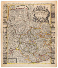
1710009139Amsterdam: Pierre Mortier 1710 Cooper engraving 58.0 x 50.5 cm on paper measuring 63.0 x 54.0 cm with original color in outline minor spotting and creasing remnants of centerfold paper slightly frayed at edges. A good copy of an uncommon map of Savoy and Piedmont published in Amsterdam by Pierre Mortier to illustrate events of the War of the Spanish Succession. Surrounded by twenty-two coats of arms representing various provinces. Pierre Mortier unknown
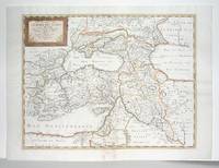
1660M2926Paris: Mariette Pierre 1660. Very Good; some browning on the lower margin near the fold. Size : 407x517 mm 16x20.375 Inches Coloring: Hand Colored Category: ; Maps Mediterranean Sea; Maps Asia Near East Turkey; Mariette, Pierre unknown
1648251162Paris 1648. unbound. Map. Engraving with hand outline color. Image measures 14.5 x 21.5 inches.<br/> <br/> This map of Switzerland centers on Lucerne covering approximately the area from Lake Constance south to Lake Como in Italy. Published in 1648 the map dates to the period of the Old Swiss Confederacy. Furthermore it predates by only a few years the Swiss Peasant War of 1653 a siege of Lucerne and Bern that demonstrated the significance of the rural population to the confederacy's stability. Hand-colored outlines on the map indicate the various independent states that made up the confederacy. A title cartouche with elaborate scrollwork adorns the lower right corner of the map. The map is in good condition with full margins and no chips or tears. Wear to lower margin. <br> <br> Nicolas Sanson 1600-1667 is considered the founder of the French school of cartography. In reaction to the prevailing trend of Dutch lavishness Sanson favored minimal details focusing rather on accurate cartography than ornament. This map demonstrates the skill that made him such a valuable asset to the French monarchy.<br/> <br/> unknown
16909797Amsterdam c. 1690. Copper engraving 19.2 x 24.5 cm modern hand colour blank verso. Sansons small map of the Mughal Empire was published in his 1652 atlas of Asia L'Asie en plusieurs cartes nouvelles et exactes. The date privilege and name of the engraver were omitted from later states of the plate but our example appears to be a Dutch version re-engraved for Francois Halmas Description de tout l'Univers. Nicolas Sanson 1600-1667 founder of the Sanson dynasty of map-makers is considered by many to be the father of the French school of cartography. He was a prolific and original map-maker admired for the clarity and scientific accuracy of his maps. Map unknown
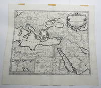
170723156Amsterdam: Pierre Mortier. Very Good with No dust jacket as issued. c.1707. Map. 3 pieces of brown paper tape along upper blank margin.; No date c. 1707. We think this map is possibly from "Le Sainte Bible" edited by David Martin Amsterdam 1707. Dimensions of sheet: 508 x 451mm. Dimensions of printed area: 439 x 368mm. Uncoloured. Copperplate engraved map. Elaborate cartouche. Centrefold. With inset map at lower left "Campemens des Israelites dans le Desert". "The first Pieter Mortier was an 18th-century mapmaker and engraver who was born in Leiden the son of a political refugee from France. He travelled to Paris in 1681-1685 then returned to Amsterdam where he operated as a bookseller from 1685 until 1711. He won the privilege in 1690 of publishing maps and atlases by French publishers in Amsterdam for the Dutch market. He used this privilege to win a similar set of privileges for printing an "illustrated print bible" in 1700." - Wikipedia entry on Pieter or Pierre Mortier accessed October 2021. NB: This map will be posted rolled in a mailing tube. . Pierre Mortier unknown
71-2849Paris: Nicholas Sanson 1656. Hand colored engraving. 18.5 x 29.7 cm. plate. Very Good folded in center. Paris: Nicholas Sanson, 1656. unknown