Sanson, NicolasBiblio.com

946 résultats
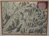
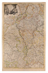
61441Paris Alexis Hubert Jaillot 1700. One sheet ink on paper. Copper engraving. Hand painted. Good condition. The map depicts the upper and lower Rhine region from Metz in the north to Lake Como in the south and Dijon in the west to Augsburg in the east. On the left hand side is the legend with miles to Italian French and German miles. In passepartout total size 650 x 750 mm. unknown
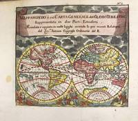
1697M11198Antwerp Belgium: Jan Duren c.1697. Very Good. Notes: Rare miniature World map.<br>California is depicted as an island.<br>There are symbols for the four continents: dangerous America strong Europe exotic Asia and wild Africa. Size : 140x160 mm 5.51x6.30 Inches Coloring: Hand Colored Reference: Shirley #553. Category: Maps World; Jan Duren unknown
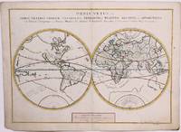
1657M8883Paris 1657 . Very Good. Notes: A handsome 17th century map of the known world typifying Sanson's scientific style of cartography. Embodying the most up to date information of the period Sanson's map depicts California as an island with Antarctica and Australia still largely unknown. A land bridge connects Asia to North America and touches Japan. A very accurate map for the period. Nicolas Sanson 1600–1667 was a French cartographer termed by some the creator of French geography in which he's been called the "father of French cartography." <br><br><br> Size : 380x537 mm 14.96x21.14 Inches Coloring: Original Hand Coloring Reference: Shirley R.W. World 400; Pastoureau M. Sanson V A 98. Category: Maps World; unknown
1713215454Amsterdam: Mortier Pieter 1713. unbound. very good. Map. Engraving with original hand outline. Image measures 14.5" x 18.75".<br/> <br/> Rare map of Paphlagonia an ancient region of northern Anatolia present-day Turkey along the southern coast of the Black Sea. Highlighting the capital city of Sinope this map depicts the region as defined by Strabo: bound by the Parthenius River in the west extending to the Hays river in the east. Sanson depicts the region comprising the Kingdom of Pontus during the rule of Mithridates IV. Neighboring historical regions of Gallatia and Bithynia et Pontus are labeled. Full original margins light scattered foxing. Based on earlier plates by Sanson. This map appeared in "Atlas Antiquus Sacer Ecclesiasticus et Profanus" published in Amsterdam by Pieter Mortier. <br> <br> Nicolas Sanson 1600-1667 who is considered the founder of the French school of cartography. In reaction to the prevailing trend of Dutch lavishness Sanson favored minimal details focusing rather on accurate cartography than ornament. <br> Pierre Mortier 1661-1711 was a Dutch cartographer engraver and printseller who worked in Amsterdam. He used advanced Dutch printing methods to produce high quality editions of contemporary French maps by cartographers such as De L'Isle Sanson Jaillot de Fer and De Wit. His greatest feat was the nautical atlas "Le Neptune Francois" or "Suite de Neptune Francois" considered to contain the most beautiful examples of cartographic art. After his death his widow Amelia continued publishing in partnership with her brother-in-law David until her death in 1719. This map was published during Amelia's tenure at the firm.<br/> <br/> Mortier, Pieter unknown
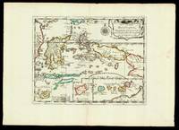
165217601Paris: chez l'autheur 1652. 265 by 370mm. 10.5 by 14.5 inches. Maps""Les Isles Molucques; Celebes Gilolo &c. Sanson's Moluccas Engraved chart with contemporary hand-colour in outline. Detailed map of the island east of Borneo in Southeast Asia with an inset of Banda and the Moluccas. Published in Sanson's 'L'Asie en Plusieurs Cartes.' 1652. Nicolas Sanson 1600-1667 began to make maps to supplement his study of history and a map of Ancient Gaul made early in his career brought him to the attention of Cardinal Richelieu. This foothold in the French court allowed him to rise to the position of geographe du roi teaching both Louis XIII and Louis XIV. Louis XIII even made him a counsellor of state. Sanson produced an atlas 'Cartes Generales de Toutes les Parties du Monde' which contained important maps of the post roads and waterways of France. He also produced two major maps of North America: 'Amerique Septentrionale' 1650 was the first map to show the Great Lakes in a recognisable form aided by Sanson's access to The Jesuit Relations a collection of accounts by French missionaries to the area. The map was drawn on a sinusoidal projection which Sanson was the first to use. In 1656 he made 'Le Canada ou Nouvelle France' which showed the Great Lakes in greater detail and included accurate representations of the Hudson Bay area the Delaware and the Gulf of Saint Lawrence. chez l'autheur, unknown
1683297468Paris 1683. unbound. Map. Copper engraving with hand coloring. Image measures 7 5/8 x 11 1/4 inches.<br/> <br/> This map published in Paris in Afrique en plusieurs cartes is one of Sanson's small atlas maps of depicting various African regions. This map offers extensive detail on the cities of North Africa as well as topographical and geographical features with mountains beautifully rendered in profile. Nicolas Sanson 1600-1667 is considered the founder of the French school of cartography. In reaction to the prevailing trend of Dutch lavishness Sanson favored minimal details focusing rather on accurate cartography than ornament. This map is a fine example of his work.<br/> <br/> unknown
170054023Nicolas Bion: L'Usage des Globes. Amsterdam: Francois Halma. 1700. Attractive map of Morocco the Saharan hinterland and the Canary Islands. Handsome title cartouche at top left. Much of the charm of early maps of Africa lies in how they show the interior of the continent which was not explored until the 19th century. Maps by Sanson in original colour are rare. Nicolas Sanson was founder of the French school of mapmakers at a time when the leadership in European cartography passed from the Low Countries to France. This map was published in Brion's treatise on globes. Nicolas Brion was a famous French mathematical and scientific instrument maker. Copper engraving. Very good condition. Faint library stamp right margin. Original colour. Size: 28 x 17 cm. 11 x 6½ inches. unknown
1663M1708Paris: Mariette Pierre 1663. Excellent. Size : 425x575 mm 16.75x22.625 Inches Coloring: Hand Colored Category: ; Maps Europe France Mariette, Pierre unknown
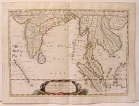
1654M2656Paris 1654. Excellent. Size : 385x530 mm 15.125x20.875 Inches Coloring: Original Hand Coloring Reference: Nebenzahl 3.9C Category: Maps Asia South East; Maps Asia Central India & Sri Lanka / Ceylon; unknown
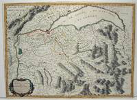
1663M645Paris: Mariette Pierre 1663. Excellent. Size : 420x575 mm 16.5x22.625 Inches Coloring: Hand Colored Category: ; Maps Europe Switzerland Mariette, Pierre unknown
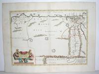
1640M2804Paris: Mariette Pierre 1640. Very Good. Size : 372x510 mm 14.625x20.125 Inches Coloring: Original Outline Coloring Category: Maps Africa North Egypt Mariette, Pierre unknown
170054022Nicolas Bion: L'Usage des Globes. Amsterdam: Francois Halma. 1700. Attractive map of north eastern Africa including Egypt and northern Libya. Much of the charm of early maps of Africa lies in how they show the interior of the continent which was not explored until the 19th century. Maps by Sanson in original colour are rare. Nicolas Sanson was founder of the French school of mapmakers at a time when the leadership in European cartography passed from the Low Countries to France. This map was published in Brion's treatise on globes. Nicolas Brion was a famous French mathematical and scientific instrument maker. Copper engraving. Very good condition. Darkened edges to margins. Faint inkstamp on right margin not affecting map. Original colour. Size: 27 x 17 cm. 10½ x 6½ inches. unknown
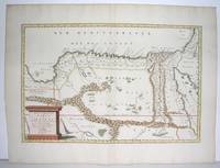
1655M2801Paris: Mariette Pierre 1655. Excellent. Size : 345x523 mm 13.625x20.625 Inches Coloring: Original Outline Coloring Category: Maps Africa North Egypt Mariette, Pierre unknown
1654M2853Paris 1654. Excellent. Size : 415x483 mm 16.375x19 Inches Coloring: Original Outline Coloring Category: Maps Russia unknown
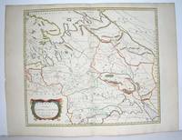
16548874Paris: Pierre Mariette 1654. Copper engraving 41.5 x 47.5 cm original hand-colour in outline trivial spotting blank verso. Showing parts of European Russia and Ukraine in antiquity. For Greco-Roman geographers and ethnographers Sarmatia was in western Scythia bordering the Roman Empire. Nicolas Sanson 1600-1667 founder of the Sanson dynasty of map-makers is considered by many to be the father of the French school of cartography. He was a prolific and original map-maker admired for the clarity and scientific accuracy of his maps. Map Pierre Mariette unknown
170054377Nicolas Bion: L'Usage des Globes. Amsterdam: Francois Halma. 1700. An armillary sphere perused by three scholars at a table. Nicolas Sanson was founder of the French school of mapmakers at a time when the leadership in European cartography passed from the Low Countries to France. This map was published in Bion's treatise on globes. Nicolas Bion was a famous French mathematical and scientific instrument maker. Size: 125 x 175 mm. Copper engraving. Original colour. Mounted size: 295 x 360 mm. Fine condition. unknown
2570Americas: Paris Par N Sanson . Chez Pierre Mariette. 1656-8. Copper engraved map of the Caribbean by Nichols sanson from his"Cartes Generales De Toutes Les Parties Du Monde". Original outline colour; verso blank. The map shows all the islands of the Caribbean with the southern tip of Florida and the coasts to the south. Decorative title cartouche . Good impression; slight dampstaining to edges far from plate ; small stain just below cartouche. Nicolas Sanson 1600-1667 is generally acknowledged as the founder of the great French school of geographers and cartographers that supplanted the Dutch as the leading European map-makers. His work was acclaimed for its geographical accuracy and high standard of engraving. As a consequence his many maps received a wide diffusion. His career marks the start of the process by which Paris superseded Amsterdam as the centre of European map production. Nicolas studied Ancient History as a young man and this awoke in him an interest in classical geography. His first map of ancient Gaul was made in 1618 when he was only 18. Sanson had three sons Nicolas 1626-1648 Guillaume d.1703 and Adrien d.1708 and a grandson Pierre Moullard-Sanson d.1730 all of whom were involved in the family's map-making activities. After Sanson settled in Paris his work came to the attention of King Louis XIII who eventually appointed Sanson Geographe Ordinaire du Roi one of whose duties was to tutor the King in geography. Sanson published some 300 maps in his career though his first most famous atlas the folio "Cartes Generales De Toutes Les Parties Du Monde" was not published until 1658. He would go into partnership with Pierre Mariette a publisher of prints. Sanson also prepared a series of quarto atlases of the different continents. These scarce atlases are more frequently encountered in the Dutch piracy engraved by Anthony d'Winter first published in 1683. The Sanson atlases are rarely found with a standard set of maps; the practice seems to have been that additional or revised plates would be inserted as available. After Sanson's death the business was continued by his two surviving sons and grandson in partnership with and later superseded by Alexis Hubert Jaillot. Credit must go Jaillot and Pierre Duval for re-engraving his maps many still unprinted at his death and re-publishing them in face of strong competition from the Dutch who continued to dominate the market until the end of the century. Americas Caribbean Antilles Lucayan Archipelago Paris Par N Sanson ... Chez Pierre Mariette. 1656-8 unknown
170058299Description de tout l'Univers 1700 published by F.Halma Amsterdam. Nicolas Sanson was founder of the French school of mapmakers at a time when the leadership in European cartography passed from the Low Countries to France. Copper engraving. Fine condition. Original colour with gold leaf highlights. Size: 17 x 18.5 cm. unknown
1710009148Amsterdam: Pierre Mortier 1710 Cooper engraving on two joined sheets measuring 59.5 x 95.5 cm with original outline coloring expertly cleaned and flattened. A good copy of a map of western Germany published in Amsterdam by Pierre Mortier to illustrate events of the War of the Spanish Succession. The first state with "2. Carte de la Meuse" added in manuscript. Pierre Mortier unknown
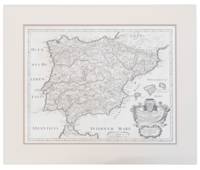
171013749441710. A map of Spain by French cartographer Nicolas Sanson 1600-1667 in a later Italian edition dated 1710. In Excellent condition with even age toning. Double matted. Mat: w 28.25 in. x h 23.5; Map: w 24.25 in. x h 19 in. Shelved at DuPont. 1374944. Arts & Antiques. unknown
201512211New Zealand 2015. 2nd Edition . Soft cover. As New. 8vo - over 7¾ - 9¾" tall. 264 pages with b/w and colour photos. Paperback. <br/> <br/> paperback
2343199892.Gpaperback. Good. Access codes and supplements are not guaranteed with used items. May be an ex-library book. paperback
20241870081L'Erma di Bretschneider 2024. paperback. New. 0x0x0. L'Erma di Bretschneider paperback
20032-2868478255PU Rennes 2003. Paperback. New. 562 pages. French language. 9.37x6.30x1.42 inches. PU Rennes paperback
92107001Paris 1654 Mariette. Single sheet map center fold minor soil rubbing period hand-color outline mile key French text sheet size: ca 58 x 42 cm. map size: 58 x 35.5 cm. an early example. R A R E With a bit of faint discoloration to the lower left margin barely entering the mile chart else fairly clean. A large scale grand map grand map showing the Ocean Septentrional Glacial et Scythique aujour-dhuy Mer de Tartarie et Mer des Tenebres then to the East "Aux Arabes Deftroit de Ieffo and Terre de Iesso" or the Kurile Islands at the North of Japan. The central map area shows in single outline the areas: Russie Blan Che Mosco Vie; Tartarie Desert; Uraie Tartarie; mer Caspienne/Mer de Gilan de Tabarestan; Usbeczaga; Turchestan Turkestan Central Asia; Cathay; Empire des Perses; Empire du Grand Mogol Mongolia; Partie du Roy au de la Chine with the great wall. The South East corner shows Corey Isle Korea and a tiny tip of the adjacent Iesso Hokkaido or the Kurile Islands the Ocean Oriental. A rather outstanding early view of the Northern and Central Asian areas West of China proper. Includes such mystical place names as Girgian Samarcand Ciartiam Cazan Steppe area Mongolia and the vast Gobi desert &c. Also shows mountains forests lakes rivers cities and borders oceans and deserts. Maps of this area and scale are unusual. Nicely executed early map. . unknown