SANSON, NicolasBiblio.com

267 résultats
1648251162Paris 1648. unbound. Map. Engraving with hand outline color. Image measures 14.5 x 21.5 inches.<br/> <br/> This map of Switzerland centers on Lucerne covering approximately the area from Lake Constance south to Lake Como in Italy. Published in 1648 the map dates to the period of the Old Swiss Confederacy. Furthermore it predates by only a few years the Swiss Peasant War of 1653 a siege of Lucerne and Bern that demonstrated the significance of the rural population to the confederacy's stability. Hand-colored outlines on the map indicate the various independent states that made up the confederacy. A title cartouche with elaborate scrollwork adorns the lower right corner of the map. The map is in good condition with full margins and no chips or tears. Wear to lower margin. <br> <br> Nicolas Sanson 1600-1667 is considered the founder of the French school of cartography. In reaction to the prevailing trend of Dutch lavishness Sanson favored minimal details focusing rather on accurate cartography than ornament. This map demonstrates the skill that made him such a valuable asset to the French monarchy.<br/> <br/> unknown
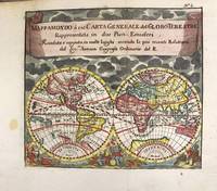
1697M11198Antwerp Belgium: Jan Duren c.1697. Very Good. Notes: Rare miniature World map.<br>California is depicted as an island.<br>There are symbols for the four continents: dangerous America strong Europe exotic Asia and wild Africa. Size : 140x160 mm 5.51x6.30 Inches Coloring: Hand Colored Reference: Shirley #553. Category: Maps World; Jan Duren unknown
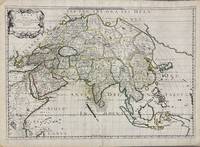
1650005908Paris: Pierre Mariette 1650. First state. Loose Sheet. Very good. Hand colored map on laid paper. Sheet Measurements: 600mm x 440 mm; Plate Measurements: 563mm x 392mm. Antique map titled "Asia Vetus" Ancient Asia by Nicolas Sanson first published circa 1650. Considered a significant piece of cartographic history marking the shift of mapmaking excellence from Amsterdam to Paris in the 17th century. Map Condition: center fold with light reinforcement ancient remains of dried adhesive to corners lower left corner shows small area of paper thinning and some disruption to text very light toning in spots. Discrete prior owner notations in pencil to verso. Please examine photographs for condition in general. Pierre Mariette unknown
1650011592Paris 1650. No Binding. Very Good/No Jacket. R Cordier. 1650 Normanie. Engraved by R Cordier. A fine and detailed province map with the english coast included. All important place names are shown. Original outline colour. very slight discoloration. otherwise good condition. 385 x 515 mm framed and glazed <br/> <br/> unknown
1667M2849Paris 1667. Excellent. Size : 424x563 mm 16.625x22.125 Inches Coloring: Original Outline Coloring Category: ; Maps Europe France; Maps Europe Italy unknown
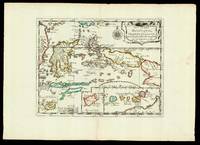
165217601Paris: chez l'autheur 1652. 265 by 370mm. 10.5 by 14.5 inches. Maps""Les Isles Molucques; Celebes Gilolo &c. Sanson's Moluccas Engraved chart with contemporary hand-colour in outline. Detailed map of the island east of Borneo in Southeast Asia with an inset of Banda and the Moluccas. Published in Sanson's 'L'Asie en Plusieurs Cartes.' 1652. Nicolas Sanson 1600-1667 began to make maps to supplement his study of history and a map of Ancient Gaul made early in his career brought him to the attention of Cardinal Richelieu. This foothold in the French court allowed him to rise to the position of geographe du roi teaching both Louis XIII and Louis XIV. Louis XIII even made him a counsellor of state. Sanson produced an atlas 'Cartes Generales de Toutes les Parties du Monde' which contained important maps of the post roads and waterways of France. He also produced two major maps of North America: 'Amerique Septentrionale' 1650 was the first map to show the Great Lakes in a recognisable form aided by Sanson's access to The Jesuit Relations a collection of accounts by French missionaries to the area. The map was drawn on a sinusoidal projection which Sanson was the first to use. In 1656 he made 'Le Canada ou Nouvelle France' which showed the Great Lakes in greater detail and included accurate representations of the Hudson Bay area the Delaware and the Gulf of Saint Lawrence. chez l'autheur, unknown
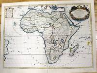
1700M11022Paris c.1700. Very Good. Notes: French map of Africa as a continent. Size : 462x645 mm 18.19x25.39 Inches Coloring: Hand Colored Category: Maps Africa Continent; unknown
1678200041AG1678. Paris Sanson d'Abbeville 1678. Original hand-coloured engraving. Plate Size: 53.6 cm x 41.7 cm. Sheet Size: 61.8 cm x 46.5 cm. Original map. In very good condition. Faint signs of browning to map. Minor paper imperfections to the outer margins. Small stain to map near centre-fold. A richly detailed map showing the northern part of Portugal. Relief on map depicted pictorially and border inlaid with longitudinal and latitudinal details The map is dominated by three rivers: the Tajo Tagus in the south the Douro and the Minho further north. The Spanish kingdom and regions such as Leon are included and the great city of Salamanca can be seen. The lower part of the map runs out before the Tagus estuary empties into the Atlantic at Lisbon. The ornamental title cartouche is in the lower right corner of the map. Off the coast is a large warship flying the coat-of-arms Kingdom of Portugal and the Algarves. The sails of the boat carry Latin text commemorates the commercial and maritime exploits of King John IV in Africa Arabia Ethiopia Persia India and Brazil. Nicolas Sanson 20 December 1600 7 July 1667 was a French cartographer termed by some the creator of French geography in which he's been called the "father of French cartography." The French school of Geography was unprecedented in its attention to precision and scientific detail and discarded much of the decorative embellishments of previous maps as irrelevant. From Sanson's time in the second half of the seventeenth century until the latter part of the eighteenth century French geographical conceptions were more influential than those put forward by any other nation. He was tutor to Louis XIII and Louis XIV. Sanson published over 300 maps. In 1692 Hubert Jaillot collected Sanson's maps in an Atlas nouveau. Wikipedia unknown
1700104160<p>Copper engraved map double page 24" x 20" hand colored and large uncolored title cartouches. Some minor soiling a little wear along centerfold with old verso repair normal aging; very good. Samson 1600-1667 is often referred to as the father of French cartography. Louis XIII was impressed with his work and appointed him "Geographe Ordinaire du Roi". During his career Sanson would produce about 300 maps and his major atlas "Cartes Generales de Toutes les Parties du Monde" would represent an important part of his body of work. While two of his sons continued publication of his maps after his death Pieter Schenk 1655-1718 an important publisher and engraver in his own right published this map. The map is attractively colored and gives a detailed view of the provinces of France. The map is also decorated with a large title cartouche. Bagrow p. 185. map hist website.</p> books
1651R320074492A COMPTE D'AUTEUR. 1651. In-Folio. Broché. Etat d'usage, Couv. défraîchie, Dos satisfaisant, Intérieur frais. 43 pages - Quelques taches jaunatres en fin de volume (en tranches - gouttiere) sans conséquence sur la lecture - + 1 planche depliante. Bandeau et lettrine en tete de chapitre. Renfort en 1er plat et dos. Bandaux; lettrines et culs de lampe. 4 PHOTOS DISPONIBLES -. . . . Classification Dewey : 94.2-Livres anciens XVII ème
1700LBW-8050Amsterdam, Pierre Schenk, [circa 1700]. 487 x 577 mm.
1683LBW-6971683 182 x 276 mm.
1690M9577Paris c. 1690. Very Good. Notes: A charming map of Malvasia Greece during the late 17th century. Size : 103x152 mm 4.06x5.98 Inches Coloring: Hand Colored Category: Maps Europe Greece Macedonia; unknown
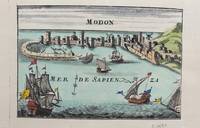
1690M9578Paris c. 1690. Very Good. Notes: A charming map of Modon Greece during the late 17th century. Size : 104x152 mm 4.09x5.98 Inches Coloring: Hand Colored Category: Maps Europe Greece Macedonia; unknown
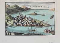
1690M9576Paris c. 1690. Very Good. Notes: A charming map of Nafplio Greece during the late 17th century. Size : 104x152 mm 4.09x5.98 Inches Coloring: Hand Colored Category: Maps Europe Greece Macedonia; unknown
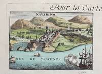
1690M9579Paris c. 1690. Very Good. Notes: A charming map of Pylos Navarino Greece during the late 17th century. Size : 104x154 mm 4.09x6.06 Inches Coloring: Hand Colored Category: Maps Europe Greece Macedonia; unknown
1696M10206Amsterdam: Covens & Mortier c.1696. Very Good. Size : 485x450 mm 19.09x17.72 Inches Coloring: Hand Colored Category: Maps Africa North Egypt; Covens & Mortier unknown
1690M7990Paris: H. Jaillot c.1690. Very Good with some minor discoloration. Notes: Map of North-Central France Size : 460x610 mm 18.11x24.02 Inches Coloring: Original Hand Coloring Category: Maps Europe France; H. Jaillot unknown
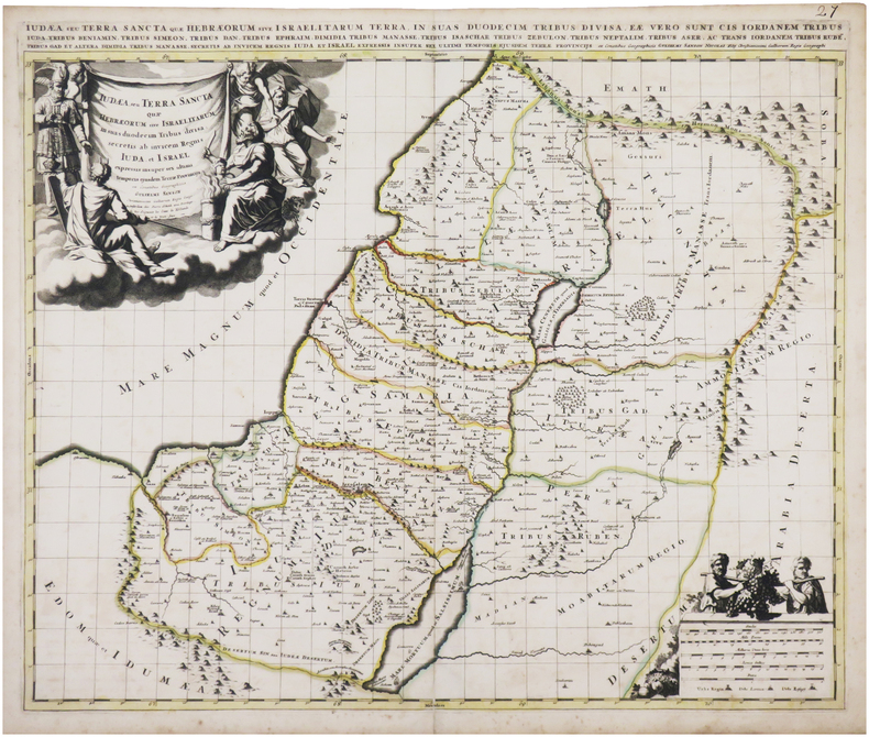
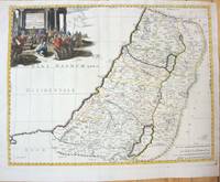
1660M7049Paris 1660. Very Good;. Notes: French map of the Holy Land with a decorative cartouche.<br><br>Nicolas Sanson 1600–1667 was a renowned French cartographer termed by some as the "father of French cartography." His works are known for their incorporation of the most up to date information of the time and their clean modern style. Size : 385x485 mm 15.16x19.09 Inches Coloring: Hand Colored Category: Maps Asia Middle East Holy Land & Palestine; unknown
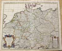
1696M10211Amsterdam: Covens & Mortier c.1696. Very Good. Size : 510x605 mm 20.08x23.82 Inches Coloring: Original Outline Coloring Category: Maps Europe Germany; Covens & Mortier unknown
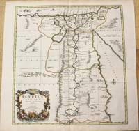
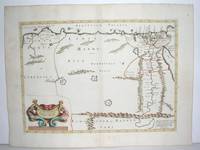
1640M2804Paris: Mariette Pierre 1640. Very Good. Size : 372x510 mm 14.625x20.125 Inches Coloring: Original Outline Coloring Category: Maps Africa North Egypt Mariette, Pierre unknown
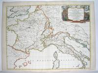
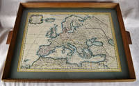
16502312280001Petrum Mariette: Lutetiae Parisiorum 1650. First Edition. Maps. Very Good. Ancient Europe : The Roman Empire Fine hand-colored double-page engraved map of Roman provinces of Europe. Mounted in wood frame with wooden side handles. Dimensions of mounted image: 40 x 56 cm. 53 x 69.5 cm in frame. Latin province names cities seas. This is an oversized or heavy book which requires additional postage for international delivery outside the US. Petrum Mariette: Lutetiae Parisiorum unknown
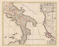
169617229Paris: Hubert Jaillot 1696. Other. In excellent condition. 445 by 550mm 17 by 21 inches. 445 by 550mm 17 by 21 inches. Original antique hand-colored copper engraving from the 'Atlas Nouveau' published in Paris 1696. Depicting Kingdom of Naples this map is a fine example of 1690s European cartography. Image: 445 by 550mm 17 by 21 inches. An attractive and historically significant 17th-century map for the discerning collector. Alexis-Hubert Jaillot c. 16321712 was a French sculptor turned cartographer who became one of the most important map publishers of late 17th-century France. After marrying into the family of mapmaker Nicolas Berey he negotiated access to the plates of the great French cartographer Nicolas Sanson 16001667 and used them to publish his monumental 'Atlas Nouveau' from the 1690s onward. Appointed 'Géographe du Roi' Royal Geographer to Louis XIV in 1686 Jaillot produced large-format maps celebrated for their elaborate allegorical cartouches and decorative ambition. His maps of Italy were among the finest large-format representations of the peninsula produced in the 17th century frequently bearing dedications to members of the French royal family.Large and decorative map of England by the French cartographer Nicolaus Sanson and Hubert Jaillot. Published in the 'Atlas Noveau.' this atlas was a masterpiece in the French cartography in the 17th century. The atlas was specially designed for Louis XIV and due of the very large size of the plates most maps were printed from two plates it took Hubert Jaillot over 12 years to complete the 'Atlas Noveau.'. The kingdom of Naples is very detailled shown on the map as well the various principalities are shown in engraved territory borders. The map is rich in detail with many cities and place names rivers mountains castles etc. The map is ornated with a large fine allegoric title cartouche with coat of arms in the upper right corner as well a decorative cartouche with a milage scale.A fine example from Atlas Nouveau Paris sought after by collectors of antique maps of Italy antique maps of Kingdom of Naples and antique hand-colored copper engravings for sale. In good condition consistent with age. The map is ornated with a large fine allegoric title cartouche with coat of arms in the upper right corner as well a decorative cartouche with a milage scale. Hubert Jaillot unknown
1658MEE1132Paris:: Chez l'Autheur 1658. 1658. PRINT: 390 x 520 mm. Paper: 457 x 610 mm. Creased cross-ways. Map outlined with original coloring. Excellent condition. First printing of this map. Nicolas Sanson 1600-1667 the "Father of French Cartography" was educated by the Jesuits at Amiens. He was soon recognized as having a gift for map drawing. As such by the age of ten he has produced his first map. "In 1627 he attracted the attention of Richelieu by a map of Gaul which he had constructed or at least begun while only eighteen." "Active from 1627 Sanson issued his first map of importance the "Postes de France" which was published by Melchior Tavernier in 1632. After publishing several general atlases himself he became the associate of Pierre Mariette a publisher of prints." Wikip. In 1630 he was appointed Geographe Ordinaire du Roy by King Louis XIII. As a geographer his most important work was his maps of the world Cartes generales de toutes les parties du monde issued in 1658 with later editions to follow. He died in 1667. Two younger sons Adrien d. 1708 and Guillaume d. 1703 succeeded him as geographers to the king. / Nicolas Sanson's map was issued "by the author" this version and another version where his printer-publisher Pierre Mariette issued the map with his own imprint on the cartouche. Chez l'Autheur, [1658]. unknown
1690M2919Amsterdam 1690. Good; fold reinforced. Size : 480x596 mm 18.875x23.5 Inches Coloring: Black & White Category: ; Maps Europe Hungary; Maps Europe Poland Lithuania unknown