SANSON, NicolasBiblio.com

442 résultats
170058299Description de tout l'Univers 1700 published by F.Halma Amsterdam. Nicolas Sanson was founder of the French school of mapmakers at a time when the leadership in European cartography passed from the Low Countries to France. Copper engraving. Fine condition. Original colour with gold leaf highlights. Size: 17 x 18.5 cm. unknown
0190310847.Gpaperback. Good. Access codes and supplements are not guaranteed with used items. May be an ex-library book. paperback
3838178408.Gpaperback. Good. Access codes and supplements are not guaranteed with used items. May be an ex-library book. paperback
2026x-0197609945Oxford University Press Inc 2026. Hardcover. New. 232 pages. 6.51x0.84x9.51 inches. Oxford University Press Inc hardcover
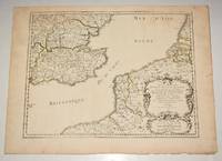
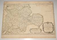
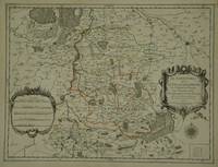
90474PARIS Chez l’Auteur 1654. Title cartouche to lower right corner. Blank on verso. In good condition. Some light tanning on edges with a few faint foxing marks. A few small nicks lower margin edge. With original outline hand colouring. Engraved Size 17.5 x 23 inches Nicolas Sanson 1600-1667 sometimes called Nicolas Sanson d'Abbeville or Sanson d'Abbeville was the most important French cartographer of the 17th century. Tooley called Sanson "the founder of the French school of cartography." He began making maps in the late 1620s and in the 1630s he was working with Melchior Tavernier. Later Sanson worked in concert with the print publisher Pierre Mariette with whom he published his great atlas: Cartes générales de toutes les parties du monde 1658. After Sanson's death in 1667 his son Guillaume carried on the business in partnership with Alexis Hubert Jaillot. Guillaume established himself as a very important French mapmaker in his own right. PARIS Chez l’Auteur 1654. unknown
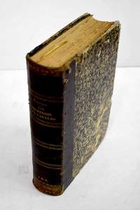
3136661Manini Hnos. Hardcover. Lomo rozado. Good. 22 cm. 860 p. Encuadernación en tapa dura artesanal. Con láminas . Lomo rozado. Literatura.82 82 Manini Hnos. hardcover
2011SONG0197264832British Academy 2011-11-07. 1. hardcover. Used: Good. 9.20x1.30x6.20. Buy with confidence. Excellent Customer Service & Return policy. British Academy hardcover
90475PARIS Chez l’Auteur 1654. Title cartouche to lower right corner. Blank on verso. In good condition. Some light tanning on edges with a few faint foxing marks. With original outline hand colouring. Engraved Size 17.5 x 23 inches Nicolas Sanson 1600-1667 sometimes called Nicolas Sanson d'Abbeville or Sanson d'Abbeville was the most important French cartographer of the 17th century. Tooley called Sanson "the founder of the French school of cartography." He began making maps in the late 1620s and in the 1630s he was working with Melchior Tavernier. Later Sanson worked in concert with the print publisher Pierre Mariette with whom he published his great atlas: Cartes générales de toutes les parties du monde 1658. After Sanson's death in 1667 his son Guillaume carried on the business in partnership with Alexis Hubert Jaillot. Guillaume established himself as a very important French mapmaker in his own right. PARIS Chez l’Auteur 1654. unknown
18633691903Madrid.: Manini Hermanos. 1863. Hardcover. Encuadernacion muy deteriorada . Good. 24 cm. 863 p. 27 h. de lám. il. Encuadernación en tapa dura artesanal. Traducción española por D. Juan de Sala . Encuadernacion muy deteriorada . Manini Hermanos. hardcover
2005X-343-635STE ECRIVAINS 2005. Paperback. Good. Former library book. Different cover. Ammareal gives back up to 15% of this item's net price to charity organizations. STE ECRIVAINS paperback
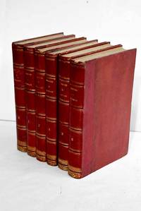
18633586263Paris.: Dupray de la Maherie. 1863. Hardcover. Cubierta deslucida. oxido leve . Good. 20 cm. 6 v. Encuadernación en tapa dura artesanal hol. Idioma frances. Sept generations d'executeurs 1688-1847 . Cubierta deslucida. oxido leve . hsitoria Dupray de la Maherie. hardcover
2004H-405-5902004. Paperback. Good. Former library book. Different cover. Different publisher. Ammareal gives back up to 15% of this item's net price to charity organizations. paperback
2005H-405-5922005. Paperback. Good. Former library book. Different cover. Different publisher. Ammareal gives back up to 15% of this item's net price to charity organizations. paperback
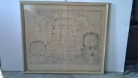
6m5023H. Jaillot Paris 1696. Grenzkolorierte Kupferkarte gerahmt ca. 56 : 65 cm gebräunt. unknown
41445142-nnew. unknown
41445142like new. unknown
170054023Nicolas Bion: L'Usage des Globes. Amsterdam: Francois Halma. 1700. Attractive map of Morocco the Saharan hinterland and the Canary Islands. Handsome title cartouche at top left. Much of the charm of early maps of Africa lies in how they show the interior of the continent which was not explored until the 19th century. Maps by Sanson in original colour are rare. Nicolas Sanson was founder of the French school of mapmakers at a time when the leadership in European cartography passed from the Low Countries to France. This map was published in Brion's treatise on globes. Nicolas Brion was a famous French mathematical and scientific instrument maker. Copper engraving. Very good condition. Faint library stamp right margin. Original colour. Size: 28 x 17 cm. 11 x 6½ inches. unknown
170054022Nicolas Bion: L'Usage des Globes. Amsterdam: Francois Halma. 1700. Attractive map of north eastern Africa including Egypt and northern Libya. Much of the charm of early maps of Africa lies in how they show the interior of the continent which was not explored until the 19th century. Maps by Sanson in original colour are rare. Nicolas Sanson was founder of the French school of mapmakers at a time when the leadership in European cartography passed from the Low Countries to France. This map was published in Brion's treatise on globes. Nicolas Brion was a famous French mathematical and scientific instrument maker. Copper engraving. Very good condition. Darkened edges to margins. Faint inkstamp on right margin not affecting map. Original colour. Size: 27 x 17 cm. 10½ x 6½ inches. unknown
30597Paris: Jaillot. 1681. 43 x 57 cm. Original outline colour. Single page folio map of Limborg and its envirions. Blank on verso. Small tear with loss to upper right margin. Some light stains at right margin though not affecting image otherwise in very good condition. Paris: Jaillot. 1681 unknown
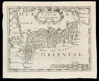
169915831Amsterdam: Chez Arnout van Ravenstein 1699. 222 by 272mm. 8.75 by 10.75 inches. Engraved map. Second state of the plate first published in Halma's pirated edition of Sanson's 'L'Asie en plvsiers cartes nouvelles et exactes; ' as part of 'L'Europe; L'Asie; L'Amerique en Pluiers Cartes' 1683. A direct copy of Sanson's map of 1652 the only differences being the lack of a privilege and a date in the cartouche the addition of the signature of the engraver Antoine de Winter in the lower left corner. This issue is distinguished by the addition of mountains added in 'Isle de Corey' and 'Terre de Iesso'; and the 'Mer de Japan' above 'Oriental'. Francois Halma 1653-1722 set up his printing business in Utrecht in 1674 where he issued a number of pirated maps and atlases. In this instance since Sanson was dead Halma may have felt that there no harm and much profit to be gained from re-printing his work. The engraver Antoine de Winter c1652-1700 achieved some notoriety for plagiarizing Petter Gedda's charts of the Baltic Sea selling them on to Loots and Doncker for inclusion in their atlases who were subsequently sued and ordered to surrender the plates and pay a fine of 300 florins. Sanson originally credited "Caardin sic Varenius" and 'others' for his map. Generally the geography follows that of Moreira/Blancus only a small portion of the eastern coast of Korea is shown without stating whether it is an island or not and there is only a hint of Hokkaido in the far northeast corner with the place name Matzumay. Varenius or Bernhard Varen fl1622-1650 was a German physician geographer and natural historian. He settled in Amsterdam and was a friend of the Blaeu family. He published 'Descriptio regni Japonia ' in 1649 and came to be known as 'the father of physical geography' Hubbard. Sanson 1600-1667 was a French mapmaker. He supposedly began to make maps to supplement his study of history and a map of Ancient Gaul made early in his career brought him to the attention of Cardinal Richelieu. This foothold in the French court allowed him to rise to the position of Geographe du Roi teaching both Louis XIII and Louis XIV. Louis XIII even made him a counsellor of state. Sanson produced an atlas 'Cartes Generales de Toutes les Parties du Monde' which contained important maps of the post roads and waterways of France. He also produced two major maps of North America: 'Amerique Septentrionale' 1650 was the first map to show the Great Lakes in a recognisable form aided by Sanson's access to The Jesuit Relations a collection of accounts by French missionaries to the area. The map was also drawn on a sinusoidal projection which Sanson was the first to use. In 1656 he made 'Le Canada ou Nouvelle France' which showed the Great Lakes in greater detail and included accurate representations of the Hudson Bay area the Delaware and the Gulf of Saint Lawrence. After Sanson's death the business was carried on by his two surviving sons and grandson in partnership with Hubert Jaillot. Sanson family members were revered among the foremost map makers in France for nearly a century. A leading exemplar of the French school of seventeenth-century cartography Nicholas Sanson I is widely regarded as the founder of modern geography and it is generally held that the so called "Great Age" of French cartography originated with his publications Hubbard 51.2. Chez Arnout van Ravenstein, unknown
16909797Amsterdam c. 1690. Copper engraving 19.2 x 24.5 cm modern hand colour blank verso. Sansons small map of the Mughal Empire was published in his 1652 atlas of Asia L'Asie en plusieurs cartes nouvelles et exactes. The date privilege and name of the engraver were omitted from later states of the plate but our example appears to be a Dutch version re-engraved for Francois Halmas Description de tout l'Univers. Nicolas Sanson 1600-1667 founder of the Sanson dynasty of map-makers is considered by many to be the father of the French school of cartography. He was a prolific and original map-maker admired for the clarity and scientific accuracy of his maps. Map unknown
16548874Paris: Pierre Mariette 1654. Copper engraving 41.5 x 47.5 cm original hand-colour in outline trivial spotting blank verso. Showing parts of European Russia and Ukraine in antiquity. For Greco-Roman geographers and ethnographers Sarmatia was in western Scythia bordering the Roman Empire. Nicolas Sanson 1600-1667 founder of the Sanson dynasty of map-makers is considered by many to be the father of the French school of cartography. He was a prolific and original map-maker admired for the clarity and scientific accuracy of his maps. Map Pierre Mariette unknown
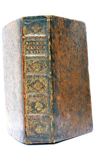
48297Paris Lutetiae Parisiorum Sumptibus et Impensis Autoris 1647. 3 ouvrages en 1 volume. 1. 2 feuillets blancs. 8 feuillets. 246 pages. 2. 13 feuillets. 283 pages. 3. 2 feuillets blancs. Page de titre. Carte gravée. 11 feuillets. 2 feuillets blancs. 15x9 Cm. Plein veau de l'époque. Dos à nerfs orné et doré un peu frotté. Pièce de titre doré. Charnières fendues. Petits accidents aux coiffes. Rousseurs et quelques taches. Les deux premiers ouvrages sont des critiques très rares du "Pharum Gallia Antiquae" de Philippe Labbé que Sanson rectifie sur plusieurs points. À la suite on trouve une courte description de la Judée accompagnée d'une belle carte dépliante. Bon exemplaire comportant l'exlibris gravé d'Henri Liébaux. Paris, Lutetiae Parisiorum Sumptibus et Impensis Autoris, 1647. unknown
14357382-nnew. unknown
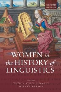
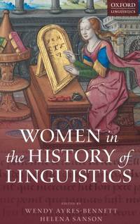
ria9780198754954_inpHardcover. New. New Book; Fast Shipping from UK; Not signed; Not First Edition; This volume offers a ground-breaking investigation into women's contribution to the description analysis and codification of languages across a wide range of linguistic and cultural traditions. The chapters explore a variety of sphere hardcover