Sanson MarieBiblio.com

442 résultats
20141-3838178408Presses Académiques Francophones 2014. Paperback. New. 212 pages. French language. 8.66x5.91x0.48 inches. Presses Académiques Francophones paperback
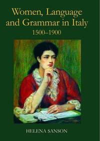
2011DADAX0197264832British Academy 2011-11-07. 1. hardcover. New. 9.20x1.30x6.20. Buy with confidence. Excellent Customer Service & Return policy. British Academy hardcover
1812006820Paris: Chez Jean Md d'Estampes 1812 Engraving 59 x 90 cm old color. The first edition of this map was published in 1674 by Hubert Jaillot under the title "La Russie Blanche ou Moscovie divisee suivant l'étendue des Royaumes Duches." It was incorporated into numerous atlases by Jaillot and his successors until approximately 1720 when it became evidently outdated. However around 1812 it was reissued likely to illustrate the French-Russian war. Chez Jean Md d'Estampes unknown
a8664Le Cercle de Westphalie. 25x38 inches. A double panel map profesionally joined together at seam. Colored in outline. Highly detailed. VG. . unknown
1983BN255751München : Beck Verlag 1983. 1983. Tagebücher der Henker von Paris : 1685 - 1847. - 2 Bände komplett Hrsg. von Eberhard Wesemann u. Knut-Hannes Wettig / Bibliothek des 18. Jahrhunderts <br/><br/>Tagebücher der Henker von Paris : 1685 - 1847. - 2 Bände komplett Hrsg. von Eberhard Wesemann u. Knut-Hannes Wettig / Bibliothek des 18. Jahrhunderts Henri Sanson München : Beck Verlag unknown
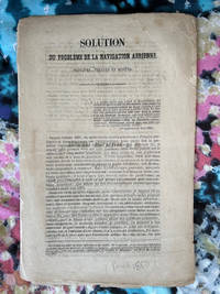
18501240111.28<p>Ledoyon Paris 1850. Good. Two ballooning pamphlets/flyers: Sanson's "Solution du probleme de la navigation aerienne" and: Lettre-Journel de Paris November 19 1870 with an account of a military balloon flight with a manuscript letter attached with stamp and corresponding verso text excised but with a "Par Ballon Monte" cancellation hand stamp and London-received postal hand stamp intact: an early airmail letter; from Wikipedia: "Historically balloons were used to transport mail from Paris during the Siege of Paris of 1870-1871. About 66 unguided mail balloons were released from Paris ." Few such letters have survived.</p> Ledoyon, Paris
0197264832New. Brand new and still unused unknown
169623767Amsterdam: Covens 1696 -1700. Other. In very good to excellent condition. A small tear at the left side. 392 by 517mm 15½ by 20¼ inches. 392 by 517mm 15½ by 20¼ inches. Copper engraving uncolored as published. Covens unknown
189370475Paris: Librairie Agricole De La Maison Rustique 1893. Quarter-leather. G/No Jacket as issued. 5 volumes published 1893-1901. Library markings; marbled boards; covers edge-rubbed with wear at corners; small scuff on front cover of volume 1; 401 386 366 376 350p illus indexes. NB: This is a heavy set which may incur a non-standard postage charge. Size: 12mo - over 6¾" - 7¾" tall <br/> <br/> Librairie Agricole De La Maison Rustique hardcover
170054377Nicolas Bion: L'Usage des Globes. Amsterdam: Francois Halma. 1700. An armillary sphere perused by three scholars at a table. Nicolas Sanson was founder of the French school of mapmakers at a time when the leadership in European cartography passed from the Low Countries to France. This map was published in Bion's treatise on globes. Nicolas Bion was a famous French mathematical and scientific instrument maker. Size: 125 x 175 mm. Copper engraving. Original colour. Mounted size: 295 x 360 mm. Fine condition. unknown
168952354Paris. 1689. The map covers the area from the Moselle in NW to Worms in SE. ornamental cartouche at lower left. Copper engraving. Good condition though map is slightly discolured and stained. Original colour. Size: 56 x 43 cm. unknown
3251Americas: Amsterdam Francois Halma 1705. Copper engraved map of Chili by N. Sanson from Halma's Algemeene Werelde Beschryving Vol. 3 Black and white; title in Dutch; verso blank; strapwork title cartouche. Small version of Sanson's important map of Chili showing the Cuyo provinces. The map is based on the descriptions of Alfonso de Ovalle. This map appeared in Algemeene Weereld-Beschryving nae de Rechte Verdeeling der Landschappen Plaetsen Zeeën Rivieren &c. Geographisch Politisch Historisch Chronologisch en Genealogisch a Dutch edition of A. Phérotée de la Croix's Nouvelle Methode Pour Apprendre Facilement la Geographie Universelle which first appeared in 1690. Dark impression. Nicolas Sanson d'Abbeville.1600-67 ' father of the French cartography' and founder of the Sanson firm. Atlas ' Cartes générales de toutes les parties du Monde' 1658-70 and a pocket atlas in 4 parts 1652-1705. Sanson's small maps from A. Phérotée de la Croix's Nouvelle Methode Pour Apprendre Facilement la Geographie Universelle. first published in 1652 and engraved by A. Peyrounin were copied several times by various map publishers. Johann David Zunners made copies of Sanson's maps for his German translation of Die Gantze Erd-Kugel in 1679. Johannes Ribbius and Simon de Vries published copies in 1682 and 1683 with new maps engraved by Antoine d'Winter. The plates were later sold to Francois Halma who used them in 1699 and then again in 1705 with the titles re-engraved in Dutch. François Halma 1653 - 1722 Dutch publisher/printer; dealer/auction house. Cartographer and publisher of maps active in Utrecht Amsterdam Franeker and Leeuwarden. Published 'Description de l'Univers' 1700; 'Algemene Wereldtbescrijving' 1705; 'Corpus Inscriptionum' 1707 and 'Lexicon Philosophicum' 1713. Keoman: Hal 1; Phillips 528. Americas South America Chili Amsterdam Francois Halma 1705 unknown
3247Americas: Amsterdam Francois Halma 1705. Copper engraved map of Guyana by N. Sanson from Halma's Algemeene Werelde Beschryving Vol. 3 Black and white; title in Dutch; verso blank; strapwork title cartouche. The map shows a large lake or inland sea Lac ou Mer que les Caribes appellent Parime les Iaoyi Roponowini. and located on its shores the mythical city of El Dorado or Manoa. Lake Parime or Lake Parima is a legendary lake located in South America. It was reputedly the location of the fabled city of El Dorado also known as Manoa much sought-after by European explorers. Repeated attempts to find the lake failed to confirm its existence and it was dismissed as a myth along with the city. The search for Lake Parime led explorers to map the rivers and other features of southern Venezuela northern Brazil and southwestern Guyana before the lake's existence was definitively disproved in the early 19th century. Some explorers proposed that the seasonal flooding of the Rupununi savannah may have been misidentified as a lake. Recent geological investigations suggest that a lake may have existed in northern Brazil but that it dried up some time in the 18th century. Both "Manoa" Arawak language and "Parime" Carib language are believed to mean "big lake". This map appeared in Algemeene Weereld-Beschryving nae de Rechte Verdeeling der Landschappen Plaetsen Zeeën Rivieren &c. Geographisch Politisch Historisch Chronologisch en Genealogisch a Dutch edition of A. Phérotée de la Croix's Nouvelle Methode Pour Apprendre Facilement la Geographie Universelle which first appeared in 1690. Dark impression. Nicolas Sanson d'Abbeville.1600-67 ' father of the French cartography' and founder of the Sanson firm. Atlas ' Cartes générales de toutes les parties du Monde' 1658-70 and a pocket atlas in 4 parts 1652-1705. Sanson's small maps from A. Phérotée de la Croix's Nouvelle Methode Pour Apprendre Facilement la Geographie Universelle. first published in 1652 and engraved by A. Peyrounin were copied several times by various map publishers. Johann David Zunners made copies of Sanson's maps for his German translation of Die Gantze Erd-Kugel in 1679. Johannes Ribbius and Simon de Vries published copies in 1682 and 1683 with new maps engraved by Antoine d'Winter. The plates were later sold to Francois Halma who used them in 1699 and then again in 1705 with the titles re-engraved in Dutch. François Halma 1653 - 1722 Dutch publisher/printer; dealer/auction house. Cartographer and publisher of maps active in Utrecht Amsterdam Franeker and Leeuwarden. Published 'Description de l'Univers' 1700; 'Algemene Wereldtbescrijving' 1705; 'Corpus Inscriptionum' 1707 and 'Lexicon Philosophicum' 1713. Keoman: Hal 1; Phillips 528. Americas South America Guyana Guiana Amsterdam Francois Halma 1705 unknown
3250Americas: Amsterdam Francois Halma 1705. Copper engraved map of Paraguayby N. Sanson from Halma's Algemeene Werelde Beschryving Vol. 3 Black and white; title in Dutch; verso blank; strapwork title cartouche. The map shows the region of present day Paraguay Uruguay northern Argentina and southern Brazil. The Rio de la Plata is the main feature of the map along with the mountains and volcanoes of the Cordillera de los Andes. Engraved by Antoine de Winter. This map appeared in Algemeene Weereld-Beschryving nae de Rechte Verdeeling der Landschappen Plaetsen Zeeën Rivieren &c. Geographisch Politisch Historisch Chronologisch en Genealogisch a Dutch edition of A. Phérotée de la Croix's Nouvelle Methode Pour Apprendre Facilement la Geographie Universelle which first appeared in 1690. Dark impression; minor dampstain at top of centre fold. Nicolas Sanson d'Abbeville.1600-67 ' father of the French cartography' and founder of the Sanson firm. Atlas ' Cartes générales de toutes les parties du Monde' 1658-70 and a pocket atlas in 4 parts 1652-1705. Sanson's small maps from A. Phérotée de la Croix's Nouvelle Methode Pour Apprendre Facilement la Geographie Universelle. first published in 1652 and engraved by A. Peyrounin were copied several times by various map publishers. Johann David Zunners made copies of Sanson's maps for his German translation of Die Gantze Erd-Kugel in 1679. Johannes Ribbius and Simon de Vries published copies in 1682 and 1683 with new maps engraved by Antoine d'Winter. The plates were later sold to Francois Halma who used them in 1699 and then again in 1705 with the titles re-engraved in Dutch. François Halma 1653 - 1722 Dutch publisher/printer; dealer/auction house. Cartographer and publisher of maps active in Utrecht Amsterdam Franeker and Leeuwarden. Published 'Description de l'Univers' 1700; 'Algemene Wereldtbescrijving' 1705; 'Corpus Inscriptionum' 1707 and 'Lexicon Philosophicum' 1713. Keoman: Hal 1; Phillips 528. Americas South America Paraguay Uraguay Amsterdam Francois Halma 1705 unknown
3252Americas: Amsterdam Francois Halma 1705. Copper engraved map of Peru by N. Sanson from Halma's Algemeene Werelde Beschryving Vol. 3 Black and white; title in Dutch; verso blank; strapwork title cartouche. The map shows the western part of the continent and the full course of the Amazon. The spurious Lac ou Mer de Parime is prominent as is the location of the mythical city Manoa el Dorado. This map appeared in Algemeene Weereld-Beschryving nae de Rechte Verdeeling der Landschappen Plaetsen Zeeën Rivieren &c. Geographisch Politisch Historisch Chronologisch en Genealogisch a Dutch edition of A. Phérotée de la Croix's Nouvelle Methode Pour Apprendre Facilement la Geographie Universelle which first appeared in 1690. Dark impression. Upper margin short cut to plate mark. Nicolas Sanson d'Abbeville.1600-67 ' father of the French cartography' and founder of the Sanson firm. Atlas ' Cartes générales de toutes les parties du Monde' 1658-70 and a pocket atlas in 4 parts 1652-1705. Sanson's small maps from A. Phérotée de la Croix's Nouvelle Methode Pour Apprendre Facilement la Geographie Universelle. first published in 1652 and engraved by A. Peyrounin were copied several times by various map publishers. Johann David Zunners made copies of Sanson's maps for his German translation of Die Gantze Erd-Kugel in 1679. Johannes Ribbius and Simon de Vries published copies in 1682 and 1683 with new maps engraved by Antoine d'Winter. The plates were later sold to Francois Halma who used them in 1699 and then again in 1705 with the titles re-engraved in Dutch. François Halma 1653 - 1722 Dutch publisher/printer; dealer/auction house. Cartographer and publisher of maps active in Utrecht Amsterdam Franeker and Leeuwarden. Published 'Description de l'Univers' 1700; 'Algemene Wereldtbescrijving' 1705; 'Corpus Inscriptionum' 1707 and 'Lexicon Philosophicum' 1713. Halma acquired many of the plates for Algemeene Weereld-Beschryving from Joannes Ribbius who had enlisted the services of engraver Antoine de Winter to make copies of the maps in Nicolas Sanson's quarto atlases of the four continents. De Winter made very few geographical changes and maintained the attribution to Sanson on the newly engraved plates. Halma supplemented the Sanson maps with about a dozen new maps engraved in the same style as Sanson's without any attribution on the maps as well as 23 panoramic views of famous cities around the world. Keoman: Hal 1; Phillips 528. Americas South America Peru Amsterdam Francois Halma 1705 unknown
3248Americas: Amsterdam Francois Halma 1705. Copper engraved map of Colombia Venezuela and Panama by N. Sanson from Halma's Algemeene Werelde Beschryving Vol. 3 Black and white; title in Dutch; verso blank; strapwork title cartouche. The map shows the Isthmus of Panama and North Western South America including most of present day Columbia and part of Venezuela. Regional boundaries are shown along with missions towns major rivers and mountains. The mythical Lage de Parime with the fabled city of Manoa del Dorado is shown at bottom right. This map appeared in Algemeene Weereld-Beschryving nae de Rechte Verdeeling der Landschappen Plaetsen Zeeën Rivieren &c. Geographisch Politisch Historisch Chronologisch en Genealogisch a Dutch edition of A. Phérotée de la Croix's Nouvelle Methode Pour Apprendre Facilement la Geographie Universelle which first appeared in 1690. Dark impression. Nicolas Sanson d'Abbeville.1600-67 ' father of the French cartography' and founder of the Sanson firm. Atlas ' Cartes générales de toutes les parties du Monde' 1658-70 and a pocket atlas in 4 parts 1652-1705. Sanson's small maps from A. Phérotée de la Croix's Nouvelle Methode Pour Apprendre Facilement la Geographie Universelle. first published in 1652 and engraved by A. Peyrounin were copied several times by various map publishers. Johann David Zunners made copies of Sanson's maps for his German translation of Die Gantze Erd-Kugel in 1679. Johannes Ribbius and Simon de Vries published copies in 1682 and 1683 with new maps engraved by Antoine d'Winter. The plates were later sold to Francois Halma who used them in 1699 and then again in 1705 with the titles re-engraved in Dutch. François Halma 1653 - 1722 Dutch publisher/printer; dealer/auction house. Cartographer and publisher of maps active in Utrecht Amsterdam Franeker and Leeuwarden. Published 'Description de l'Univers' 1700; 'Algemene Wereldtbescrijving' 1705; 'Corpus Inscriptionum' 1707 and 'Lexicon Philosophicum' 1713. Keoman: Hal 1; Phillips 528. Americas South America Colombia Venezuela Amsterdam Francois Halma 1705 unknown
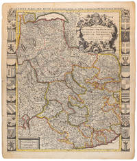
1710009139Amsterdam: Pierre Mortier 1710 Cooper engraving 58.0 x 50.5 cm on paper measuring 63.0 x 54.0 cm with original color in outline minor spotting and creasing remnants of centerfold paper slightly frayed at edges. A good copy of an uncommon map of Savoy and Piedmont published in Amsterdam by Pierre Mortier to illustrate events of the War of the Spanish Succession. Surrounded by twenty-two coats of arms representing various provinces. Pierre Mortier unknown
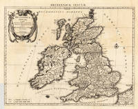
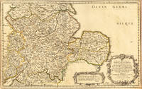
165417463Paris: N. Sanson 1654. Other. In very good condition. 365 by 580mm 14¼ by 22¾ inches. 365 by 580mm 14¼ by 22¾ inches. Copper-engraving handcolored in outline when published. Fine and strong impression of this early decorative mid-seventeenth century map of this English regional map covering the area Chester Darbing Nottingham. by the famous French cartographer Nicolaus Sanson. Very detailled and naming many cities and villages as well many places along the coastline. Showing prominently the eastern part of central England. In the lower right corner with a large floral title cartouche and milage scale. N. Sanson unknown
18-1027Paris: 17th Century European Publisher 1648. 22 x 16 inches. Very Good. 17th Century hand colored map of Lower Lombardy. Some toning and two one-inch tears at bottom edge. Text in French. Scarce.Nicholas Sanson 1600-1667 is considered the father of French cartography in its golden age from the mid-seventeenth century to the mid-eighteenth. Over the course of his career he produced over 300 maps. His success can be chalked up to his geographic and research skills but also to his partnership with Pierre Mariette. Previously Sanson had worked primarily with the publisher Melchior Tavernier. Mariette purchased Tavernier’s business in 1644. Sanson worked with Mariette until 1657 when the latter died. Mariette’s son also Pierre helped to publish the Cartes générales de toutes les parties du monde. [Paris]: 17th Century European Publisher, [1648]. unknown
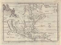
17005097Sanson being d'Abbeville Geograph du Roy. Map covers North America with a small amount of South America included. Has California as an island. 9 3/4 x 7 1/2 inches. Chez Paul Marret
1950158225Rome: Unitalia Film / IFE 1950. Collection of 14 vintage oversize promotional brochures for Italian and international actresses. Each brochure features a one-page biography in Italian and a full-page black-and-white photograph of each actress. <br /> <br /> Actresses represented are Sylvana Mangano Isa Miranda Annamaria Gerrero Yvonne Sanson Alida Valli Delia Scala Ingrid Bergman Silvana Pampanini Lea Padovani Lucia Bose Eleanora Rossi Gina Lollobrigida Carla Del Poggio and Anna Magnani. <br /> <br /> 11 x 14.25 inches folded once vertically as issued with a company statement on the verso. Very Good plus overall some with light toning and foxing and a few with short tears. Unitalia Film / IFE unknown
170054030Nicolas Bion: L'Usage des Globes. Amsterdam: Francois Halma. 1700. Attractive map of Spain divided into its provinces. Maps by Sanson in original colour are rare. Nicolas Sanson was founder of the French school of mapmakers at a time when the leadership in European cartography passed from the Low Countries to France. This map was published in Brion's treatise on globes. Nicolas Brion was a famous French mathematical and scientific instrument maker. Copper engraving. Fine condition. Original colour. Size: 23.5 x 18 cm. 9½ x 7 inches. unknown
188834050Paris: Lib. agricole de la raison rustique 1888. Fine. Lib. agricole de la raison rustique Paris 1888-1893 11.50 x 18.50 cm 5 volumes reliés Third edition with some parts in first edition as revised and corrected. The first volume is part of the third printing of the third edition the following volumes are part of the second printing. Half red shagreen bindings spines with five raised bands set with gilt fillets and showing minor rubbing on some volumes spines decorated with gilt floral motifs three joints with slight lacks at heads blind fillet frames on red cardboard boards boards of first volume discolored contemporary bindings. Work illustrated with figures in the text. Some foxing. Rare. Lib. agricole de la raison rustique hardcover
1916-25Paris H. Jaillot 1692. Alt grenzkolorierte Kupferstichkarte von 2 Platten. 64 5 x 99 cm Blattgr. Breitrandiges Exemplar. Äußere Ränder etwas gebräunt kleiner Randeiniß sonst gut erhalten. Großformatige Karte von Guillaume Sanson 1633-1703 die das Gebiet von Deggendorf bis Wagram und von Kromeríz/Kremsier bis Veszprém/Weissbrünn mit dem Neusiedler See Newsidler See zeigt. Aus dem Verlag von Alexis-Hubert Jaillot um 1632-1712 der eng mit Sanson zusammenarbeitete. Paris, H. Jaillot 1692. unknown
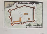
1690M9479Paris c.1690. Very Good. Notes: Map of Chielafa Greece during the late 17th century. Size : 105x152 mm 4.13x5.98 Inches Coloring: Hand Colored Category: Maps Europe Greece Macedonia; unknown